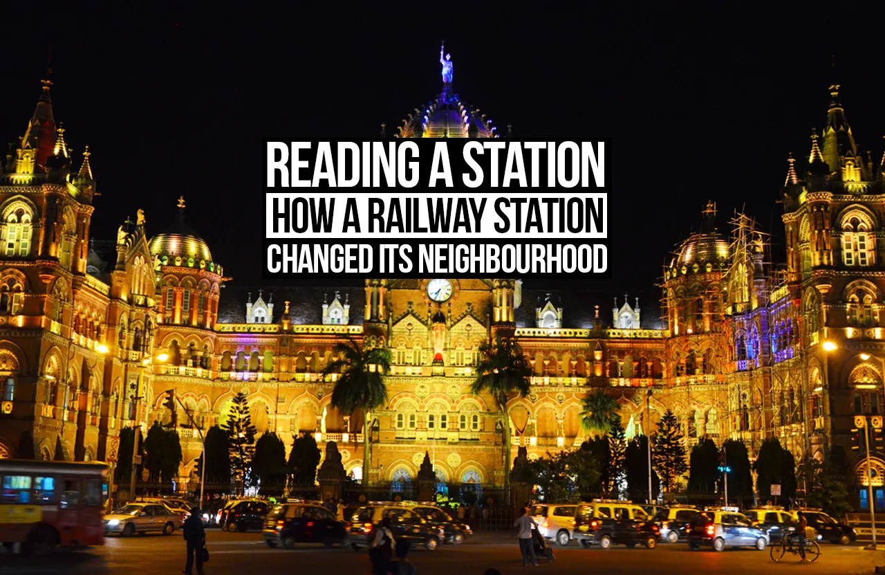
On maps, watercolours and old sketches that show how Mumbai’s CSMT rearranged the city around it.
A Station Is Never Just a Station
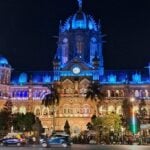
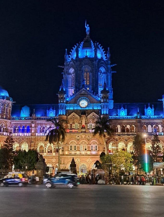
Stand outside Chhatrapati Shivaji Maharaj Terminus on a weekday morning and the first thing you notice is the noise. Horns, announcements, vendors, the shuffle of thousands of people who all seem to know exactly where they are going. The second thing you notice is the building itself, a riot of domes, turrets, gables and carved stone that looks as though it wandered in from another century and decided to stay.
What is harder to see from the pavement is how much of the surrounding city exists because this building does. To understand how a railway station changed its neighbourhood, you have to stop looking at the station and start reading the paper trail around it: early maps, newspaper sketches, a famous watercolour, municipal records and the building’s own carved façade. Together they tell a story about trade, power, technology and ambition. This article follows that trail, comparing what the archives show with what stands in Mumbai today.
What the 1855 Plan Shows
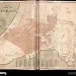
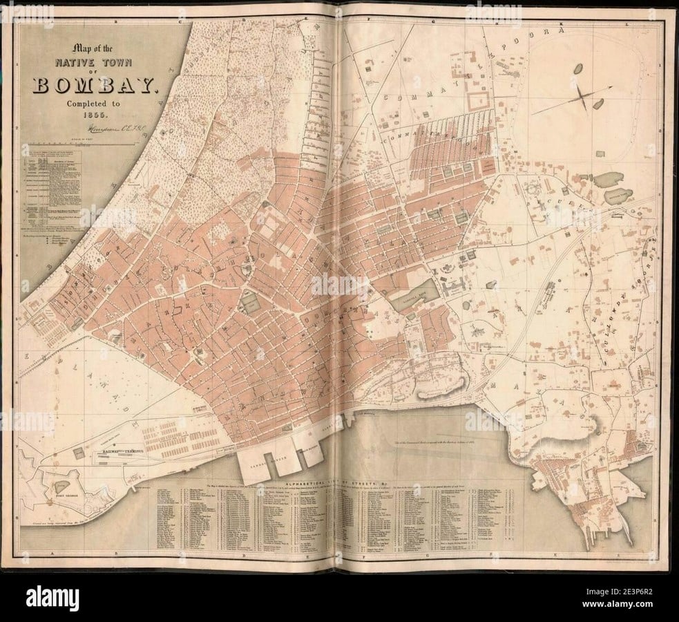
Start with an early map. Plans of Bombay’s Fort area from the mid-1850s, including a map of the native town completed to 1855 that is now held by the Library of Congress, show a very different place from the one we know (Library of Congress, 1855). The first railway terminus sits at Bori Bunder, on the edge of a walled, military-minded town. Beside it are the Sepoy Lines, the barracks of Indian soldiers, which tells you immediately that this land was not yet a civic heart. It was a margin.
The name gives another clue. Bori Bunder was a port and warehouse district, a place of landings and goods rather than grand arrivals. The Great Indian Peninsula Railway opened its first line from here to Thane on 16 April 1853, and the station that served it was modest and practical. Newspaper sketches of the period show a large yard with bales of cotton lying on the ground, waiting for the sea voyage to Britain. The earliest version of this railway station was less a gateway for passengers than a loading bay for the empire’s economy.
This is the first lesson the archives teach. Before a building changes a neighbourhood, a purpose does. Here, the purpose was moving cotton to the docks, and the neighbourhood was shaped to serve it.
The Walls Come Down
The second set of documents concerns what happened around the station in the 1860s. Sir Bartle Frere, Governor of Bombay from 1862, had the old Fort ramparts demolished so that the city could grow beyond them. In 1865, the municipal corporation was created, with Arthur Crawford as its first commissioner. Crawford Market opened in stages in 1868 and 1869 and gave the area a new civic anchor.
Read in sequence, these records show a city rewriting its own boundaries. The railway had brought more people and more trade, and the walled town could no longer contain either. A map from before the demolition and a plan from after it do not look like the same city. Streets open out, institutions arrive and the land around Bori Bunder starts to look like a place worth investing in.
A Watercolour Wins a Commission
By the 1870s the old Bori Bunder station was no longer adequate, and the company wanted something that matched its ambitions. The commission went to Frederick William Stevens after he presented a watercolour sketch by the draughtsman Axel Haig. Think about how unusual that is. A building that would define a city’s silhouette began life as a painting.
Work started in 1878, on a site just south of the old station. The terminus opened in 1887, the year of Queen Victoria’s Golden Jubilee, and was named in her honour, with finishing work running into 1888. Records put the cost at about Rs 16 lakh. It was built as both a station and a headquarters for the railway company, which tells you how deliberately the building was meant to project authority.
Drawings like Haig’s matter because they capture intention. They show what the designers hoped to say before budgets, supply problems and politics trimmed the edges. Compare that watercolour with the finished building and you can see how much of the original vision survived: the dome, the pinnacles, the pointed arches, the carefully composed façade. It is a rare case where the dream and the reality sit close together.
Reading the Façade as a Document
Here the archive is not a box in a records office. It is carved into the stone. The dome is crowned by a figure representing progress. The main gables carry sculptures representing engineering, commerce and agriculture. The approach is guarded by a lion and a tiger, usually read as England and India. The interiors combine Italian marble, polished Indian blue stone, tiled dados, stained glass and ornamental ironwork, much of it executed with students of the J.J. School of Art.
This is a document with several authors. The Gothic vocabulary came from Victorian Britain. The craftsmanship and many of the motifs came from India. The result, which UNESCO would later describe as an outstanding example of the fusion of Victorian Gothic Revival and traditional Indian architecture, was never purely one thing or the other (UNESCO World Heritage Centre, 2004). It was a statement about empire made by hands that were largely Indian.
It is worth being honest about that tension. The building celebrated a colonial power and its commercial machine. It also gave work and visibility to Indian artisans, and today it belongs firmly to the city that grew around it. Archives let us hold both truths at once.
How the Neighbourhood Rearranged Itself
Once the terminus opened, the area began to organise itself around it. Across the road, Stevens went on to design the municipal headquarters, another Gothic landmark completed in the 1890s. The two buildings face each other like partners in a conversation, one representing the railway company, the other the city government. Offices, banks, newspapers and warehouses clustered nearby, reinforcing the Fort district as Bombay’s commercial and civic core.
What is striking is how little of this was accidental. A station of that scale attracted footfall, and footfall attracted business. Hawkers, clerks, porters, shopkeepers and tea sellers all found a living in the station’s shadow. The railway station changed its neighbourhood not only through architecture but through the daily habits of everyone who passed through it.
From Cotton Yard to Commuter Machine
Technology changed the station again in the twentieth century. Railway histories note that India’s first electric train ran from Victoria Terminus to Kurla in 1925, a moment that quietly turned the building into the centre of a suburban network. The older station beside the grand terminus was reserved for suburban traffic, which tells you the planners understood that two kinds of travel were emerging: the long-distance journey and the daily commute.
That shift matters because commuters behave differently from cargo. They arrive in waves. They need platforms, subways, bridges and queues. They create demand for food stalls, newspaper stands and cheap lodgings. Gradually the neighbourhood became less about warehouses and more about people in motion. The cotton yard of 1855 had become a machine for moving a city’s workforce.
Then and Now: What Changed, What Stayed
Set the archives beside the present and a clear pattern appears. In the 1850s the terminus was an edge, small and functional, near barracks and a dock. In the 1880s it became a monument, a deliberate declaration of permanence. Today it is a living piece of infrastructure and a World Heritage Site, inscribed by UNESCO in 2004.
Even its name has been an archive of changing politics. It opened as Victoria Terminus, was renamed Chhatrapati Shivaji Terminus in 1996 and gained the honorific Maharaj in 2017. Each change reflects who the city wanted to honour at that moment. The building stayed the same while the story told about it moved on.
What has not changed is the pressure. Modern Mumbai asks the station to carry far more people than anyone in 1887 imagined, while also asking it to remain a protected heritage building. The archives do not solve that dilemma, but they do show that it is old. Every generation has asked this building to do more than its designers planned.
So. What Do the Archives Teach Us?
The story of Mumbai’s grandest station is really a story about how places are made. A cotton yard became a terminus. A terminus inspired a district. A district grew into the centre of a city. At each stage, the evidence was left behind in maps, sketches, drawings and carved stone, waiting for someone to read it.
That is why archives matter for anyone who cares about architecture. They remind us that buildings are not isolated objects. They are decisions, negotiations and accidents that happened to harden into stone. The next time you walk past CSMT, look up at the dome, then look around at the streets it shaped. You are standing inside a record of how one railway station changed its neighbourhood, and with it, the city.
References:
Dwivedi, S. and Mehrotra, R. (1995) Bombay: The Cities Within. Bombay: India Book House.
Evenson, N. (1989) The Indian Metropolis: A View Toward the West. New Haven: Yale University Press.
Library of Congress (1855) Map of the native town of Bombay, completed to 1855. Washington, DC: Library of Congress Geography and Map Division. LCCN 2015588078.
Metcalf, T. (1989) An Imperial Vision: Indian Architecture and Britain’s Raj. London: Faber and Faber.
UNESCO World Heritage Centre (2004) Chhatrapati Shivaji Terminus (formerly Victoria Terminus). Available at: https://whc.unesco.org/en/list/945 (Accessed: 7 October 2026).
About the Author
Resham Uppal is a participant in the RTF Training Programme. This article draws on archival maps, drawings, records and published histories to examine how Mumbai’s Chhatrapati Shivaji Maharaj Terminus reshaped the neighbourhood around it.