From mapping ancient landscapes to shaping the future of smart cities, photogrammetry has quietly transformed the way we capture and understand the world around us. At its core, it’s the marriage of photography and geometry turning simple images into precise, measurable data. What began in the 19th century with French scientist Aimé Laussedat’s early experiments has now evolved into a powerful technology used in everything from disaster management and heritage conservation to agriculture and urban planning. Today, drones, high-resolution cameras, and AI-driven software have pushed photogrammetry far beyond cartography, making it an essential tool across industries that rely on accuracy, efficiency, and visual clarity.
What is photogrammetry?
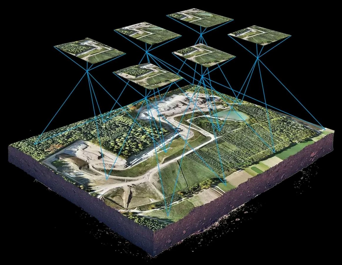
Photogrammetry is the science of obtaining precise information about any surface, building, or landscape by overlapping photographic datasets captured from different angles with integration of optics, geometry, and photographic imaging. Initially, the concept of photogrammetry was used in geographical mapping and surveying. Though the term photogrammetry might sound fresh and recent, the idea has been around since the mid-19th century. In the 1850s, French scientist Aimé Laussedat, the father of photogrammetry, started using terrestrial photographs to produce terrestrial maps. Since then, the technique of photogrammetry was used for cartography, and after World War 2, the advancement of technology in photography paved the path for photogrammetry to be the primary technology in civil engineering and mapping.
Applications of photogrammetry
With the advent of cartography, photogrammetry has widened its wings towards various sectors such as
Disaster management
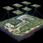
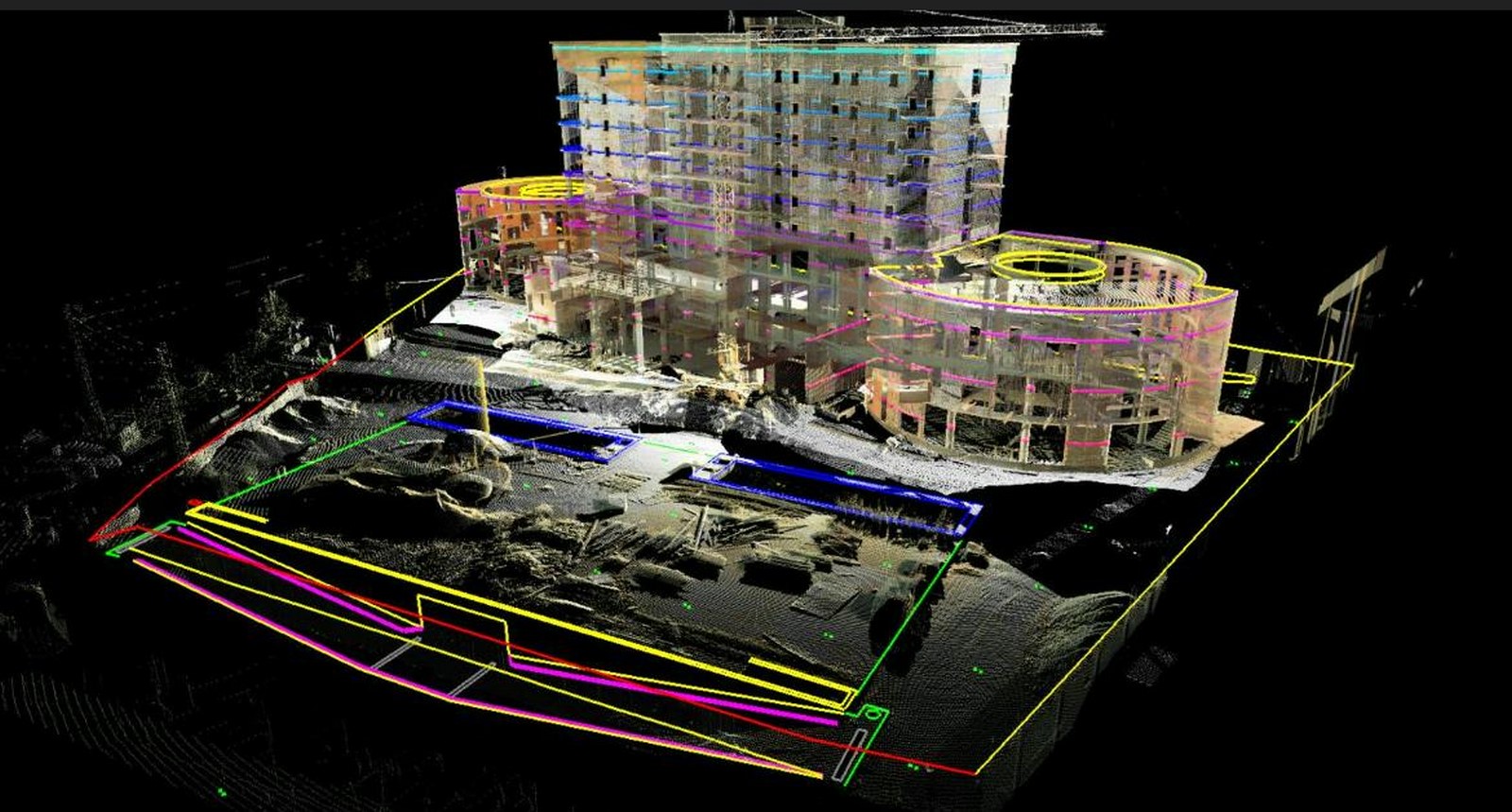
It has been used to map post-disaster zones for analysing the damage created and creating relief plans according to the damage assessment. It uses drones to click multiple pictures of the affected area and create a 3D model space with known distance between the camera and the photographs, which are arranged in sequence of identical pictures. These photographs are fed into software like one 3d to create a 3D simulation model for better understanding.
Construction
It is used to create 3d models for documentation of heritage sites by organisations like ICOMOS, ASI., to assess the areas and precise details of wall and sculptural textures in old construction.
It is also used to assess excavation precision, monitoring the progress of construction for turnkey projects from different locations, and a highly accurate 3D contextual model for better understanding of the site and infrastructure. These drones are equipped with RTK(Real-Time Kinematic positioning) and GPS technology.
It also helps in data collection for urban development without disrupting the daily hustle of the public.
Agriculture
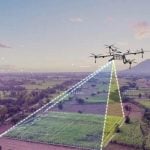
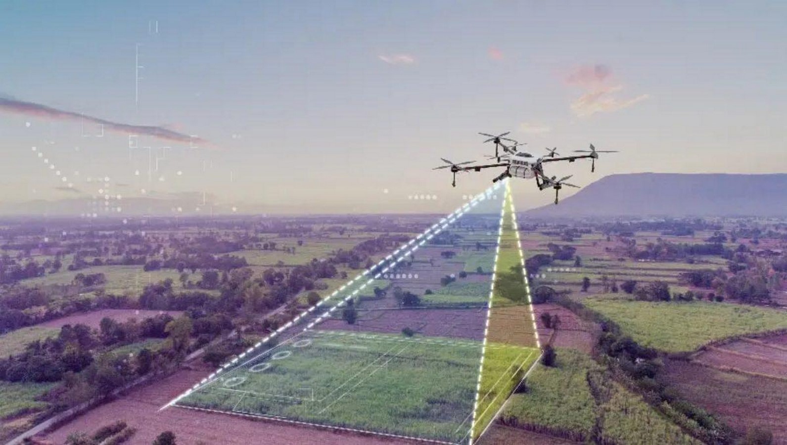
It is used to monitor real-life agriculture updates; the monitoring and categorisation of vegetation provides data on which cycle the plant is undergoing to provide them with proper care. This is also used to control the climatic conditions, humidity,and temperature to maintain ideal conditions for higher yield For eg:- Pilot projects by SKUAST-K use UAV photogrammetry for predicting the yield by running phenology analysis in regular intervals which helps in the prediction of yield and individual care for plants, minimizing the losses incurred.
Other applications
Other applications of photogrammetry include those of climate analysis, astronomical photographs of Mars, mapping of the moon’s surface, etc.. The applications are endless and are continuing to expand every single day with the advancement of technology. It is also used in the gaming sector to create real-life-like simulations by mimicking real-life textures and structures for the users to get an immersive experience.
Technology
Photogrammetry has significantly contributed to the development of other sectors while it has single-handedly revolutionised the construction industry. This technology eliminated the need for theodolites, heavy tripods, and machinery, with hours of precision of surveyors to monitor and create an accurate 3D model of existing historic buildings for heritage conservation within much-reduced timeframes. But this was not instantaneous or effortless. This involved patience and practice, which turned this technology from a humble sequence of photographs; photogrammetry has evolved into a highly trusted technology from below the land to beyond the space, marking the involvement of highly evolved technologies . Let’s take a look at a few technologies which has turned photogrammetry into an unshakable empire in contruction.
1.Heritage Documentation & General Photogrammetry Software
Tools:
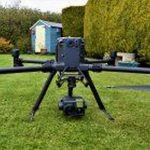
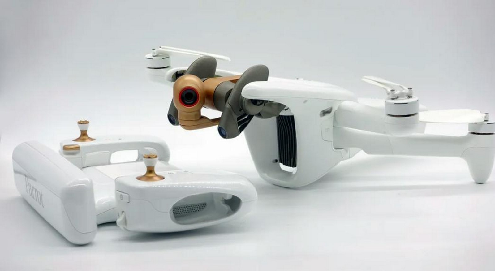
- Drones/UAVs: DJI Phantom 4 RTK, Parrot Anafi Ai — both equipped with RTK (Real-Time Kinematic) positioning for sub-centimetre accuracy.
- Cameras: DSLR cameras like Nikon D850 or mirrorless Sony A7R IV with 42–61 MP resolution to capture intricate carvings and weathering patterns.
- Special Lenses: Fixed focal length lenses (e.g., 35mm prime) to reduce distortion.
Software:
- Agisoft Metashape – widely used for high-fidelity texture mapping and mesh generation.
- RealityCapture – known for its speed in processing large heritage datasets.
- AutoDesk ReCap – integrates easily with BIM workflows for restoration planning.
2. Urban Planning
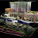
Photogrammetry plays a crucial role in mapping, infrastructure planning, and large-scale site analysis.Through photogrammetry the most difficult part of urban planning – the data collection is sorted without any halt to daily hustles of the city.It helps in creating accurate geospatial datasets for zoning , road alignment , land zone modelling and figure ground marking
Tools:
Drones/UAVs: SenseFly eBee X (fixed-wing drone) for covering large city sections in fewer flights.

- LiDAR-Integrated Drones: For combining photogrammetry with laser scanning in dense urban areas.
- Satellite Imagery: High-resolution imagery from platforms like WorldView-3 for integrating photogrammetric outputs with GIS.
Software:
- Pix4Dmapper – for large orthomosaic generation and DSM (Digital Surface Model) creation.
- ArcGIS – for integrating photogrammetric outputs into spatial analysis models.
- Bentley ContextCapture – used for city-scale 3D modelling.
3. Monitoring of Construction
Construction monitoring benefits from photogrammetry’s ability to track progress. It can easily identify if there are any deviations in progress or process and generate inbuilt documentation to avoid any errors, saving much time , effort, and labour waste.
- Tools:
Drones: DJI Matrice 300 RTK -It is used for stability in varying weather conditions and integration with thermal imaging as in few other cameras if the lighting , humidity and temperature arent in ideal condition the tracking ight be different . Maintaining an ideal situation in realtime tracking is almost impossible.

Action Cameras: GoPro HERO11 – These are used for capturing timelapse recordings in tight spaces .
Ground Control Points (GCPs): It is used to increase positional accuracy for comparison with design models.
- Software:
DroneDeploy – real-time site mapping and measurement is done using the data that is procured from the drones and action cameras.
Trimble Stratus –It is used for calculating the volume measurements for earthworks and excavation tracking.
NavVis IndoorViewer –It is used for indoor as-built verification.This is also becoming increasingly popular in abroad for integration of execution along with BIM.
4. Interior Design and Renovation
In interior-focused projects, photogrammetry allows designers to create precise 3D models of existing spaces to test layouts, furniture, and finishes virtually before actual construction. Through photogrammetry, the designers can avoid the great leap of measuring every inch of the existing building and creating a base model, which took days before even starting the design process.
- Tools:
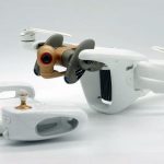
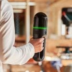
- Handheld 3D Scanners: Leica BLK2GO for mobile scanning of interiors with high spatial accuracy.
 Leica BLK2GO_©www.detailed-planning.co.uk
- DSLR/Mirrorless Cameras: Canon EOS R5 with wide-angle tilt-shift lenses to minimise distortion in confined spaces.
- Tripod-based Laser Scanners: Faro Focus for fine detail capture.
- Software:
- SketchUp + Undet for SketchUp – integrates photogrammetry point clouds into design workflows.
- Autodesk Revit – for creating BIM-compatible renovation plans from photogrammetric data.
- Polycam or 3DF Zephyr – quick scanning solutions for smaller interior elements.
- SketchUp + Undet for SketchUp – integrates photogrammetry point clouds into design workflows.
AI in photogrammetry
While photogrammetry has made its way from mere photographs to a fully automated database, it is further taking its leap towards hyperrealism with the use of development and integration of artificial intelligence. With the use of AI, the errors of overlapping, detection of cracks, and labelling huge sets of data, such as roads, buildings, and vegetation in urban planning, can be done in comparatively less time than conventional methods. This is another huge leap for advanced precision databases for the future.
Automated image matching: automatically identifies and matches photos with common points, reducing the time of setting the algorithm to match photos. eg:-AI algorithms like SIFT (Scale-Invariant Feature Transform) automatically detects such similarities and matches.
Noise Reduction & Image Enhancement –It removes motion blur, adjusts lighting, and sharpens low-quality images before processing, providing clearer data for processing.
eg:- Topaz Labs AI
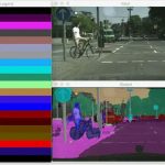
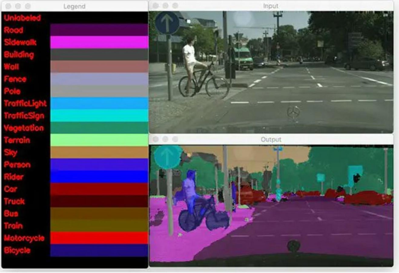
Semantic Segmentation – Divides 3D models or images into meaningful regions (e.g., wall, window, roof) for easier analysis . eg :- opencv.
Generative Filling and real-time 3D building– AI predicts and reconstructs missing or damaged, or blurred details in the model, and it also helps in building real real-time 3D models simultaneously as the data is scanned or processed.
Architecture has embraced many techniques for illustration and representation, but since the invention of the camera, photography has remained a primary tool for documentation. With the advancement of technology, photogrammetry—a branch of photography—has brought greater ease and precision, enabling architects to study and execute designs grounded in science as much as in aesthetics. Architecture has always been a field of fascination, and the evolution of age-old methods through the integration of modern technologies ensures that this sense of astonishment never fades.