We have come a long way; transformed from ancient civilizations to cities. The present-day cityscape is embellished with the street culture of food, fashion and flair, flashing lights, fast cars and motorways, people, people, and some more people. Some of the biggest cities in the world such as Tokyo and Mumbai are known to shimmer all day long, every day of the year. Sleep is for the dead.
On encountering the term ‘city-life’ there is an instant state of bustle and havoc that waves past. It may be an overwhelming nightmare to some, while to others, a dream to get lost in the ever-moving crowd, a sheer definition of progress. To the rest who haven’t been considered, the only way they know life.
But, how did it all start?
Places starting taking shape of cities and over time, transformed into what is now recognized as the urban fabric. Sometime around 4000 BC, the nomadic nature of man was subdued. It was during then, the man initiated an ‘urban revolution’ by systematic cultivation of plants, herding of animals in addition to, storing surplus food in granaries. These advancements led to a complex social organizational system, inventions in technology along with a need for ‘planning’ as these places were now hubs for trade and transportation. As times changed, man’s intelligence jumped leaps, to finally embrace modernity.
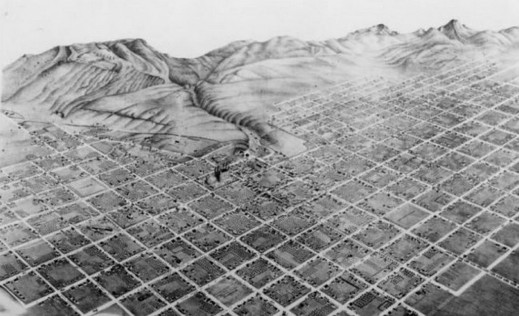
Concrete, glass, and steel made their way into the construction industry, giving cities the glamorous profile we capture as silhouettes from afar. Furthermore, just as these elevational qualities suggest a hint at which city it may be and what it stands for, in a similar manner plans or aerial views can narrate a whole new story.
The city block system is one planning technique adopted by planners to organize metropolis’ layouts. A city or urban block is defined as the smallest area defined by streets. They are the basic unit of an urban planning system. Buildings are usually built on the perimeter of the block while social spaces are in the center, in a courtyard-like fashion. Such as system can be seen in places such as Melbourne in Australia, Chicago, Illinois, Minneapolis, Minnesota in America and Calgary, Edmonton in Canada.
However, for this article, let us consider the context of India – How does this system transition in cities of India? Can it find its place? Maybe it has already. We know that Corbusier designed, city of Chandigarh, has grid planning incorporated. How does that function vis-a-vis Mumbai where the urban situation was birthed due to the marriage of seven islands, some geographical, numerous social and administration conditions or on the other hand Delhi, which has stark divisions of the old, the new and maybe… Gurgaon? We expect some scoffs at the last statement.
In India, apart from the well known, glorious city of Chandigarh, there are the cities of Gandhinagar, Amravati, and Jaipur which are planned similarly to the grid or block system. These instances prove that the Indian context is not devoid of this particular planning ideology.
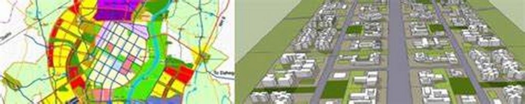
History is one way to understand the roots of urban planning. In the case of Gandhinagar, urban design inception can be seen from 1965-1970. Two Indian town planners, H. K. Mewada and P. M. Apte tried to bag the job by bringing in American architect Louis Kahn. But, the government was adamant to have a city designed by Indian town planners to commemorate Gujarat’s rich heritage using principles of Mahatma Gandhi. Therefore persisting, the two men to plan the new capital. This translates to Gandhinagar being the product of a conscious belief in the western planning style plus a push from the government to incorporate heritage. Also since Gandhinagar was not too far from away from the city of Ahmedabad, the government allowed only farmhouses to be built in the villages between Ahmedabad and Gandhinagar. They did not want Gandhinagar to be seen as just another suburb. Planning can be a major way for a city to gain it’s identity, especially visually when a visitor recognizes the transition from one city to another.
Benefits enjoyed by cities similarly planned in the grid block system are high walkability, easy navigation, adaptability (if in case land use needs to be changed) and sustainability.
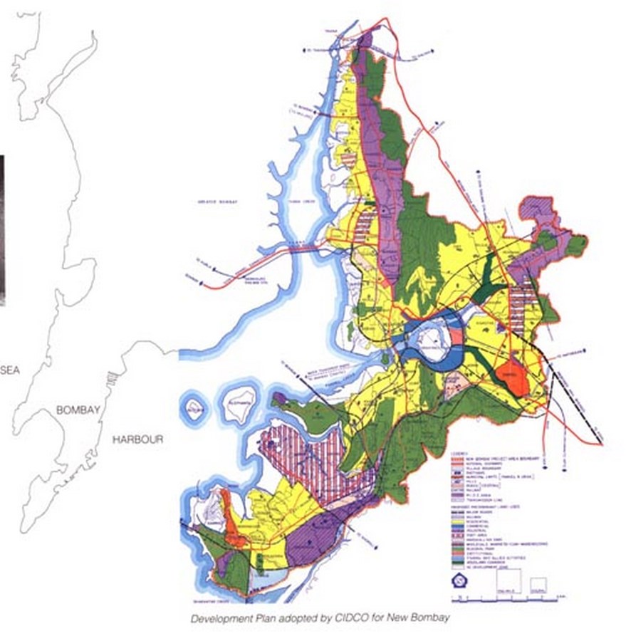
Nevertheless, it is essential to highlight cities or sections of cities, such as Navi Mumbai, Bidhannagar, Bhubaneshwar and Jamshedpur which do not conform to this method of planning, but in their own right are recognized as beautifully planned cities rather than a lawless mess.
For instance, the case of Navi Mumbai. Navi Mumbai Development Plan came into effect from March 1980. The Polycentric development which avoids concentration of people and activities (a serious issue faced by Mumbai), is spread over 2 Districts,
Thane and Raigad while engulfing 95 revenue villages and 100 Goathans. Twin city concept was one of Ar. Charles Correa, engineers Pravina Mehta, and Shrish Patel.
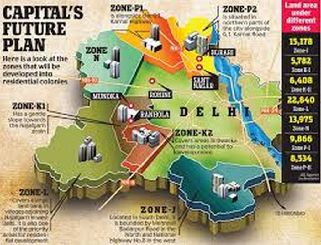
Finally, there are cities such as Delhi which have a rich history for them to be planned purely in a modernist way. It has seen the likes of Shahjahan (1938-48) and the invasion of the East India Company (1803). In 1912, it became the new capital, after Kolkata to see independence in 1947. Finally, in 1962, the first master plan for Delhi was drafted, with another revision proposed in 2001 and an upcoming one in 2021.
Hence, it would be appropriate to conclude- for the context of India there is no right way to plan. Indian terrains have seen multiple layers of historical, political, geographical, sociological changes for it to conform to one style of planning that sticks throughout the nation. Consideration of the past and present, with a prediction for what’s coming next, is what is key.