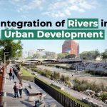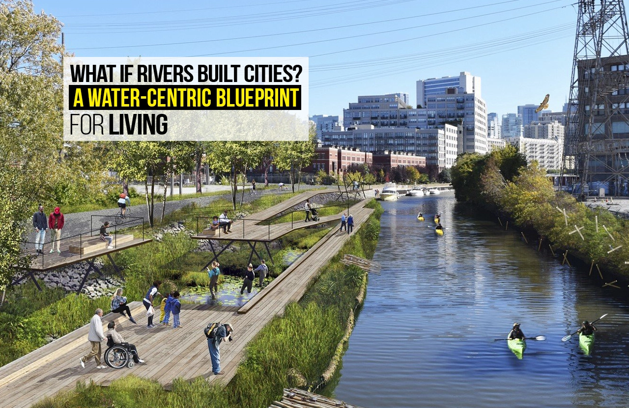
The age of cities has traditionally been described as the age of conquest of nature — sweeping rivers out of the way, concrete poured atop floodplains, and infrastructure constructed as a barrier between society and the hydrologic realm. But what if we turned that model on its head? What if, rather than subduing rivers, we allowed them to construct our cities — or at least shape their development with a water-driven master plan?
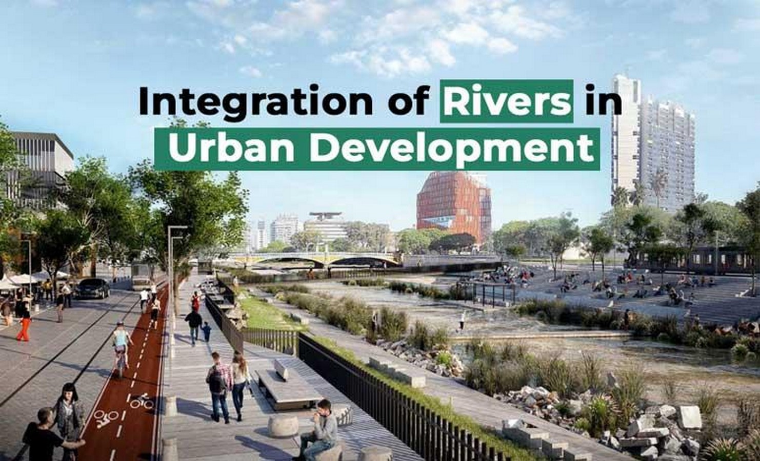
In a water-focused city, the natural dynamics of rivers, rainfall, groundwater, and ecological flows become integral to urban form, infrastructure, public space and governance. Rivers would not be an afterthought or pest to be controlled; they would be driving forces in deciding where—and how—we live, move, and prosper.
This article outlines a conceptual and practical model for such a blueprint. It examines historical precedent, current theoretical underpinnings (e.g., water-sensitive urban design), design guidelines, challenges and hazards, and representative case studies. Finally, it contends that a water-led masterplan is neither a utopian dream, but an imperative restyling in the context of climate change, increasing water stress, and the need for resilient and equitable cities.
Why Rivers and Water Are Important to Urban Futures
- Rivers as Foundation Organisers of Civilisation
Since the earliest human settlements, rivers have given life: drinking water, transportation, fertile ground, and commerce. Mesopotamia, the Nile Valley, the Indus, the Ganges: all owe their origins to riverine systems. As time passed, cities tended to move away from their original river axis, or cut their connection to rivers through embankments and city spread. But even when concealed, water was a hidden substrate.
Over the last few centuries, particularly during industrialisation, most cities diverted rivers underground (into culverts) or treated them as exclusively engineered drains. These practices have resulted in pollution, flooding, environmental degradation, and disconnection from water for people.
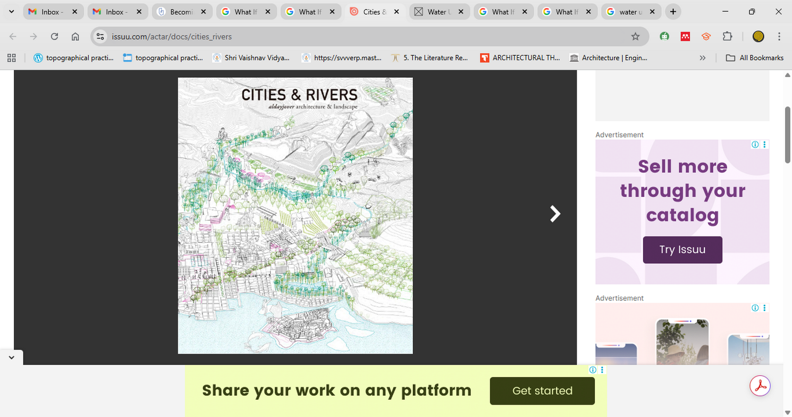
The concept of letting rivers “build” cities is also in part symbolic: it involves re-shaping the city’s relationship with hydrology, letting the currents of water shape the grid of streets, architecture, parks, drainage, and public life.
- Water Stress, Climate Change, and the Case for Integration
Urban areas now face increasing hydrological threats: more frequent and more severe storms, more flooding, sea-level rise, droughts, loss of groundwater, water contamination, and altered water cycles. The old “grey infrastructure” model—big sewers, pipes, dams and channels alone—is frequently brittle and expensive.
Current scholarship supports hybrid, nature-based, and integrated solutions. Water-Sensitive Urban Design (WSUD), One Water, sponge cities, and “blue-green infrastructure” are ideas that seek to integrate the water cycle into urban planning instead of repressing it (Tasnia et al., 2025; Porse, 2022). These seek decentralised capture of stormwater, infiltration, reuse, and natural flows.
Porse (2022) posits that sustainable urban water systems call for interdisciplinarity: the integration of planning, engineering, ecology, landscape design, governance, and participation of the community. (Also see Tasnia et al., 2025, for a literature review of WSUD practices.)
The One Water strategy, as advocated by the American Planning Association, prioritises that stormwater, wastewater, and potable supply are all components of an integrated system that must be addressed comprehensively (APA, 2017; Planners and Water, 2017).
Therefore, as cities expand, we have to imagine water as not a limitation but as a designer and fellow participant.
Principles of a Water-Centric Blueprint
To allow rivers to “build” cities isn’t to forego human agency or planning, but to need a new organising principle. The following are primary principles for a Water-Centric Blueprint.
- Hydrological First Principles
Map and comply with natural drainage, watershed boundaries, floodplains, and groundwater recharge areas. Rather than pushing water into preconceived infrastructure, infrastructure should adapt to natural hydrology. In other words, let water dictate where roads, open space, and buildings go, not the other way around.
- Living with Water, Not Against It
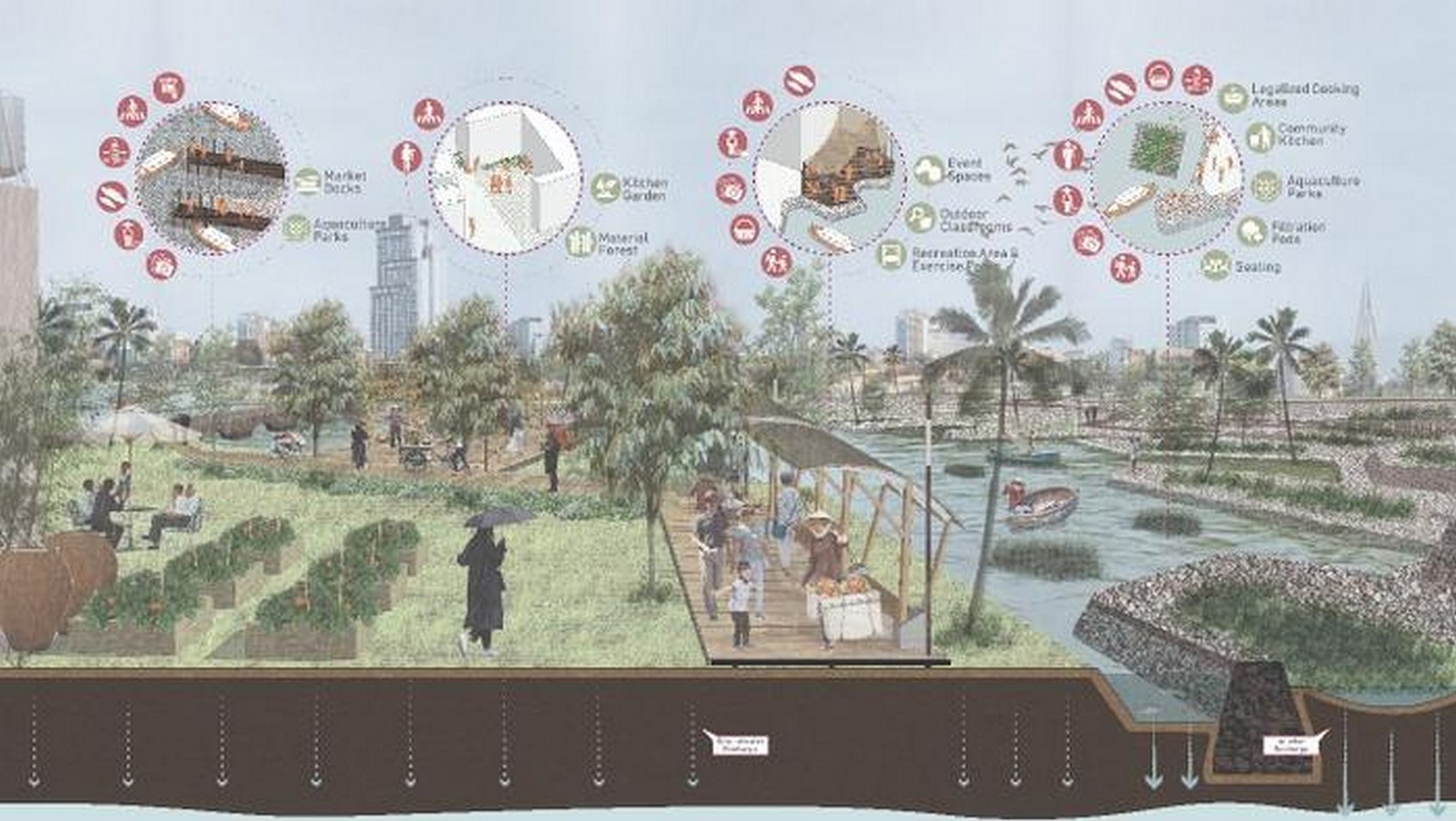
Replace stiff embankments and barriers with flexible, adaptive, and modular river interfaces. Design floodable parks, flood-resilient architecture, water plazas, and stepped terraces that can withstand changes in water levels.
- Blue-Green Infrastructure Integration
Integrate green infrastructure (trees, parks, soil, vegetation) with blue infrastructure (streams, ponds, canals, wetlands). These are the components that absorb, store, slow, clean, and transport water while providing amenity and ecological services (Porse, 2022).
- Decentralisation and Distributed Systems
Instead of a few big pieces, incorporate micro- and meso-scale water systems: rain gardens, permeable pavements, bioswales, infiltration trenches, local storage, greywater reuse networks. These alleviate main system loads and build resilience (Tasnia et al., 2025).
- Multi-Functionality and Synergy
Water infrastructure must also serve as a public amenity: parks, walkable canals and play spaces, wetlands as habitat, flood sockets as event spaces. There is no need for a waterway to be only utilitarian—it can be beautiful and social.
- Temporal Adaptability
Waterways and water regimes change in space and time. The city needs to respond seasonally, daily, and over decades. There must be infrastructure for dynamic reaction: gates, adaptable flood defences, reversible systems.
- Social Equity and Access
Water has to be available for everyone—no longer simply for waterfront elites. Water edges, marginalised communities, and peri-urban areas have to benefit from water (flood defence, water supply, public space).
- Water Leadership and Governance
A water-centric city requires commitment from institutions. Leadership, policy, and capacity for coordination of several water functions (supply, drainage, flood, ecology, and recreation) are needed. Milwaukee’s “Water Centric City Initiative,” for example, incorporates water leadership as one of its main principles (City of Milwaukee, 2024) (see also Water Centric City Initiative, 2024).
- Cultural, Educational, and Technological Integration
There should be water culture, interpretive signage, educational corridors, and water research centres in cities. Architectural design should also include water systems (Muller’s “blue architecture” is one such call) (Inside Charlotte, 2022).
- Adaptive Monitoring and Feedback
Ongoing monitoring, model updating, and feedback mechanisms enable the system to adapt, detect failure, and improve.
These principles can inform the planning, design, and governance of co-designed riverside cities.
How a City Built on a River Could Look: Speculative Morphologies
Here are imaginative predictions of how a city designed around water might physically take shape.
- Spine of the River and Branched Canals
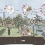
Instead of encapsulating a river in a concrete pipe, allow it to flow as a spine through the city and have branching canals emanate outward like veins. These canals transport stormwater, greywater, and overflow and serve as linear parks, promenades, and ecological corridors.
The buildings are oriented on either side, and terraces fall to the water. Bridges and pedestrian spines are landmarks. Parallel rather than orthogonal streets follow the paths of water flow.
- Floodable Parks and Water Squares
Parts of the city, especially on riverbanks, are built as flood parks. They are public gardens, sports fields, party lawns in dry times, and controlled retention areas in flood times. In Rotterdam, for instance, water squares fill with water during storms and slowly release it, which offloads pressure from sewers (The Guardian, 2024)
- Stepped Terraces and Adaptive Architecture
Along riverbanks, structures step down in elevation progressively to accommodate changing water levels. Façades can feature water-level entries or “boat docks”, elevated platforms, or amphibious foundations. Resilience in design is crucial: ground floors could be sacrificial or flexible, while higher floors are always habitable.
- Infiltration Networks and Sponge Zones
Behind the riverfront, high-absorption areas—bioswales, infiltration trenches, permeable streets, rain gardens—soak up stormwater upstream so that peak flows to the river are tempered. Dense vegetation and soil storage behave as sponges.
- Water Loop Districts
Neighbourhoods can be organised as water loops: closed loops of reused water (greywater, rainwater), local storage, and tempered discharge into the main canal or river. Residents view, walk past, and engage with water locally.
- Floating and Amphibious Zones
Where flood or rising water is particularly prevalent, floating residences, boat-stilted houses, or amphibious buildings may be the norm. Already in the Netherlands, floating housing is a reality (New Yorker, 2024)
- Buffer Wetlands and Ecological Margins
Between river limb and city, buffer wetlands serve as ecological filters, taking up runoff, eliminating erosion, and supporting aquatic biodiversity.
These morphological concepts are not mutually contradictory; in fact, a true water-focused city would mix them as required across districts.
Implementation Strategy: Vision into Reality
Making a water-focused design a reality is no easy task. Following is a phased strategy and enabling factors.
Phase 0: Baseline and Hydrological Mapping
- Plot the watershed, existing river channels, floodplains, groundwater recharge areas, and soil infiltration rate.
- Apply hydrological, hydraulic, and climate models (including future climate projections) to interpret extreme events.
- Investigate current urban infrastructure, flood risk, water demand, and drainage systems.
Phase 1: Strategic Framework and Visioning
- Create a water-focused master plan with definitive goals, zoning, and landscape corridors.
- Pinpoint priority areas (flood-prone, regeneration, growth).
- Involve stakeholders—communities, planners, engineers, ecologists—in participatory workshops to interpret the blueprint into functional prototypes.
Phase 2: Pilot Projects and Prototyping
- Start with demonstration projects: water plaza, floodable park, canal retrofit, rain garden district.
- Experiment with modular systems, governance models, and community engagement.
- Track performance strictly, feed lessons back.
Phase 3: Incremental Scaling
- Scale up the successful pilots to surrounding blocks.
- Employ adaptive thresholds: as performance meets thresholds, move forward.
- Maintain flexibility at all times: don’t overcommit to hard infrastructure.
Phase 4: Full Integration and Governance Embedding
- Generalise water-centric zoning, building codes, impervious area restrictions, buffer zones.
- Establish institutional arrangements: river authorities, water governance boards, and funding mechanisms.
- Organise long-term maintenance, data, and feedback systems.
Key Enablers and Enabling Policies
- Regulatory reform: Permit water-adaptive buildings, flood-zone codes, buffer setbacks.
- Incentives and subsidies: for rainwater harvesting, permeable surfaces, green roofs, and river-edge activation.
- Financing mechanisms: water funds, public–private partnerships, ecosystem service payments.
- Institutional capacity: cross-agency coordination among water, planning, environment, parks, and public works.
- Community participation: citizen science, water literacy programmes, local stewardship.
- Monitoring and adjustment: sensors, remote sensing, and hydrological modelling to modify over time.
Challenges, Risks, and Critiques
A water-focused master plan is not without challenges. These need to be addressed head-on, not skirted.
- Technical and Engineering Complexity: Rivers are dynamic, unresponsive, and sensitive to upstream or downstream conditions. Sediment transport, bank erosion, extreme floods, and pollution control in an urban setting are challenging tasks. The blending of engineered and natural systems needs to be accurate; simplified designs may catastrophically fail.
- Institutional and Governance Barriers: Most cities are plagued with siloed governance: water utilities, planning organisations, parks, and highways all function in isolation. A water-planning strategy requires coordination, institutional changes, and frequently new institutions. Without political will and leadership, projects languish.
- Cost and Risk Aversion: Green and resilient infrastructures tend to have longer payback periods, unknown maintenance costs, and risk exposures. Public agencies and investors might prefer tried-and-true “hard” engineering methods over untested hybrid systems.
- Social Equity and Displacement: Waterfront and riverfront sections are of high real estate value. There is a risk that water-focused redevelopment would expand gentrification, pushing out lower-income residents. Equitable access and inclusive planning need to be central.
- Climatic Extremes and Uncertainty: Severe floods or droughts can exceed design levels. Underestimating tail events may fail. Therefore, resilience must be designed in with buffers, safety margins, redundancy, and adaptability.
- Maintenance and Institutional Long-Term Capacity: Most “green infrastructure” projects are failures because once the design stage is reached, there is not enough ownership or maintenance. Without knowledge of long-term maintenance, systems fall apart.
- Retrofitting Existing Cities: Retrofitting water-oriented designs in already dense cities is much more difficult. Land is limited, infrastructure is established, and disruption risk is high. It can involve radical changes that are resisted.
Despite these difficulties, the emergence of climate change and water scarcity necessitates seeking out these strategies, not as a choice, but as a necessity.
Case Studies and Inspirations
No city yet has fully permitted rivers to “build” it, but several examples in existence offer lessons, prototypes, or partial realisations.
- Milwaukee and the Water Centric City Initiative
Milwaukee, a city where three rivers flow into Lake Michigan, initiated a Water Centric City Initiative. Seven pillars are the foundation of the initiative: water leadership, arts/talent/culture, water technology, green infrastructure, applied water research & policy, fishable/swimmable rivers, and resilient water bodies (City of Milwaukee, 2024).
Through the “Water Current Tour,” the city teaches citizens and visitors about their water past and infrastructure, infusing water into civic identity (Milwaukee Independent, 2022).
Milwaukee’s model is a model of culture, design, research, and governance infused around water, though still in its development.
- Sponge Cities in China
China’s sponge city initiative, started in 2013, seeks to make cities more absorbent and resilient. Permeable pavements, rain gardens, green roofs, and retention basins are implemented to decrease surface runoff, prevent flooding, and recharge groundwater. Tasnia et al. (2025) note that the philosophical crux is to make natural hydrological processes work (i.e., allow water to flow, percolate, and be reused). Quantitative analysis of low-impact development (LID) measures in Guangxi indicates that concurrent scenarios incorporating bio-retention, sunken green space, permeable pavements, and storage tanks can decrease runoff by as much as 75% annually (Qian et al., 2021).
Efforts at sponge cities typically target stormwater more than whole river integration, but are prime examples of the distributed, nature-based systems that are the hallmark of a water-centric city.
- Sabarmati Riverfront, Ahmedabad, India
Ahmedabad‘s Sabarmati Riverfront Development Project is India’s most celebrated riverfront intervention. The 11.25 km riverfront was built by reclaiming land and constructing embankments, promenades, roads, and public spaces (Wikipedia, 2025)
. The scheme aims to preserve flood-carrying capacity and offer recreational facilities. Nevertheless, critics note that a lot of the river water is artificially kept up through canal feedings, and untreated sewage continues to flow upstream. Groundwater has kept falling (Sharma & Bansal, 2022).
Sabarmati therefore shows the potential as well as pitfalls: great public areas, but hydrological, long-term water supply, and ecosystem integrity issues.
- Dongtan Eco-City (near Shanghai)
Dongtan was conceived as a model eco-city on Chongming Island off Shanghai, sandwiched between wetlands and the Yangtze Delta. Designers aimed to establish a closed water cycle, harvesting and reusing water, restricting off-site discharge, and using ecological buffer zones (Wikipedia, 2025)
Development has fallen behind because of finances, politics, and environmental concerns. The dream remains powerful: a city integrated into its river-wetland environment.
Waterfront Redevelopment (Casablanca, Liverpool, Hong Kong, Shanghai)
Benabbou et al. (2022) discuss several global waterfront redevelopment sites that bring back the water element into city identity—promenades, terraces, public space, and urban reconnecting to rivers (Benabbou et al., 2022).
They highlight the fact that water identity activation enhances social life, urban character, and ecological reconnecting.
- A Speculative Blueprint: River-Built city (or Any Mid-Sized City)
To put the ideas into practice, let us consider how a comparable mid-sized city would implement a water-focused master plan.
Baseline
Assume that it possesses one or more rivers or seasonal streams (nala systems). These would have been historically channelled or contaminated. The urban development has essentially neglected drainage flows, resulting in monsoon flooding and waterlogging. Groundwater is over-extracted; river quality is poor.
Vision
- The central river is turned into an urban spine: a linear continuum of ecological canal, accessible to the public, with terraces, water plazas and wetlands.
- Nalas and storm drains are daylighted where feasible and become branch waterways or bioswales.
- Floodable parks are developed on floodplains; high the monsoon season, they fill with excess water, and during the dry season, they are for recreation.
- Rainwater harvesting, infiltration zones, green roofs, permeable paving, and micro-retention systems are required in all neighbourhoods.
- Greywater and treated wastewater are reused within blocks, minimising discharge load on rivers.
- Adaptive architecture: in flood zones, buildings have elevated ground floors or amphibious design.
- Buffer wetland belts between the urban edge and the river absorb sediment, pollutants, and provide habitat.
- Riverside culture corridors, educational trails, interpretive signage, water museums, and public art celebrating water identity.
Phased Implementation
- Pilot the river spine along a central reach (2–3 km).
- Retrofit a neighbourhood as a “water loop district” with internal water circulation, infiltration, and streets reconfigured for runoff.
- Transform a floodplain area into a floodable park.
- Implement sensors and monitoring to quantify water flows, infiltration, flood peaks, and ecological indicators.
- Phase in incrementally, adaptively refining designs depending on performance.
Anticipated Benefits
- Lower flood risk because upstream and local stormwater is soaked up early.
- Better water quality through buffer wetlands and infiltration.
- Improved microclimate and minimised heat islands through green-blue networks.
- More biodiversity in the inner city.
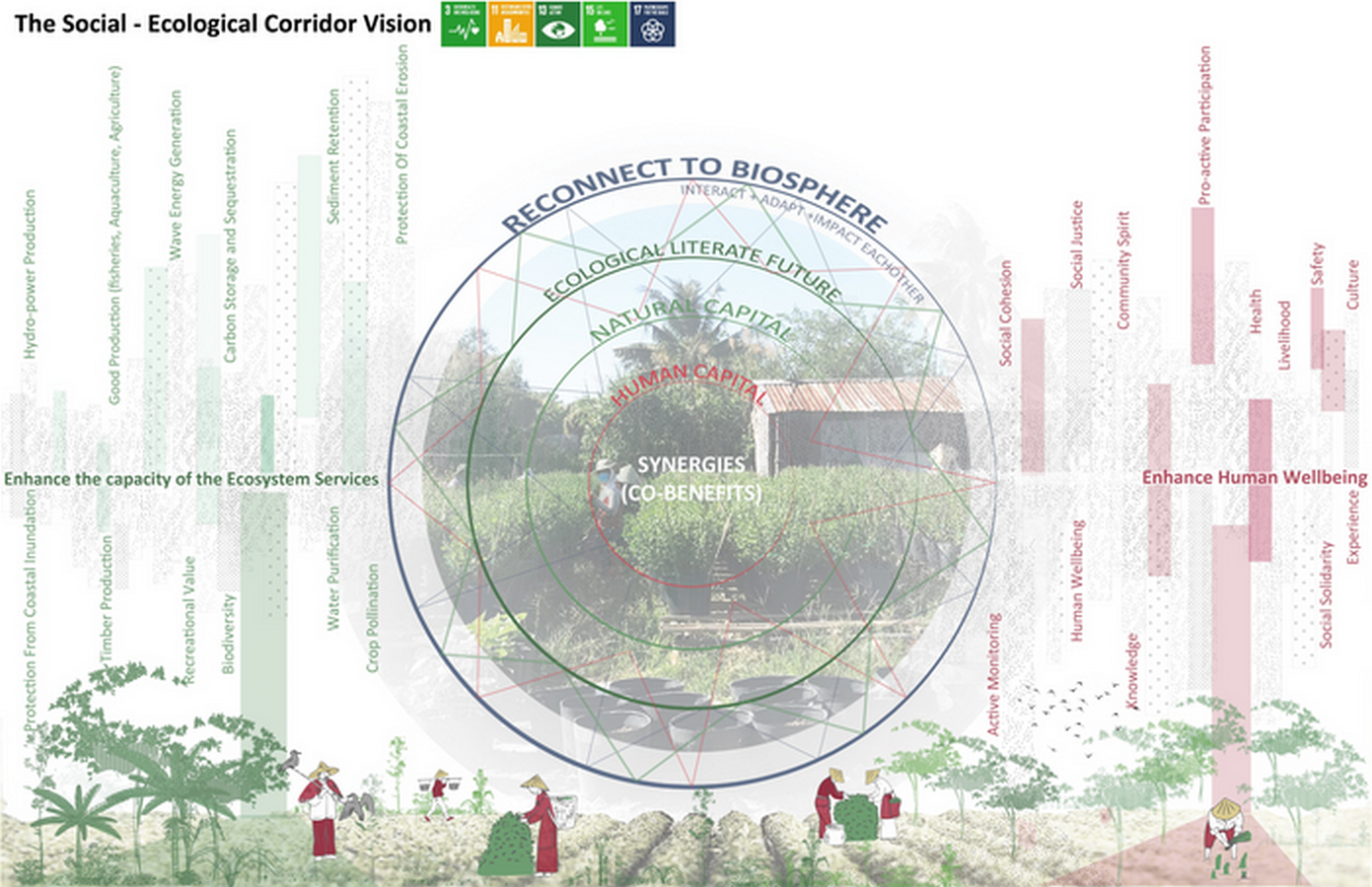
- Health, recreational, and social advantages from water access.
- Climate variation resilience.
Risks and Mitigations
- Even in severe flood years, buffer parks can become inundated—design overflow corridors and emergency bypasses.
- Maintenance strain: implement special water stewardship teams.
- Resistance from local communities, particularly where land needs to be rezoned: ensure participation, compensation, and inclusive planning.
- Hydrological model uncertainty: incorporate safety margins, learn over time.
- Upstream pollution loads: implement watershed interventions outside urban boundaries.
Although speculative, such a master plan is feasible and can be translated to numerous Indian cities or other mid-sized world cities.
Comparative Reflex: What a River-Centric City Avoids or Solves
| Traditional Urban Approach | Problems / Limitations | Water-Centric Blueprint Remedy |
|---|---|---|
| Hidden culverted rivers, piped drains | Loss of natural systems, flooding, expense, and ecological disconnection | Daylighted and integrated waterways reduce loads, improve ecology |
| Hard embankments, levees | Rigid structures, failure risk, and ecological dead zones | Flexible river edges, terraces, and floodable parks |
| Centralised “grey” drainage | Overwhelmed in peaks, limited adaptability | Distributed, modular stormwater systems ease burdens |
| Monofunctional water infrastructure | No amenity value, no social benefit | Multi-functional blue-green systems combine utility and amenity |
| Siloed planning (water separate from urban) | Coordination failures, inefficiencies | Integrated water-urban design ensures coherence |
| Reactive flood control | Expensive emergency response | Proactive absorption, retention, and adaptive buffers |
| Unequal waterfront development | Gentrification, exclusion | Equitable distribution of water access, buffer zones, and planning safeguards |
Towards a Research and Implementation Agenda
To turn these ideas into action, additional research and pilots are required. Top areas are:
- Hydrological modelling under uncertainty
New models that combine climate change, land use change, and adaptive infrastructure responses.
- Performance assessment of hybrid water systems
Long-term monitoring and comparative analysis of green-blue systems vs. traditional infrastructure.
- Cost-benefit and lifecycle assessments
Quantify economic, social, and ecological paybacks, including avoided damage from flooding, health benefits, and ecosystem services.
- Institutional design for integrated water governance
Examples of effective river authorities or governance boards that span departmental boundaries.
- Community engagement and water literacy
Approaches to engaging citizens in stewardship, citizen science, and participatory water system design.
- Retrofitting strategies for dense cities
How to retrofit water-focused systems incrementally in already constructed settings.
- Resilience and failure modes
Investigating safe failure, redundancy, buffer design, and adaptation to extremes.
- Cultural and aesthetic integration
How design, architecture, art, and landscape can infuse water identity into cities meaningfully (e.g. “blue architecture”) (Inside Charlotte, 2022)
- Ecological reconnection and biodiversity
Research on how aquatic systems, river corridors, fish passages and wetlands can be revitalised in the matrix of cities.
- Policy and financing frameworks
Innovations in water funds, payments for ecosystem services, bonds, and public-private models.
The notion that rivers could “build” our cities is poetic—but beyond metaphor, it implies a reconsideration of the way we think about, plan, and govern urban structure. In the context of climatic uncertainty, water scarcity, and accelerating urbanisation, a water-based design holds the promise of a resilient, human, and nature-regenerative future.
Such a master plan doesn’t supplant all traditional infrastructure, nor does it guarantee some utopian refuge from danger. But by integrating with hydrology rather than fighting against it, by inserting corridors of absorption, storage, reuse, and dynamic response, we can engineer cities that are adaptive, gorgeous, socially equitable, and profoundly embedded in the waters that give them life.
References:
American Planning Association. (2017). Planners and water: A planning advisory service report. APA.
Benabbou, R., Hui, Y., Roberts, E., & Shao, J. (2022). Reinventing the image of cities using the element of water: International case studies of waterfront urban developments. International Case Studies of Waterfront Urban Developments. (via ResearchGate)
City of Milwaukee. (2024). The Water Centric City Initiative presentation. (PDF)
city.milwaukee.gov
Inside Charlotte. (2022, May 23). New work promotes water-centric methods in architecture, urban planning. (News)
Inside UNC Charlotte
Porse, E. (2022). Editorial: Urban water management, planning, and design. Frontiers in Water, 4.
Qian, L., Wang, F., Yu, Y., Huang, Z., Li, M., Guan, Y., et al. (2021). Comprehensive performance evaluation of LID practices for the sponge city construction: A case study in Guangxi, China. arXiv.
Tasnia, T., et al. (2025). A systematic literature review of water-sensitive urban design. Land, 14(2), 224.MDPI
The Guardian. (2024, February 1). ‘Water comes from all four sides’: how Rotterdam’s tidal park protects the city.
Wikipedia contributors. (2025). Sabarmati Riverfront. Wikipedia.
Wikipedia contributors. (2025). Dongtan, Shanghai. Wikipedia.
Cities & Rivers. (2023, June 7). Issuu. https://issuu.com/actar/docs/cities_rivers
Urban Design Lab Educations Pvt. Ltd. (2022, August 5). Integration of rivers in urban development. Urban Design Lab
. https://urbandesignlab.in/integration-of-rivers-in-urban-development/?srsltid=AfmBOop1PB-ZOrUrGG-TciJgTKzwmiKZi6inhKMA8W3fpcUElQhb5HJl
Water Urbanism: Can Tho – Columbia GSAPP. (n.d.). Columbia GSAPP. https://www.arch.columbia.edu/books/reader/419-water-urbanism-can-tho