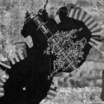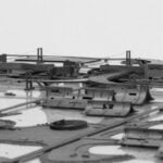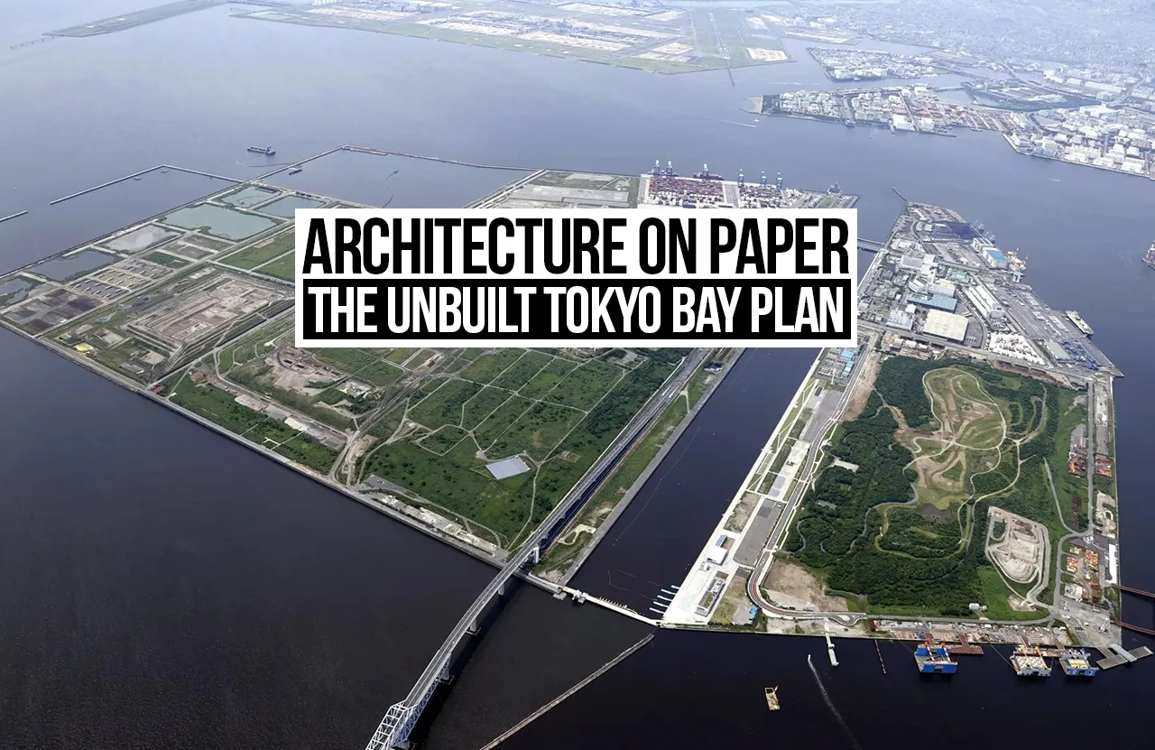
Probably the most famous structure in twentieth-century architecture is the Tokyo Bay Plan. When Kenzo Tange wrote out his plan for Tokyo in 1960, he envisioned a city that could keep on developing without becoming congested. Although the plan was never realised, one almost cannot even mention a megastructure or postwar Japanese architecture without mentioning it. Not because of the built structures, but because of the ideas it made possible. Roads, railways, housing and urban development could all be seen as part of the same system, and a drawing could be architecture.
A City Looking for a New Form
By the late 1950s, Tokyo was outstripping its current infrastructure. The population rose from 3.5 million in 1945 to 10 million in 1960. The Harvard GSD Urban Design Case Study Archive confirms Tokyo was experiencing the consequences of economic growth and the constraints of its current infrastructure.
But the problem was the geometry. Because Tokyo was a centripetal city, and everything different flows towards the centre, each new inhabitant demanded more and more space from a location which was already congested. The conventional policy was to encourage growth in an outward direction. Junichi Hasegawa reports that the 1958 metropolitan plan, which aimed to do this, proposed establishing a greenbelt zone around the central districts to disperse both the population and industry. Tange, however, had a different idea. Instead of trying to force the city outwards, he wondered what would happen if the centre could be enlarged.
Land was obviously the problem, and the bay clearly the answer. “Hiseakira Kano, who was president of the Japan Housing Corporation, gave up trying to find cheap land for builders and began to explore new land, away from landlords. For those people, the bay stopped being the fringe of the city and became its largest undeveloped land.”
The Tokyo Bay Plan: Constructing a Megastructure City
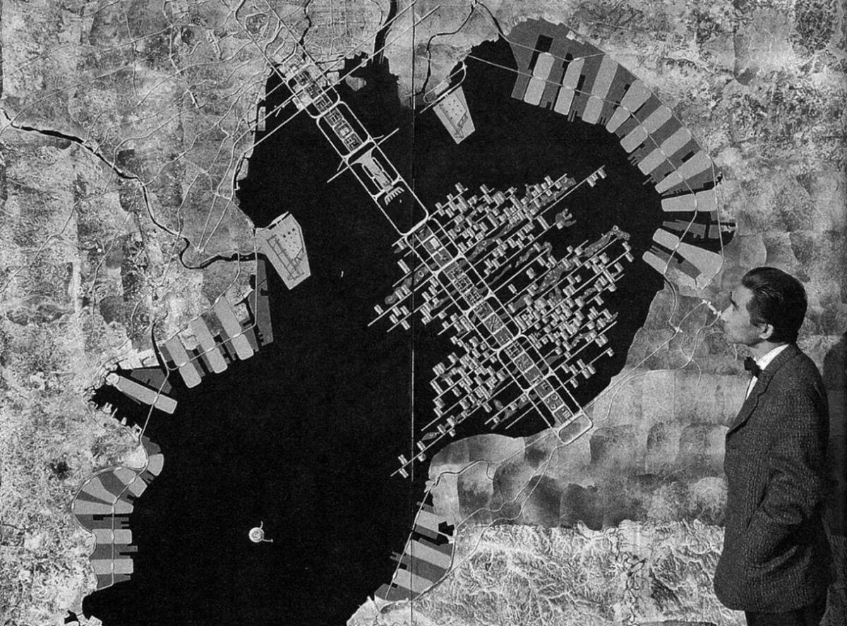
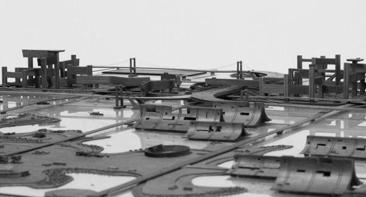
Imagine the spine uncoiled above the water. As this is from the Harvard archive: “The concept was based on a linear megastructure of linked loops. It would reach about 18km (11.2 miles) into Tokyo Bay and was projected to house five million additional inhabitants.” From Hasegawa: “to be the ladder-shaped megastructure and bridge-section across Tokyo Bay with back-branches reaching out perpendicularly from either side of the line of structure, thus enabling multi-storey dwellings to be built,” observed on the 1960s report; a newspaper comment of that period calling the axis ‘the backbone of the latest animal’.
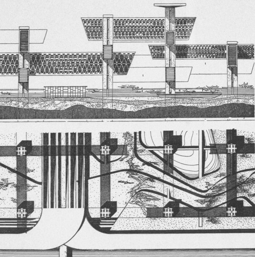
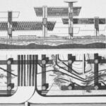
The plan has an architectural feel to it, due to the layering of the spine. There is a fast motorway route as the core, with secondary roads and a subway system running underneath or parallel. Elevated walkways are used to keep pedestrians from competing with the vehicle traffic and slow human passengers from contending with fast motorway travel. Residential areas, business areas, and industrial and recreational areas are all placed on platforms and artificial islands, which are designed to contain most of their needs while remaining linked in some way to the spine.
The infrastructure here exists as the structure onto which the buildings hang. It has been remarked that Tange saw the car as having transformed the way in which human beings experience space and that the city needed a new hierarchy whereby a single vehicle moves from fast roads to slow roads before stopping at its destination. In the Harvard archive, his three aims were to move from a singular, use-driven, arbitrarily concentric order to one that is linear and scalable, to throw structure, transport and architecture into a moment of convergence, and to develop a 2D spatial hierarchy of topographical organisation that reflects lateral, decentralised mobility. The city grows by expansion, not inflation.
The Metabolist Dream Meets Urban Reality
The project is linked to ‘Metabolism’, a stream of thinking which saw cities as living systems that grow, evolve and replace parts. The archives from Harvard and other sources stress its living, modular expansion. Arch Eyes is more precise: we have a fixed lattice of roads and subways with a programme which flexes as the needs change. Permanent forms the foundation of the temporary.
Why not use it? Evidently, the cost. Hasegawa finds that the newspapers have for some time called the reclamation schemes ambitious and expensive, but he is, as so often, interested in the policy question. As large-scale reclamation violated the doctrine of dispersal, it was taken as encouraging concentration in Tokyo, and this was contrary to the policy of the 1958 metropolitan development plan and the 1962 Comprehensive National Development Plan. In his view, the government turned down large-scale reclamation in 1962 already.
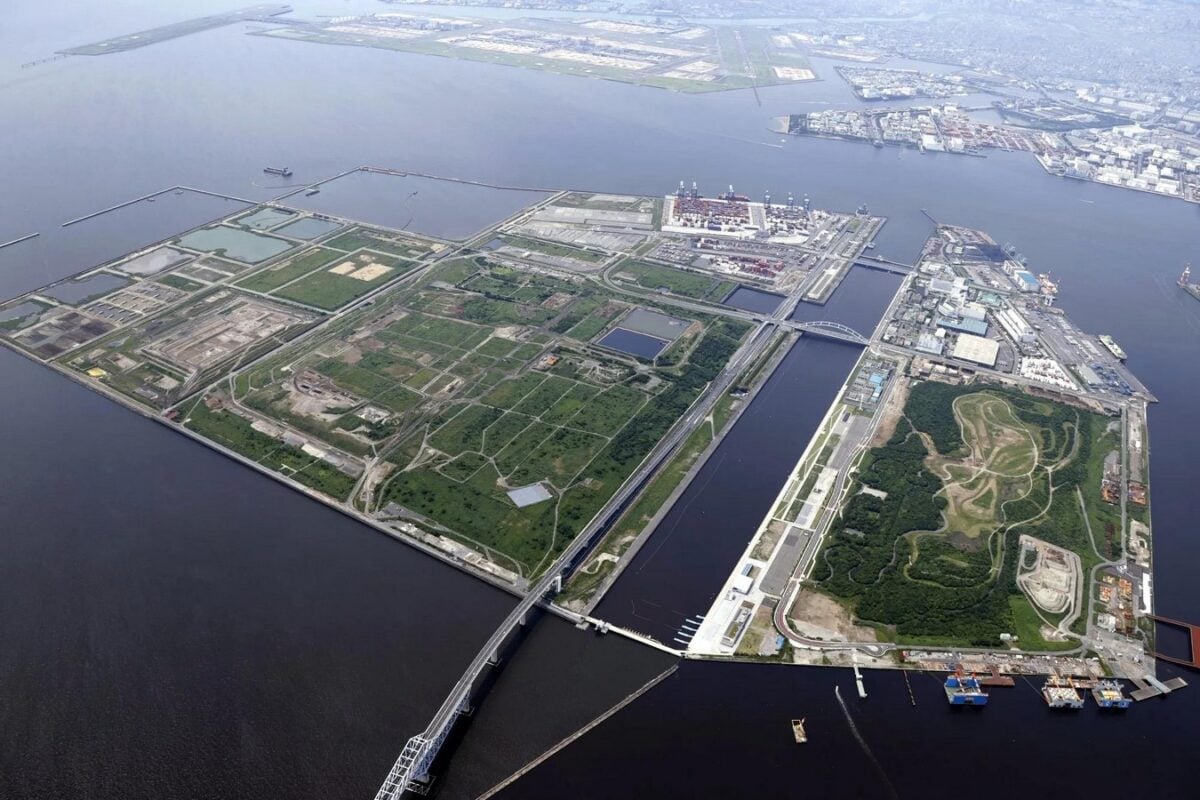
A warning must be issued. The most relevant aspect of Hasegawa’s paper is the plans for reclamation using the ideas of the Kano and the Council for Industry Planning, which have been an inspiration for architects including Tange’s; even though Tange’s plan is in the same period, it was another project, so that this assertion can be applied to that plan as well.
Hasegawa arrived at the central conclusion that an absence of a decisive national policy had produced contradictory policies and fractured stakeholders. The conflicts were real; Chiba wanted industry, while Tokyo and Kanagawa no longer did. Even politicians against extensive reclamation supported airports and coastal roads on reclamation. There was also the question of technology: the opposition to deep alluvial mud described in the Diet, as a concept for the metropolitan area, meant that no one had a fixed idea.
When an Unbuilt City Continues to Leave a Legacy
Can we consider a project that was never built to be a successful one? Hasegawa notes that it is considered by academics that Tange’s dream has been the inspiration for megastructure thinking all over the world in the 1960s, and similarly, Arch Eyes believes that this project initiated the ‘megastructural’ movement and marked the start of Tange’s building and urban experiments.
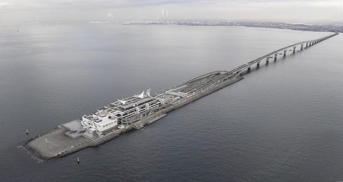
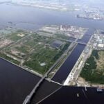
The bay was developed in several phases that were carried out in isolation. Hasegawa observes the reinstatement of different waterfront plans such as Yokohama’s Minato Mirai 21 and Tokyo Teleport Town in the 1980s, then mentions the Trans-Tokyo Bay Highway, or Aqua Line (opened in 1997, built as a bridge and tunnel rather than as the road, railway and breakwater on reclaimed land as had been proposed). He states that the grand plan was ‘thrown to pieces as several projects, essentially motivated by a wish to stimulate demand for construction, rather than state urban planning’, with only 0.66 m² out of the 11 m² of public space in the waterfronts planned to be actually provided for residential developments, whereas in his version of events, Tange’s 1986 plan and later suggestions by Kurokawa advocated housing and public space rather than private speculation.
That contrast may be the plan’s greatest benefit. Although artificial land and waterfront developments became the norm, the principle that infrastructure should coordinate architecture, housing and public life as a whole was not carried over in full. It is here that the idea of “architecture on paper” becomes meaningful. The Tokyo Bay Plan never relied on each and every line turning into actual buildings. Tange’s method may have been more symbolic than practical. Nevertheless, it did provide architects with a means of imagining the city as a whole thing—something bigger than a simple collection of buildings, a structure that was capable of growing, adapting and connecting. Although a drawing cannot realise that city, it can affect what the profession thinks a city could be, and that kind of influence is difficult to measure in terms of built square metres.
References:
- ArchEyes. (2022). Plan for Tokyo 1960 / Kenzo Tange. https://archeyes.com/plan-tokyo-1960-kenzo-tange/
- Harvard Graduate School of Design. (n.d.). A Plan for Tokyo: 1960. Urban Design Case Study Archive. https://udcsa.gsd.harvard.edu/projects/64
- Hasegawa, J. (2024). The plans for Tokyo Bay: the challenge of urban policy, 1950s–1990s. Urban History, 51(2), 414–434. https://doi.org/10.1017/S0963926823000184