The history that has been taught to us revolves around Romans in Britain, the Norman conquest in 1066; Henry VIII and the Tudors; the American War of Independence; Victorian industrialization; the battle of Somme; and the rise and fall of Nazi Germany and small accounts here and there of civilisations and empires that perished. The accepted and lazy history is one where one civilisation influenced the next, a history where ancient Greece gave rise to Rome, Rome gave rise to Christian Europe, Christian Europe to the Renaissance, the Renaissance the Enlightenment, the Enlightenment the political democracy and the Industrial Revolution. Industry crossed with democracy yielded the United States, symbolizing the rights to life liberty and the pursuit of happiness and the Western superpower.
There are alternate ways to look at history, one that does not involve looking at the world from the perspective of the winners of the recent past. People travelled across continents from the earliest times and the knowledge that was passed down orally was rarely recorded. These are neutral accounts of world history, one where winners and vanquished come secondary. One through the lens of cultural exchange and routes of pilgrims and warriors, where nomads and merchants travelled, where goods and produce were exchanged and ideas were refined, where ideas and words travelled from the mouth of a common man and not of empires that ruled.
Trade routes have been the backbone of human civilisation, the arteries that linked distant lands and shaped societies over the centuries. In the past, these roads linked the Pacific, Central Asia, India, the Persian Gulf and the Mediterranean. It was not only goods that flowed along these arteries but also ideas and thoughts, and intellectual and religious exchange that shaped societies.
The routes whose centre flourished and cities that ruled the world are all but forgotten now. These routes are where empires rose and fell, where after effects of clashes between cultures and rivals were felt a thousand miles away. Where languages flourished and evolved, where Indo-European, Semitic and Sino-Tibetan tongues wagged alongside those speaking Altaic, Turkic and Caucasian. Where the world’s greatest religions burst into life, and where Judaism, Christianity, Islam, Buddhism and Hinduism bumped against each other.
Through architecture and trade, we see the change in the global landscape. Trade routes shaped the landscape of cities with a physical manifestation of ideas and thoughts that travelled these routes, demonstrating an influence of power while also serving as an identity for cultural and religious change.
The Ancient World and Foundation of Global Exchange
The early trade routes from the prehistoric civilisations of Mesopotamia, Indus Valley and Ancient Egypt emerged around 3000 BCE. These trade routes exchanged agricultural products, pottery and tools and developed urban centres like Uruk and Mohenjo-Daro, with architecture such as ziggurats and bathhouses symbolising wealth and the organisation of society. They were a catalyst for the rise of empires and control over regions for economic and political dominance.
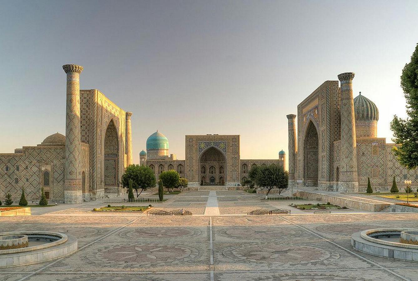
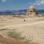
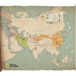
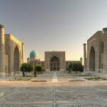
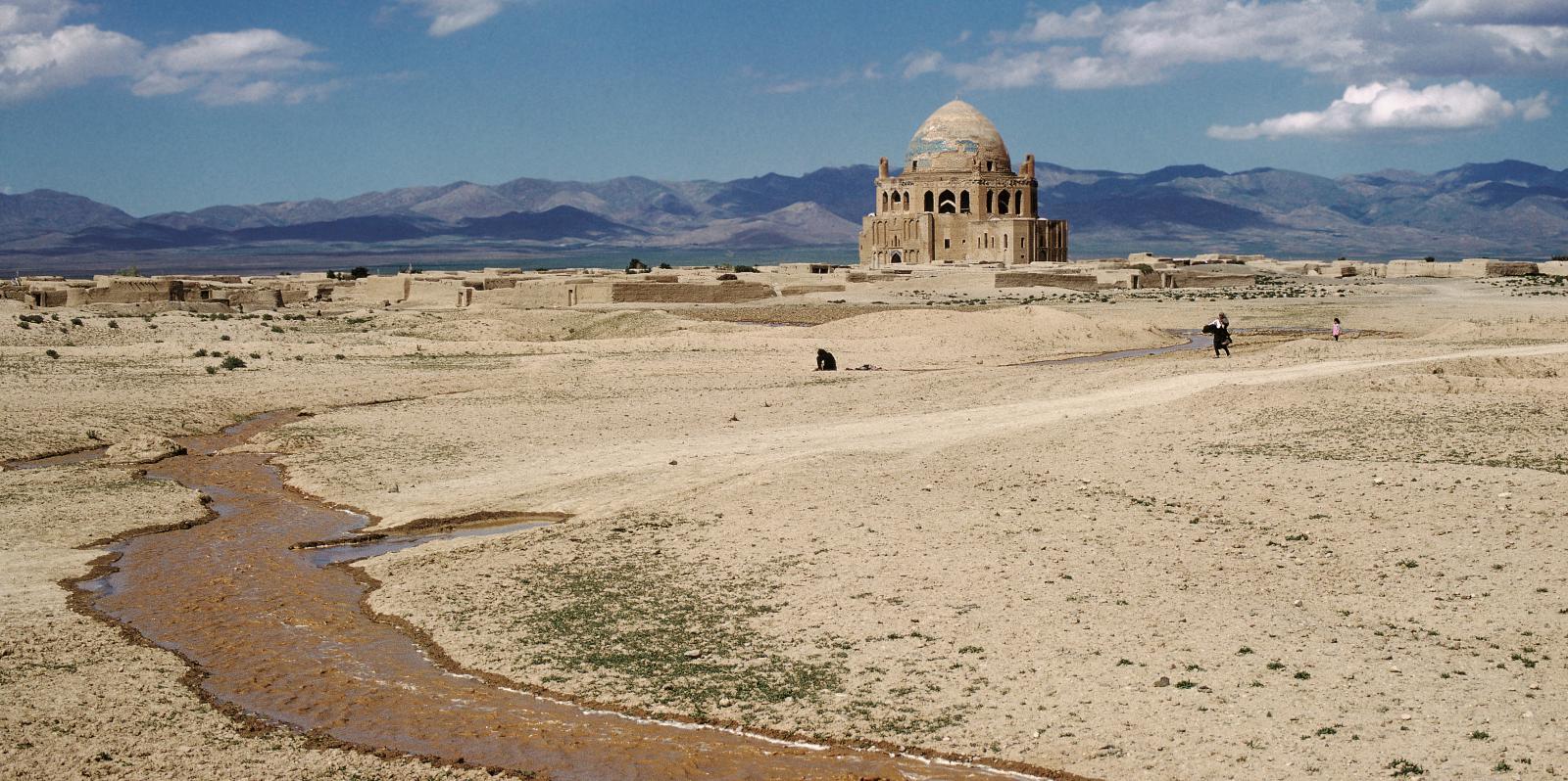
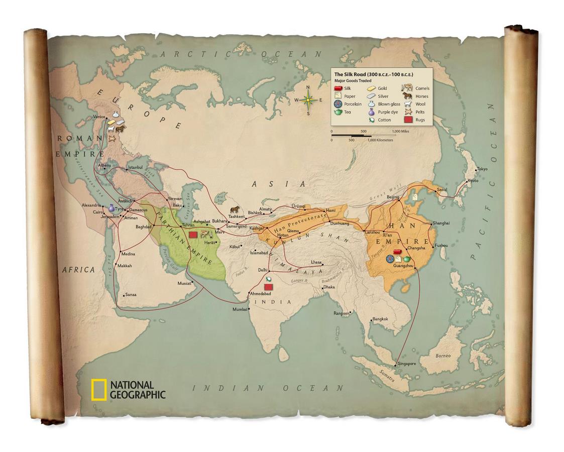
The Silk Roads were established around 200 BCE and became the lifeline of commerce for cities from China to Central Asia, Persia and Europe. These routes enabled the exchange of high-quality silk from China to the Roman Empire, gaining the name Silk Road. Along with the exchange of silk, spices, paper and metals; the exchange of religious and cultural ideas was also taking place. Cities like Samarkand and Bukhara flourished as cultural hubs, showcasing Islamic architecture with grand madrasas and caravanserais that served traders and travellers. The Byzantine Empire in the West and the Tang Dynasty in the East thrived showcasing the wealth from these trade networks in their architectural wonders.
The Age of Exploration

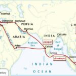
The Maritime Spice Routes of the Indian Ocean, famous for the spice trade from India to Western countries, were well known between the first millennium CE and the fifteenth century. Coastal cities such as Malacca, Calicut, and Zanzibar developed into prosperous ports, displaying architectural marvels including mosques, palaces, and defended docks. The interchange of spices, linens, and jewels benefited local economies while also disseminating Islamic culture and maritime technology. During this time, the Chola Empire in South India expanded its influence throughout Southeast Asia, as evidenced by temple architecture and commercial networks connecting India to Java and Sumatra.
Trans-Saharan trade routes in Africa allowed empires such as Ghana and Mali to develop between the 8th and 17th centuries. These routes facilitated the trade of gold, salt, and ivory, allowing the building of architectural marvels such as Timbuktu’s mosques and Gao’s palaces. The wealth generated by trade enabled these empires to become cultural and intellectual powerhouses, with Timbuktu rising as a hub of Islamic study and commerce.
The Age of Exploration, which spanned from the 15th to 17th century, witnessed European nations build trans-Atlantic and trans-Pacific routes, signifying an important turning point in global commerce. The trade-in spices, sugar, gold, and enslaved people transformed economies and gave rise to the colonial empires of Spain, Portugal, and Britain. The Columbian Exchange had a major effect on agricultural methods and ecosystems, while wealth created by colonies funded the construction of European architectural projects such as the Versailles Palace and the Lisbon Cathedral.
The trans-Atlantic slave trade between the 16th and 19th centuries had vast impacts on society and the economy. The inhumane exploitation of African labour powered the Americas’ plantation economies, leading to the creation of port towns such as Havana. This century also witnessed the emergence of colonial communities with a combination of European and indigenous architectural forms, reflecting the complicated cultural exchanges and struggles of the time.
The Modern World
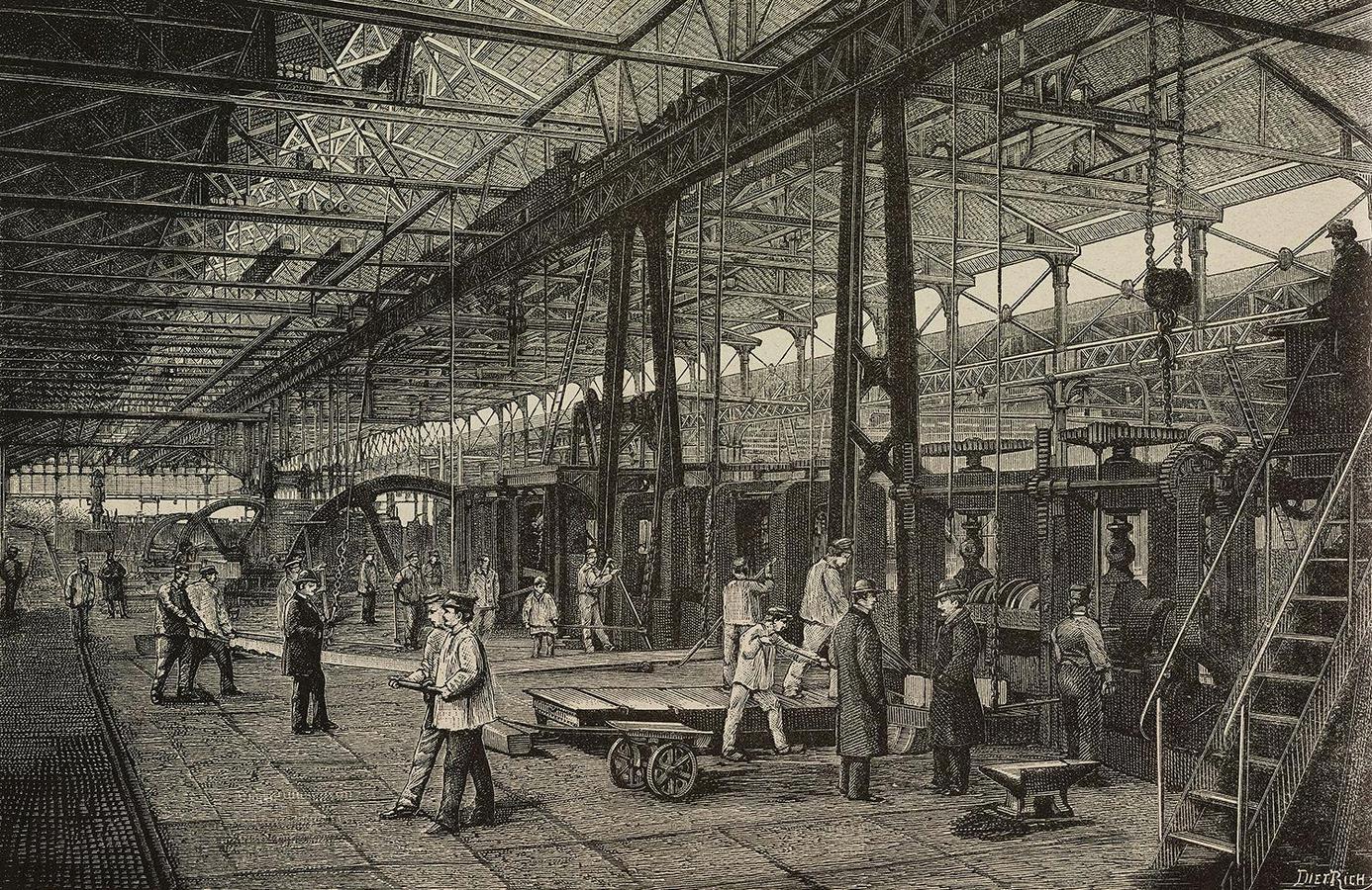
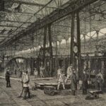
The 18th century Industrial Revolution transformed trading with developments in transport including ships and railroads. Cities such as Manchester, Mumbai, and Shanghai became centres of trading and evolved, with manufacturing facilities, storage spaces, and architecture that represented industrial power. Colonies were combined into a worldwide supply network, with architecture reflecting the economic power of European nations. This era also saw the growth of the British Empire, as well as the final demise of the Ottoman Turks, whose architecture demonstrated control over vast resources.
Trade routes in the modern world have changed as technology has advanced, including the creation of canals such as the Suez Canal and the Canal of Panama, as well as the creation of digital trade networks. Cities such as Dubai, Singapore, and Shanghai have evolved as global trading hubs, with innovative design and technology to match their economic importance. The expansion of regional trade has been encouraged by the development of global economies, which has further transformed the architectural and geopolitical landscapes.
Lessons for the Future
Trade routes have played a major role in shaping the global landscape, not only through architecture but also through ideas that travelled these routes. The trajectories of empires and civilizations were shaped on these routes, from ancient caravans of the Silk Roads to the digital trade network of the 21st century, the exchange of goods and influence of ideas keep changing the world on every level.
Architecture will continue to play a crucial role in the process of trade of ideas and goods. From ancient caravans of the Silk Roads to the digital trade network of the 21st century, the story of trade and architecture remains as lessons, one of innovation, collaboration and progress. By reflecting on these lessons of historical trade routes and the course of architecture for the global landscape we can overcome the challenges of the past.
- Books
Lowe, N. (2013). Modern World History. 5th ed. London: Palgrave Macmillan.
Marsha, A., Michael, S., Janice, T., Jiu-Hwa, U., Mark, W., (2008). Encyclopedia of World History-complete volumes. New York: Infobase Publishing.
Peter, S. (2001). The Encyclopedia of World History. 6th ed. New York: Houghton Mifflin Company.
Jack, M. (2009). A comprehensive outline of World History. Texas: University Press of Florida.
Frankopan, P. (2015). The Silk Roads A New History of the World. Great Britan: Bloomsbury
Whitfield, S. (2000). Life Along the Silk Road. University of California Press.
Beaujard, P. (2019). The Worlds of the Indian Ocean: A Global History. Cambridge University Press.
- Online sources
Minerva Magazine. (n.d.). Surveying the Silk Roads. [online]. Available at: https://minervamagazine.com/surveying-the-silk-roads.html [Accessed: 7 January 2025].
China Highlights. (n.d.). Silk Road Facts. [online]. Available at: https://www.chinahighlights.com/silkroad/silkroad-facts.htm [Accessed: 7 January 2025].
Encyclopaedia Britannica. (n.d.). Silk Road: Trade Route. [online]. Available at: https://www.britannica.com/topic/Silk-Road-trade-route [Accessed: 7 January 2025].
- Images
Image 1_ Minerva Magazine. (n.d.). Silk Road Map. [Map]. Retrieved from https://minervamagazine.com/media/posts/6/silkroad.png
Image 2_ National Geographic Society. (n.d.). The Silk Roads. [Interactive resource]. Retrieved from https://education.nationalgeographic.org/resource/silk-roads/
Image 3_ Travel Earth. (n.d.). Top Places to Visit in Uzbekistan. [Photograph]. Retrieved from https://travel.earth/the-top-places-to-visit-in-uzbekistan/
Image 4_ English with Sophia. (2022). The Spice Route Map. [Map]. Retrieved from https://www.englishwithsophia.com/wp-content/uploads/2022/04/geo-the-spice-route.jpg
Image 5_ Getty Images. (n.d.). Ancient Trade Routes Map. [Photograph]. Retrieved from ThoughtCo
- Maps
Minerva Magazine. (n.d.). Silk Road Map. [Map]. Retrieved from https://minervamagazine.com/media/posts/6/silkroad.png
English with Sophia. (2022). The Spice Route Map. [Map]. Retrieved from https://www.englishwithsophia.com/wp-content/uploads/2022/04/geo-the-spice-route.jpg