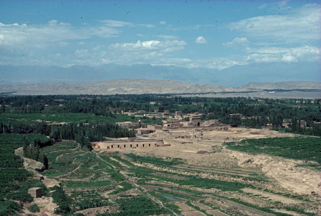
Turpan was once an important base of the Silk Road. Today there is a strong agricultural industry focused on grapevines, the main export item from the region. Located in a hollow in eastern Xinjiang, Turfan Village is one of the few places on earth that is below sea level. Turpan is a long, narrow stretch of land bounded by mountains to the north and south and lies at a negative elevation of over 500 feet. The area offers attractive terrain, vegetation, and wildlife due to the varying elevation from the valley floor to the summit. Permanent snow covers the peaks and reveals lush green landscapes deep in the valleys. An oasis nestled in the desert, Turpan offers a welcome respite from the dry heat and miles of sandy beaches.
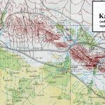
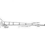
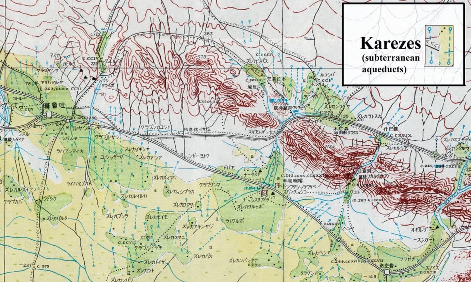
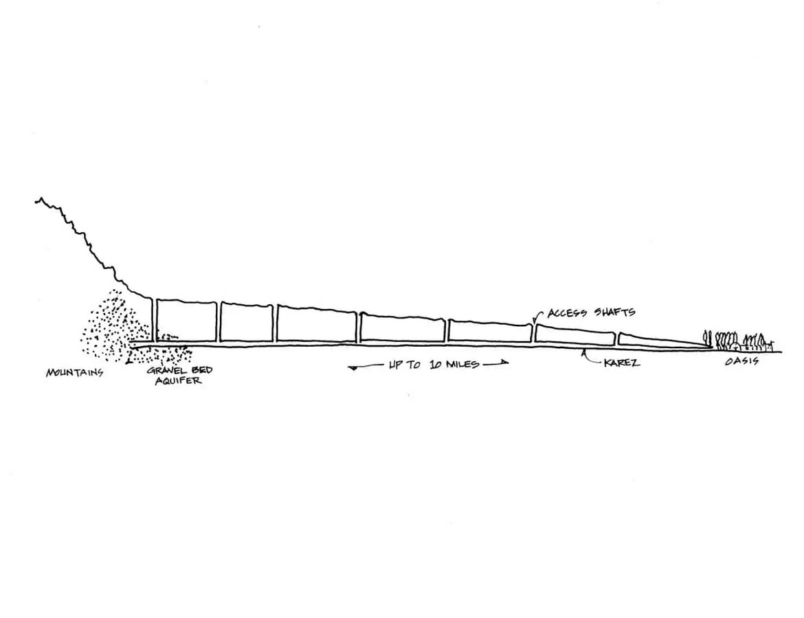
Despite the extreme heat and harsh dry climate, Turpan flourished through trade and agriculture thanks to radical hydrological innovations brought from Persia centuries ago. This is the Karaze system, an underground aqueduct that pumps water from the foothills of the Tianshan Mountains to an oasis in the north. A kareze is a tunnel dug beneath the surface of the desert, carefully constructed to maintain a constant, shallow slope to prevent erosion. Turpan thus enjoys clean and cold water for domestic and agricultural purposes throughout the year. A map of Turpan made by a Japanese spy in 1943 shows Kalez as a dotted line.
The brutalist concrete architecture of downtown Turpan can be found anywhere in China, but in certain neighborhoods the old town still stands, if only barely, on a side street lined with ancient poplar trees. The gates of the houses are painted with Persian flowers or hand-carved with abstract geometric patterns. This is the Central Asian architecture of the Uyghur Muslim minority.
History of Turpan
It is located in the Turpan Basin and is surrounded by irrigated fields. Turpan was contested and controlled for 1,500 years by successive waves of nomads, Chinese, Tibetans, Uighurs, and Mongols. After about 400 years, it began to decline, and after about 100 years, it was raped for its treasures – frescoes, sculptures, and 2000-year-old relics.
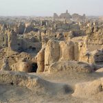
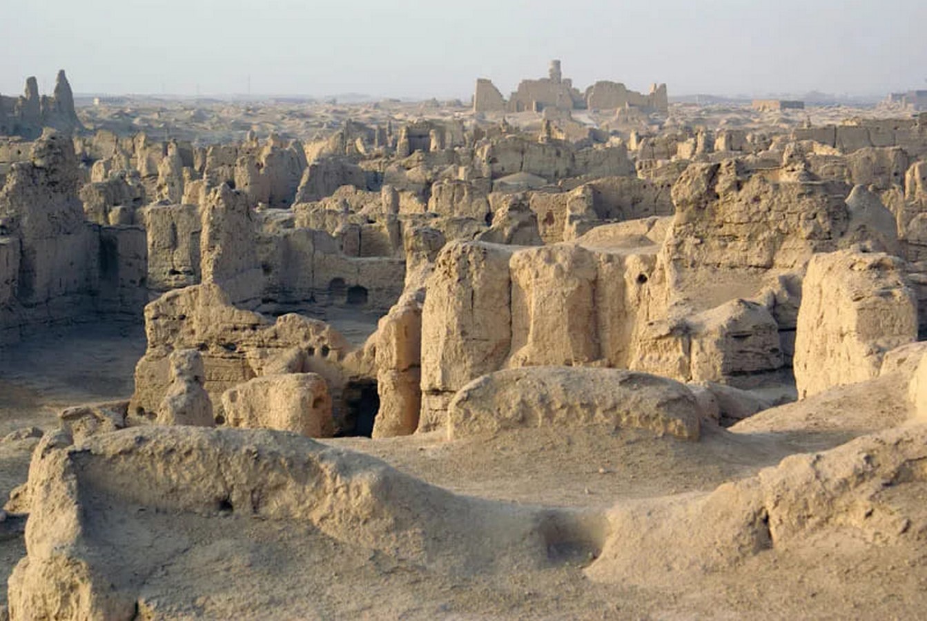
Turpan used to be an important strategic point on the Silk Road. Already two thousand years ago, a city called Jiaohe was built kilometers from today’s Turpan city. Jiaohe was then the capital of the outer kingdom of Chshi. During the first century, Jiaohe came under the rule of the Han Dynasty (206 BC to 220 AD). During the sixth century, Turpan was under the rule of the Gaochang Kingdom. During the reign of Emperor Tai Zong (626-649), the Gaochang Kingdom was conquered by the Tang Dynasty (618-906), and Turpan once again became a border city of China, serving as a stopover for merchants, monks, and other travelers. on their way west.
The Uyghurs emerged as a regional power around AD 750 in what is now Mongolia. Turpan has been an Uyghur city since the ninth century when Uyghurs immigrated to the area and established the Qocho Kingdom.
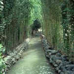
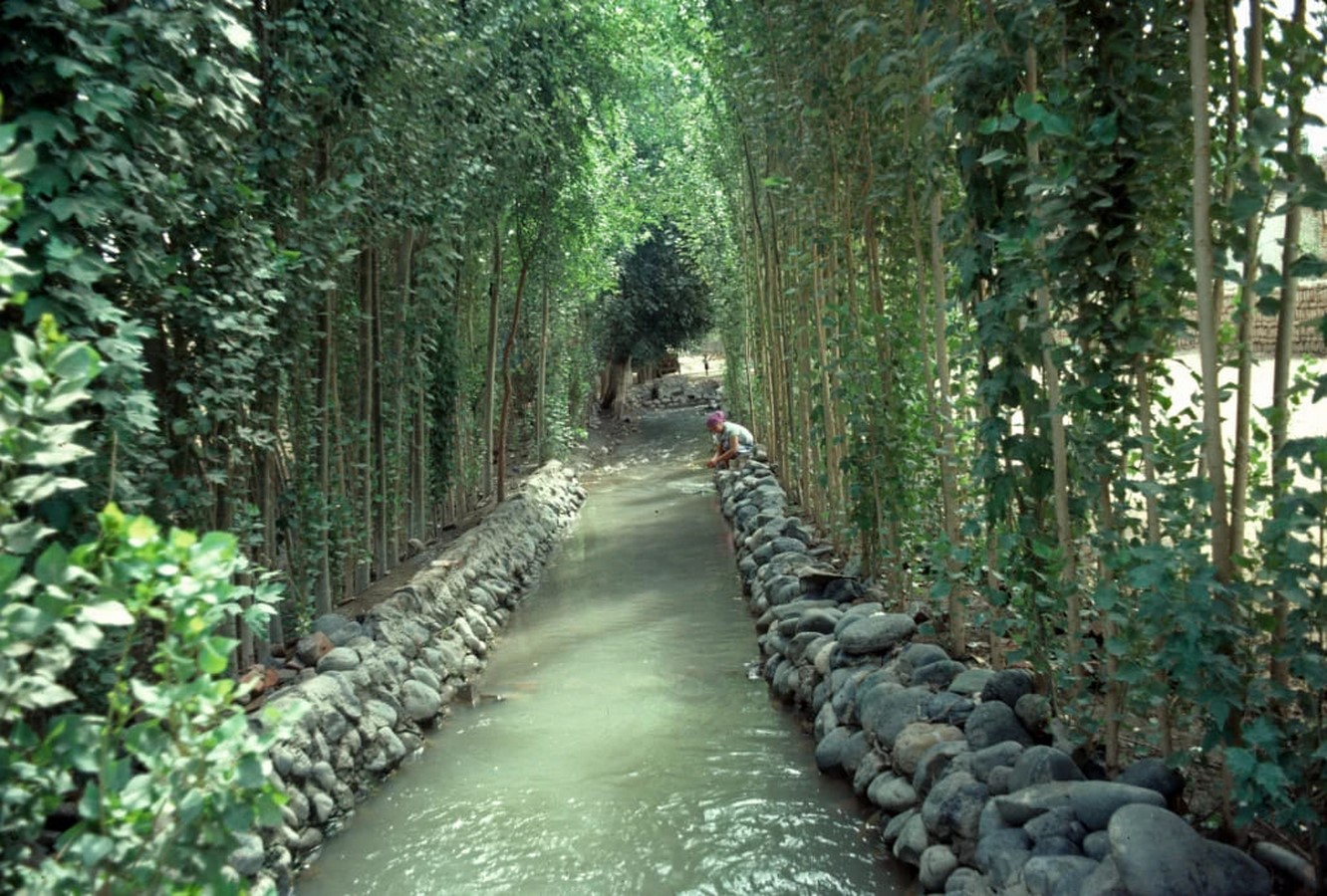
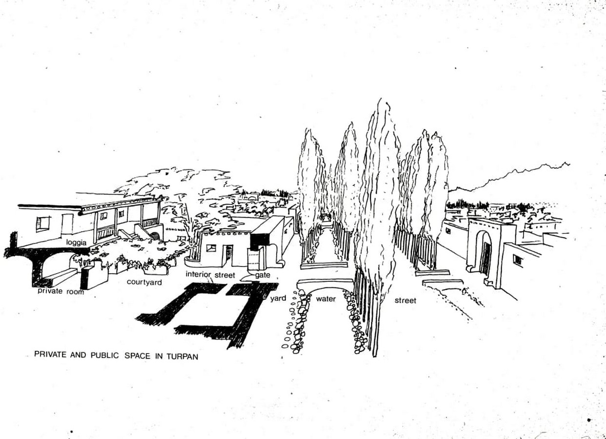
The Kareze flows into the city’s system of canals that form the boundaries between streets and apartments. Tall and straight poplar trees line the canal. It performs several important functions. It provides deep shade for houses and streets. They create a windbreak to control dust. Wood for construction and heating is readily available. It also creates a microclimate on the street by evaporating moisture from the leaves into the air, creating a natural air conditioner that can reduce the temperature of the street and adjacent houses by up to 20 degrees Fahrenheit. The water circulates entirely through the city by gravity before entering its second canal system for agricultural irrigation. All of these are truly sustainable methods that are done without the use of mechanical devices or artificial energy sources.
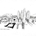
The house form used in Turpan for centuries was the typical indigenous house found in an arc stretching from Morocco to North Africa, the Middle East, and Central Asia. All the living spaces are arranged around the courtyard, which serves as the main living area of the house. The design is a highly efficient and sustainable building form perfectly suited to hot and dry climates without the use of mechanical means of artificial heating or cooling. At night, cool air collects in the courtyard, and heat stored in the thick surrounding walls during the day is released into the night air. During the day, the gradually warming mass of the house draws the cool air of the yard into the surrounding interior.
Another important feature of Turpan’s indigenous houses was the construction technique based on adobe bricks combined with a simple wooden frame made of poplar. The materials are 100% organic, non-toxic, biodegradable, and recyclable and do not require fossil fuels. processing and transportation. This worked well for two reasons. Second, construction methods were easily transmitted through oral instruction and were so simple that most people could build their own houses.
Apart from its perfectly rational ecological attributes, the typical traditional Turpan house is also a home for organizing and managing social relations between the members of the family who house it and the rest of the community. The privacy afforded by the house seemed more harmonious than the public life of the street. There were eight social environments organized in a linear order. A short, wide bridge over the canal in front of the house. A narrow yard between the canal and the front wall of the house. A monumental gate creates a private space facing the street but is separated by a canal. Internal streets are separated by economic zones. courtyard; second-floor mezzanine overlooking the courtyard; And finally the very private interior of the family.
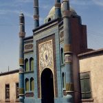
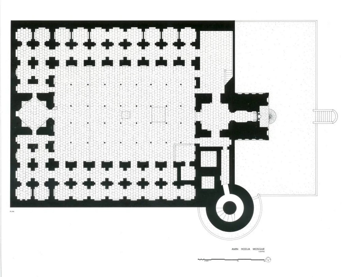
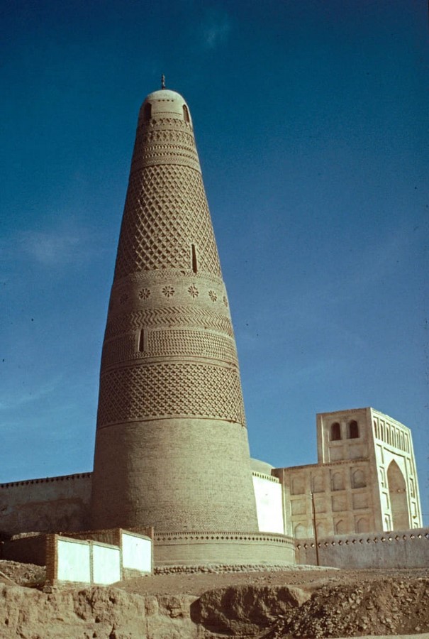
There were two types of mosques in Turpan. Small mosques serve their neighborhoods and large congregational mosques serve the entire community. Most of the smaller mosques disappeared when the areas they served were destroyed. Neighborhood mosques, such as the one shown here, usually had ornate street entrances followed by narrow passages leading to simple, often open prayer halls. This motif recalls a much older and defunct precedent where minarets were made of bundles of reeds. These were placed in pots of water to protect them from insects. The old traditional forms of brittle materials remained in later durable materials.

The vernacular architecture of Turpan functioned as a physical armature of Uyghur culture and a clear indicator of a permanent, transparent social structure. The destruction of this architecture meant a fatal weakening of traditional social relations and ultimately the destruction of the entire society. The Chinese government saw this as a means of eradicating the Uyghurs as a separate ethnic group and establishing a total surveillance state in Xinjiang province. Among other methods of control was the destruction of mosques.
References:
Hays, J. (no date) Turpan area of Xinjiang: Karez Wells, grapes, ancient Silk Road cities and a Hot Depression, Facts and Details. Available at: https://factsanddetails.com/china/cat15/sub104/entry-6533.html (Accessed: November 6, 2022).
Silk road: Turpan: China: Luxe and intrepid asia (no date) Remote Lands. Available at: https://www.remotelands.com/destination/turpan (Accessed: November 6, 2022).
The case of Turpan, China: How to destroy a culture (2019) American Geographical Society Library. Available at: https://agslibraryblog.wordpress.com/2019/10/03/the-case-of-turpan-china-how-to-destroy-a-culture/ (Accessed: November 6, 2022).