Humans have been communal beings since the beginning of time. They would rather remain in groups and communities. Everything stems from people’s basic requirements, one of which is shelter and habitat. Numerous elements such as food, water, transportation, communication, and clothing emerged into the equation after diverse trade and interaction activities emerged. This gave rise to civilizations, which evolved into cities and towns. As the population and manufacturing of products increased following the industrial revolution, so did the demand for dwelling, resulting in unplanned growth.
After an in-depth evaluation of these challenges, the solution was to effectively implement and design various sectors of the town to preserve the environment, stimulate economic growth, and give adequate space for all. Urban planning is a compilation of sociological, economic, environmental, and constructive activities aimed at making an urban area a decent, healthy place to live, work, and go around. It was done to resolve the harmful physical and social effects of the industrial revolution on individuals, particularly in metropolitan areas.
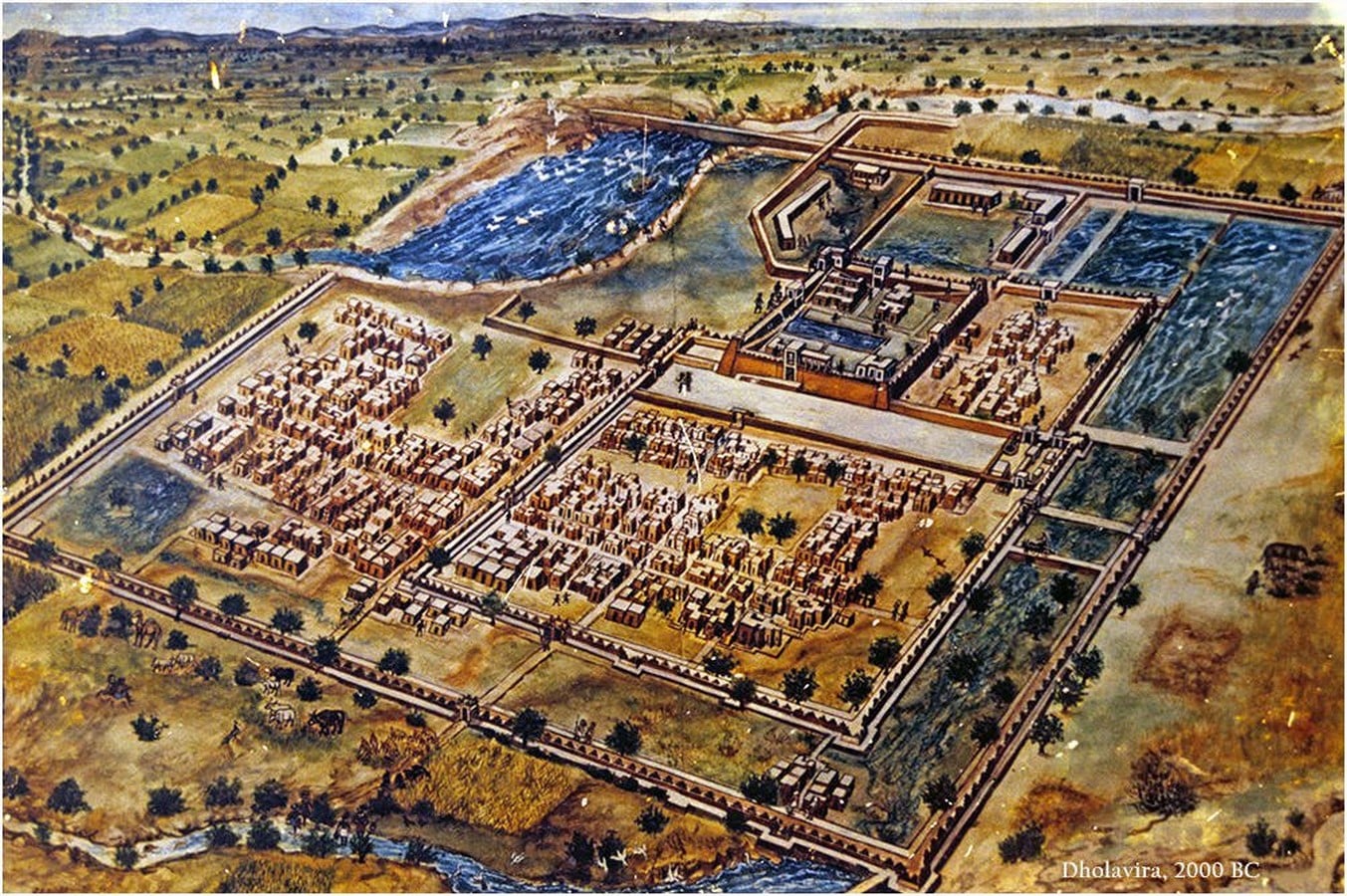
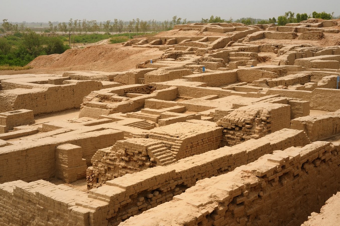
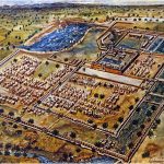
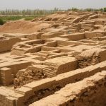
The beginnings of urban planning in India can be traced back to the Indus Valley Civilisation’s planned towns of Mohenjodaro and Harappa as early as 2500 BC. Cities and towns were also formed around forts and trade and commerce hubs throughout India’s history. The city was split into two parts. A fort-like structure was built to safeguard the city’s higher and upper levels. Perhaps the governing class of the towns lived in the protected region. The second section of town was lesser in elevation than the former, and common men lived there. Indus Valley’s main streets ran from north to south and east to west, meeting at right angles.
The roadways were wide, ranging from 9 to 34 feet. They ran a mile straight. They were suitable for wheeled transportation. Lanes were connected to streets. There was a public square in each lane. The civilization‘s complex drainage system was a unique feature. Cities featured magnificent dockyards, granaries, warehouses, brick piers, and fortifications. Massive citadels guarded the city against floods and invaders. Most city people were traders and artisans.
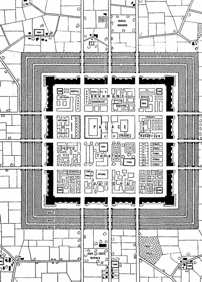
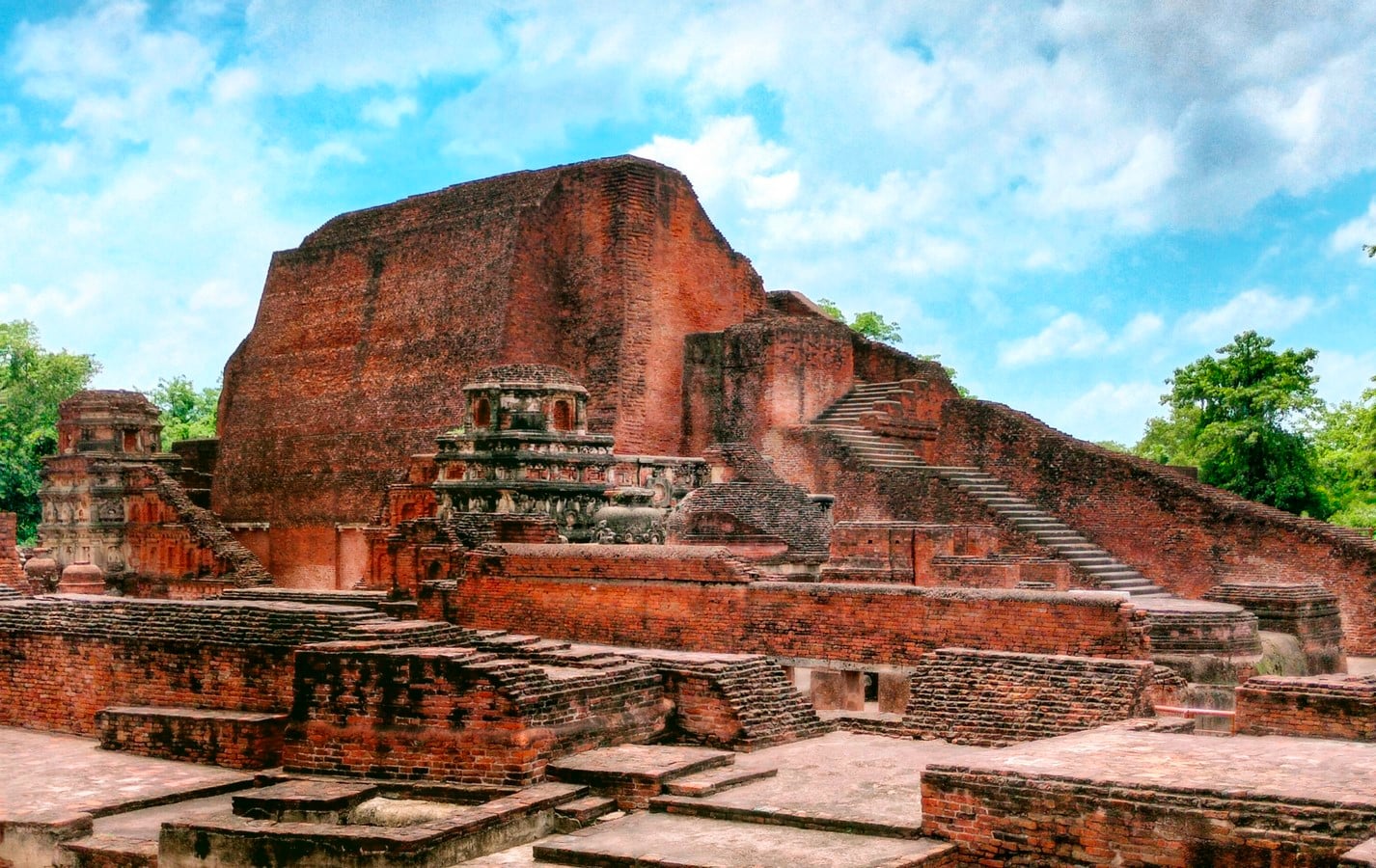
The medieval period in India was a transitional phase, and under unpredictable political conditions, planned and systematic urban growth was not possible. Fortifications were built in several towns. Buddhist architecture and development are heavily affected. the well-known “Arthashastra,” a treatise on urban planning. It specified the following features: Community-based zoning regulation. The excavation at Patliputra, the capital of Magadha (now Bihar), demonstrates advanced planning expertise. During this time, Taksha-sila and Nalanda, the famed learning center, were founded.
As the years progressed, several leaders launched political invasions to conquer regions in search of a better lifestyle, status, and capital. Medieval towns, whether in India or elsewhere, were walled and surrounded by an outside moat. The entire town organization was divided into socially hierarchical classes that were controlled by the chieftain or jaghirdar.
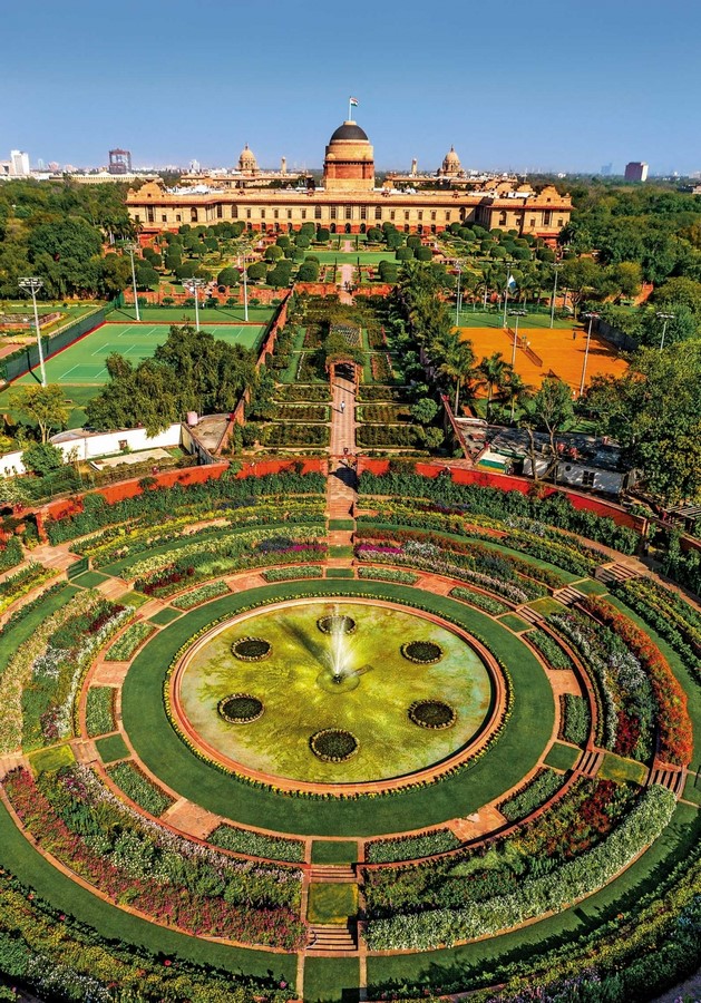
Mughals adopted the Hindu notion of Vaastu Sastra, as well as rectilinear form and pattern, in locating towns and cities, and were later influenced by the Rajput style in both buildings and layouts. Mughal supremacy reached its pinnacle under the reign of Shah Jahan. The city’s infrastructure was designed in a geometric layout. Both Persian and Hindu traditions of town planning and architecture can be observed with the Persian influence accounting for the rigidity and symmetry of the palaces, lawns, and promenades.
The Industrial Revolution and advancements in transportation influenced urban layout in India by the time the British settled and colonized most of India in the latter half of the nineteenth century. The introduction of railways accelerated urbanization. The nature of this economic activity characterized these colonial cities from traditional towns and urban settlements in India. Railway towns such as Jamalpur, Waltair, and Bareilly grew. In the mid-nineteenth century, the nature of the colonial city evolved even further.
Following the First War of Indian Independence, town planning in British India changed dramatically. Around this time, underground piped water supply, sewerage, and drainage systems were also installed. Thus, sanitary vigilance became another approach to governing Indian communities. The British design paradigm in the subcontinent comprises wide, straight roads; a supply of water and sewage infrastructure; segregation of land uses; provision of open space; garden communities; regulation of new development. Furthermore, the British Colonial era in India witnessed the emergence of contemporary urban planning and building codes.
In the years following independence, political leaders and international organizations were preoccupied with the issue of how the city should appear in an independent India. New cities were built, most notably in Chandigarh, but also in Bhubaneswar and Gandhinagar. The government also housed hundreds of thousands of Partition migrants by constructing houses in Delhi and Calcutta, as well as new towns in Punjab. Most critically for the institutionalization of planning, several cities began to develop Master Plans for the first time, with support from the Central Government and a push from the Five-Year Plans.
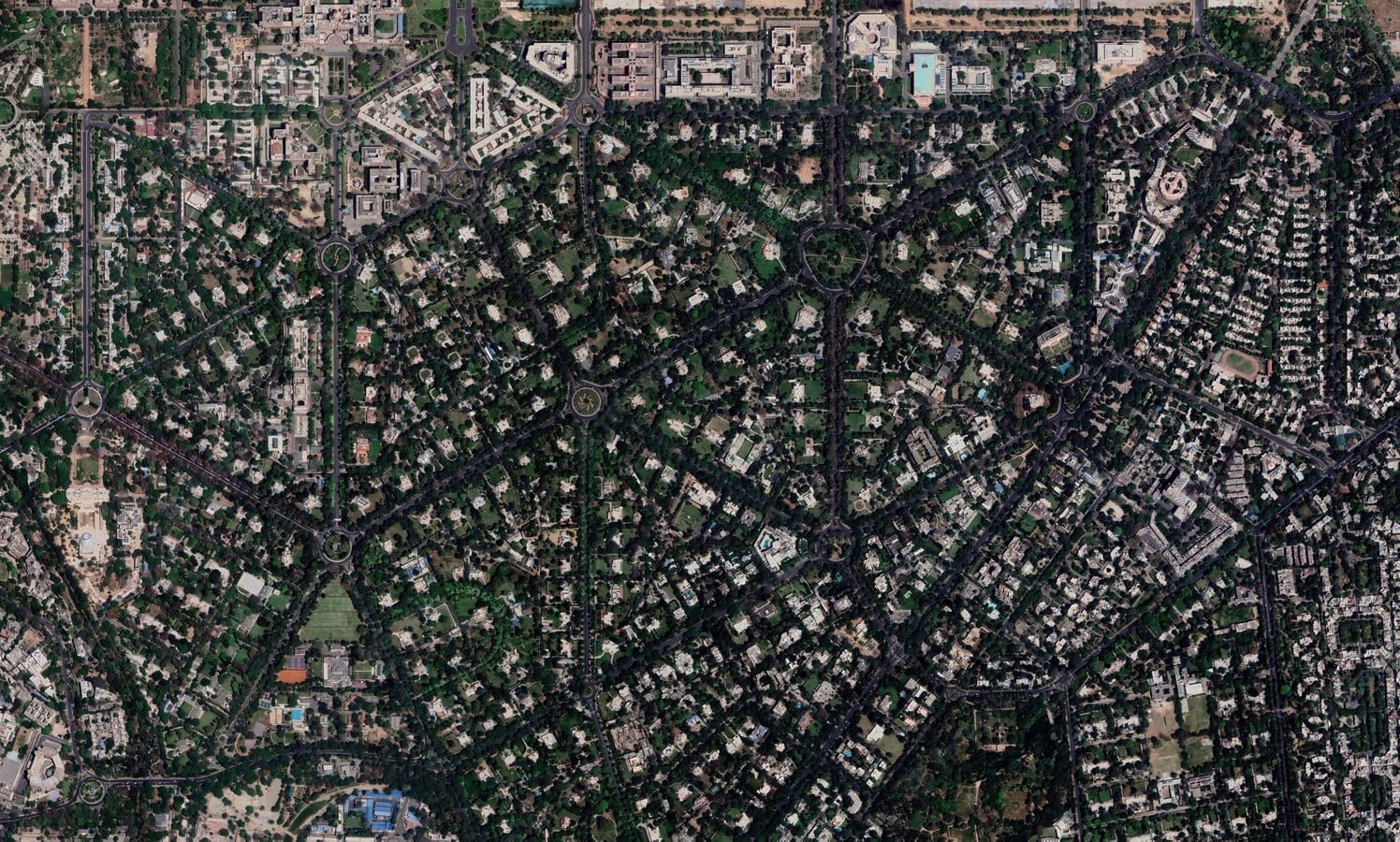
The post-independence era saw the introduction of Master Plans with a ‘Top-Down Approach.’ Plans that were land use plans with a proposed Circulation network of Ring Roads and arterial roads thrown in, along with a set of zoning regulations, building regulations, and layout rules- with execution given to both civic bodies and Development Authorities such as Water and Sewerage Board, Housing Board, Industrial Development Corporation, and so on. These Master plans were exceedingly ambitious in their plans for the city. They were creative solutions to a new environment for urban planning, resulting from collaborations between American and Indian planners, social scientists, and officials.
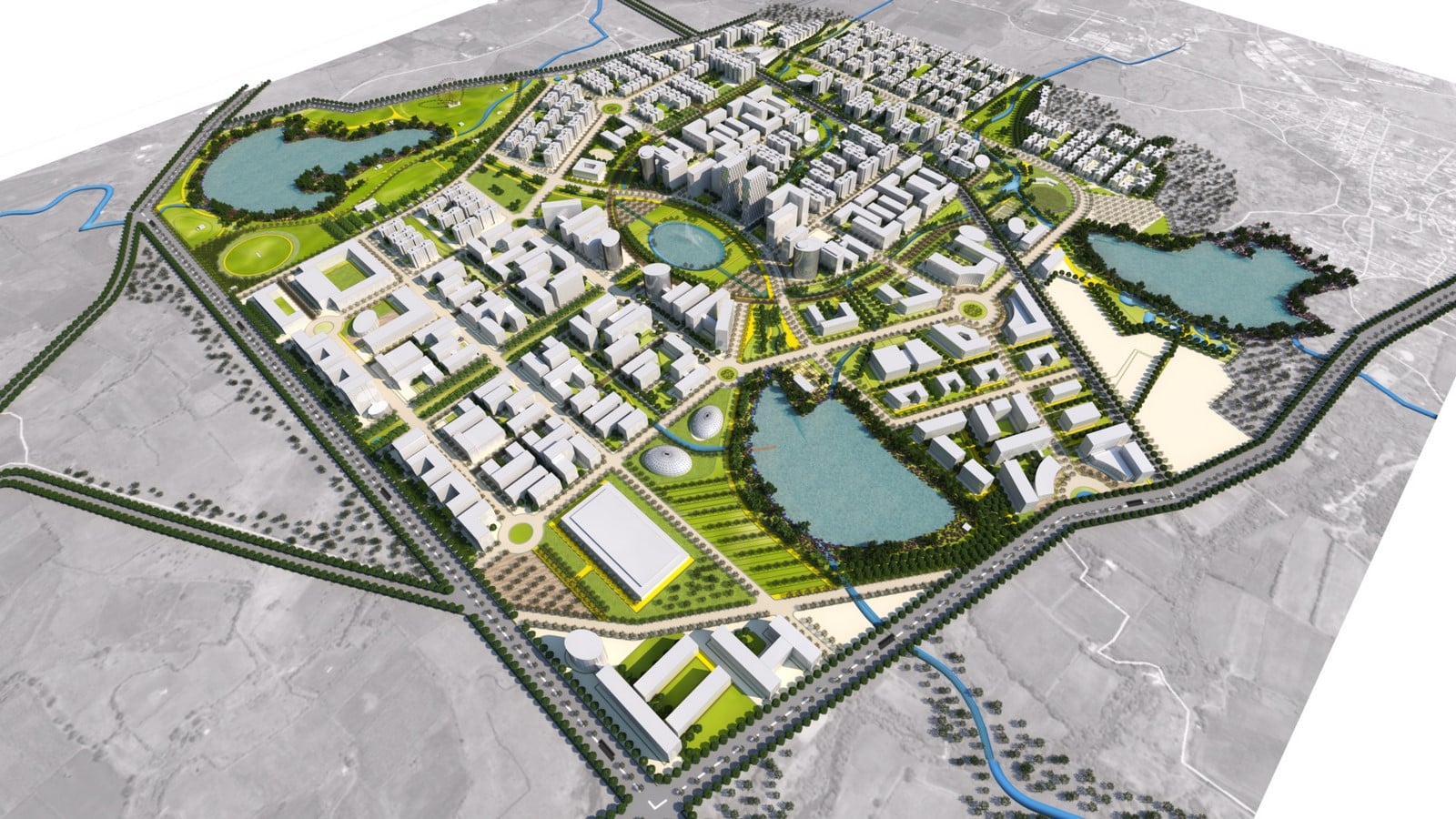

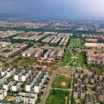
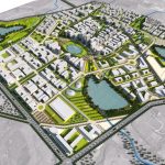
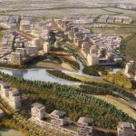
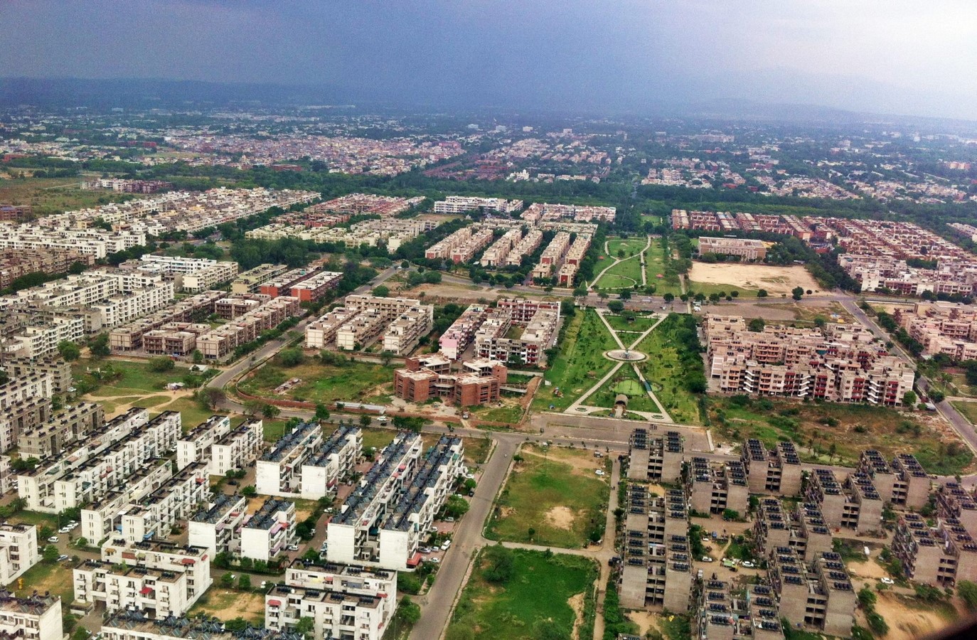
India is accelerating its development to catch up with the developed nations. One such breakthrough is the implementation of the smart city mission. A smart city in India will provide its citizens with the best amenities. It makes good use of the available land. The Indian government set an initial goal of 100 smart cities. This project is almost finished. In its proposal, India’s list of smart cities includes practically every corner of the country. States and union territories are also responsible for carrying out this plan.
Building a ‘world-class urban India in a sustainable and methodical way is a herculean task. This necessitates a massive government urban planning effort that incorporates meaningful citizen participation. The government’s work must include collecting resources, modifying the rules of supporting technologies, and offering opportunities to residents. This will improve their ability to take advantage of appropriate learning opportunities, allowing them to play a role in the mission’s suggested ‘inclusive’ strategy.
References:
- gauravashist (2017). Town planning in india. [online] Available at: https://www.slideshare.net/gauravashist/town-planning-in-india [Accessed 20 Jan. 2023].
- Gahlawat, S. (n.d.). TOWN PLANNING IN INDIA -ANCIENT AGE -MEDIEVAL AGE -MODERN AGE. www.academia.edu. [online] Available at: https://www.academia.edu/28716657/TOWN_PLANNING_IN_INDIA_ANCIENT_AGE_MEDIEVAL_AGE_MODERN_AGE.
- BYJUS. (n.d.). Urban Planning in India – Challenges and Solutions. [online] Available at: https://byjus.com/free-ias-prep/urban-planning/.
- education.nationalgeographic.org. (n.d.). Urban Planning | National Geographic Society. [online] Available at: https://education.nationalgeographic.org/resource/urban-planning.
- www.iias.asia. (n.d.). Cities, Towns, and Urbanization in Medieval India | IIAS. [online] Available at: https://www.iias.asia/the-review/cities-towns-and-urbanization-medieval-india [Accessed 20 Jan. 2023].
- Advisory, D.S.K.S. in P.P. (2017). Urban Planning and Development: The Indian Challenge. [online] Athena Infonomics. Available at: https://www.athenainfonomics.com/urban-planning-india/.
- Hamzah Meraj, Faculty of Architecture, Jamia Millia Islamia, New delhi (2014). Medieval cities. [online] Available at: https://www.slideshare.net/hamzaaaaaah/medieval-cities.
- Magicbricks Blog. (2022). 8 Smart Cities in India that are Best for Living. [online] Available at: https://www.magicbricks.com/blog/smart-cities-in-india/129132.html [Accessed 20 Jan. 2023].
- Ansumant (2020). Satellite City | Meaning, Characteristics, & Examples. [online] Planning Tank. Available at: https://planningtank.com/settlement-geography/satellite-city.
- Quora. (2022). What is the history of town planning in India? [online] Available at: https://www.quora.com/What-is-the-history-of-town-planning-in-India [Accessed 20 Jan. 2023]
- Anon, (n.d.). Rajkot Smart City Masterplan Under Smart Cities Mission, Govt. of India – INI Design Studio. [online] Available at: https://www.inidesignstudio.com/portfolio/rajkot-smart-city-masterplan-under-smart-cities-mission-govt-of-india/ [Accessed 20 Jan. 2023].
- BYJUS. (n.d.). Urban Planning in India – Challenges and Solutions. [online] Available at: https://byjus.com/free-ias-prep/urban-planning/.
- says, R.T. (n.d.). Top 12 Upcoming and Planned Satellite Cities of India. [online] Available at: https://www.walkthroughindia.com/cities/top-12-upcoming-planned-satellite-cities-india/ [Accessed 20 Jan. 2023].