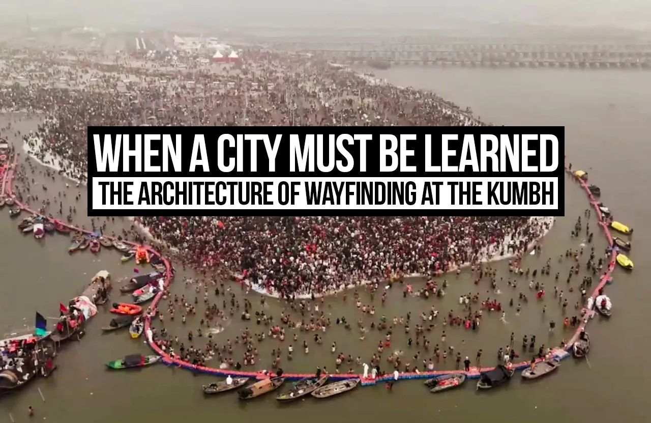
Imagine arriving in a city that you’ve never been in before. You’re surrounded by unfamiliarity: the streets, stalls, and junctions are unfamiliar; the landmarks almost identical; and the movement around you constant. As voices and announcements overlap and compete for your attention, you struggle to figure out which of the multiple turns lead to your desired destination. You follow signs, interpret what they say, and try to locate yourself. Somewhere in the midst of deciding where you want to go and navigating yourself there, the city becomes difficult to decipher.
Now imagine, such a city has been designed for you and for a million others who remain just as overwhelmed as you.
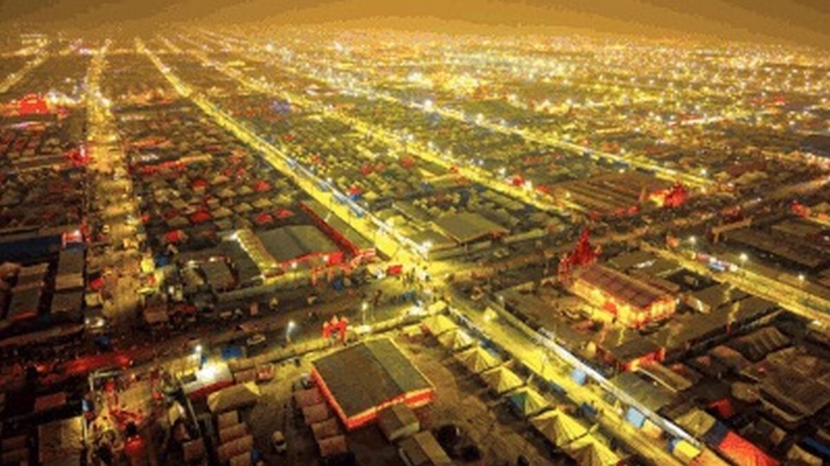
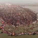
The Maha Kumbh Mela serves as the perfect setting to examine this hypothesis. In 2025, the Maha Kumbh’s temporary settlement reportedly sprawled across a massive 4,000 hectares, accommodating nearly 15,000 tents alongside an elaborate network of roads, bridges and public infrastructure. The Kumbh Mela was a city in its own right: carefully planned, serviced and inhabited only to disappear once the spiritual gathering drew to a close.
Lest we mistake it for anything else, the Kumbh Mela is nothing short of an architectural marvel, given the precision and the limited timeline within which it is built and eventually deconstructed. It does, however, raise a rather simple question: How does one design for people who intend to learn a city as they move through it?
A City that Waits to be Understood
Cities generally reveal themselves gradually. The acquaintance demands repetition, curiosity and familiarity before one can memorise landmarks and design mental maps of their everyday journeys. The memory and connection with a city vary from person to person. More times than not it’s the little things; perhaps a peculiar facade or a shop at a street corner that aids the formation of spatial memory. And this, over time, demands almost no conscious interpretation from dwellers who are well acquainted. But how is this connection to be made with an urban environment that’s designed to be temporary while time remains a constraint?
Temporal urban settlements such as the Kumbh thus do not have the luxury of time to rely on that cities normally do.
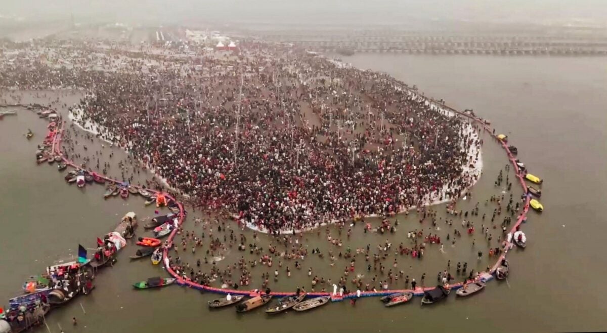
Pilgrims at the Kumbh arrive with varied degrees of familiarity, with the need to locate bathing ghats, accommodation locations, gathering points, and movement routes throughout the Mela. The spatial organisation and layout of the Mela then play a crucial role, and so does its ability to communicate itself to pilgrims. Since the duration for which each pilgrim stays at the Kumbh is unpredictable, it matters that the Mela can be made sense of within the duration of their stay.
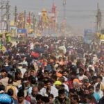
So where does this gap lie really? While masterplans manage to organise roads, sectors and streets, bringing in absolute clarity in planning, the experience for visitors on the ground need not necessarily be the same. What may appear orderly in plan or in aerial view may in fact appear repetitive and indistinguishable when the layers of crowd, busy street edges, vendors and traffic are added, which may leave pilgrims rather perplexed and overwhelmed.
The difference between a city that can be mapped and a city that can be read is rather distinctive.
While both remain equally important, in the case of the Kumbh, its intelligibility determines the pilgrims’ experience. While Architecture critiques them both, temporal cities make experiential legibility particularly urgent.
When Wayfinding Becomes An Overstimulant
The Kumbh’s organisers did not overlook navigation. The reports on the Mela in 2025 described elaborate provisions, multiple multilingual signboards, digital navigation tools and crowd-managing systems.
Within these provisions lies a subtle question: Does making navigational information accessible make a city easy to navigate?
Wayfinding is unfortunately often approached as a problem of information delivery. When the concern is that people may find themselves lost or unaware of which street to take, we assume that signboards, clear symbols and digital tools are the most effective solutions. The effectiveness of these provisions however isn’t ensured with its mere availability. It is dependent on the conditions in which they function, their functional efficiency in unforeseen situations and amongst large crowds.
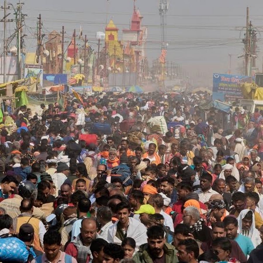
At a gathering of this nature and scale, navigation is also impacted by heavy movement all around, sound, stimuli of all sorts, physical proximity between people and the visual chaos altogether. In such a scenario, navigation as it is becomes a cognitive challenge for the average human. Added to this are individual factors such as age, health, and physical and cognitive capacity that complicate the process of navigation further.
Imagine trying to locate signboards to get to your accommodation in a sea of public announcements, while being overstimulated by the number of people and trying to make decisions in the midst of negotiating a moving crowd. This makes the journey throughout the Mela extremely uncomfortable for everyone.
This makes for the ideal case to examine temporary urbanism and wayfinding in temporary urban settlements through the lens of sensory overload. While the sounds, colours, rituals and the collective movement of the Kumbh are integral to its character and add to its spatial richness, it would be short-sighted to overlook the possibility that they may affect the navigational capacities of pilgrims.
Reports from the Maha Kumbh held in 2025 highlighted struggles to locate destinations, lack of location markers and trouble locating exits due to excessive crowds. While these reports establish that wayfinding and circulation posed multiple challenges, they, on their own, do not establish sensory overload as their cause. The question that remains then is how the sensory conditions in a situation like this may compound the difficulties of navigation.
Architecture of Uncertainty:
Wayfinding and design must account for the various factors that impact the experience of visitors as they make navigational decisions. Destinations should be easily identifiable, routes distinguishable and landmarks consistent enough to help visitors easily locate themselves.
A navigational system should also not burden its users to take the correct route each time; it should instead be capable of helping people find their way again if they are lost.
Good wayfinding does not simply aid movement; it makes uncertainty easier to navigate.
Cities develop their identity and a relationship with their dwellers through repetition and familiarity. Temporary settlements, however, are pressured to communicate their spatial language and order within a stipulated time. Constant directional cues, recognisable spatial markers and clear street and route hierarchies help visitors build a mental map of their journey rather than relying entirely on signage and navigation boards.
This legibility primarily needs to be inclusive. Wayfinding is still largely presumptuous of the physical and mental capacities of its users- signage, for example, is purely visual, while announcements are purely auditory, and they both serve different purposes. Hence, people of varied capacities are never entirely supported. They bear the burden of compensating for the lack of inclusive wayfinding.
The Kumbh raises a question worth delving into: Does efficient crowd movement necessarily signify successful spatial organisation and legibility? Efficient crowd movement and human-centred wayfinding shouldn’t be confused for the same; while the former focuses on circulation, the latter focuses on ensuring that users can navigate independently.
Beyond the Temporary City:
These questions go way beyond the Kumbh – they apply to all sorts of temporary settlements, whether festival sites, public exhibitions, or even emergency settlements such as refugee or disaster relief camps.
No matter how carefully planned or how detailed the masterplan may be, the settlement may still be difficult to read on the ground and even more so with the constraint of time. The challenge here doesn’t lie only in building a temporary settlement quickly, but also in spatial legibility for the people who must find their way through it.
Citations:
- India Today. (2025). Maha Kumbh 2025: Getting lost and finding your way back at Prayagraj. [online]. Available at: https://www.indiatoday.in/india/story/maha-kumbh-2025-navigations-map-directions-lost-and-found-how-to-explained-trains-car-bus-2666238-2025-01-17
- Claro. Temporary Wayfinding – Designing Clarity Through Change. [online]. Available at: https://clarowayfinding.com/2026/04/temporary-wayfinding-designing-clarity-through-change/