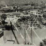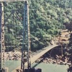
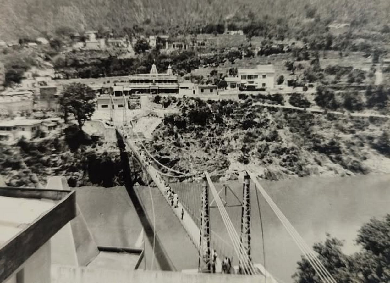
Begin with a photograph of the kind that survives in colonial albums. A gorge, pale boulders, and the Ganga running fast between forested hills. A thin line is drawn across the water, a suspension bridge that seems to carry almost no weight. On the bank, a few low roofs and a path vanish into the trees.
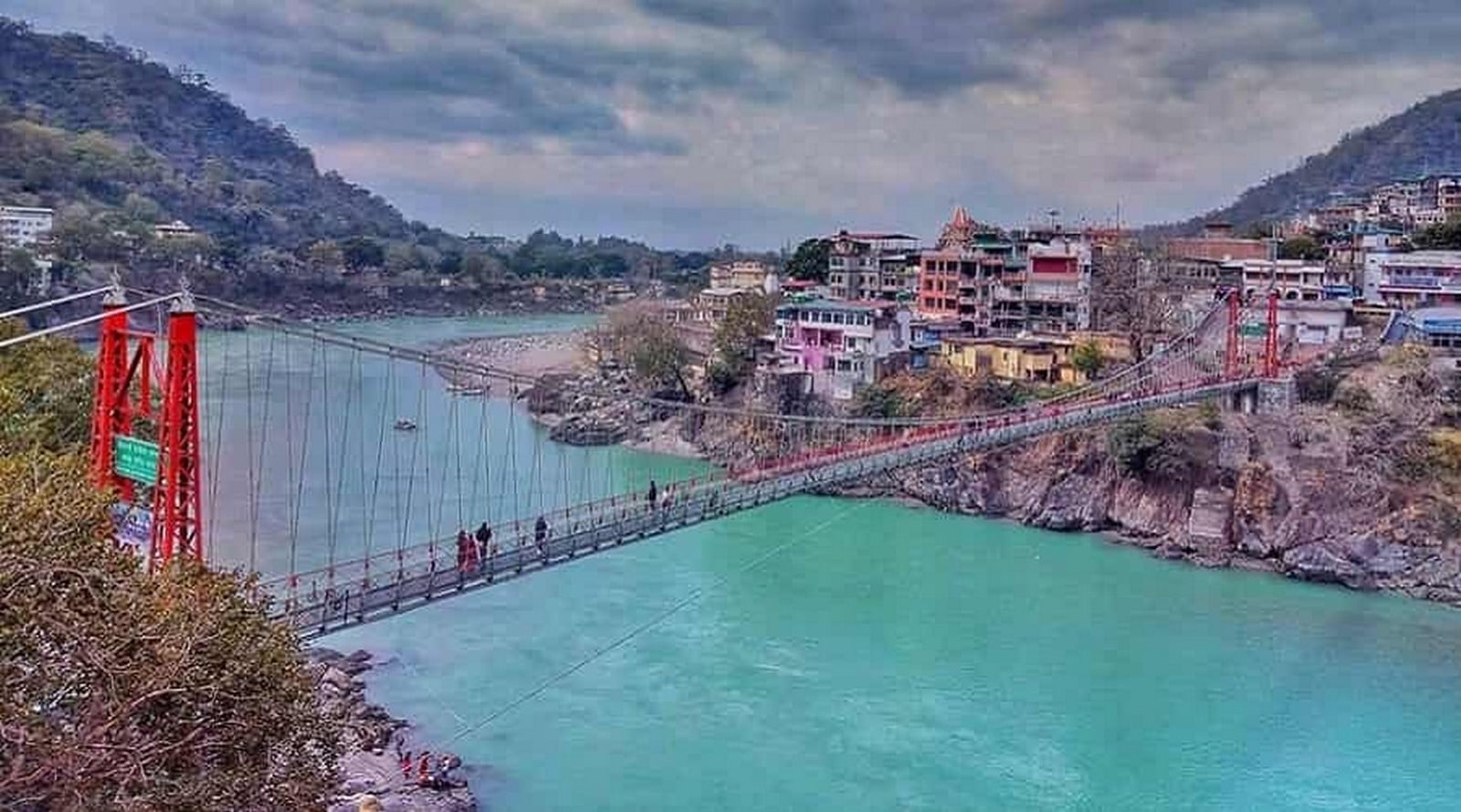
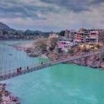
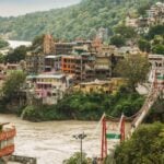
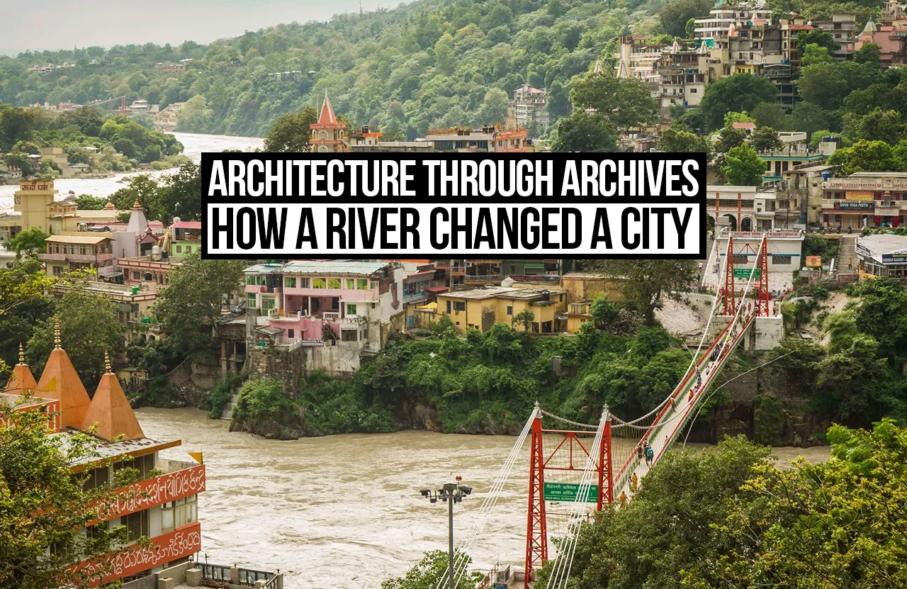
Stand roughly where the photographer stood. The hills close the frame at the same angles, and the river bends where it always bent. Everything that touches it has changed. Concrete terraces climb the slopes, signboards crowd every level, and the old bridge has been closed to foot traffic since 2024 while its neighbour fills with scooters and people. The water is the one element you could lay over the old print without adjusting it.
So the question becomes slightly odd. What happens to a place when the river stays, but the way people live beside it doesn’t?
A Bath, A Route, A Boundary
Rishikesh sits where the Ganga stops being a mountain river. Upstream in the valley is a slot. Here it opens into sandy terraces and shingle beaches, which is how one neighbourhood became Muni ki Reti, the sand of the sages. Hermits chose these terraces for sensible reasons: water, forest, quiet, and soft ground for a hut.
The town’s origins belong to tradition rather than the archive. Local belief ties the name to Vishnu appearing as Hrishikesha before the sage Raibhya and links the Bharat Mandir near Triveni Ghat to Adi Shankaracharya. Historians are more cautious about such attributions. What can be observed is a temple that faces the river, and steps that drop from it to the water, because bathing was the act around which the settlement organised itself.
The written record arrives late and describes a small place. Nineteenth-century gazetteers, Edwin Atkinson’s Himalayan Gazetteer among them, treat Rishikesh as a halt on the pilgrim road rather than a town, and the later British Garhwal: A Gazetteer by H. G. Walton, published in 1910, describes the same corridor of pilgrim traffic. For centuries Rishikesh was the last comfortable stop before the walk to Badrinath, Kedarnath, Gangotri and Yamunotri. Pilgrims arrived from Haridwar, bathed, rested, bought supplies and climbed. The architecture of that routine was modest: dharamshalas, shelters along the path, and charitable kshetras that fed ascetics and pilgrims. The real geography was a line, the river and the footpath beside it.
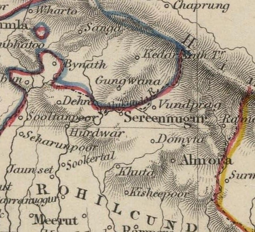
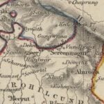
An early map from this period, laid beside the photograph, shows what the photograph cannot: how thin the settlement was. A few clusters sit along the water’s edge, joined by a track. Nothing is planned. Each cluster sits where the ground allows it, near a bathing place or a spring or a bend in the path.
The Ganga was doing several jobs at once. It was a bath and destination, a guide through the hills, and, because crossing it was hard, a boundary. It was an administrative one too. The river separated Tehri Garhwal territory on one bank from British-administered land on the other, a division that made each side’s growth a separate matter. Tradition says Lakshman crossed here on jute ropes. A rope bridge did stand at the site before the iron one, which suggests how long people had been solving the same problem.
A Line Drawn Across The Water
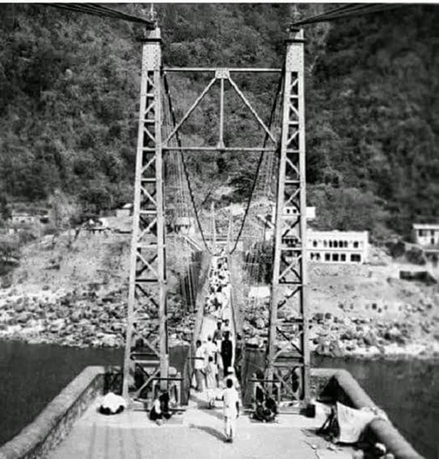
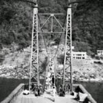
The early photographs of Lakshman Jhula show how little there was to it: a narrow iron suspension span, built in 1889 to replace the rope crossing and funded by a private donor, Surajmal Jhunjhunwala. The footway is wide enough for a single file. Floods in 1924 damaged it, and the replacement, completed around 1930, is closer to the bridge people picture today.
Looking at these pictures, what stands out is less the engineering than where the bridge points. Before it, the far bank meant a ferry or nothing. After it, the bank was worth building on. Rest houses and ashrams gathered toward the approaches, and shops arrived where people hesitated before stepping onto the span. A bridge makes people walk a particular line, and whatever stands along that line gains value.
Rail and road did the same work at a larger scale. A railway branch reached Rishikesh in the late 1920s, and motor roads pushed into the hills through the twentieth century, turning a pilgrimage of weeks into one of days. Rishikesh stopped being only the place where the walk began. It became the place where road, rail and river met.
Ram Jhula, built in the 1980s, completed a different pattern. It tied the Sivananda Nagar side to Swarg Ashram, and the settlement began to read as one long stretch of riverfront instead of a scatter of clusters. The administrative line the river had drawn was still there on paper, but people crossing the bridges ignored it.
Ashram Town, And Then Something Else
Hermits had lived in these forests for as long as there were hermits, but the twentieth-century ashram was a different thing: a planned complex of prayer hall, dormitory, dining room, bookshop and ghat. Swami Sivananda founded the Divine Life Society here in 1936, and Parmarth Niketan followed in 1942. They were built facing the water, with courtyards opening to the river and steps going down to it. It was pilgrimage architecture re-scaled for people who stayed.
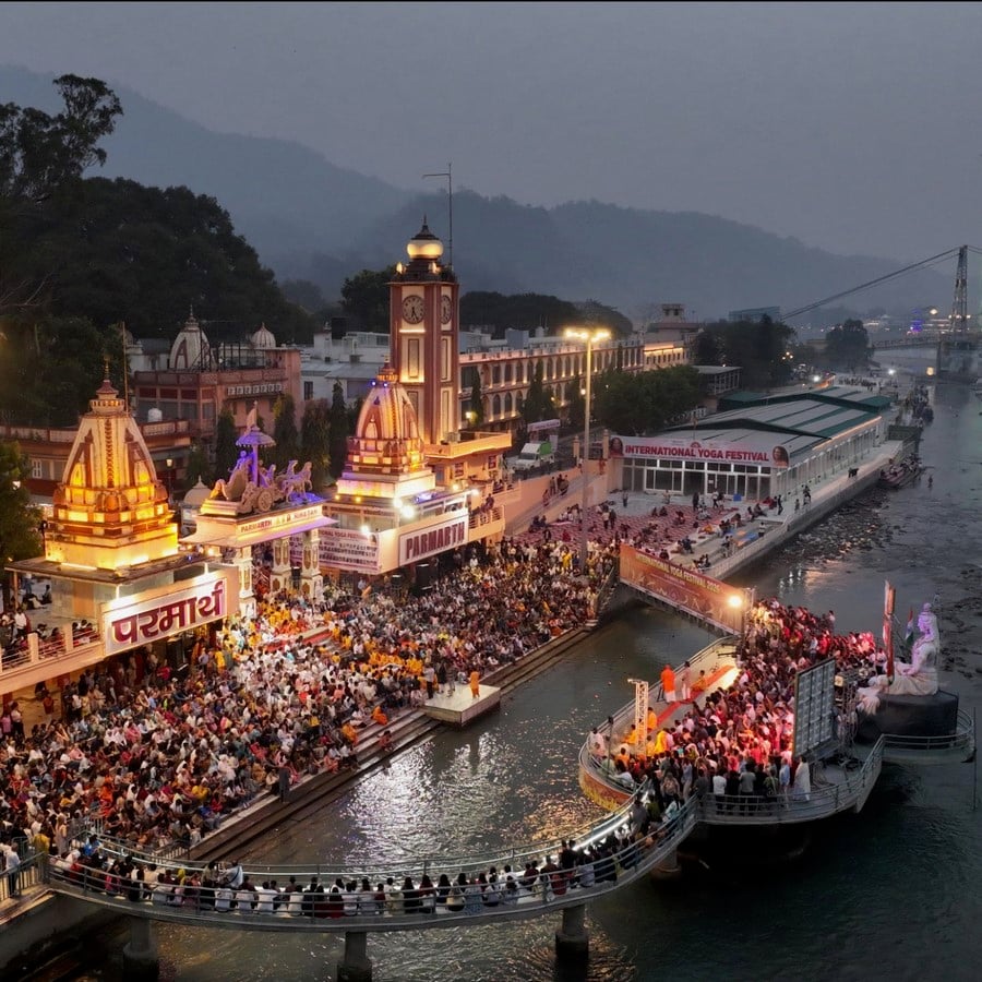
Then attention arrived from further away. Maharishi Mahesh Yogi’s ashram, in the forest above the river, drew the Beatles in 1968, and photographs of that visit remain some of the most widely circulated images of the town. Yoga gave people another reason to come, and it was added to the landscape rather than replacing what was there. Rishikesh did not stop being a pilgrim town. It acquired a second clientele.
Politics adds another layer. When Uttarakhand was formed in 2000, the state’s identity leaned heavily on pilgrimage and tourism, and Rishikesh sat at the gateway to both. Roads widened, hotels multiplied, and the language of building shifted. Guesthouses grew balconies toward the water. Cafés moved onto rooftops, rafting outfitters lined the roads to the sand beaches, and rental scooters crowded lanes laid out for walkers. Architecture that had once been organised around the descent to the water began to be organised around the view of it.
The river pushed back. The floods of 2013 reshaped the banks and swept away the Shiva statue at Parmarth Niketan, a reminder that the Ganga had never been a fixed backdrop.
Two Photographs, One Bend
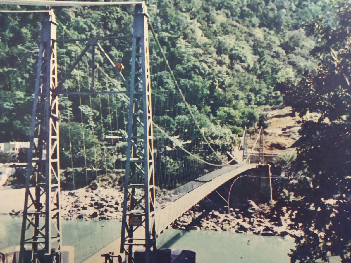
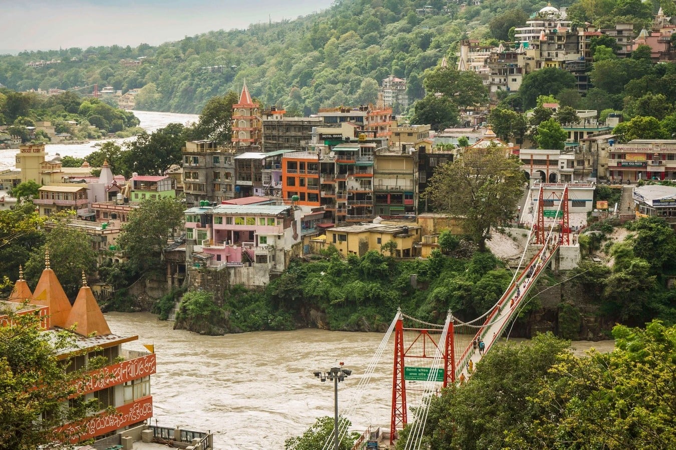
The difference between the two photographs makes it clear at once how Rishikesh has changed. In the older one the landscape is characterised by dense vegetation, the bridge spanning a mostly undeveloped and rocky river valley, and the built-up area is scarce and almost blends into the surrounding landscape. In the more recent photograph, however, this situation has been reversed. The buildings now take up a much larger part of the hillside and the river bank, while the vegetation remains in the form of isolated patches situated between and behind the developed areas.
The difference is just as clear in the size and type of buildings. In the older picture there is a basic suspension bridge set among forest, rocks and a number of small buildings. In the current view, the hillside is covered with multi-storey concrete buildings, hotels, cafés and places of religious worship, giving rise to a far more crowded and visually striking built boundary. The large amount of signage also shows the change in land use, since the modern landscape promotes accommodation, yoga, food and tourism.
This change in intensity is shown by the bridge. The older bridge is narrow and not heavily used, there being only a small number of people crossing in a mainly natural environment. By contrast, the current-day Lakshman Jhula is situated in a far more crowded urban and tourist area, with pedestrians, commercial activity and buildings all located near its approaches.
Above all, the way people relate to the river has changed. In the earlier photograph, the river is seen as part of the natural landscape, closely linked to the rocky banks and the forested slopes. In the current photograph, however, the river is surrounded by buildings, terraces, roads and commercial activities. It is now increasingly treated as something to be viewed, accessed and consumed as part of the tourist experience, rather than simply as a sacred natural boundary. The change therefore shows a wider shift in Rishikesh—from a landscape based on pilgrimage, nature and direct interaction with the river to one that is more and more influenced by accommodation, commerce, recreation and tourism.
What The River Kept
Pilgrimage landscape, connected settlement, ashram town, tourist destination, increasingly urban place: that makes five Rishikeshes, and the Ganga is the only element present in all five frames. In a sense, it set the terms, deciding where the sand terraces formed, where the hills opened and where the path ran. After that it changed little, and the city changed constantly. The city kept renegotiating the relationship: descending to the river, crossing it, sitting above it, and selling a view of it.
A river changes a place once, by being where it is. A city changes its relationship to the river every generation. Laid in sequence, the maps, photographs and gazetteer pages record less what the water did than what people wanted from it.
References:
- Walton, H. G. (1910). British Garhwal: A Gazetteer, Vol. XXXVI of the District Gazetteers of the United Provinces of Agra and Oudh. Allahabad: Government Press.
- Atkinson, E. T. (1882-86). The Himalayan Districts of the North-Western Provinces of India (the Himalayan Gazetteer), Allahabad: North-Western Provinces and Oudh Government Press.
- British Library, Online Gallery and India Office Records (Photo and Prints collections).