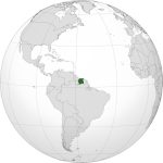
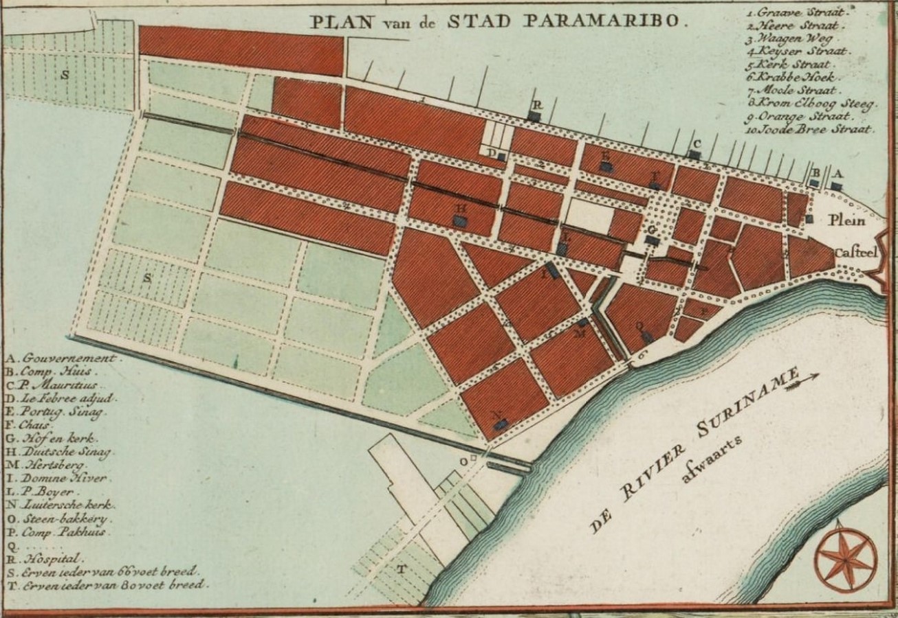
Suriname, a country in South America, was a colony of the Europeans in the 17th and 18th centuries. Paramaribo is the capital city of the country. The city of Paramaribo is situated along the northeastern coast of southern America and colonised by the Dutch. Being a Dutch Colony, the Architecture and Culture of the city was much influenced.
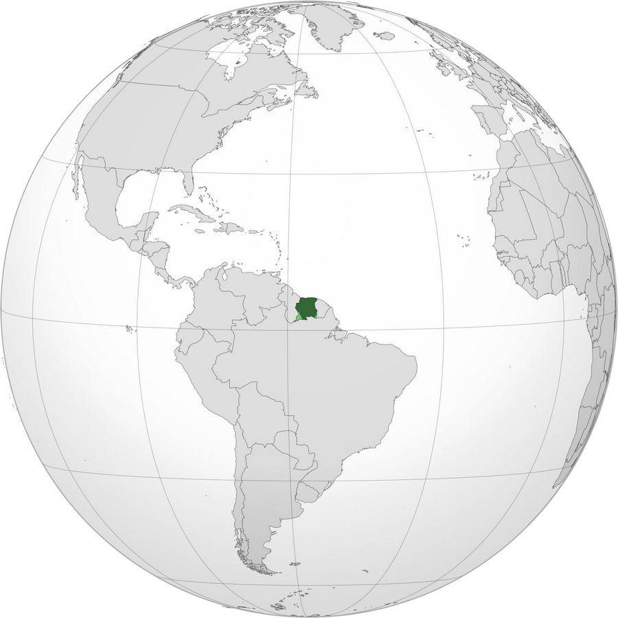
Most settlements of any place start along a water body, to support a civilisation during the early stages of flourishment. This Country of Suriname also flourished along the coast and hence the name.
However, The coast helped the Europeans to find the route to southern America and establish a colony around it. Europeans were not only enticed by the location but also the tropical climate, which gave them the advantage for cultivation, trade and import of labour.
Through time, as these colonists settled, areas expanded. Different European countries had control over different pockets of South America.
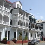
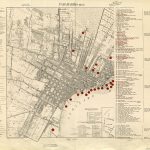
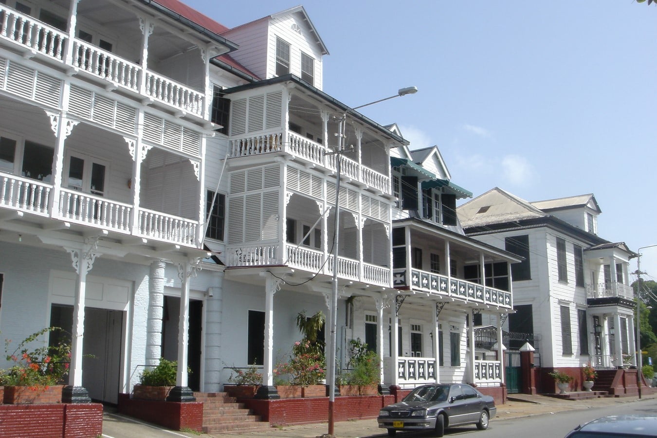
For instance, the Dutch had control over Paramaribo and the influence can be felt even today, through its architecture and planning, which has made little to no changes over the years. Timber as a construction material remained the same and much of the older constructions needed renovation. With the existence of these Timber yet Historical structures, the city was declared a World Heritage Site in 2002. As of record, 200 monuments were found that needed conservation.
The slow changes in construction typology, materials and renovation were observed, by the slow growth in the economy of the place, also the growth of the population was responsible.
The city, however, has expanded to 180 square km, with an increase in population to 241,000 people.
Architecture, planning and its Transformation
During the colonisation period, the country served as a tea and coffee-producing region, and many African slaves were brought in to work for the Dutch. Therefore, it resulted in a change of demographics for the country and this again highly influenced the style of architecture. The architecture was, therefore, mostly influenced by the techniques of indigenous people and the known craftsmanship of Creole (a tribe known to be descendants from Africa, bought for slavery).
The city of Paramaribo is known to have all the main functions: political, economic, social and administrative functions, however, the city is less known for housing. The activities were highly influenced by the economic and political changes in the country. As the agriculture scenario changed, most ethnic groups moved towards the city. And the city underwent economic crises during the 1990s. The housing market changed and was reduced due to the stagnant growth of the population.
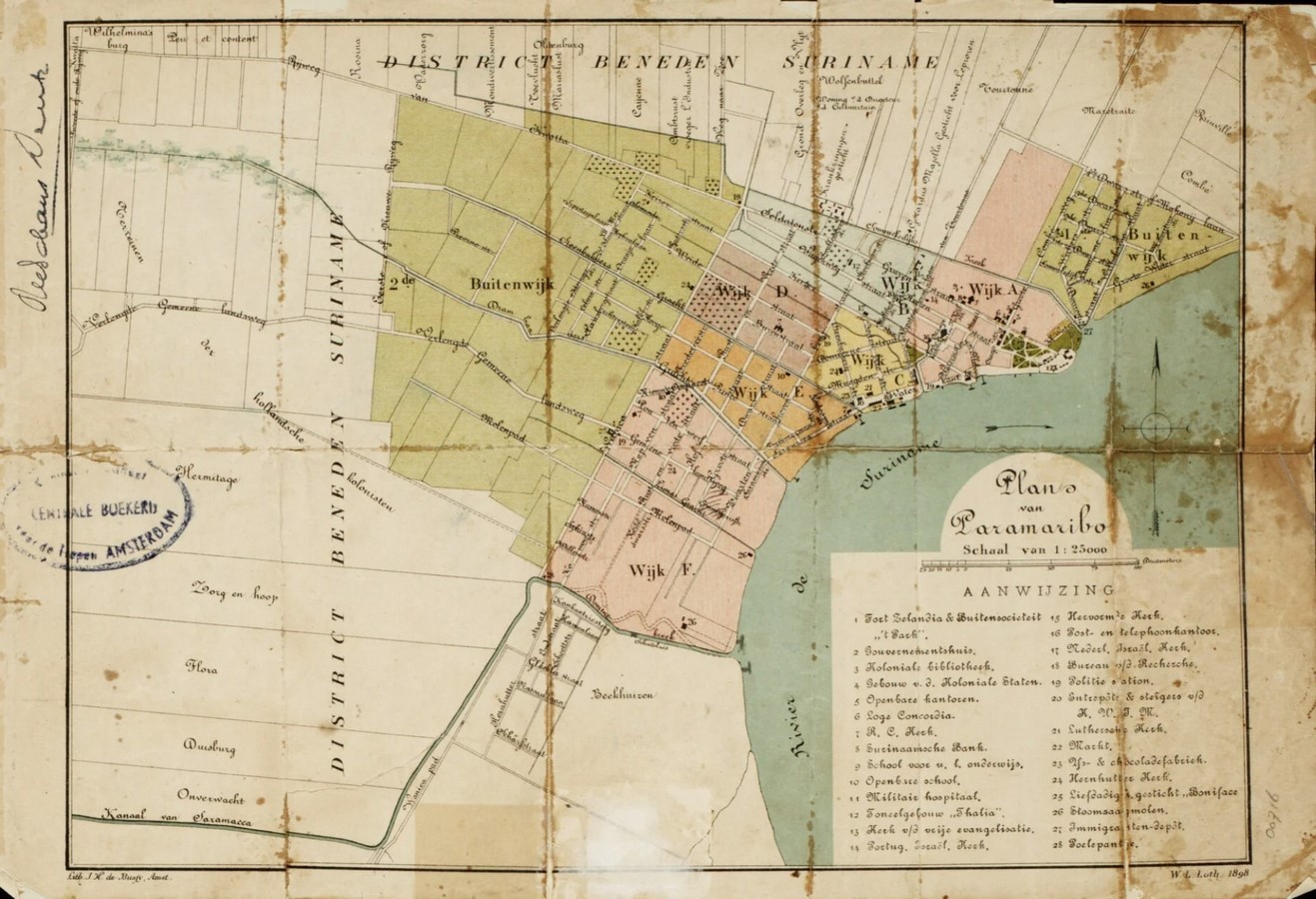
The city saw a rise in population until the 1980s but reduced to almost half during the 2000s. Housing inside the City became a restrained activity and became limited. Many people after independence from the Dutch emigrated to Europe and over the years became Surinamese Dutch people. The population started settling outside the core of the city. Many mini metropolitan regions developed in and around. (Potter, 1995).
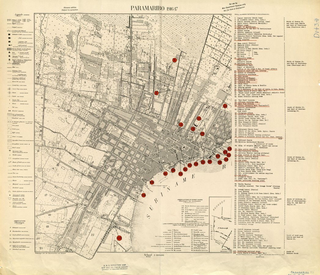
Therefore the activities of the inner city became limited until daytime as housing shifted to the peripheral areas.
Another point notably is the city monuments are owned mostly by the government, almost 1/5th of the old buildings in the city are owned by the government. (Patiwael, 2015)
On the contrary, the peripheral areas are mostly owned by individuals, as most of the city has expanded to meet housing requirements.
Policy measurement undertaken by the government of the country also has a great deal for influencing the urban planning of the city and the growth of the city.
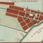
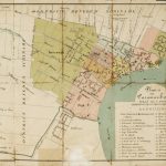
Most of the planning was influenced by two laws, the Urban Development Act from 1972 and the Planning Act from 1973. The influential urban planning act was created by the Dutch lawyer J. Vink, former Director-general of the Rijksplanologische Dienst in the Netherlands. Therefore it is vividly observed that most of the planning has a strong resemblance to the Dutch typology of planning and has a strong hierarchical system of planning, focusing on spatial coordination. According to the act, the Ministry of public works has taken up its duties to maintain the structural plan, take care of local land use mapping and create it on a regional level. To take care of the system of planning and to adhere to the laws Suriname is divided into development areas, residential areas, and special governmental areas. However, further reforms were made in 2005, dividing the Ministry of Natural Resources and creating the Ministry of Spatial Planning, Land and Forestry.
The Changing Spatial Narrative
Though the inner city of Paramaribo is of historical importance and the planning is well influenced by the Dutch style of planning, yet now the city is facing a lot of difficulties in terms of planning and also restoration of most parts of the historical sites especially in the inner part of the city. Reportedly, there have been maintenance issues.(Hebe J.L.M. Verrest, 2010) due to Climate change, longer periods of interval between maintenance, etc. Also, other reasons stated were: 1) properties in the centre were difficult to be maintained as few were under individuals and the ownership was unclear along with a lack of interest for redevelopment.2) The Restoration was concluded to be expensive due to the technique and materials used.(del Hierro et al., 2020).Even for housing Paramaribo is facing a lot of issues due to accessibility of land and politicisation. It also seems to be lacking a profound land registration system (Verrest, 2010). Even if few of the Developers have taken up the job for restoration and planning, they have had issues with laying out proper connectivity and affecting the spatial planning.Paramaribo has been facing issues with traffic due to the non-sensible placement of properties along the main road itself. But, By far the development over the years has created a lot of challenges for the city and its expansion. And therefore the urgent need for such a place is to put spatial planning and policies to strict order. As discussed, the historical city has improved in terms of implementation of public sector investment in terms of urban planning but it has to go a little further and meet the needs for a comprehensive mature integrated planning approach. And the government needs to step up and be mindful of its actions and adhere to them strictly. (Patiwael, 2015). As the city is known to be famous for its historic identity, its identity to it shall never be lost and should be preserved well despite all adjustments that may come along for making it better.

References
1.Patiwael, P. (2015). Active stakeholder perceptions of policy transfer between UNESCO and national governments: The case of the historic inner city of Paramaribo, Suriname. University of Groningen.
- van Maanen and Gregory Ashworth, E. (2013). Colonial Heritage in Paramaribo, Suriname: Legislation and Senses of Ownership, a Dilemma in Preservation? International Journal of Cultural Property, 20(03), 289–310.
3.Verrest, H. J. L. (2010). City Profile, Paramaribo. Cities, ELSEVIER, 27(1), 50–60.
- van Maanen and Gregory Ashworth, E. (2016, June). The Mutuality of Colonial Heritage in Multi-ethnic Paramaribo; Reality or Illusion? What Does Heritage Change?
- Del Hierro, S., de Carvalho Filho, L., & Tjong-Ayong, J. (2020). Reimagining Heerenstraat, Paramaribo / Active Heritage in Paramaribo’ s Historic Inner City. TU Delft.