The Bay area of California consists of cities like San Francisco, Oakland, Berkeley, San Jose, and others. San Francisco is the biggest city in the bay with a population of 8,65,000 spread across 121.4 sq km area. Many people from the rest of the bay area, commute every day to San Francisco, thanks to the Public Transport, i.e. BART (Bay Area Rapid Transit) and CalTrain that makes the commute so quick and efficient. Along with being the largest city, San Francisco also has other very important factors in its urban planning which make it among the best, most expensive, most liveable cities of America. Let’s look at the history of the city’s urban planning briefly.
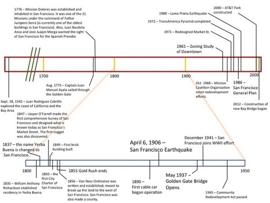
Going through many phases of being explored and established, the city got Spanish migrants and soon after the gold rush in the 1850s, the demand for better city planning arose. With the increasing influx of people moving into the city, Cable cars were invented in 1890. They became the first mode of public transport, carrying people up and down the hill. The cable cars operate in the city even today. Daniel Burham suggested the ‘City Beautiful’ plan for the city but that could not be executed. Just after the earthquake and fire in 1906, buildings started building up outrageously and haphazardously during the panic. This is when the government took control and formulated the ‘General Plan’.

Neighborhoods were classified and organized on the basis of aspects like – people’s needs, environmental & economic aspects while retaining the feel of San Francisco. Certain districts like the Filmore, Mission, Presidio were already formulated. The General Plan focused on the planning of Downtown in 1965. Block pattern of Streets was laid out orthogonally, to reduce the commute time for people, making navigation and orientation lot easier. Since the downtown is already too densely packed and congested, the general plan tried to promote visitors and make San Francisco a pedestrian-friendly city. The downtown was divided into 4 major zones:
- Office District (Financial District): Mainly high rise office and corporate buildings
- Retail District (Union Square): Shopping centers
- General Commercial District (East Cut): Hotels, entertainment, restaurant
- Support District (SOMA): Institutions, parking, small area for future growth
All these 4 zones were developed, keeping in mind the quality of life and community character of the people of San Francisco.
The city is a grid type organization for almost all streets, making it very easily perceivable for anyone.
The grid of around 400*300 sq ft is formed by blocks, a housing average of 10 buildings on the long edge. 50-70 of such blocks come together to form districts. There is strategic planning involved in the evenly scattered mixed land use of districts. All districts are in a way self-sustaining, with their own commercial, residential, office, public parks, and other land uses distributed across the district. But the city planning of San Francisco is a middle ground when trying to define the tree-like pattern Christopher Alexander talks about in his book “A Pattern Language”. San Francisco does not possess a strict hierarchy of independent parts (Districts) but as an interconnected semi-lattice of the parts, as discussed in the “A city is not a tree” chapter by Christopher.
It has got a very adaptive and evolving connected system in which multiple configurations are possible. Although there isn’t a great intercultural diversity in these districts, the edges of these districts have formed semi-lattice structure, blurring the boundaries.
Looking at the city planning, it can be concluded that the hierarchy concept proposed by the Central place theory and other traditional planning models are not relevant at this scale and time anymore.
When discussing these aspects, one can never fully finish without mentioning the 5 principles of Kevin Lynch from ‘Image of the city’. The 5 principles can be identified very easily in this city due to its transparency and ease of relatability. Although San Francisco weaves a complex fabric of network and density, one can still perceive the image of the city even without quite fully analyzing it.
- Paths are the most easily recognized entity because of the Grid like spatial organization. Market St, Columbus Ave, Geary Blvd, Mission St, to name a few.
- Edges are most of the time read when standing on the top or bottom of the hills. Also, since the facades of the road facing Victorian buildings always create a membrane, it’s identifiable.
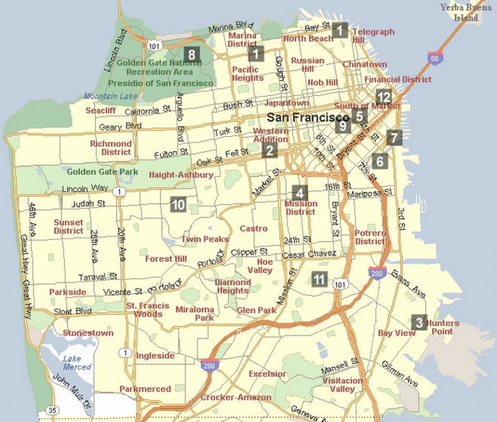
- Due to the nature of its scale, districts are too homogenous in this city. But all other factors like the style, language, and scale of architecture, people and activities can help one understand these districts. SOMA, Financial District, Mission district, Richmond district, Filmore and Presidio are few famous districts in the city.
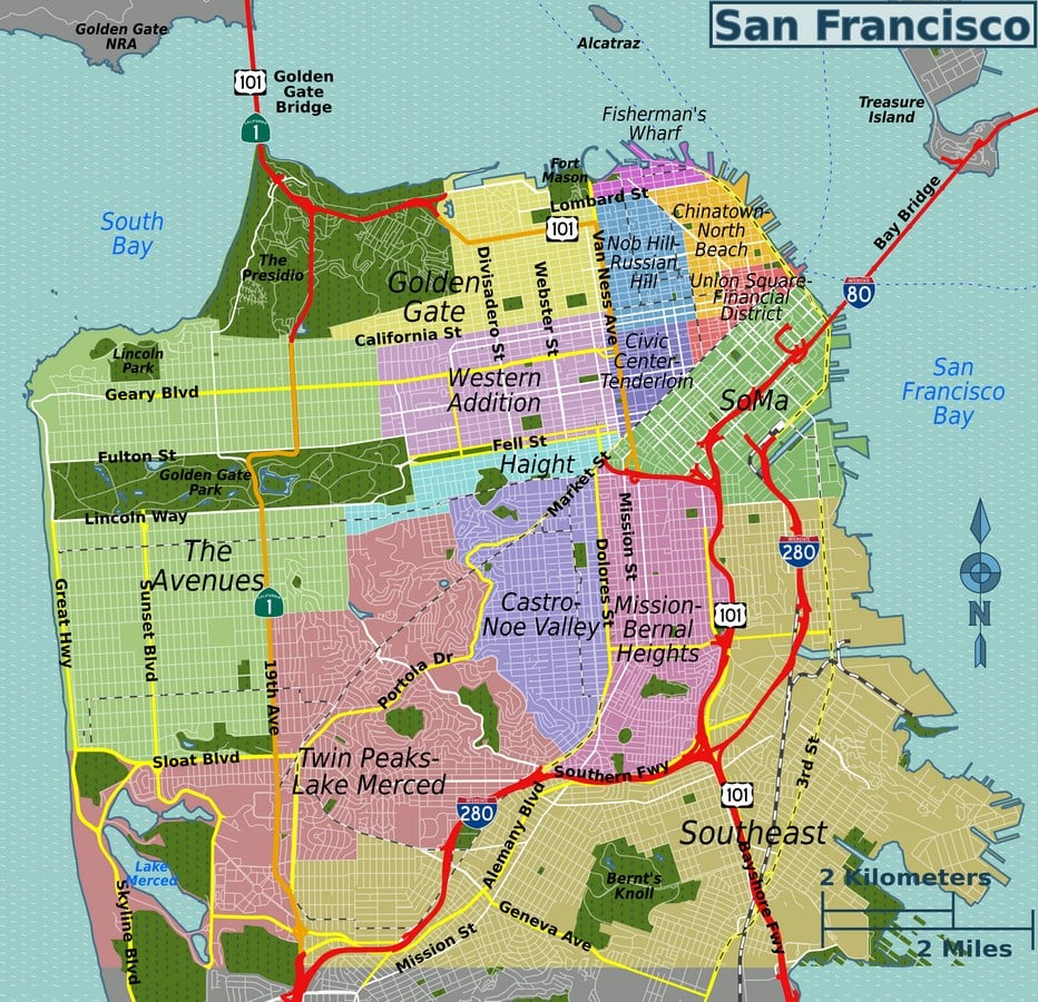
- Landmarks can be missed sometimes while mesmerizing over the dense and interlaced network of architecture. But Transamerica Pyramid, Golden Gate Bridge, Golden Gate Park, and others cannot be missed even from a distance.
- Lastly, nodes are quite tricky if not consciously sought for. The downtown is filled with such nodes at the junction of Orthogonal Grid with the rotated grid of SOMA. We are yet not regarding the major layer of transportation, over this dense and congested fabric of the bay city of San Francisco.