“How India’s Military Architecture Shaped Urban Planning”
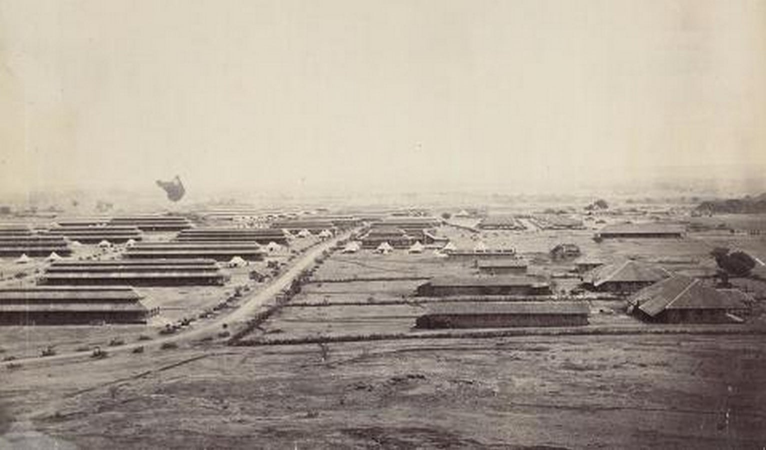
Behind the tree-lined avenues and orderly streets of many Indian cities lies an unexpected story, one that began with military camps. Long before town planning emerged as a formal discipline in India, military establishments were already shaping the spatial organisation of settlements. While defence architecture is commonly associated with fortifications, walls, and garrisons, its most enduring legacy in the Indian subcontinent lies in its influence on urban planning.
Ancient Indian texts such as the Arthashastra, Manasara, and Mayamata describe carefully planned fortified cities and military encampments. These were places where security, surveillance, and movement determined spatial form. Forts were strategically located on hills, riverbanks, deserts, or coastlines, with concentric defensive walls, gateways, moats, and synchronised circulation forming the backbone of their design. Temporary military camps (śibira) and permanent garrison settlements (skandhāvāra) were equally systematic, combining defence with administration, storage, housing, and logistics. These early military landscapes demonstrated that settlements designed for strategic purposes could also function as organised urban environments.
Vāstu texts explicitly compare this arrangement to the cantonments of later centuries, suggesting that the pairing of a defended military enclave with the civilian settlement it protects is a recurring planning idea in the subcontinent (Wisdomlib, 2022).
The Origin Story
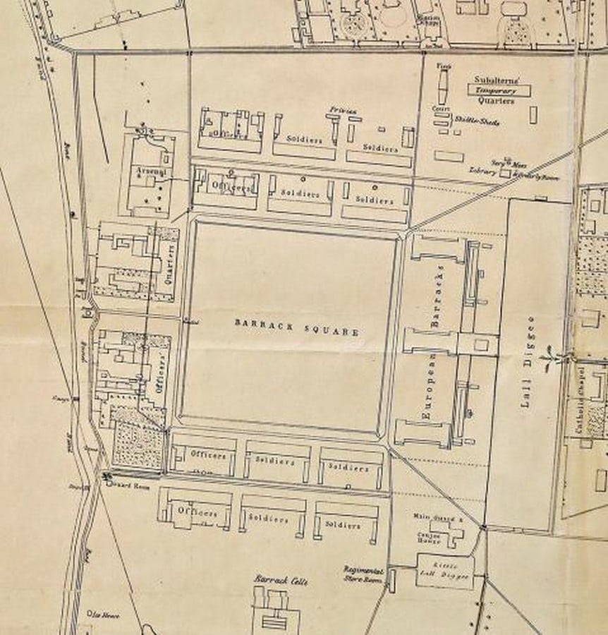
How can the origins of the modern Indian city be traced to British cantonments?
The origins of the British cantonment in India lay not only in military strategy. Unlike the seasonal conditions of northern Europe, the Indian subcontinent presented prolonged heat, heavy monsoon rains, and varied regional climates. Something European armies were unaccustomed to. They soon realised that sustaining troops required permanent, sheltered bases located close to strategic theatres of operation.
An early example occurred during the Carnatic Wars in 1754, when the Madras Army, caught in the monsoon while campaigning near Tiruchirappalli, was forced to suspend military operations and seek refuge beneath the massive stone structures of a Hindu temple. As historian Robert Orme records, the army was compelled to “canton” under the shrine until conditions improved. The episode revealed the inadequacy of temporary camps in the Indian environment and highlighted the need for purpose-built military settlements. Since quartering soldiers in civilian homes was considered unsuitable, the British increasingly established dedicated garrison towns that offered permanent accommodation, secure storage, administrative facilities, and protection from both climate and conflict. (Cowell, 2016)
From the late eighteenth century onwards, they reinterpreted the long-standing tradition of camps through the institution of the cantonment. First conceived as a military settlement for housing troops, Cantts gradually evolved into a model that informed the planning of many modern Indian towns. More than two and a half centuries after the establishment of the earliest cantonments, their characteristic street networks, expansive green spaces, and residential typologies remain embedded in the urban fabric of numerous Indian cities.
The Anatomy of a Cantonment
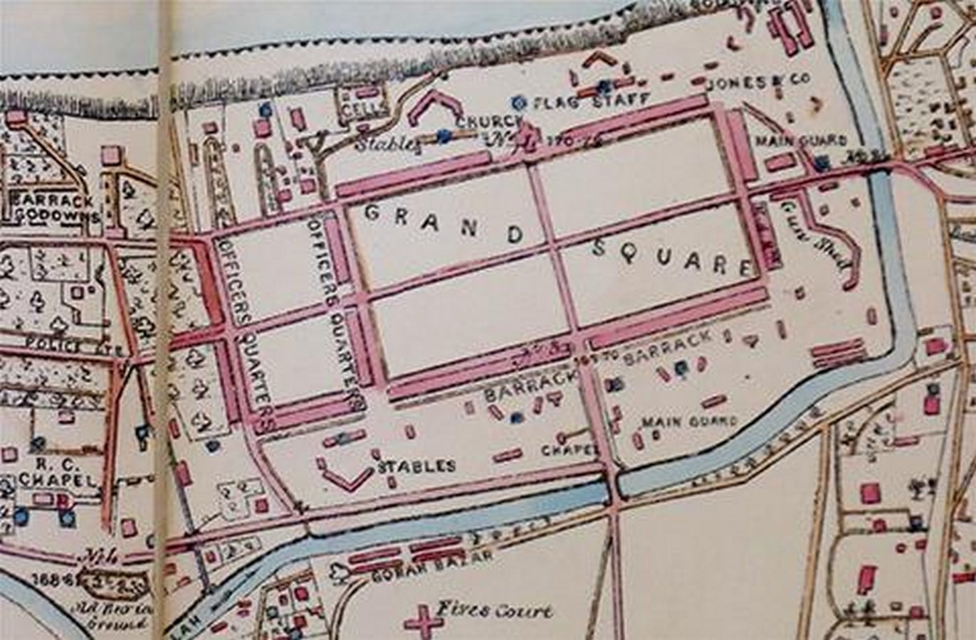
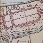
Early cantonments were loose arrangements of freestanding buildings in open ground. As pressure on land increased, the layout matured into a gridiron plan of regularly divided plots strung along wide, tree-lined roads, with a central thoroughfare, the Mall Road, as its social and commercial spine (Boloji, n.d.). The bungalow, a low-rise dwelling set within a generous compound, became the dominant house type, and its form was refined over roughly a century of colonial habitation into an archetype that would later be absorbed into mainstream Indian domestic architecture (Boloji, n.d.)
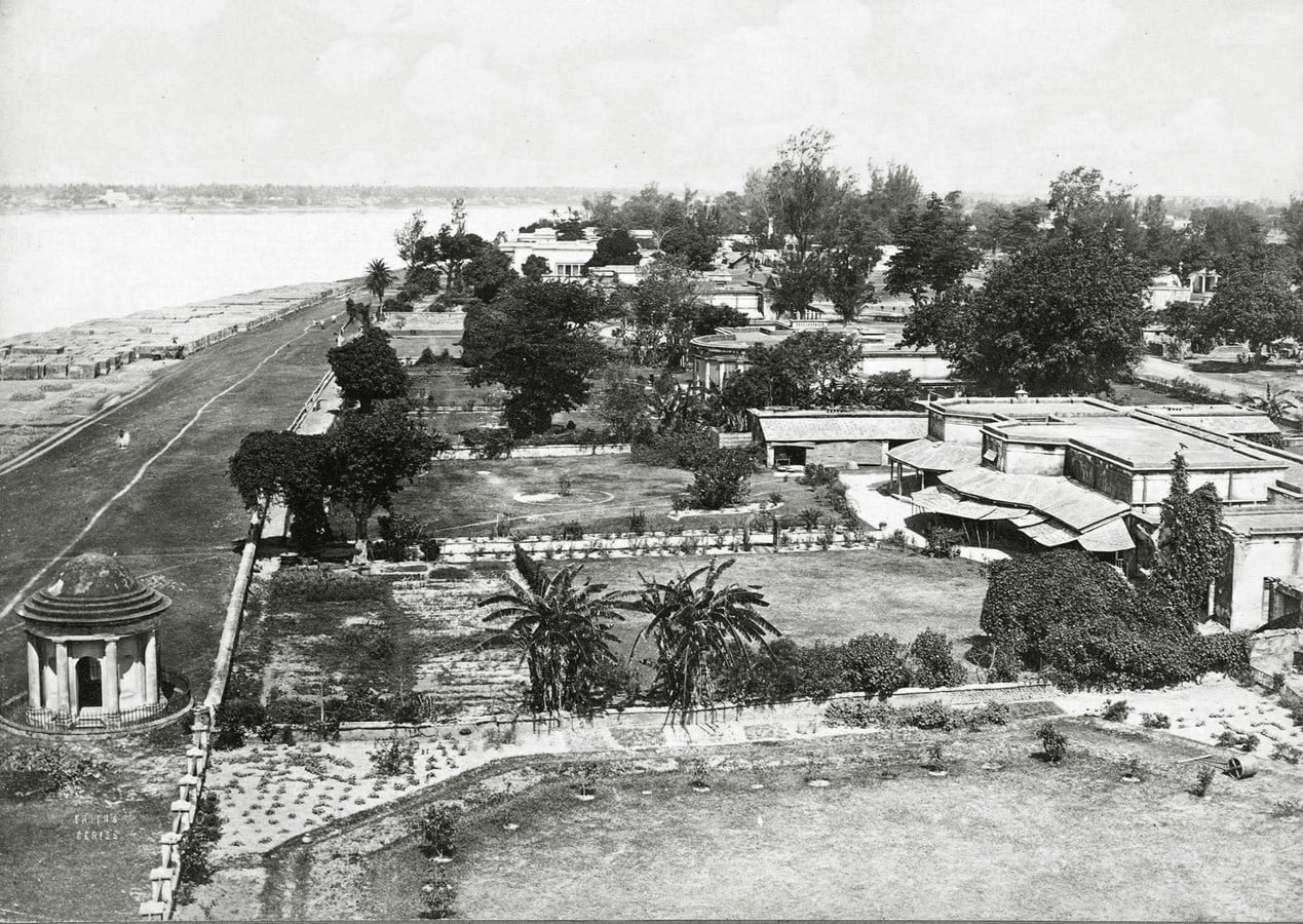
Beyond its residential precincts, the cantonment evolved into a settlement supported by a network of institutional, administrative, and recreational facilities. Churches, cemeteries, clubs, racecourses, golf courses, hospitals, and schools were strategically integrated into its layout, recreating an idealised version of British civic life within the colonial landscape. Adjacent to the military enclave, the Civil Lines accommodated senior administrators and government officials, extending the same orderly planning principles beyond the barracks.
The segregation this layout encoded was not merely aesthetic. In Bangalore, for instance, the cantonment grew into a self-sufficient town of roughly 100,000 residents by the early twentieth century, complete with its own offices, parks, schools and churches. These were kept administratively and physically distinct from the older city. Street and neighbourhood names across the Bangalore Cantonment Austin Town, Cox Town, Richards Town, Fraser Town- among them still record the officers after whom these quarters were platted, even where several have since been renamed (Wikipedia, 2024).
At the interface between the cantonment and the indigenous city emerged organised markets. These vibrant commercial districts were established to supply goods, services, and labour to the military establishment. Developed largely by local communities, these market streets combined the shop-cum-residence typology of Indian bazaars with elements of colonial planning, producing a distinctive hybrid urban character that remains visible in many cantonment towns today.
Impact On the Modern Urban Fabric
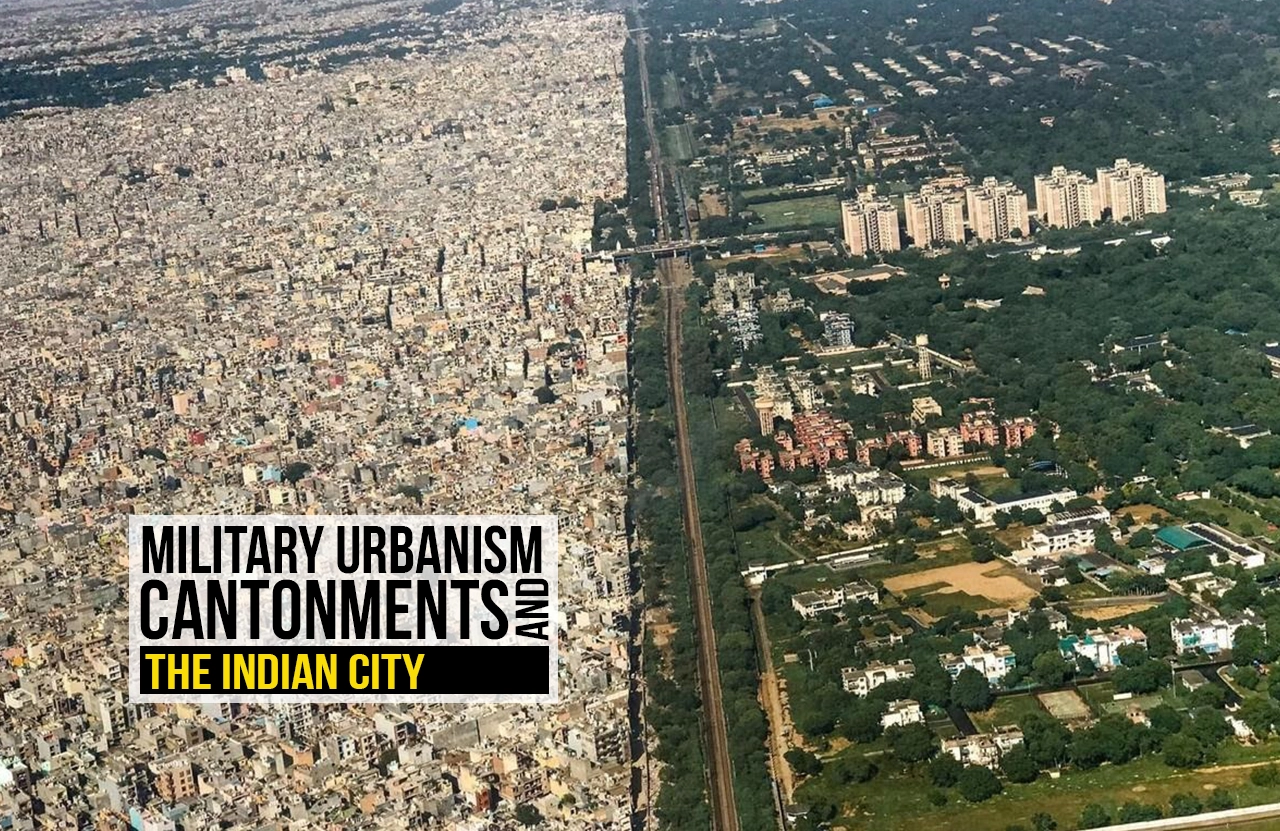
If one looks at an aerial view, the cantonment is remarkably consistent from Meerut to Bangalore to Secunderabad. After 1947, the Indian Army largely stepped away from establishing new cantonments in the classical mould, favouring self-contained military stations to reduce exactly the civil-military tension that cantonment governance had always invited; nonetheless, major existing cantonments such as Pune and Agra continued to function, and cantonments kept being expanded well into the post-independence decades (Civils daily, 2023). Today they remain woven into the fabric of cities including Pune, Mumbai, Secunderabad, Nashik and Lucknow, with Kanpur Cantonment the largest in the country and Barrackpore still its oldest (Deccan Herald, 2024a).
Delhi Cantonment, established in the early twentieth century following the transfer of the imperial capital to Delhi, exemplifies this mature form. More than a military enclave, it demonstrates how principles developed for discipline, health, and defence came to shape the physical structure of Indian cities. This article traces the evolution of the cantonment from ancient military planning to colonial urbanism, examining how a landscape created for war became one of the most enduring influences on the modern Indian city.
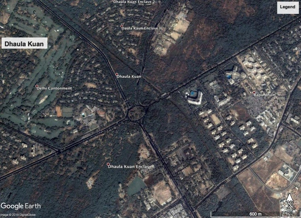
The legacy of cantonment planning is evident in planned neighbourhoods such as Lutyens’ Delhi, post-independence government housing colonies, defence residential enclaves, institutional campuses, and modern gated townships. Features such as wide roads, landscaped public spaces, controlled development, and low-rise neighbourhoods continue to shape planning practice. At the same time, the cantonment model has also prompted debates on exclusivity, spatial segregation, land accessibility, and the balance between heritage conservation and urban densification.
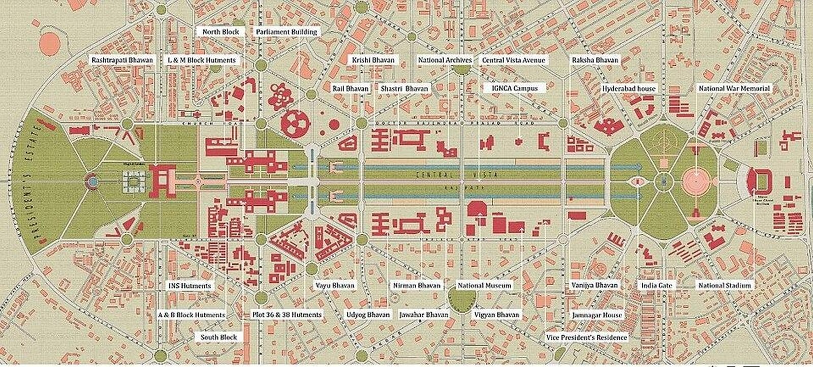
For urban designers, the cantonment remains a significant precedent, not because it should be replicated, but because it demonstrates how military planning principles profoundly influenced the morphology, governance, and environmental character of the modern Indian city
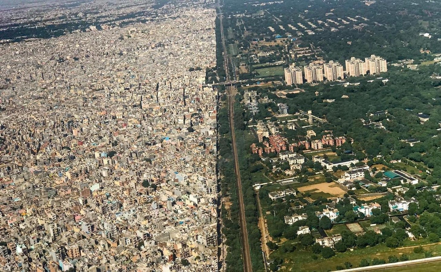
Over the past century, however, Delhi has expanded far beyond its colonial boundaries, gradually enveloping the cantonment within its metropolitan fabric. What was once a peripheral military settlement is now embedded within one of the world’s largest urban agglomerations. Despite this transformation, the cantonment has retained its distinctive spatial identity. Its mature tree canopy, generous open spaces, walkable avenues, and low-rise built form provide a striking contrast to the high-density development surrounding it. Roads that once connected isolated military precincts have become important citywide transport corridors, while the cantonment’s green cover functions as a vital ecological asset for the capital. Today, Delhi Cantonment demonstrates how a military landscape can become inseparable from the modern city, serving simultaneously as a defence establishment, a heritage precinct, and an integral component of Delhi’s urban structure.
The lesson
For architects and urban planners, the cantonment represents far more than a colonial relic. It stands as one of India’s earliest and most influential examples of a planned, low-density, self-governing urban enclave. Characterised by tree-lined avenues, generous open spaces, segregated land uses, institutional cores, peripheral marketplaces, and independent governance, the cantonment established a spatial model that continues to resonate in contemporary urban development. Many of its defining features reappear today in gated townships, integrated residential communities, and privately managed urban enclaves, making the cantonment an important precedent for ongoing discussions on urban segregation, housing typologies, public accessibility, and the balance between autonomous estate management and municipal governance.
Citations:
- Boloji (n.d.) British Colonial Architecture. Available at: https://www.boloji.com/articles/1008/british-colonial-architecture (Accessed: 14 July 2026).
- Civils daily (2023) Excision and Merger of Civil Areas in Cantonments. Available at: https://www.civilsdaily.com/news/excision-and-merger-of-civil-areas-in-cantonments/ (Accessed: 17 July 2026).
- CrackitToday (2023) Transforming Cantonment Towns. Available at: https://crackittoday.com/current-affairs/transforming-cantonment-towns/ (Accessed: 14 July 2026).
- Deccan Herald (2024a) The Cantonment and the City. Available at: https://www.deccanherald.com/opinion/in-perspective/the-cantonment-and-the-city-1238045.html (Accessed: 17 July 2026).
- Deccan Herald (2024b) Army Cantonments to be Handed Over to Civil Authorities. Available at: https://www.deccanherald.com/india/army-cantonments-to-be-handed-over-to-civil-authorities-3172901 (Accessed: 18 July 2026).
- Directorate General of Defence Estates (DGDE) (n.d.) Cantonments. Available at: https://dgde.gov.in/en/division/cantonments/ (Accessed: 16 July 2026).
- Drishti IAS (2023) Transforming Cantonment Towns. Available at: https://www.drishtiias.com/daily-updates/daily-news-analysis/transforming-cantonment-towns (Accessed: 16 July 2026).
- GS Score (2023) Cantonment Towns and Administration. Available at: https://iasscore.in/current-affairs/cantonment-towns-and-administration (Accessed: 16 July 2026).
- International Journal of Sustainable Development and Planning (IJSDP) (2023) Facades of Historic Shop-Cum-Houses in Colonial Cantonment Towns in Bengal Presidency, India. Available at: https://www.iieta.org/journals/ijsdp/paper/10.18280/ijsdp.180220 (Accessed: 16 July 2026).
- Scribd (n.d.) Understanding Cantonments vs Military Stations. Available at: https://www.scribd.com/document/475810989/thesis-cantonment (Accessed: 17 July 2026).
- Wikipedia (2024) List of Areas in Bangalore Cantonment. Available at: https://en.wikipedia.org/wiki/List_of_areas_in_Bangalore_Cantonment (Accessed: 18 July 2026).
- Wisdomlib (2022) Towns or Cities in Ancient Indian Town-Planning. Available at: https://www.wisdomlib.org/hinduism/book/vastu-shastra-indian-architecture/d/doc1112516.html (Accessed: 18 July 2026).
- Cowell, C. (2016) ‘The Kacchā-pakkā divide: Material, space and architecture in the military cantonments of British India (1765-1889)’, ABE Journal, 9–10. doi:10.4000/abe.10893. (Accessed: 14 July 2026).