


Jülich was established in Roman times due to its strategic position for crossing the river Rur. The town played a pivotal role in history from the Middle Ages up to the 17th century. In the 16th Century, Jülich was rebuilt in the Italian renaissance town planning style following a major fire, with the citadel continuing to dominate the landscape of the Town Centre still today. The town was almost completely destroyed during the chaos of World War II. Later, it was rebuilt in the 1950s. Jülich gained popularity and prominence through the establishment of the Nuclear Research Centre in the post-war period.
Jülich is known today for its Research Centre, but you can still find instances of Roman road-building, medieval fortifications, Renaissance town planning techniques and Napoleonic stonework here. The town has been ruled by Franks, Romans and Prussians, in which time it has been destroyed and rebuilt three times.
Several of the historic buildings are open for visitors. The visit assures a trip through time, between the past and the present. Some of the important sites include the Medieval Witches’ tower, the Citadel from the 16th century, the Bridge Head from the 18th / 19th century, and the modern Research Centre.
Activities in Jülich
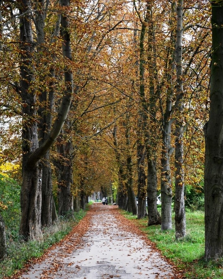
This strategic location with an excellent infrastructure is an attractive living environment. The diverse culture and leisure programs (such as walks in The Brückenkopf-Park) in Jülich make it a feasible economic location and a comfortable place to live. The city is also an ideal starting point for long cycling tours.
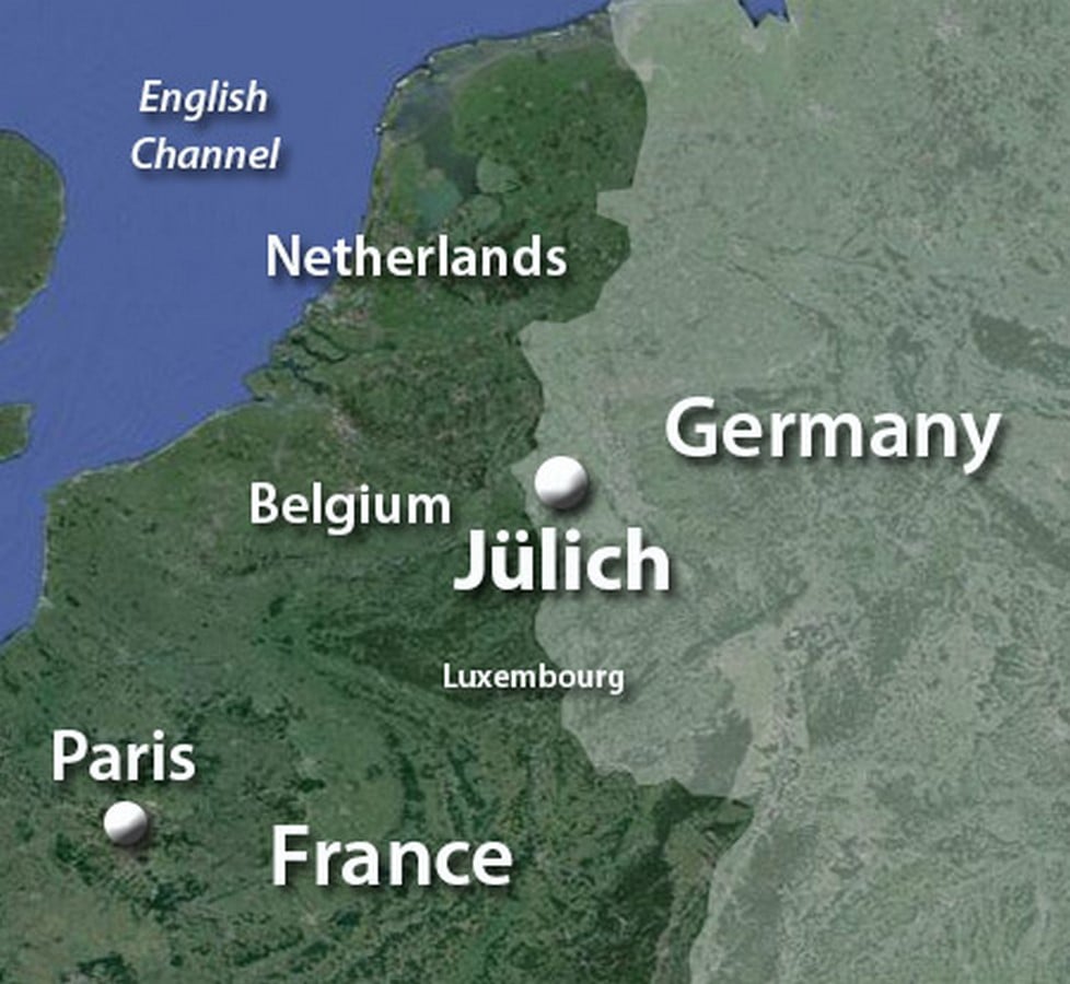
The cycle path along the river Rur runs directly through the town. In addition, the triangle perimeter of Belgium, the Netherlands, and Germany offers walkers, cyclists, and culture vultures the chance to discover new areas in three different countries. Major cities like Brussels, Paris and London are all close enough for an extended weekend break. Jülich has good rail connections to all three cities, ensuring an easy commute.
This area of Germany is known for its Carnival celebrations. The season begins in November and culminates in a series of parades and festivities usually in February. Many people are involved in preparing and taking part in the events, many of which are televised. The parades attract tourists from all over the country and abroad, serving as a key attraction event to a diverse group of people.
Jülich over the ages
Jülich is both an old fortress town and a modern research location, with an estimated population of about 33000. The residents of Jülich not only witness the town’s history, but also help to shape its future. A total of about 6000 people work at the Jülich campus of Aachen University of Applied Sciences.
Some also work at the German Aerospace Center’s Institute of Solar Research. Several of these employees have arrived in Jülich from all across Germany. The institutes also encourage foreign employees to be part of the team. They contribute to the town’s international and open atmosphere.
Eight squares in the city center of Jülich bundle up to convey the history of the city from the beginnings of settlement to the present day. Today, they stand in an urban context that can be vividly narrated and experienced on a tour through the city:
- Walramplatz and Hexenturm
- Marktplatz
- Kirchplatz
- Schloßplatz
- Düsseldorfer Straße/Schloßstraße
- Zitadelle
- Neusser Platz
- Schwanenteich
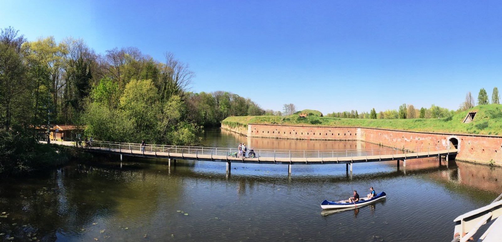
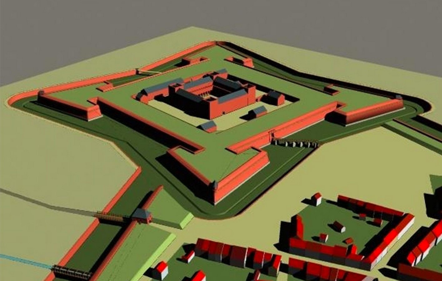
Jülich was founded around the birth of Christ and has developed into a residence, modern town and fortress. Structures such as ramparts and bastions of the citadel, the town blueprint and remains preserved of the town fortifications stand as witnesses to the present day. The iconic east wing, part of the former Ducal Castle in the citadel, is a testimony to Italian High Renaissance architecture. The fortifications were continuously extended until the 19th century. A bridgehead is a strategically important area located at the end of a bridge. The bridgehead in Jülich was constructed during Napoleon’s reign in the Rhineland.
In the later Roman periods, Jülich was fortified with stone walls and as many as sixteen towers. These fortifications were revamped around the 13th and 14th centuries, reinforcing the town into a strong fortress. Jülich was set to transform into an ideal Renaissance town, planned in accordance with the latest Italian ideas and equipped with modern fortifications.
In 1547 however, disaster struck. A fire destroyed most of the medieval town. This allowed the emergence of a completely new town. An Italian engineer and architect, Alessandro Pasqualini, was appointed to design the new town and its fortifications. His contributions are key to the rebuilding of the town.

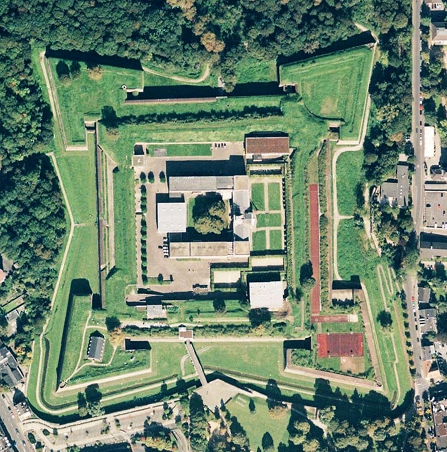
To the north of the town, there stood a large square citadel with four bastions that projected out. The citadel housed a palace within it, surrounded by a medieval-style wall with round corner towers. Eventually, the citadel had to be shrunk in size (due to a lack of funds). Pasqualini shifted it slightly to the east, taking advantage of higher ground. He kept the design for the palace unchanged, but it was not surrounded by the medieval-style wall anymore.
The practice of combining a palace and a citadel was common in Italian renaissance town-planning, but in actual construction, it was rarely used. The fortifications were typical of the Italian School of thought, using squared-off arrow-headed bastions consisting of two tiers of guns in the flanks. There was a deep ditch in front of the fortifications, which could be flooded, to shield the base of the wall from the enemy.
The fortifications of the town joined the citadel in the west with the St. Sebastianus Demi-Bastion. The flank of the bastion faced away from the citadel. On the opposite side, St. Franziskus Bastion was linked to the citadel. It was done so with a curtain wall. The wall was bent halfway along its length. This was a slightly weaker joint than the one on the western side, since the St. Franziskus Bastion could easily be used against the citadel by any enemy in possession of the town.
Despite such issues, Jülich was one of the first bastioned fortresses to be constructed from scratch, outside of Italy. Pasqualini designed the town’s layout with defense strategies in mind.
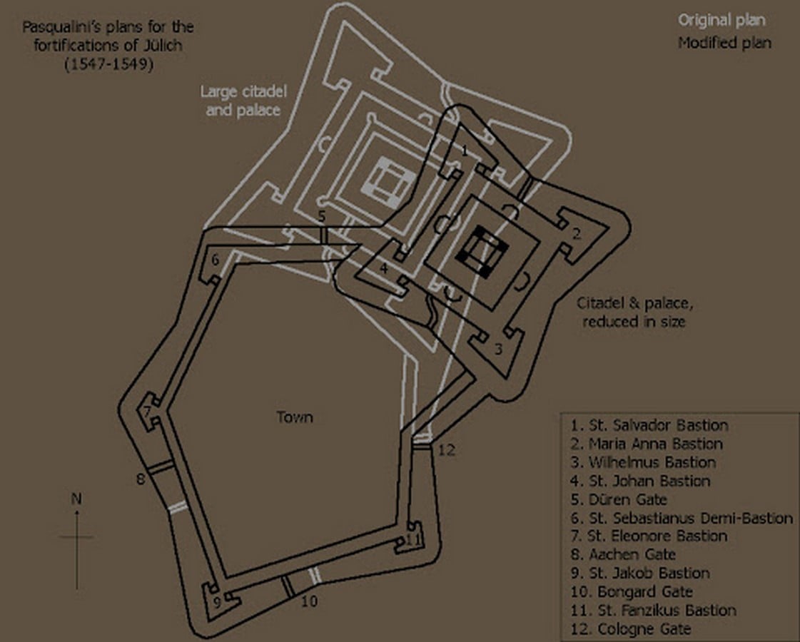
Roads were in alignment with the citadel, so that its guns dominated the town. The streets were designed wide enough, in such a way that a house collapsing from a bombardment would not obstruct the whole street. The fortifications had remained almost unchanged since the mid-16th century. The Dutch decided to render them stronger. The Spanish made minor modifications to the fortifications (they occupied the town until 1660), but no large-scale changes were undertaken. The next major alteration to the fortifications of Jülich came during the Napoleonic era.
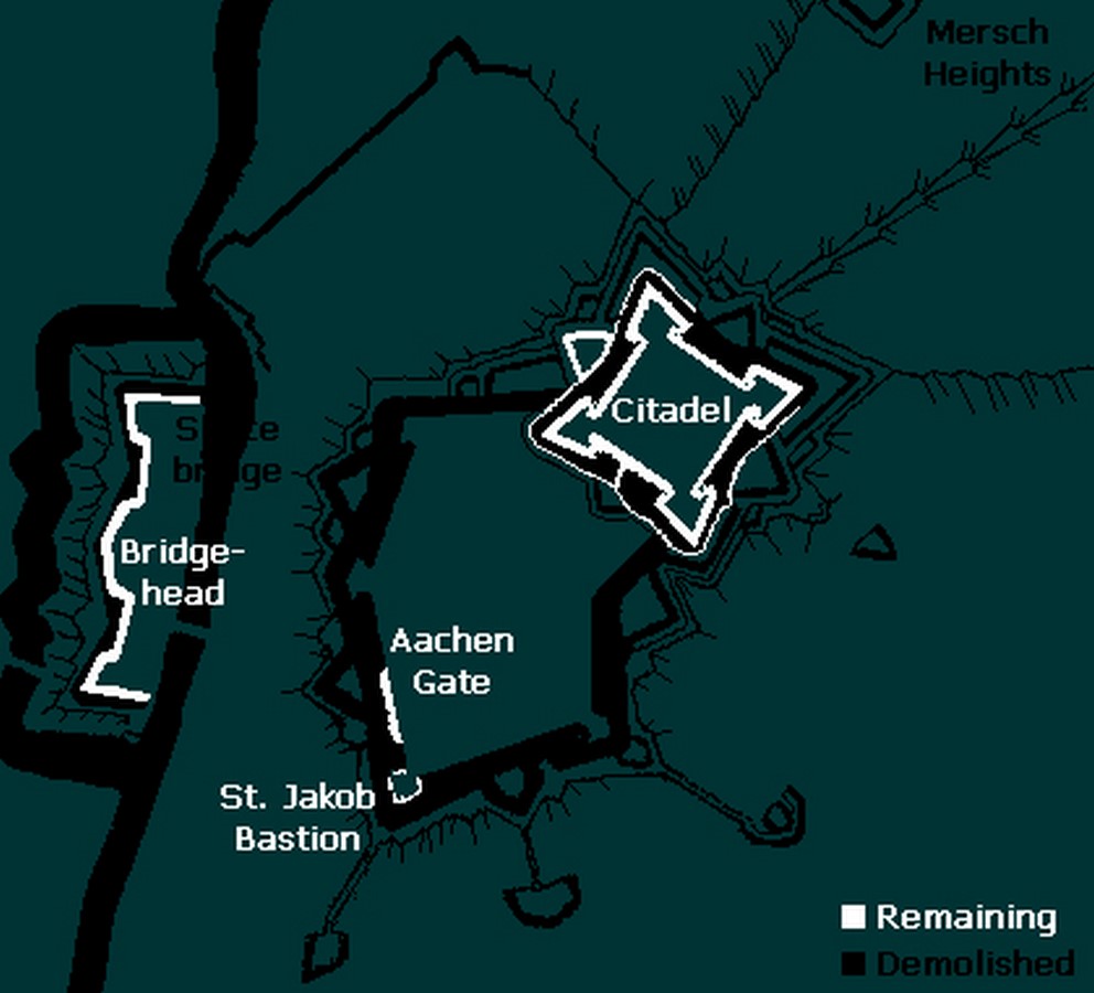
The French occupied the town in 1794. The fortress was important to the French as a base between the Rhine and the Meuse. The fortifications around the town were demolished to allow for urban expansion, but the citadel was repurposed as a military school, so it remained intact. The Napoleonic bridgehead was also upheld as before.
Jülich in Recent Times
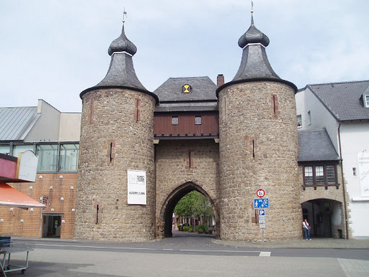
Although Jülich, like many other towns in Ruhr, suffered extensive destruction in 1944, there are substantial remains of the old fortifications. Of the town defenses, which were mostly demolished, the archway of the Aachen Gate has stood the test of time and battles, along with the adjacent curtain wall.
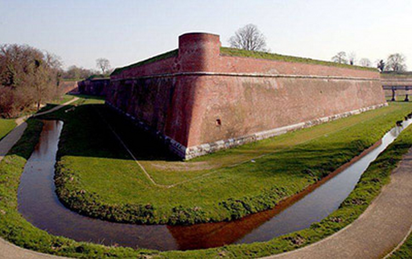
The real highlight, however, is the citadel, the core of which is in good condition even today. Although it has been modified over the years, it is still a great example of early bastioned fortification, featuring squared-off arrow-headed bastions. The walls of the citadel have been restored since the destruction of the Second World War and a modern school has been built inside, one that incorporates the eastern side of the palace (the only part to have survived).
The citadel is open to visitors during summer and on the weekends in winter. A guided tour of the Bastion St. Jakob and the cellars of the palace are also offered. The cellars exhibit various antiques and artefacts about the history of the citadel and the town itself.
Today, Jülich is a one-of-a-kind example of Renaissance architecture in the Rhineland. It is a place of residence offering a high quality of life. The town is equipped with modern and high-performance infrastructure with rich cultural value.
References
Stadt Julich. (2012). https://www.juelich.de/
Fortified places. (2019). http://www.fortified-places.com/julich/default.htm
Starforts. (2014). http://www.starforts.com/julich.html


