Istanbul at a Glance
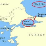
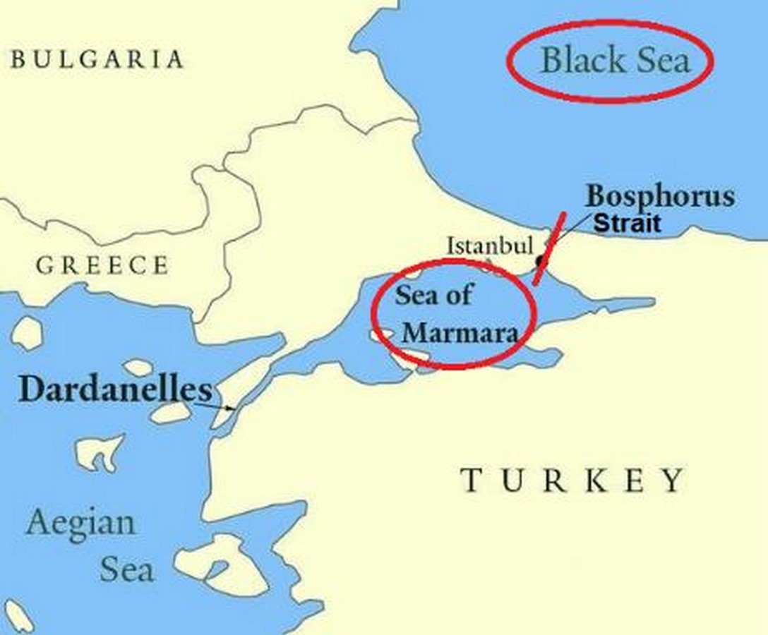
Istanbul serves as a remarkable illustration of geographical and political survival in the world. Situated between the European and Asian continents and spanning the Bosphorus Strait, this city has been known for its water-oriented character. Due to its location and reliance on water, Istanbul’s narrative contains several objections. Water was utilized as both a system and primarily aimed at political control, as evidenced by the integration of water infrastructure into underground chambers like the Basilica Cistern and open reservoirs at Hagia Thecla and Valens Aqueduct.
Empires began using stone as a means of communicating their control over water, making it the primary symbol of power. The past demonstrates that water in Istanbul is not limited to its physical properties.’ Cultures are determined by the combination of these factors, wealth, and identity as their pillars of survival.


Basilica Cistern – The Subterranean Fortress of Water
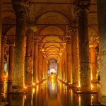
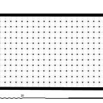
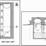
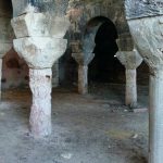
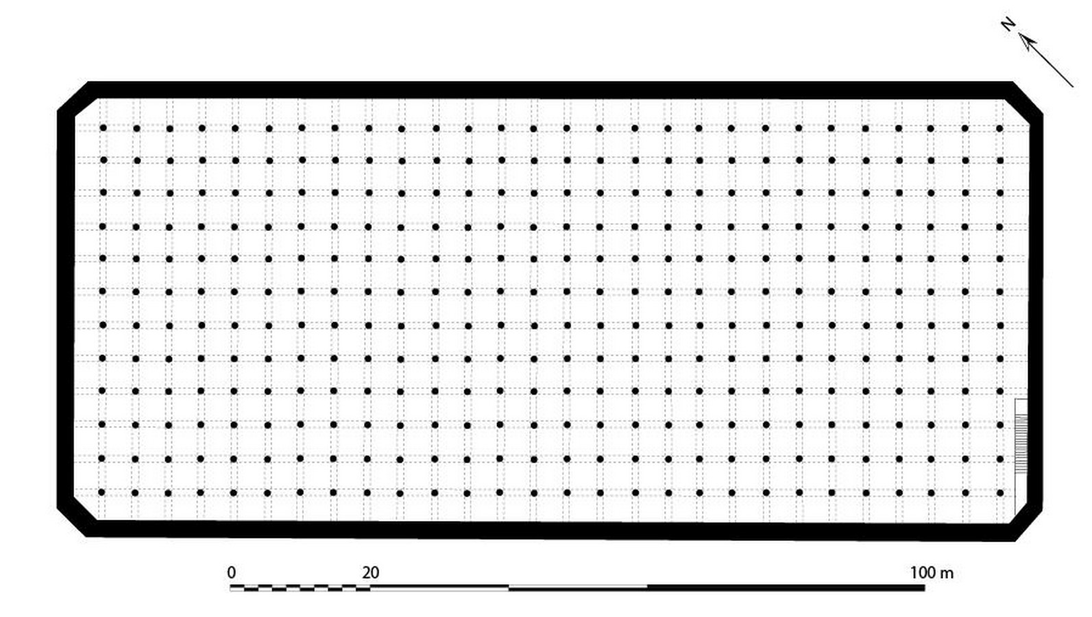
The Basilica Cistern, an iconic water storage facility in Istanbul, is a well-known landmark. The Byzantine Empire built a massive underground facility that spans 9800 square meters and can hold more than 100 tonnes of water. A system of aqueduct-fed canals and nearby forest areas was combined with seasonal flood sources to provide water. The control of water systems through the cistern was a symbol of political authority for emperors. The city was under the control of those who had authority over its water resources. It was not only a public building but also a cistern. These large cavities provided a refuge for inhabitants during wars and safeguarded the precious freshwater resource.’ Keeping water below ground level fulfilled several purposes as it prevented water reserves from being polluted while conserving space in the city above.
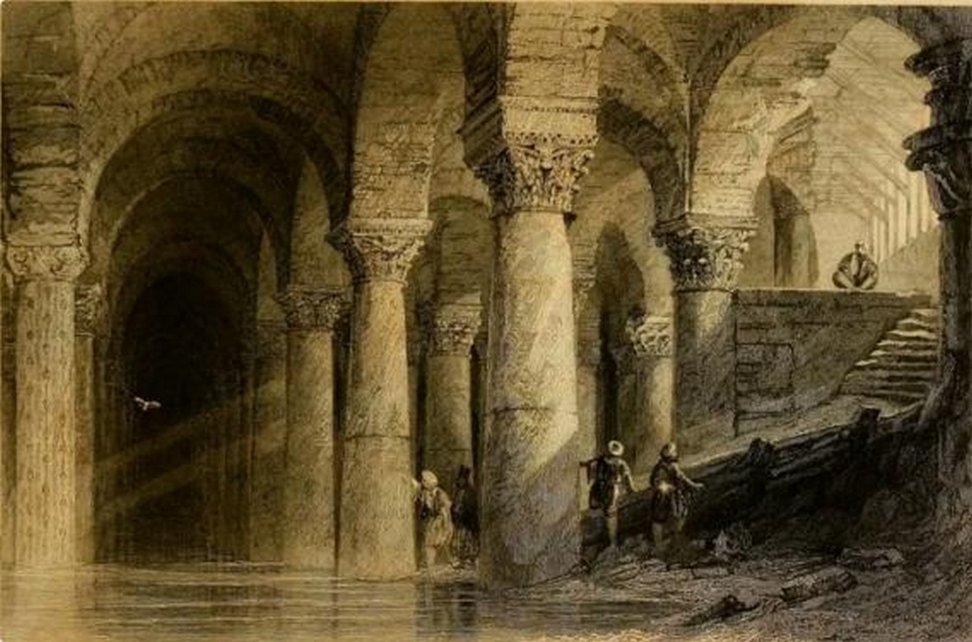
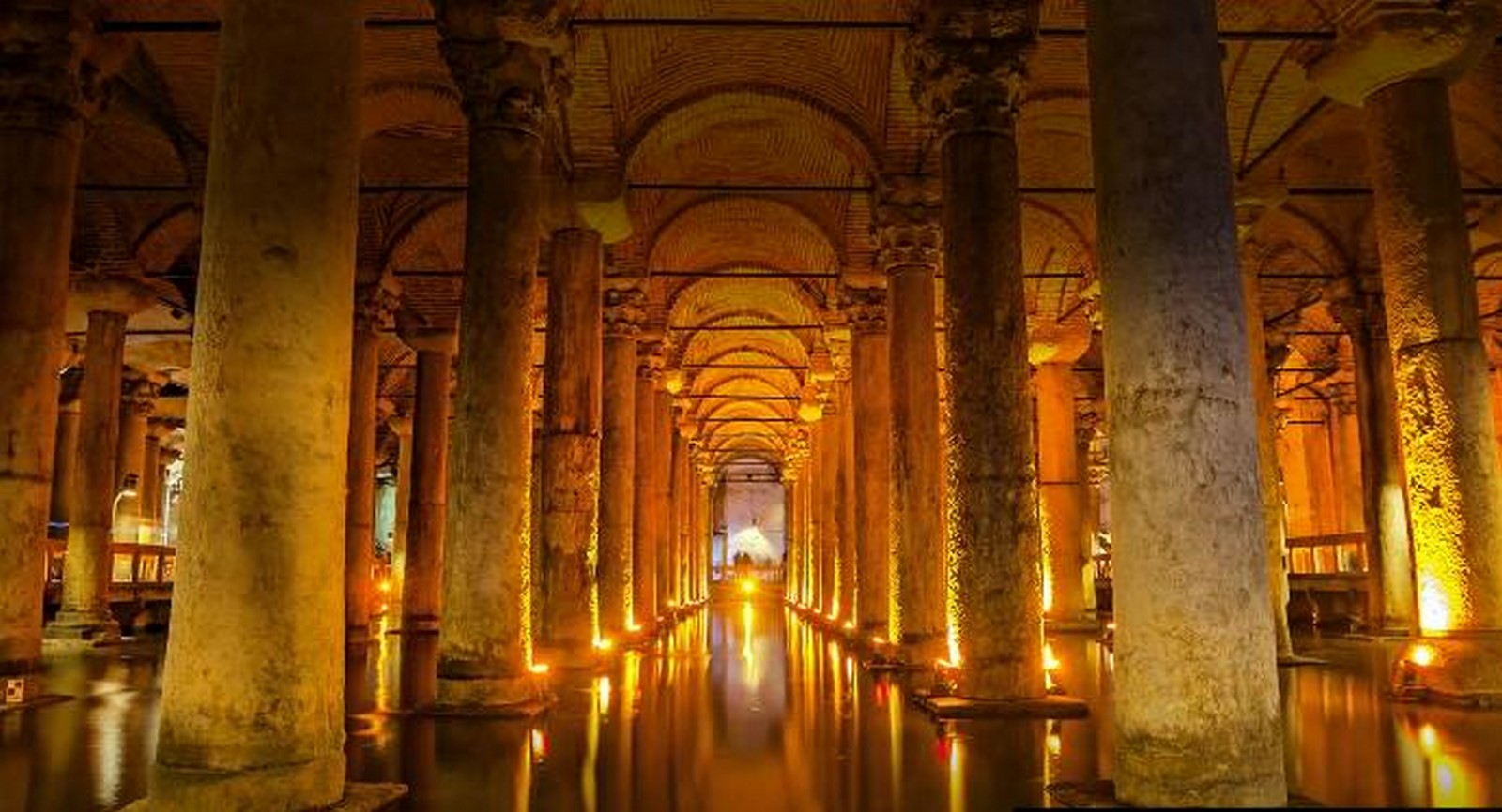
Remarkable biological balance was demonstrated by the operation of the cistern.’ Freshwater was exclusively utilized by the cistern to sustain living fish, which also served as a means of maintaining water flow in its system. The cistern was an ecological system that functioned automatically, even though it wasn’t considered sustainable for several centuries. Economic stability relied on water security because the quantity of drinking water was directly linked to monetary wealth. The Basilica Cistern is a cultural hub as it attracts numerous tourists who contribute to the revenue of this historical site.
Hagia Thecla Basilica Cistern (Open Reservoirs) – Water in the Siege Economy
The Basilica Cistern remained out of sight, while the open cisterns at Hagia Thecla served different purposes. By providing transparent water storage solutions, the entire city could monitor the reservoirs. In the sixth century, Constantinople had to cater to 500,000 residents who needed 2-3 liters of water per day, but the river and well supplies were insufficient to meet their requirements. Open cisterns were responsible for ensuring an uninterrupted water supply, particularly during prolonged siege periods.
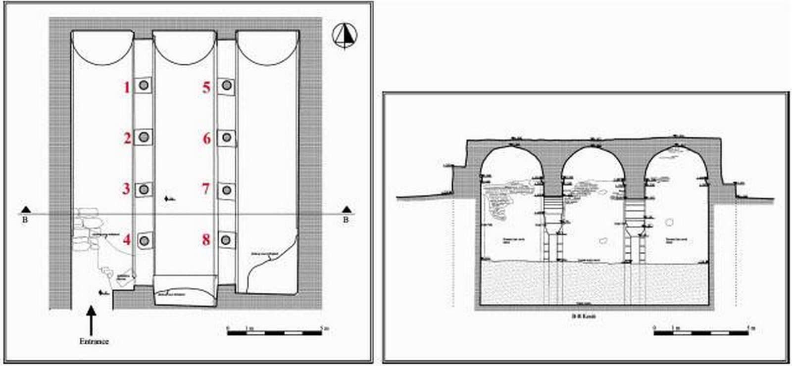

Through the use of aqueducts, the Sassanids and Arabs utilized strategies to threaten Byzantium. The cisterns provided essential shelter during times of crisis. The Hagia Thecla system, which measured 71.4 by 56.5 meters and stored more than 4 tonnes of water, was designed to protect against external sabotage.
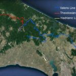
The system was watered by the Valens Aqueduct for a 30-kilometer distance from Belgrade Forest. This route. With the ability to control forest watersheds and move aqueducts while also being able to store or spill water from city walls, this loop system proved to be remarkably resilient. This triangular protection became a key element in the defense of Byzantium against starvation and disease outbreaks, as well as military defeat.
Aqueduct of Valens and the Imperial Arteries
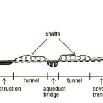
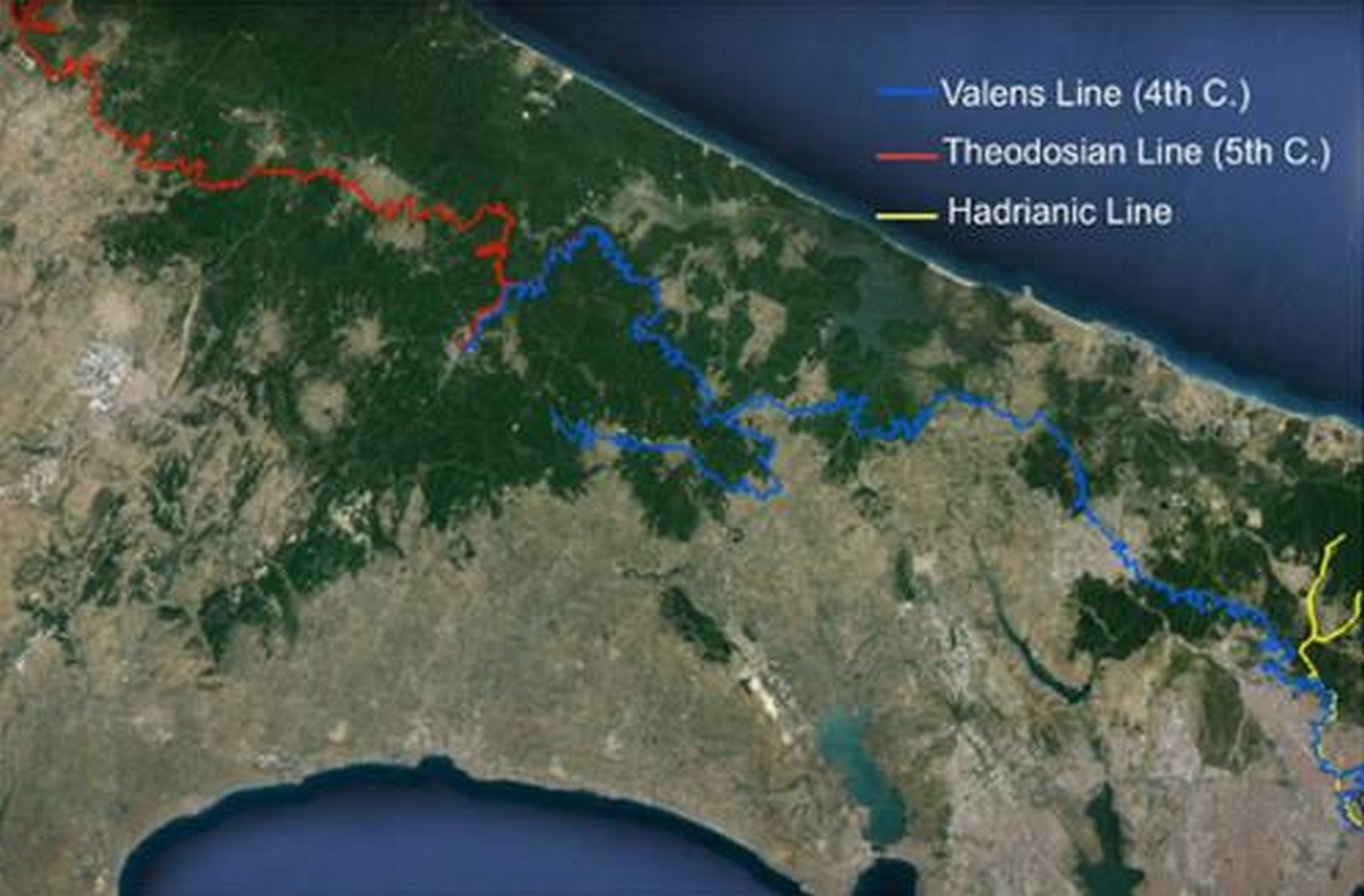
During the fourth century under Emperor Valens, the Aqueduct of Valens was constructed and represents the most well-known hydraulic structure from Byzantine times. The water network, which covered 250 km, was extensive and included multiple channels, tunnels, and bridges that connected water sources from Thrace and distant regions. The aqueduct section in Istanbul that is still intact only serves as ice cubes.
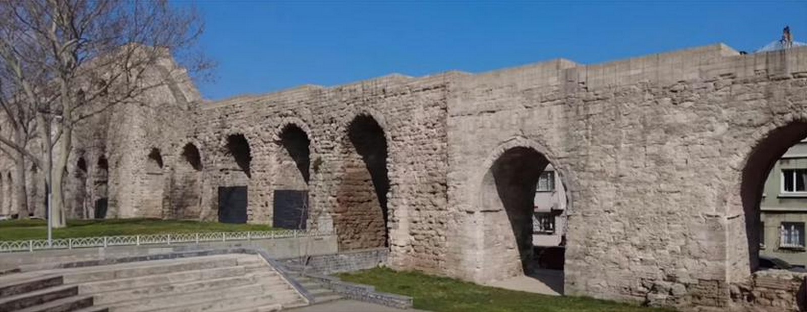
By utilizing a 1:1000 gradient, the system enabled water to move through great distances without the need for pumps. Engineers constructed both underground tunnels and grand arcades that functioned as dual-use constructions, serving as urban landmarks or military platforms for strategic purposes. The. The installation of catapults and other defensive equipment during the siege periods highlights the structure’s function as a crucial infrastructure and defense mechanism.
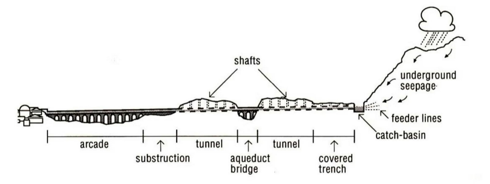
Over 200 fountains and baths were connected to Constantinople via the aqueduct. Byzantines had advanced knowledge of public health practices and used sand and charcoal filters to purify water. A few aqueducts functioned as water channels and vehicular bridges, serving both the needs of public mobility and hydraulic operations. The Valens system embodied the ideology of the empire due to water’s function as a vital resource and symbol of order, hygiene, defensive capability, and prestige embedded in stone construction.
Then and Now – Resilience Across Time
Ancient and modern Istanbul share many important similarities. Why? The Byzantine city’s water management system comprised a range of redundant components, including cisterns, long-distance duct systems, biological water maintenance systems (such as open, well-drilled troughs), and forest watershed management that is similar to modern urban water control tasks.
The vulnerabilities faced by individuals today are more significant than those of the past. The effects of climate change result in longer, more frequent droughts and unpredictable rainfall patterns, which were not experienced by Byzantine emperors. During the dry season, the agricultural industry is completely devastated as livestock deaths cause rural communities to migrate to Istanbul. The population of the city is rapidly increasing due to an increase in people moving there. Even though Istanbul’s advanced treatment plants handle 95% of wastewater, the water supply remains a topic of ongoing debate.
This ancient wisdom teaches that survival is dependent on many interconnected systems, not on one engineering feat. Over time, the Byzantine Empire developed a network of cisterns and ducts that were highly intricate and had redundant overlaps.
References:
Website
İSKİ – organizations – IMM. Available at: https://data.ibb.gov.tr/en/organization/i-s-k-i
State of Türkiye’s climate in 2021. Available at: https://www.mgm.gov.tr/eng/Yearly-Climate/State_of_the_Climate_in_Turkey_in_2021.pdf
Book
Kafescioglu, C. (2010) Constantinopolis. Pennsylvania State University Press.
Crow, J. G., Bardill, J. and Bayliss, R. (2008). The Water Supply of Byzantine Constantinople. Malet Street: Society for the Promotion of Roman Studies.
Images
Important geographical term. Available at: https://targetkicker.com/article/Important-Geographical-Term
Jpifer (2013) Connecting Continents: Turkey’s Marmaray Project, Pace International Law Review. Available at: https://pilr.blogs.pace.edu/2013/11/01/connecting-continents/
Archaeology, W. (2023) ‘The City Thirsts’: Water in Istanbul: Past, present, and future, The Past. Available at: https://the-past.com/feature/the-city-thirsts-water-in-istanbul-past-present-and-future/
Medya Midas. Available at: https://www.medyamidas.com/
Baraj doluluk oranı i̇stanbul… İSKİ 9 aralık 2023 Baraj Doluluk Oranı ne Kadar, Yüzde Kaç? – CNN Türk Haberler (no date) CNN TÜRK. Available at: https://www.cnnturk.com/turkiye/baraj-doluluk-orani-istanbul-iski-9-aralik-2023-baraj-doluluk-orani-ne-kadar-yuzde-kac-2069094?page=4
(2022) Hydropolitics Academy,Turkey would like to thank all of the speakers and attendees for their contribution to the webinar, Academia.edu. Available at: https://www.academia.edu/69230376/Hydropolitics_Academy_Turkey_would_like_to_thank_all_of_the_speakers_and_atendees_for_their_contrubution_to_the_webinar
Goara Vetisyan. Available at: https://goaravetisyan.ru/en/drevnyaya-stolica-vizantiiskoi-imperii-vizantiiskaya-imperiya-istoriya/
Landscape (2025) Encyclopædia Britannica. Available at: https://www.britannica.com/place/Istanbul/Architecture
Istanbul – Gezgi̇nleri̇n Bakişi – Yerler – Anıtlar – i̇nsanlar Güneydoğu Avrupa – Doğu Akdeniz Yunanistan – Anadolu – Güney i̇talya – 15. yüzyıl – 20. Yüzyıl. Available at: https://tr.travelogues.gr/tag.php?view=10784&page=46
Cistern Basilica Plan.svg (2005) Wikimedia Commons. Available at: https://commons.wikimedia.org/wiki/File:Cistern_basilica_plan.svg
Numerical Analysis of historic structural elements using 3D point cloud data. Available at: https://benthamopen.com/FULLTEXT/TOBCTJ-10-233/FIGURE/F2/
Anasayfa. Available at: https://istanbultarihi.ist/387-the-contributions-to-istanbul-of-the-prehistoric-archaeological-field-surveys-and-the-banthonea-excavations
Valens Aqueduct (bozdogan kemeri), Istanbul. Available at: https://www.tripadvisor.com/Attraction_Review-g293974-d319163-Reviews-Valens_Aqueduct_Bozdogan_Kemeri-Istanbul.html
Water Supply System of Constantinople The Byzantine Legacy. Available at: https://www.thebyzantinelegacy.com/aqueducts
Youtube
YouTube. Available at: https://www.youtube.com/watch?v=-ma2GD8r8jE