Coming from a country of astonishing architecture, mesmerizing thoughts, wild imagination, and execution is another great project- The Greater Southern Waterfront. Singapore has come a long way from being just a port city to a significant urban metropolitan city, and this project is just another step closer to making it come into the limelight in front of the entire world.
From start to the present- A long way | Greater Southern Waterfront
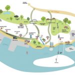
First envisioned in the year 2013, to ease the growing population density and revitalize the area, this urban planning project aims at redeveloping the waterfront for Singapore which covers over 2000 hectares of area and stretches across 30 km of coastline from Gardens by the Bay East to Pasir Panjang, comprising of
- Gardens by the Bay East
- Cruise Hub & Coastal Park at Marina South/Straits View
- Keppel & Tanjong Pagar Terminals
- Mount Faber – Harbourfront
- Keppel – Labrador
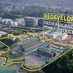
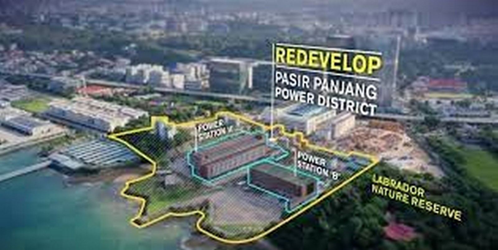
- Pasir Panjang Power District
- Pasir Panjang Terminal
- Pulau Brani
- Sentosa
The development of this waterfront would begin on the ground where the currently existing City Terminal and Pasir Panjang Terminal, only after the former, is shifted to the Tuas Port by 2027 and the latter by 2040 to the same location, thus freeing up the required frontage and landmass.
Vision- For a better tomorrow
The project began with the very basic thought of making sustainable, liveable, and breathable space for the highly dense population of the country with a clear vision for the future and its growing needs. The designers, planners, and architects all envisioned motives to create-
- new opportunities to live, work, and play which will be achieved through private and public housing options with waterfront promenades and open spaces, more office spaces to bring about more job opportunities and benefit those staying in the area, and more recreational and entertainment for residents
- to extend the city to the greater southern waterfront
- expanding the network of public open spaces
- capitalizing on blue assets
- creating a continuous waterfront
- creating open and green spaces
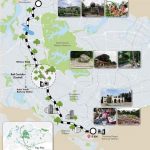
The journey so far
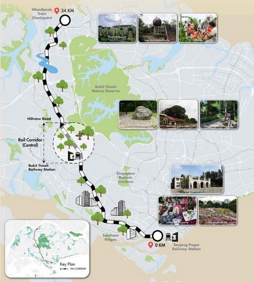
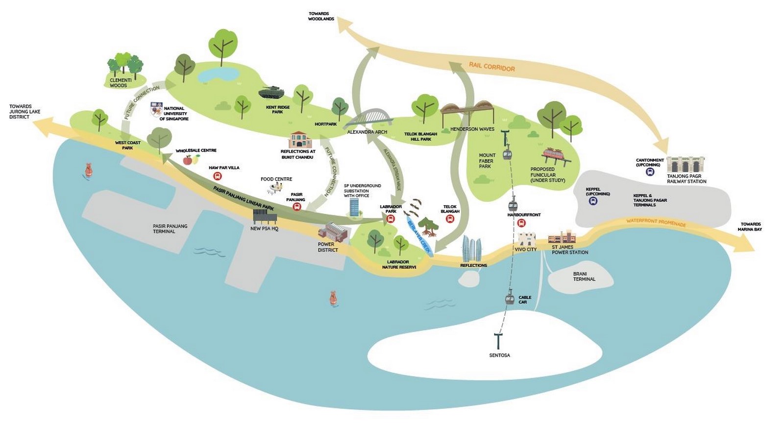
- Rail Corridor
-
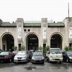
- Opened in May 2021, the rail corridor was a former railway line for the Malaysia KTM. In 2011, Singapore took the whole 24km stretch of land from the woodlands checkpoint to Tanjong Pagar Railway station and now intends to develop it into a promenade for people to visit, cycle, and walk.
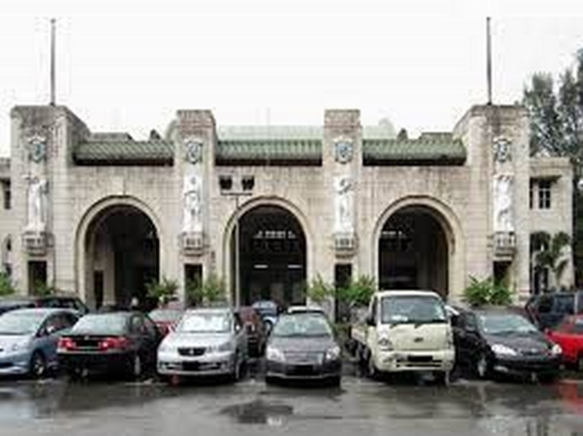
- The 87-year-old Tanjong Pagar Railway station is preserved and turned into a multifunctional building for events and linked underground to the MRT station in 2025.
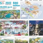
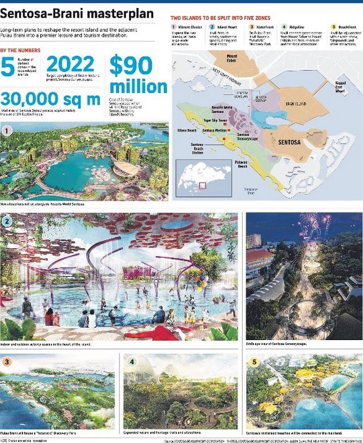
- Sentosa-Brani Master Plan
This $90 million project consists of a Sentosa Sensory scape which would be the size of 5-6 football fields, and a 30,000 sqm multi-sensory walkway linking the Sentosa beach to the Resort World Sentosa. This will also include the amusement parks and theme parks in the locality.
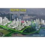
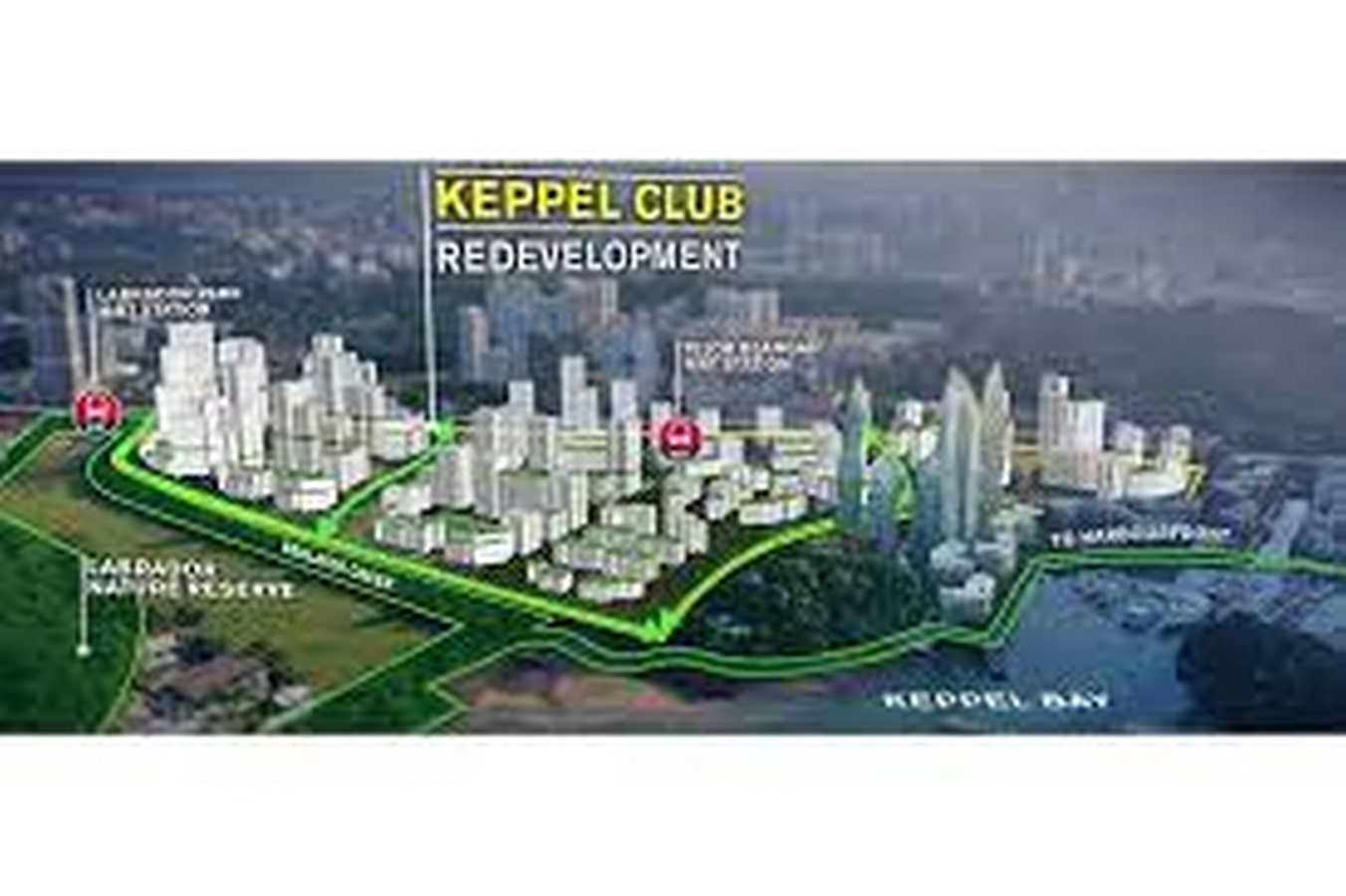
- Keppel Club Redevelopment | Greater Southern Waterfront
Under this, 9000 housing units which included private and the public would be provided on the grounds taken over from the current golf course land, thus accommodating nearly 5 times the population currently residing in The Pinnacle. The continuous waterfront for private housing would mean an increase in land prices as well as the neighborhood.
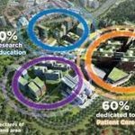
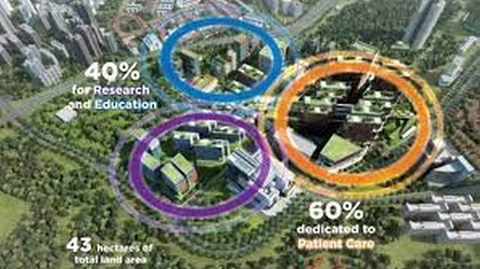
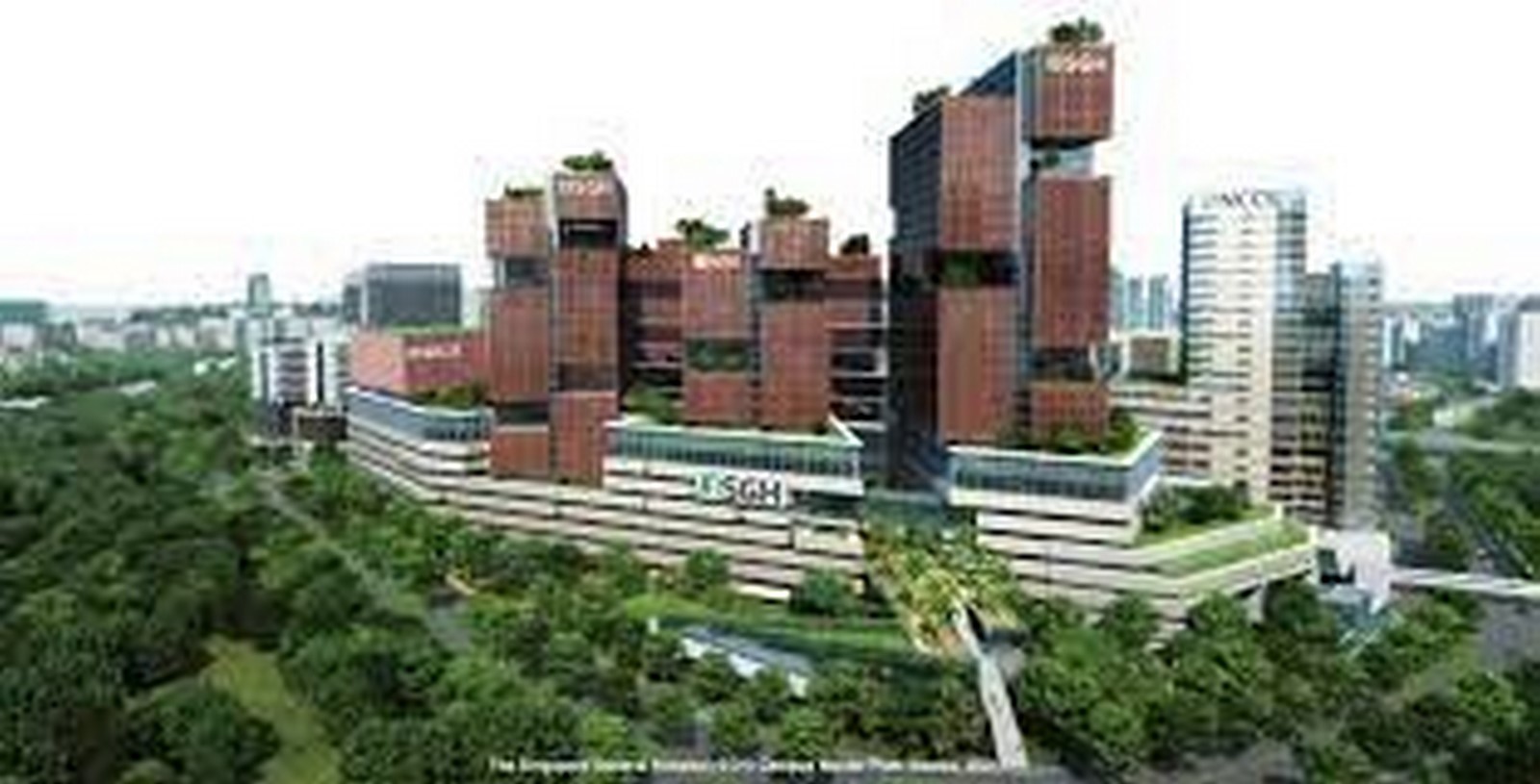
- SGH Campus Master Plan
The SGH campus with its master plan aims to mix-used development to suffice all the needs in the given vicinity thus having 60% of the area for patient care, and 40% for education and research purposes. Till it becomes fully materialized by 2030, rental prices would see a steep hike and create a number of job opportunities.
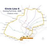
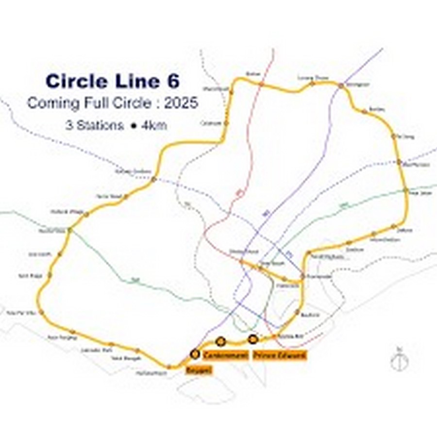
- Circle Line stage 6
The circle line is the connection of railway stations between the Harbour gate and Marina Bay forming a loop, however, the absence of a few stations at the ends make it incomplete. Therefore, to form a full circle, by 2025, three stations at Keppel, Cantonment, and Prince Edward save on time which they had to spend on changing two stations and then walking between the Harbour Gate and Marina Bay. This will increase the prices along the stretch along Pasir Panjang, Telok Blangah, and Harbourfront.
- Greater Southern Waterfront
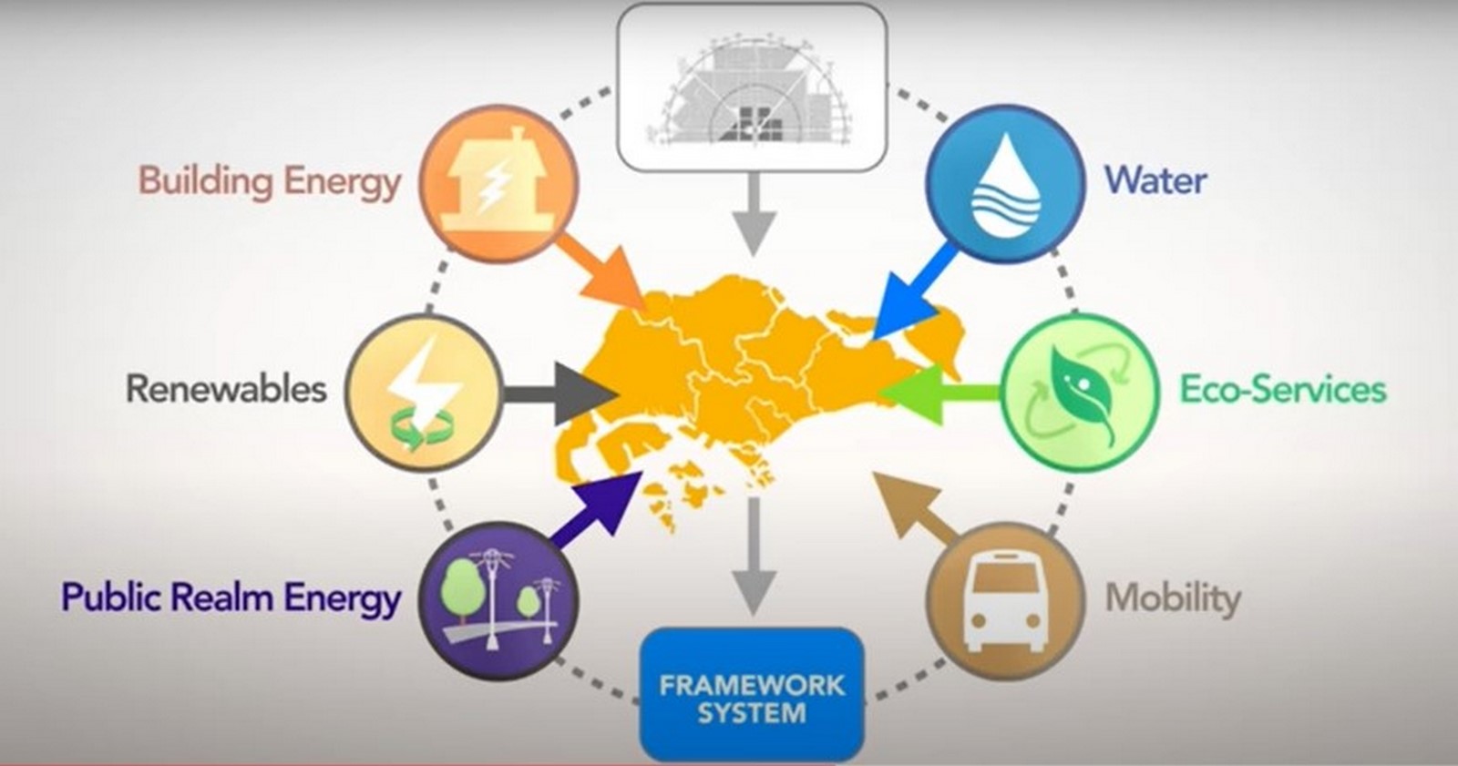
The greater southern waterfront captures the rainwater and excess water from the marina barrage which is currently being discharged directly into the sea. The design of the waterfront works in the flow of the principle of being self-sufficient in its water supply.
- Eco-corridor
The eco-corridor consists of a water body, a wetland habitat, and a forest surrounding the area. The entire zone along with the area surrounding the Gardens By The Bay is aimed at creating completely pedestrian-free pathways that would be well connected to all the places and hence make it easy for people to interact, collaborate and prosper.
Green space, natural trails, and what else | Greater Southern Waterfront
Envisioned with the perfect balance of all, the design works on the needs and requirements of every sector of society and has strategically placed them to have maximum utilization. Administration, residential, recreational, entertainment, socializing, refreshment, and civic, all these categories have been very well catered.
A continuous promenade would ensure connecting the various places of interest along the entire route of the Waterfront, from the Pasir Panjang Linear Park to West Coast Park and finally to the Labrador nature reserve.
Conclusion
With the massiveness of this project, the aims, and progress done to achieve it, the technological instruments and techniques used, and the vision to make a better living for people, improve the standard of living, to make balanced survival conditions for the community where one can live, play and work, all of this development has been on a steady path, however, it is set to have a peak and rapid growth in the future. It is all set to be the epitome of architecture in the near decade and be an inspiration for growth, ideology, valuing community well-being and sustainable development.