Have you ever walked down a city street and felt that something wasn’t quite right? Maybe the sidewalk is too narrow, or a large square feels lonely and cold. Perhaps you’d like to sit down while waiting for the bus, but there are no benches. We’re all familiar with that feeling. For many years, those who built our cities relied on paper maps and used tiny plastic models. But the paper doesn’t give a complete picture of the situation.
You cannot feel the sun on your skin or hear the noise of traffic on a map. Now we have something better. We use Virtual Reality and 3D Digital Twins. These tools let us walk through a space before it exists. We can check the streets and the squares before we spend any money. This tech helps us make better places for everyone.
To start a project like this, you need the right tools. High-end software for cities can be very expensive. Not every small town or local group has a huge budget. Because of this, many people look for a cheap version landscape design software alternatives to pro tools in United States to get their ideas off the ground. These budget options help smaller teams build 3D models without spending a fortune.
What is a Digital Twin?
“Digital twin” – it sounds like something out of a science fiction movie. Simply put, it’s an exact digital copy of a real-world location. If you want to restore an old town square, you first need to create its digital twin. This model includes buildings, trees, underground pipes, and even the way the wind blows through the alleys.
This twin is not just a static picture. It lives and breathes. If you add a new fountain to the model, you can see how the water flow looks. You can see how the sound of the water might drown out the noise of cars nearby. It allows us to test ideas.
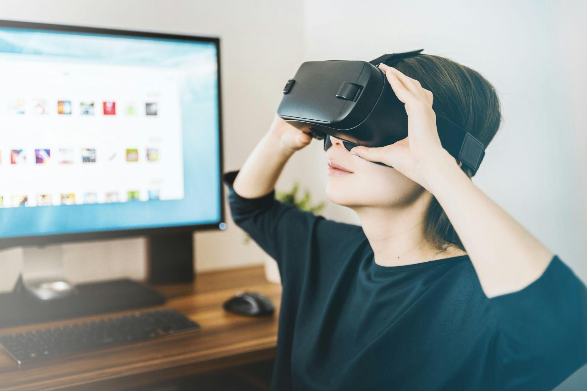
Step Inside with VR
Once you have a digital twin, you can put on a VR headset. This is the “immersive” part. You are no longer look at a screen, you are standing in the middle of the street. You can look up at the tall buildings and walk from the bus stop to the library.
A map might show that a walkway is ten feet wide. That sounds like a lot on paper. But when you stand there in VR, you might realize it feels cramped because of the tall walls on either side. VR gives us a sense of scale that we never had before.
 A Better Way to Talk to the Public
Usually, when plans are made to build a new transportation hub or waterfront, a meeting is held and the blueprints are presented. Most people find these drawings hard to read and imagine how a 2D sketch will change your daily walk to work.
VR changes the game for community meetings. Instead of a boring slide show, a city can let residents “walk” through the new design. Imagine you live in a neighborhood where the city wants to turn a busy road into a pedestrian street. You might worry about traffic or noise. But if you can put on a headset and see the wide sidewalks, the new trees, and the safe bike lanes, you might feel better about it.
More Than Just Good Looks
3D digital twins are great for the “nerdy” side of design. We can simulate how the sun moves across a plaza throughout the year. If we build a new office tower, will it leave the public square in total darkness all winter? The digital twin will tell us. We can also simulate wind. Nobody wants to sit in a plaza that feels like a wind tunnel. By testing these factors in a 3D model, we can change the shape of buildings or add trees to block the breeze.
We can even test how people move. If a train station lets out five hundred people at once, where do they go? Do they all jam up at one exit? A digital twin can show us the flow of the crowd. This helps us place doors, stairs, and signs in the right spots.
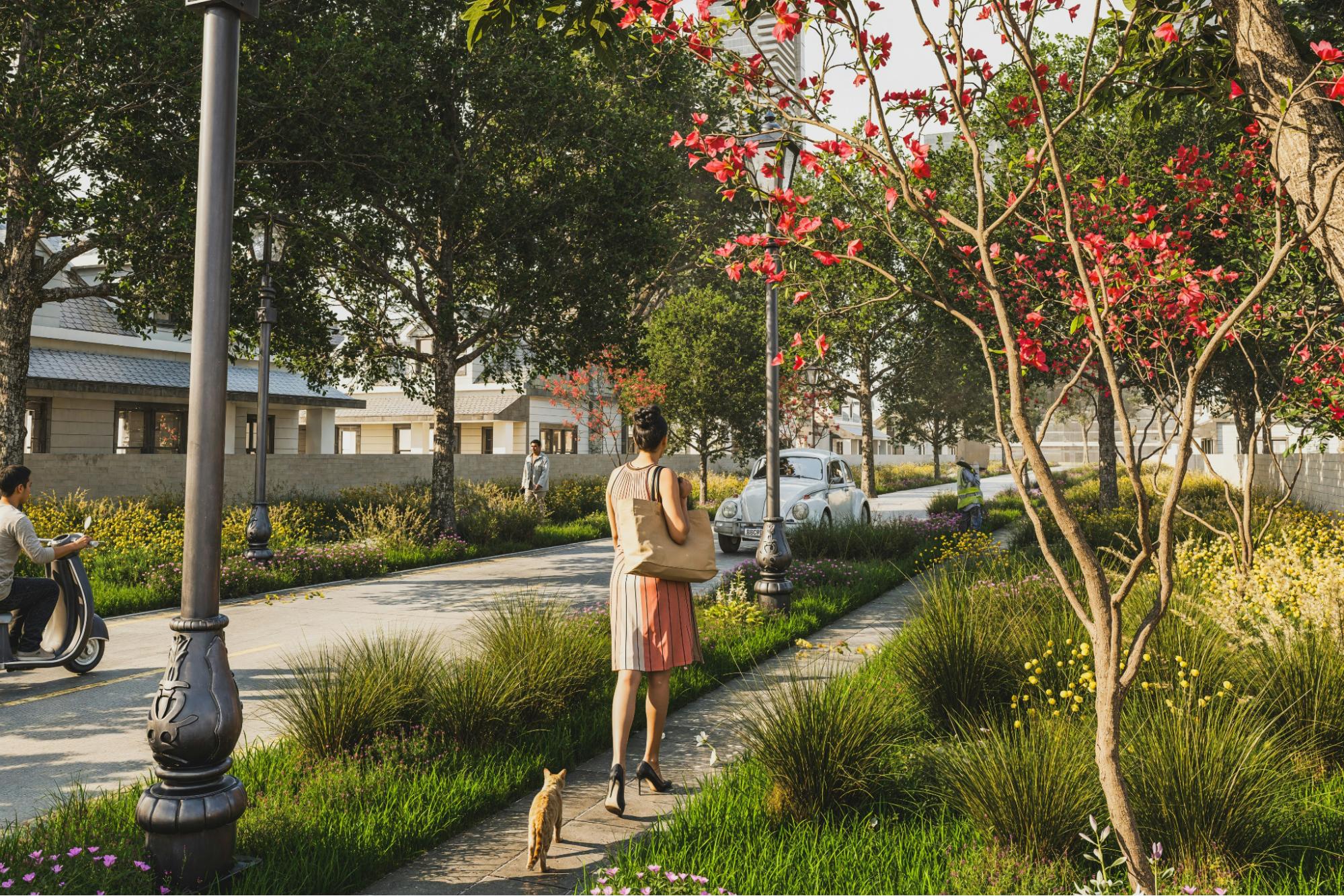
Beyond Parks: All Public Spaces
When people hear “landscape design,” they often think of grass and flowers. But our “landscape” is everything outside our front doors. This includes the sidewalk where you wait for a taxi, the alleyway behind your favorite cafe, the big concrete plazas in front of government buildings.
All these spaces benefit from VR and digital twins. Think about a local market. A digital twin can help planners figure out where the stalls should go so people don’t get stuck in a “human traffic jam.” Think about a bus station. VR can help us see if a person in a wheelchair can move easily from the street to the platform. We can design for everyone, not just for the “average” person.
 The Cost Factor and the Future
In the past, this tech was only for huge projects with millions of dollars. You needed massive computers and teams of experts. But things have changed. The software is getting better and cheaper. As I mentioned earlier, there are now many versions of landscape design software that are more affordable for the average user.
This means small towns can use these tools too. A small village can create a 3D model of their main street to plan for better parking or more trees.
Keeping the Space Alive
A public space is never really “finished.” Cities and people are changing. A plaza that was popular in the 1990s might be empty today. This is another reason why digital twins are great. The model stays with the city.
Ten years after a project is built, planners can go back to the digital twin. They can add new data and see how the trees have grown. They can see if the traffic patterns have changed. If designers need to make an update, they already have the foundation ready. It is a long-term tool for care and growth.
Final Thoughts
Designing public spaces is a huge responsibility. These are the places where we meet up with friends, wait for the bus, and enjoy the sunshine. They are the heart of our community.
Using virtual reality and digital 3D twins helps us achieve better results. By using these tools, we don’t just create a place that looks good on a map. We create a place where people enjoy spending time.