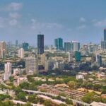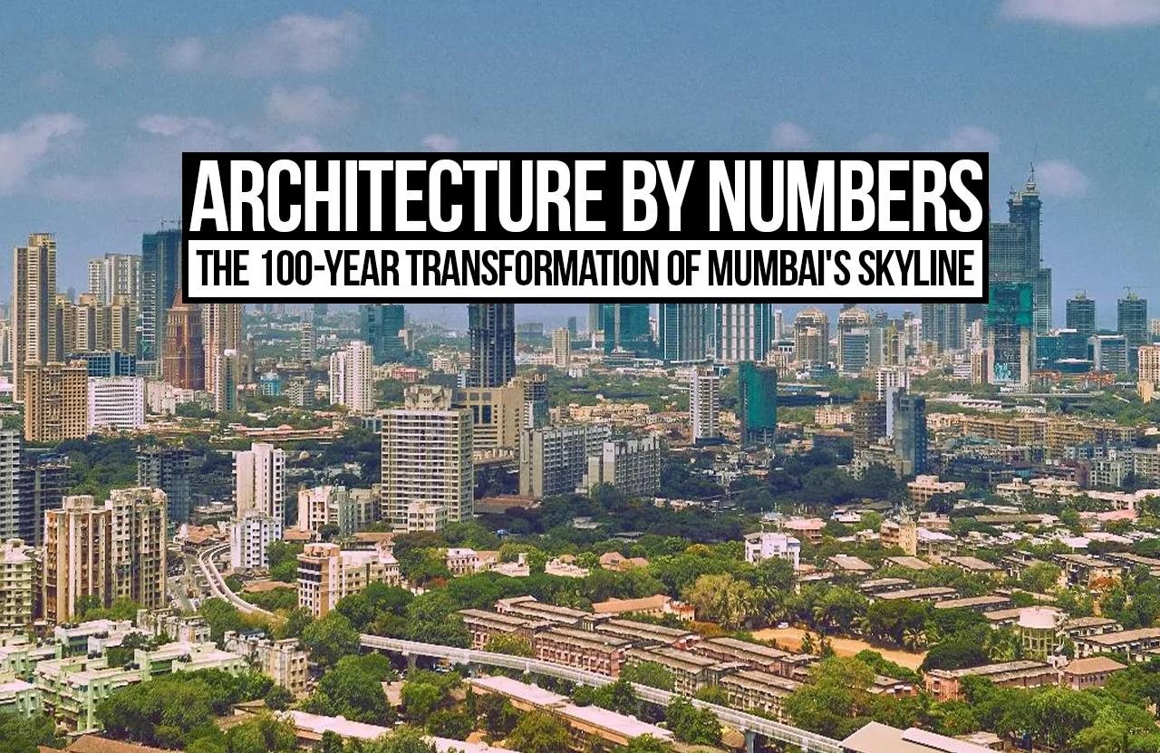
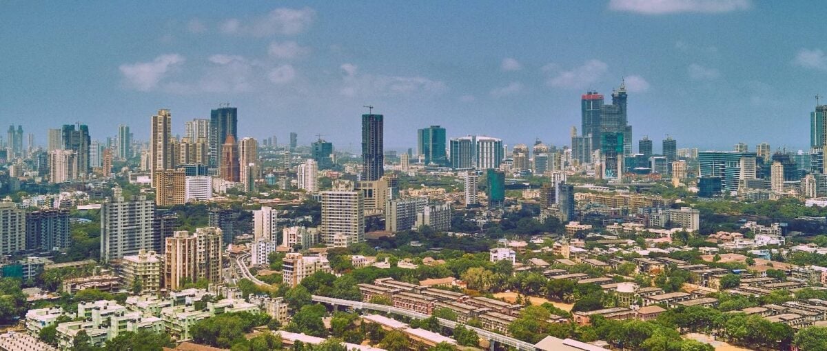
When land grew constrained, the sky broadened. This title depicts the transformation of Mumbai’s horizon over a hundred years, but it also raises a deeper question about why it rose. Limited expansion, rising land values, strict building rules, and shifting factory uses have shaped this city, where not only heights changed but also the spaces available for habitation and the relationship between buildings and streets. (UNESCO World Heritage Centre, n.d.) (Bertaud & Brueckner, 2003) (Bertaud, 2011) (Shaban & Aboli, 2021) Therefore, interpreting this transformation needs numbers that can explain what lies behind this picture! And why does a taller skyscraper not necessarily mean greater population density? The answers reveal a city that has redistributed its spaces as much as it has reshaped its image before the sky over the course of a century.
Here was once the sea… and now people live.
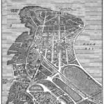
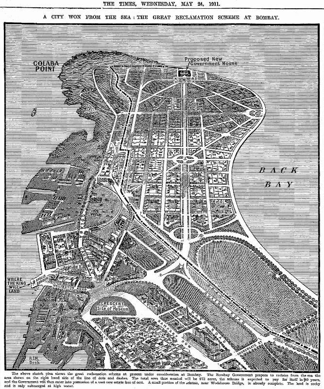
During the first half of the twentieth century, expansion towards the sea was one of the steps that changed the shape of Mumbai, as the reclamation/backfilling project of Back Bay allowed the westward extension of the city, (UNESCO World Heritage Centre, n.d.) giving rise to residential, commercial, and service-oriented buildings. And with it, the Marine Drive waterfront was formed, and UNESCO documents this phase as a key milestone in the modernisation of the city. Its importance lies in the fact that the expansion did not only rely on reusing the already-existing land but rather on the creation of new ground to build on from scratch. And this expansion adds an important aspect to Mumbai’s skyline analysis, and it is that the comparison of old and modern buildings alone is no longer enough, because the boundaries of the land it carries itself have also geographically changed. Hence, before the high-rise became a way of adding space, backfilling the sea was a way to increase the number of sites available for building and construction. Image 2
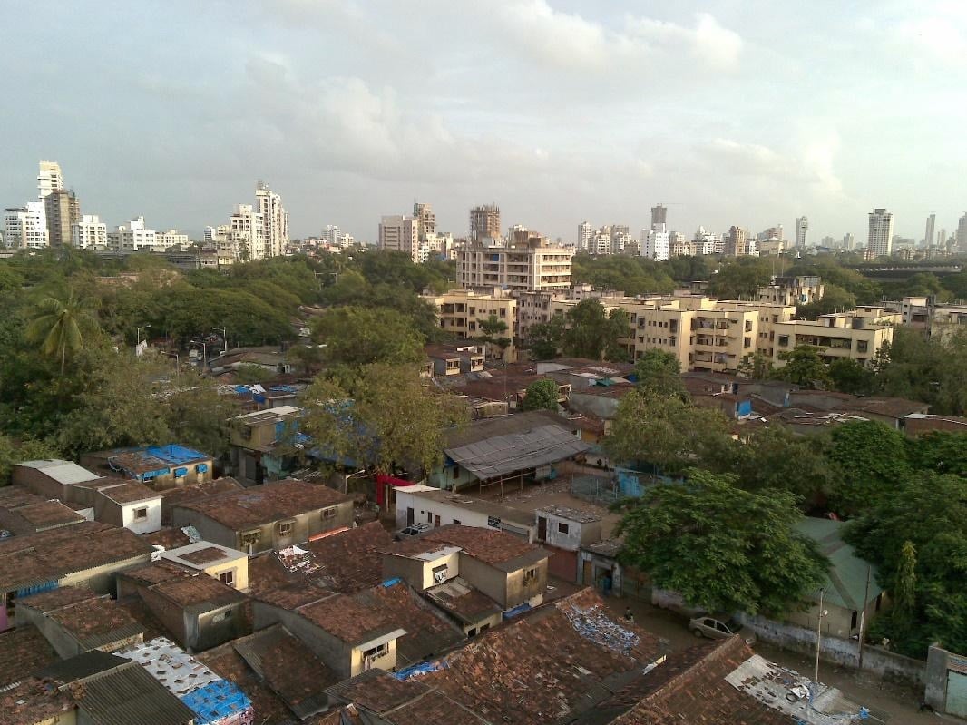
Shorter buildings may be crammed!
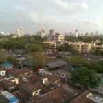
Geography and land area did not alone determine the amount of construction in Mumbai. Rules have also been set that link the total area of floors to the area of land on which it is built; that ratio is about 1.33 times the land area in the island portion of the city and once in the suburbs, with exceptions. (Bertaud, 2011). For example, the first ratio allows the establishment of about 1,330 square meters of the calculated area on a piece of land with an area of 1,000 square meters and its distribution on floors according to the other applicable rules. Thus, the ability to establish a high-rise building does not mean that its entire area is allowed to be built. And to be more accurate, these numbers describe a historical period and do not essentially have to be the same as all present rules; however, they reveal a side that is less visible during the transformation process, since the available space for habitation has been affected by what the law allows to be built during this time and not only by what technology can achieve. (Bertaud, 2011). Image 3
And studies show that the minimisation of a building’s size is not directly related to the reduction of congestion itself. (Bertaud, 2011). As in the year 2003, Alain Bertaud and Jan K. Brueckner’s study linked the rise of land plot prices to land constraints and policies limiting construction. (Bertaud & Brueckner, 2003). That is to say that the same price may shift with changes in construction restrictions! And in later analysis, Berto showed examples of slums with a low height, yet their density reached up to 2,000 people per hectare, as contrasted with about 1,000 people per hectare in neighbourhoods with high-rise buildings’ apartments. (Bertaud, 2011). A low neighbourhood may include small rooms crowded with people, while a high neighbourhood may provide larger, uncrowded apartments where height becomes an inadequate indicator of overcrowding, as the built area may increase without a similar increase in population, and construction may decrease while overcrowding within the dwellings increases. (Bertaud, 2011).
The Breadth of the Sky for Life
Land reuse has allowed for a new opportunity for development to serve the people and provide open spaces as well as affordable housing. Research published by Springer explains that building protocols in 1991 relied on a division of land into three parts, including private development, open spaces, and affordable housing. (Shaban & Aboli, 2021). However, an adjustment was added in 2001, which made the partition limited to land without existing built structures. (Shaban & Aboli, 2021). According to the researchers’ explanation. The area required to be assigned for public utilities has contracted. The research notes that only about 133 acres were allocated for open spaces and public housing within the lands of factories estimated at 600 acres. (Shaban & Aboli, 2021). This does not mean the complete disappearance of the share of the population; however, it shows how the method of calculation affected the amount of land allocated to open spaces and public housing therefore changing the future of the land by a regulatory decision before its shape changed with buildings, and the distribution of land functions and uses during development became an essential part of explaining the transformation of Mumbai’s Skyline.
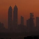
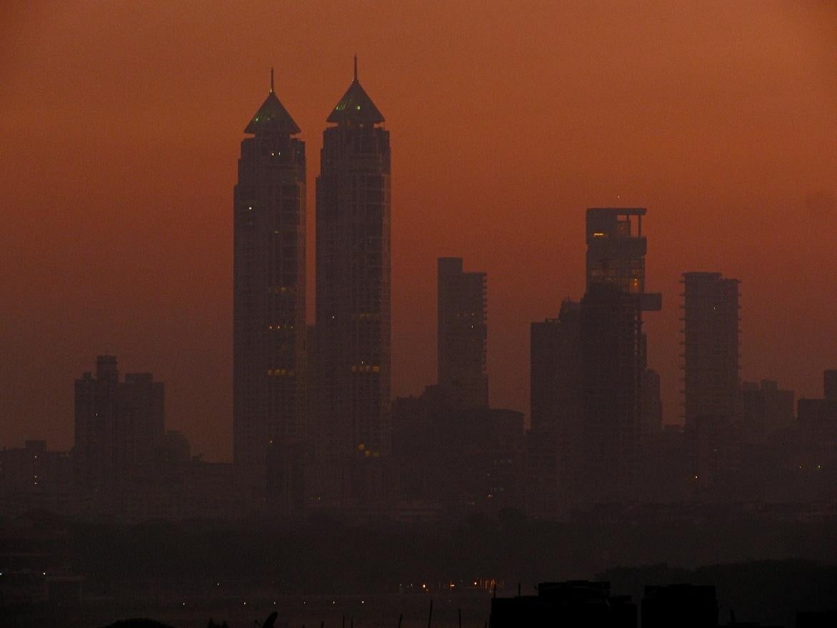
The first Imperial Tower delivers an example of the necessity to look at the use of space and not just the height: this tower was finalised in 2010, with an architectural height of 256 meters and 60 floors. (Council on Vertical Urbanism, n.d.). But an typical residential floor only has four units, and the units on the upper floors, from the 40th floor up, extend over two floors rather than one, with outdoor spaces, spacious views, and planted areas. (Council on Vertical Urbanism, n.d.). The example shows that height may be used to provide spaciousness and privacy and does not automatically mean housing larger numbers. It is a focal point in the design, so one tower is not enough to judge the city, but it opens up an important question for Mumbai’s Skyline: Who produced these towers and these new spaces? The answer is that, in 100 years, Mumbai has been able to expand its land and raise its buildings. However, the success of this transformation is also measured by the ability of inhabitants to obtain proper housing and a share of parks and utilities. What matters most is that the place of life extends as much as the sky expands for building.
References:
Bertaud, A. (2011). Mumbai FAR/FSI conundrum: The perfect storm: The four factors restricting the construction of new floor space in Mumbai. [online]. Revised 20 July 2011. Available at: https://alainbertaud.com/wp-content/uploads/2013/06/AB-Mumbai-FSI-Conundrun-Revised_June-2013_kk-ab1.pdf [Accessed: 18 October 2026].
Bertaud, A. and Brueckner, J.K. (2003). Real estate markets in Mumbai: A case of topographical constraints worsened by public policies. [online]. World Bank presentation, Mumbai, April. Available at: https://alainbertaud.com/wp-content/uploads/2013/07/Real_Estate_Markets_in_Mumbai.pdf [Accessed: 18 October 2026].
Council on Vertical Urbanism (n.d.). The Imperial I. [online]. The Skyscraper Center. Available at: https://www.skyscrapercenter.com/mumbai/the-imperial-i/889/ [Accessed: 18 October 2026].
Shaban, A. and Aboli, Z. (2021). Socio-spatial segregation and exclusion in Mumbai. In: Urban Socio-Economic Segregation and Income Inequality. Cham: Springer, pp.153–170. Available at: https://doi.org/10.1007/978-3-030-64569-4_8 [Accessed: 18 October 2026].
UNESCO World Heritage Centre (n.d.). Victorian Gothic and Art Deco Ensembles of Mumbai. [online]. Available at: https://whc.unesco.org/en/list/1480/ [Accessed: 18 October 2026].
Image 1: Malhotra, V. (2015) Mumbai Skyline Wide [Photograph]. Wikimedia Commons. Available at: https://commons.wikimedia.org/wiki/File:Mumbai_Skyline_Wide.jpg (Accessed: 15 October 2026).
Image 2: Unknown author (1911) A city won from the sea: The great reclamation scheme at Bombay [Illustrated plan]. The Times, 24 May. Wikimedia Commons. Available at: https://commons.wikimedia.org/wiki/File:BombayReclamation_1911.jpg (Accessed: 15 October 2026).
Image 3: Hillary, M. (2009) Dharavi slum in Mumbai, India, August 2009 5 [Photograph]. Wikimedia Commons. Available at: https://commons.wikimedia.org/wiki/File:Dharavi_slum_in_Mumbai,_India_August_2009_5.jpg (Accessed: 15 October 2026).
Image 4: Krishnamurthy, S. (2010) Imperial Towers Mumbai [Photograph]. Wikimedia Commons. Available at: https://commons.wikimedia.org/wiki/File:Imperial_Towers_Mumbai.jpg (Accessed: 15 October 2026).