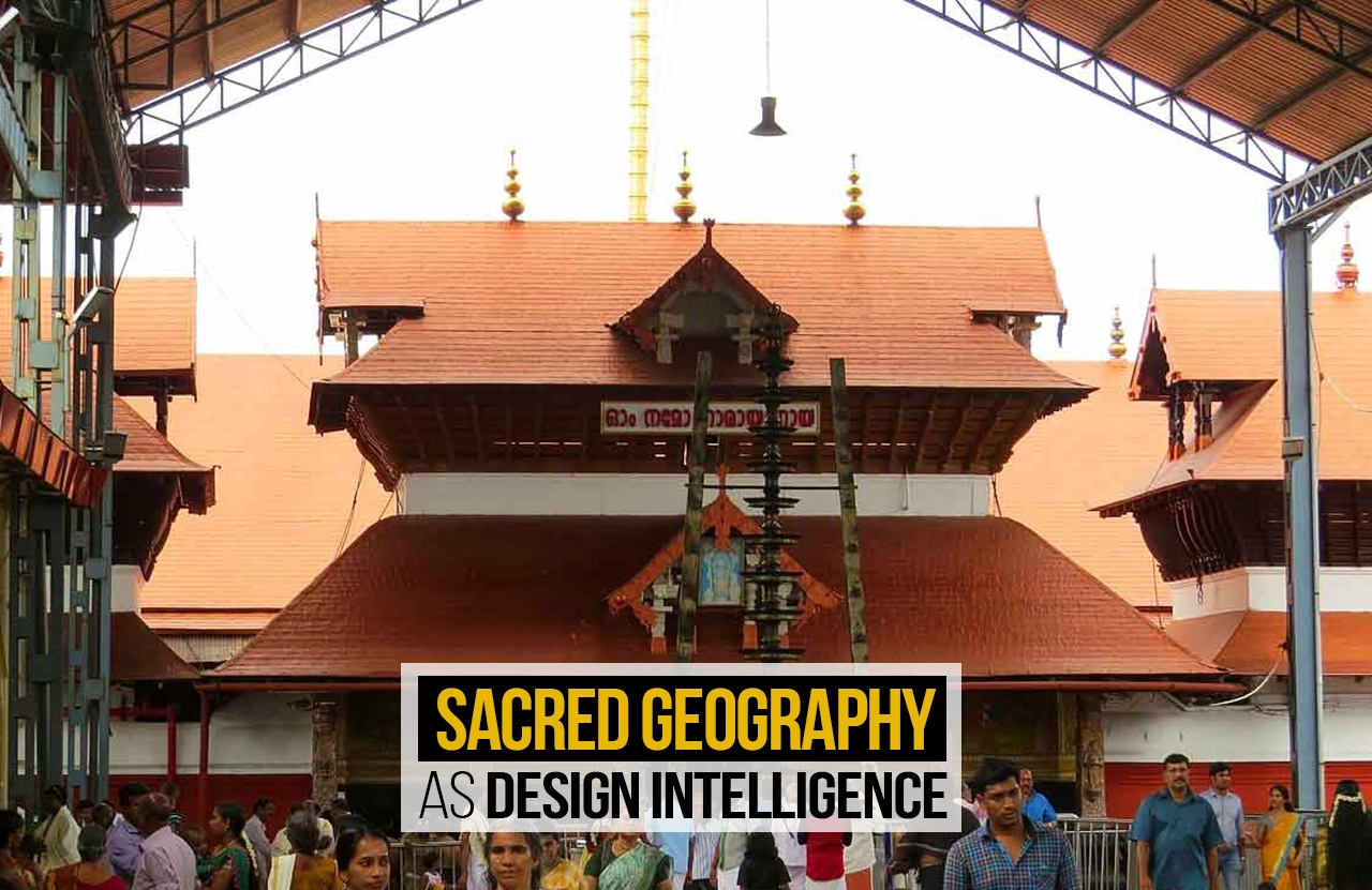
Long before design intelligence became a term for strategic, data-led practice, communities were already building it into sacred geography. Across South Asia, Hindu temples, Sufi shrines and forest groves encode centuries of observation about sun paths, water flow and human movement directly into their plans. Guruvayur Temple in Kerala offers one such case: a site shaped as much by religion as by a measured response to behaviour and climate. Reading these spaces as design intelligence, rather than only as religious architecture, reveals how myth, ritual and planning have always worked together.
What Sacred Geography Actually Means
Sacred geography refers to the spiritual meaning ascribed to physical land, producing networks of holy sites connected by nature, myth, and pilgrimage. It may be defined, more precisely, as the regional, and at times global, location of sacred places according to mythological, symbolic, astrological, geodesic and shamanic reasoning. A river bend, a hilltop, or a grove of trees becomes sacred not arbitrarily but because generations of observation have linked it to religious, mythical, or remembered events. Chains of such sites, linked by pilgrimage routes across a region, form entire networks of sacred geography long before roads or maps formalised them. Over the centuries, these associations accumulate into dense layers: myth folds into ritual, ritual into architecture, and architecture into everyday use.
From Devotion to Design Intelligence
Design intelligence, in contemporary practice, describes the strategic capacity to fold human behaviour, systems thinking and data-informed insight into core decisions, rather than treating design as a decorative layer applied after the fact. Sacred geography, understood this way, functioned as an early version of the same capacity. Priesthoods and builders tracked pilgrim numbers, seasonal flooding, sun angles and crowd behaviour long before these became measurable ‘data’. Temple complexes were revised across eras in response to what was observed, not only to what was prescribed by text. The mythological explanation offered to devotees and the operational logic embedded in the plan are, in many cases, two readings of the same decision. Sacred geography, on these terms, sits comfortably within a definition of design intelligence built on clarity, persistent learning and pliability.
The Guruvayur Temple: A Layered Case
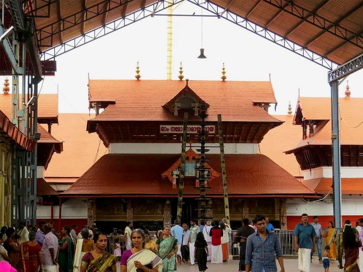
Guruvayur Temple, in Kerala’s Thrissur district, illustrates this layering clearly. According to legend, the deity was installed at the site by Guru, preceptor of the gods, and Vayu, the wind god, after the submergence of Dwarka, giving the town its name and the temple its early title, Bhooloka Vaikuntha, or ‘Vaikuntha on Earth’. Devotional accounts place its origins in deep antiquity. However, the surviving structure was substantially rebuilt in the sixteenth century under the Zamorins of Calicut, and again after a serious fire in 1970. Each rebuilding retained the same underlying organisation: the entire complex oriented east, so worship is aligned with the rising sun; a square sanctum, the sreekovil, held within a pillared inner courtyard, the nalambalam; and an outer enclosure, the chuttambalam, containing kitchens and stores.
Reading the Plan as a Behavioural System
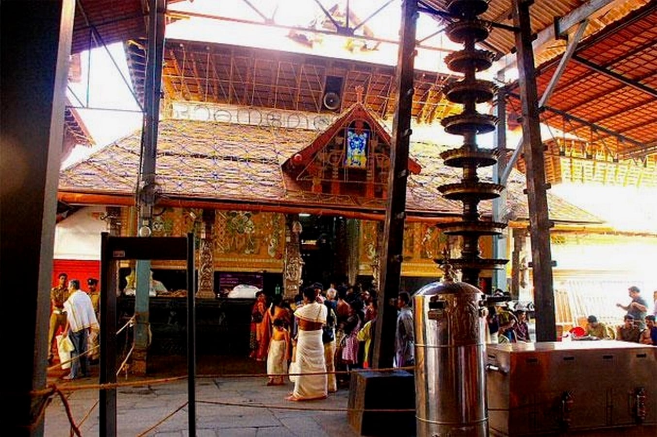
By stripping away the theology, the layout reads as a considered response to scale and behaviour. The eastward orientation calibrates the entire daily schedule, from the early-morning nirmalya darshanam to the evening rites, around available daylight rather than artificial lighting. The pradakshina patha, a circular walkway encircling the sanctum, provides thousands of daily visitors with a single, self-organising path for circumambulation. Concentric zones, from the open outer courtyard to the enclosed inner sanctum, function as a graded threshold system that controls access and privacy absent walls or signage. Even the tall Dwajasthambam flagpole and the lamp-covered Deepastambham operate as wayfinding devices, visible above the crowd by day and legible after dark. All of this planning emerged from generations of adjustment, the same recursive feedback loop that design intelligence now names deliberately.
What Contemporary Design Can Learn
For architects and urban researchers, sites of sacred geography such as Guruvayur function as long-running case studies with centuries of use already tested and refined. They demonstrate that orientation, sequencing, materials and light can carry as much operational information as any modern data set, provided someone reads the site for logic rather than only for symbolism. Applying this to contemporary practice does not mean replicating temple forms elsewhere; it means recovering the underlying habit of treating a site’s accumulated history, myth, and pattern of use as evidence rather than as a backdrop. Postcolonial and South Asian urbanism, in particular, holds many such under-read precedents in which systems thinking was practised long before the vocabulary existed to describe it.
A Framework, Not a Relic
Sacred geography, in this light, is not a historical curiosity to be preserved separately from serious design discourse. It is a working framework, tested across centuries and still legible in temples such as Guruvayur. For designers willing to read past the myth, these sites suggest that design intelligence was never a wholly modern invention; it was, and remains, latent in how communities have always built meaning, memory and function into land.
Images:
- Image 01: Guruvayur temple. Source: https://achyuthan.com/guruvayur-sree-krishna-temple.html
- Image 02: Dwajasthambam flagpole. Source: https://avianexperiences.com/attractions/guruvayur-temple