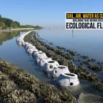
Coastal regions worldwide experience anomalous sea-level rise, erosion, and shifting of coastlines due to capricious climate change, which is primarily driven by anthropogenic interference. This, in turn, leads to ocean warming, melting ice caps, and intensified storms, concluding in the reshaping of global shores at accelerated rates. Architecture for moving borders” refers to designs addressing dynamic or shifting boundaries, often shaped by natural forces like climate change or human factors like migration. Here comes the architecture’s valiant intervention for the moving borders.
The term is derived from projects like Italy’s “A Moving Border,” which maps alpine shifts resulting from glacier melt. Italy’s northern borders follow the Alpine watershed line, separating northern and southern drainage basins of Europe at the highest altitudes across glaciers and snowfields. The glaciers’ melting causes the watershed shifts and so of the border, diverging it from its official maps. Italy, Austria, and Switzerland have prompted a novel legal concept of a “moving border,” acknowledging geographical change, offering a model for coastal architecture.
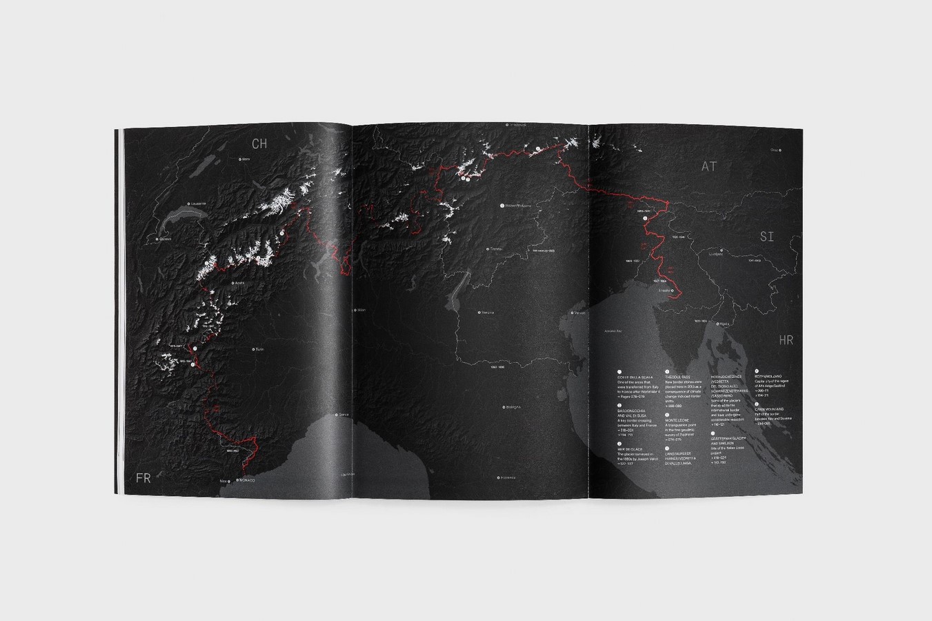
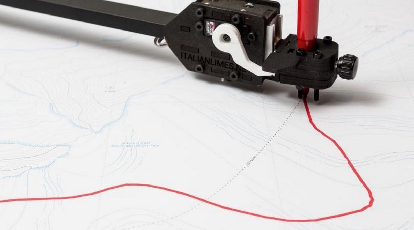
In the Alps, Studio Folder’s Italian limes project visualises how ocean warming causes Italy’s border with Austria, France, and Switzerland to shift nearly 1 km since 1947. These designs use cartography and lightweight installations like automated pantographs plotting mutable lines autonomously the shifting borderlines in real-time. The work rethinks sovereignty over changing terrain, and the designs reveal borders as dynamic inscriptions. Borders aren’t always static walls or fences; “moving borders” highlight fluid frontiers, such as those altered by rising seas or political flux.

Sea-Level Rise
Oceans are expanding and melting ice caps and glaciers thermally due to heat absorption drive sea-level rise of 4.5 mm per year, which is double the historical rate, eventually flooding low-lying zones. Architecture here head-on tackles it by adapting flexible water smart designs.
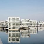
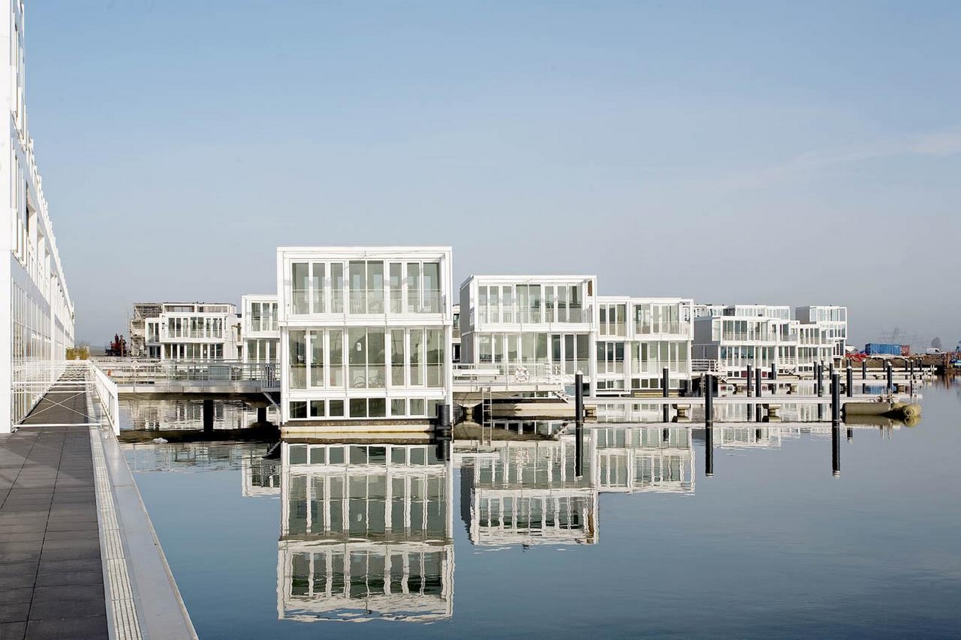
Amsterdam’s IJburg
IJburg’s floating homes in Amsterdam are designed for flood resilience, it features piled platforms at fixed elevations and floating houses by Marlies Rohmer that rise with water levels, countering sea-level rise and storms. These buildings use buoyant concrete platforms that rise with tides, preventing flood damage whilst supporting residential and commercial spaces. These integrate solar panels and rainwater systems. High-density (90 homes/ha) integrates trams, electric boats, and biodiversity, blending housing with climate-adaptive infrastructure, demonstrating an amphibious design for urban coasts.
Erosion
Erosion is a challenging point for architectural borders such as sea walls, coastal barriers and site edges, intensifying wave action, flooding and soil loss, leading to the collapse of systems. In coastal or sloped sites, this process is accelerated, demanding adaptive designs that scream design with erosion rather than against erosion. Architects counter erosion by integrating natural methods like deep-rooted plants, vegetative barriers, and permeable pavements allowing controlled water flow.
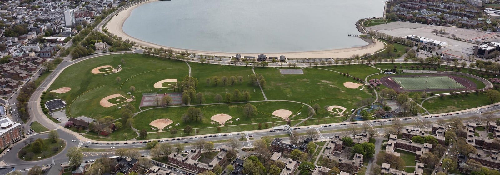
Moakley Park in Boston
This project reimagines a 60-acre waterfront site, built on marshland prone to flooding, as a Recreational hub for South Boston Communities. It articulates resilient landscape architecture that addresses erosion and coastal flooding through green infrastructure where elevated beams shield against 21-40 inches of sea level rise, porous pavements and revitalised fields and paths to ensure equitable access, ultimately enriching the ecology.
Shifting Coastlines
Shifting coastlines are a result of sediment redistribution, where forces like the waves, storms and rising seas strip the material from the shores and deposit it elsewhere in an unpredictable manner. This phenomenon redraws shorelines, displacing ecosystems and buildings under volatile patterns whilst the water levels prograde and retrograde oscillatorily. Instead of tunnel vision towards the moving borders, architecture can accommodate the flux rather than resist it, transforming precarious shore edges into resilient thresholds embracing impermanence over rigidity.
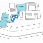
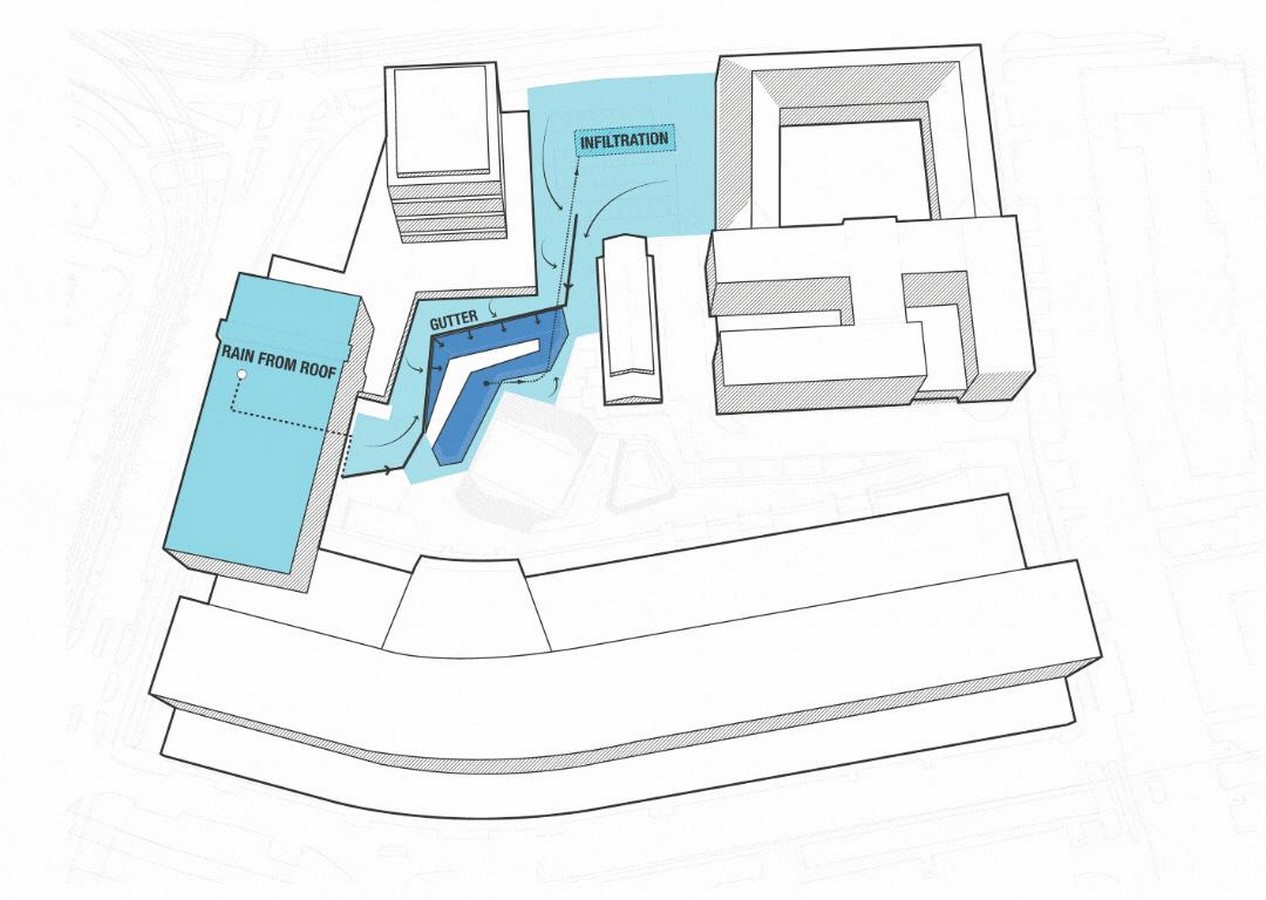
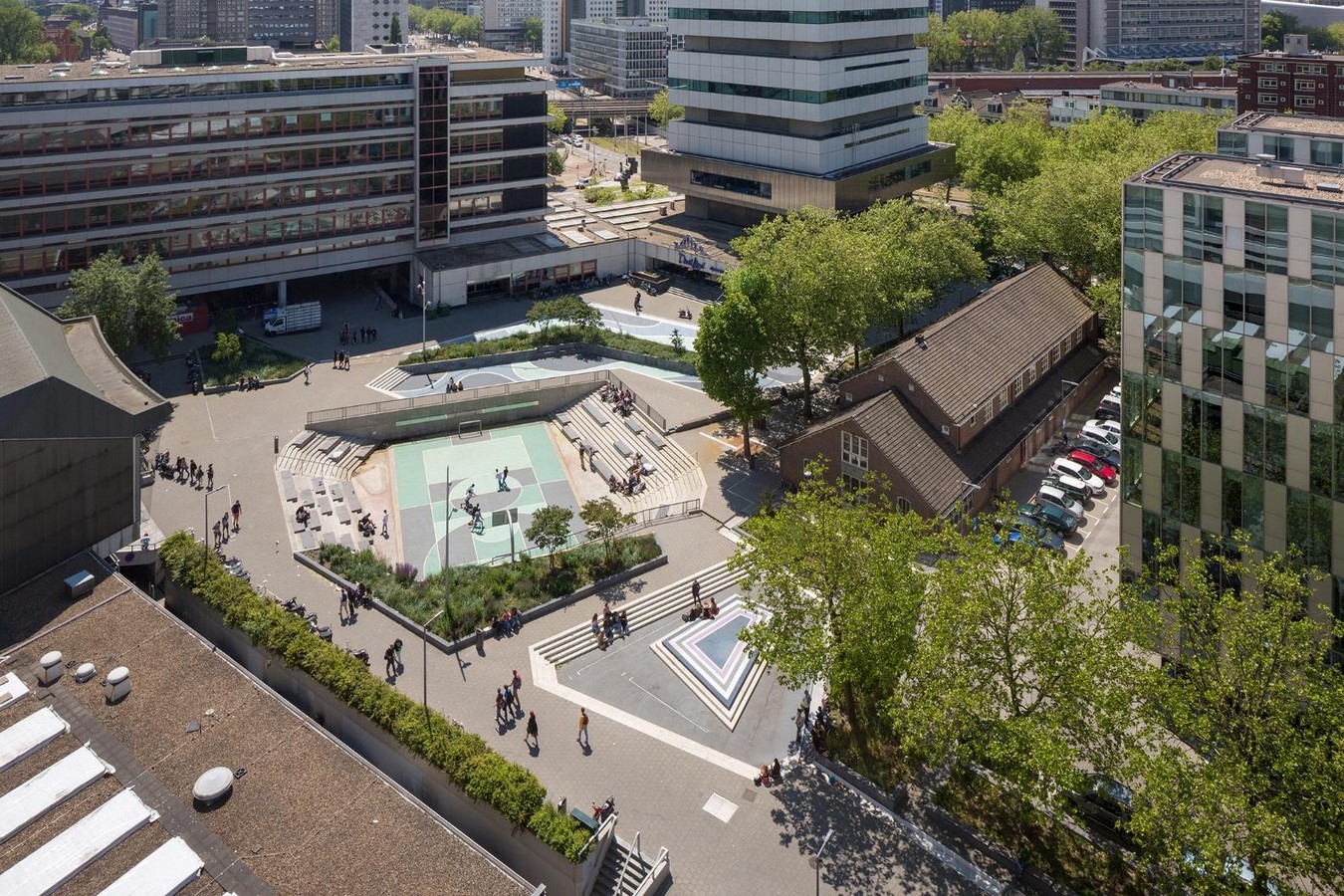
Rotterdam Water Square
The water square is a two-fold strategy where it acts as both a water storage facility and a recreational space, acting as a great example of a functional placemaking strategy in the urban design context. The square adapts itself into tiered basins functioning as reservoirs of water, capturing 1700 cu.m of runoff. There are shallow shelves for drizzle and deep voids for deluge, which are channelled well into steel gutters, which also act as a spectacle in this urban monument. The tectonic duality, where the plinth becomes the void, challenges moving borders while funding resilience.
Key Architectural and Planning Strategies
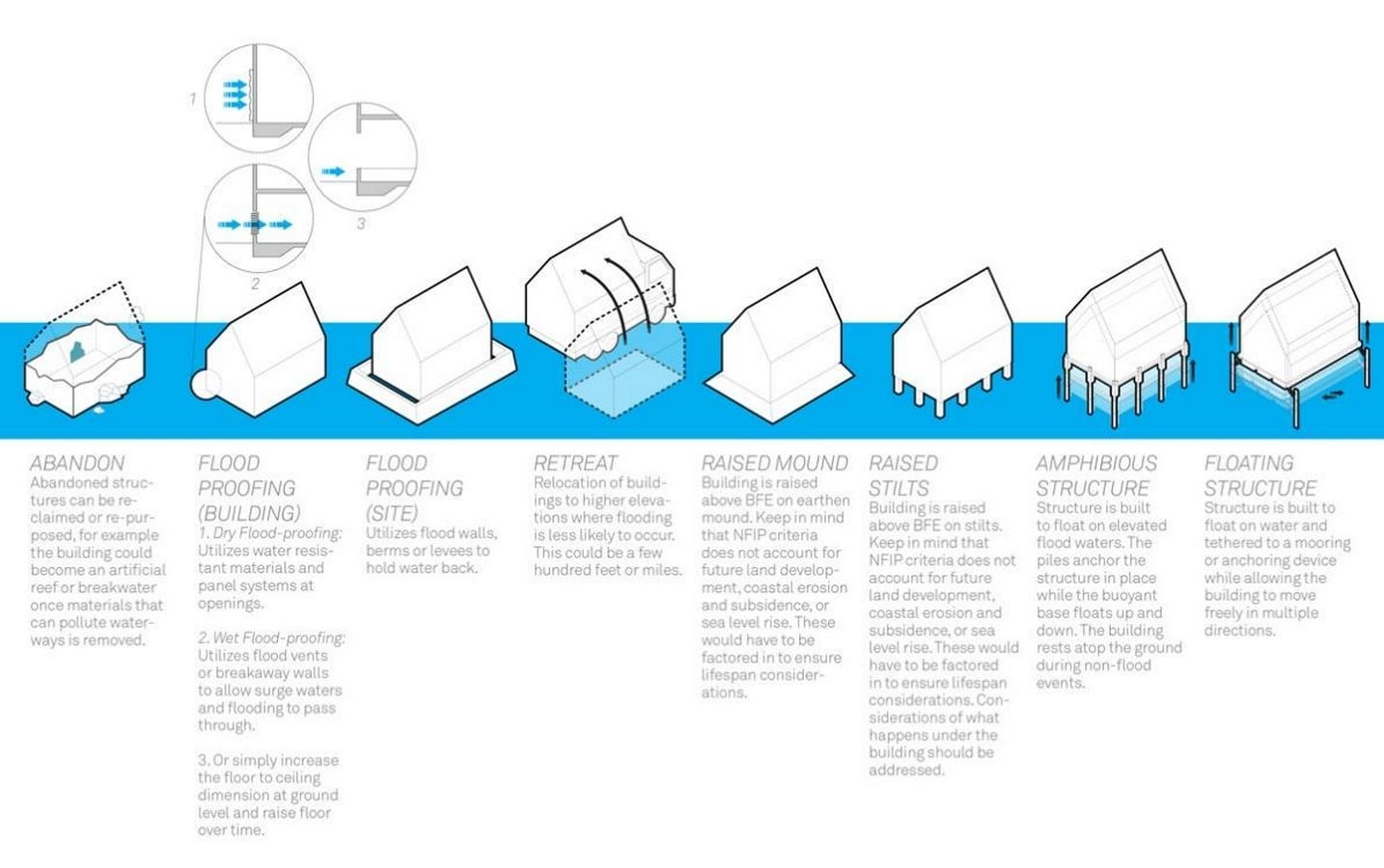
Architects respond with adaptive structures that facilitate rather than block movement. The primary “architecture” here is a combination of architecture, urban planning, and ecological solutions, categorised into three main objectives: protect, accommodate, and retreat.
Objective 1 – Protect :
This involves using hard infrastructure like seawalls, levees and nature-based solutions like restoring wetlands, mangroves and salt marshes to defend existing development from further damage by flooding and erosion.
Objective 2 – Accommodate :
This approach designs buildings and communities to coexist with higher water levels without necessarily preventing the water from entering the area through strategies like Elevated foundations, Buoyant foundations, land-use restrictions, improving drainage and using public spaces to endure high tides.
Objective 3 – Retreat :
This is the long-term, most efficient, and enduring approach that involves the planned relocation of people, infrastructure, and development away from high-risk coastal zones. This strategy recognises that some areas cannot be effectively protected or accommodated indefinitely.