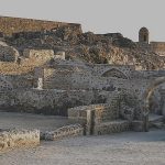
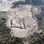
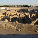
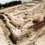
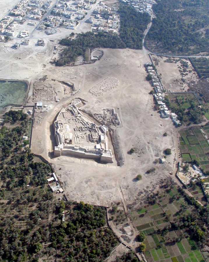
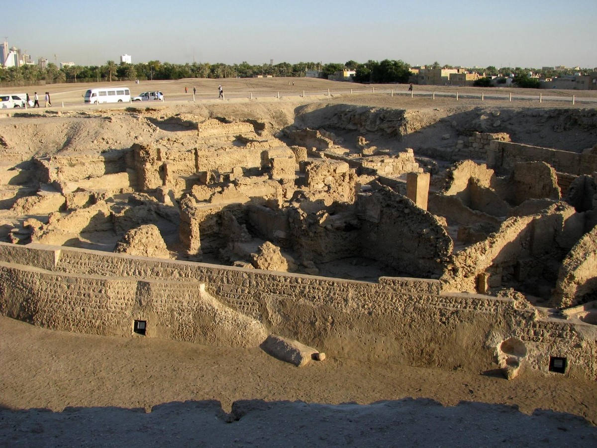
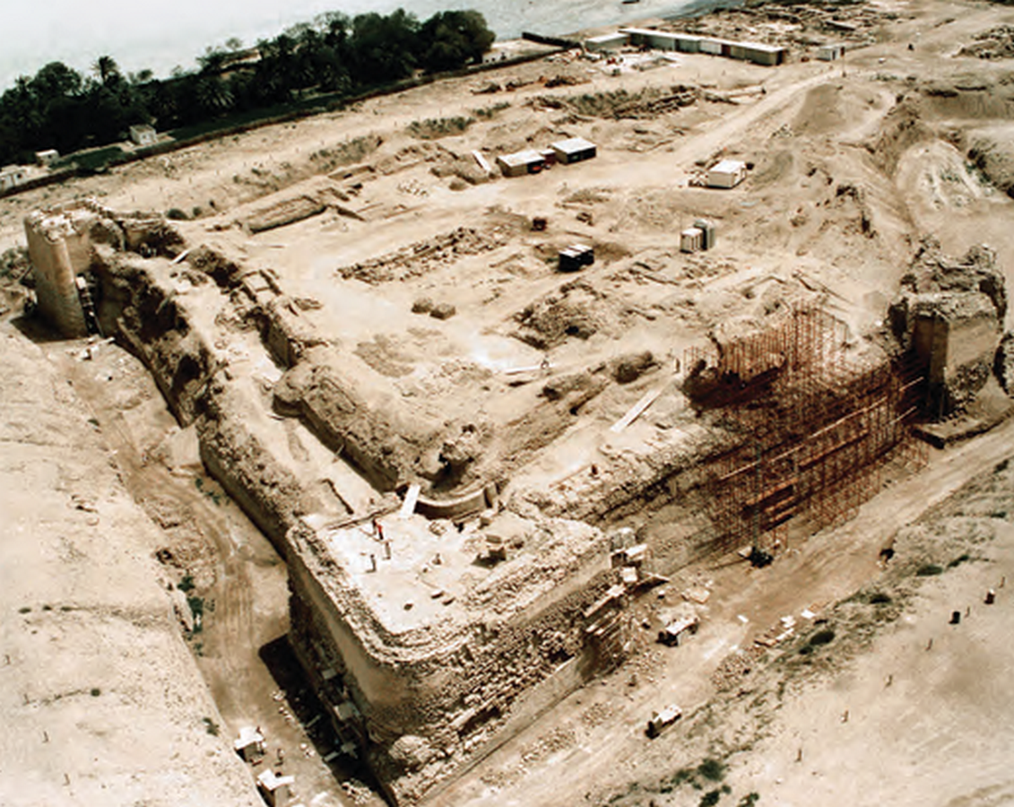
Rising along the northern coast of the Kingdom of Bahrain, Qal’at al-Bahrain is more than just a defence or military structure; it is a profound archaeological tell of an artificial hill formed by 4500 years of continuous human civilization. Inscribed as a World Heritage Site in 2005, this 18-hectare mound provides glimpses of Dilmun civilization, followed by others. In order to understand the architectural and historic importance of Qal’at al-Bahrain, one must turn back the pages of history. Starting from the Bronze Age to the colonial Portuguese, this fort offers a sequence stratigraphy record of human progress.
Historical Significance
Qal’at al-Bahrain is considered as one of Bahrain’s most ancient and historic sites as it was capital of the Dilmun, one of the ancient civilizations as mentioned in the Sumerian achievement which was one of the trading partners notably for copper. This fort consists of the richest archaeological remains from this civilization which is mentioned on Sumerian clay tablets and also on the bas-relief from the palace of the Assyrian king Sargon II II at the ancient city of Dur Sharrukin (modern Khorsabad, Iraq).
The area and its culture are described in Sumerian mythology, which connects Dilmun to the beginnings of the world. The land of Dilmun is said to represent the Garden of Eden, where Gilgamesh, the ruler of Uruk, may have discovered immortality. Dilmun is described in Sumerian texts from the third millennium BC as a god-blessed land with copious fresh water and a reputation as an international marketplace.All of these historical periods are clearly represented at Qal’at al-Bahrain, which served as the capital of Dilmun and the seat of the monarch – or administrator – when the island was captured by other nations.
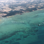
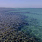
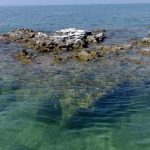
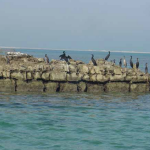
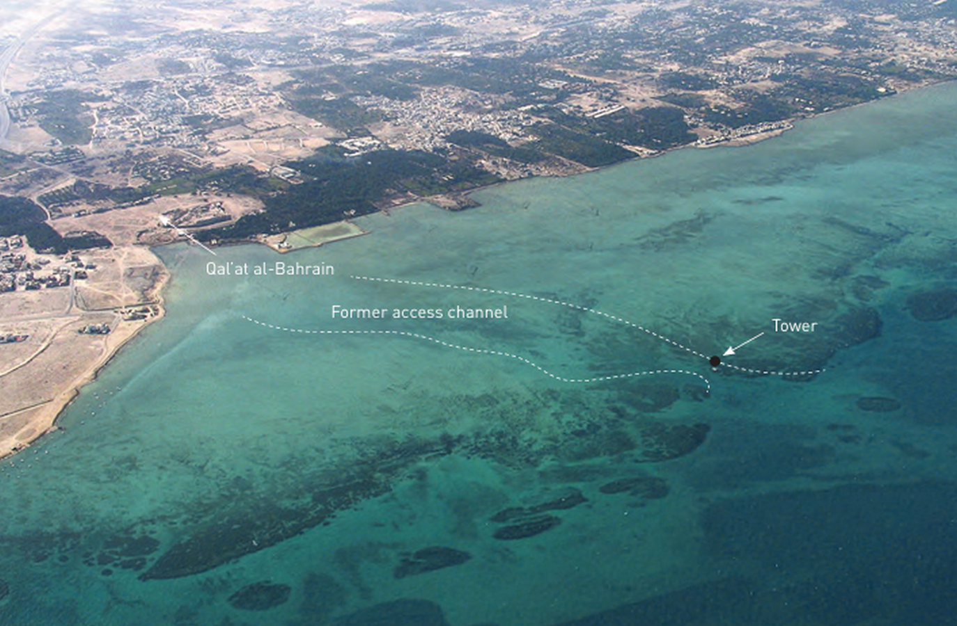
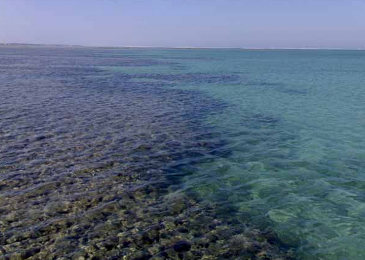
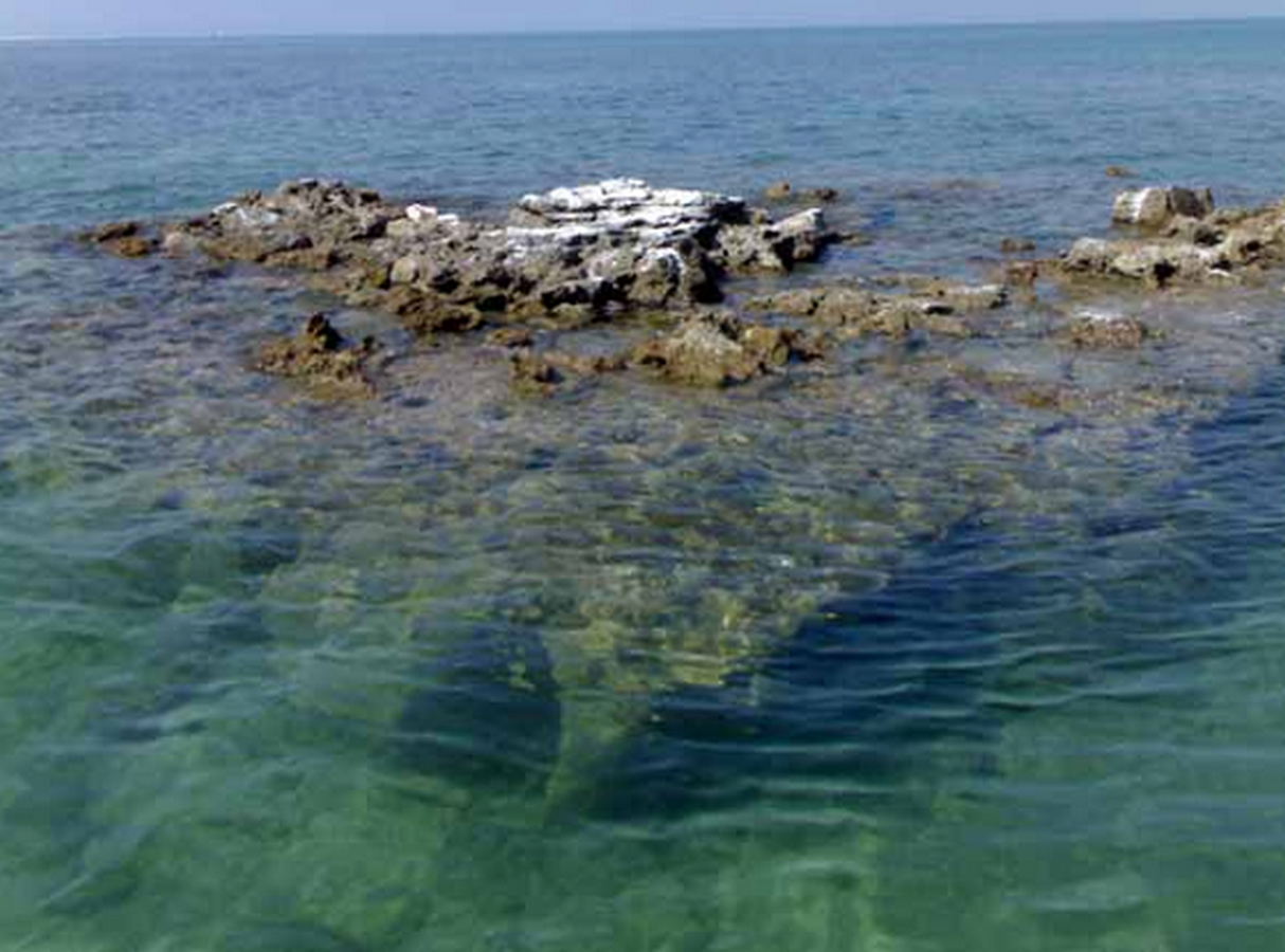
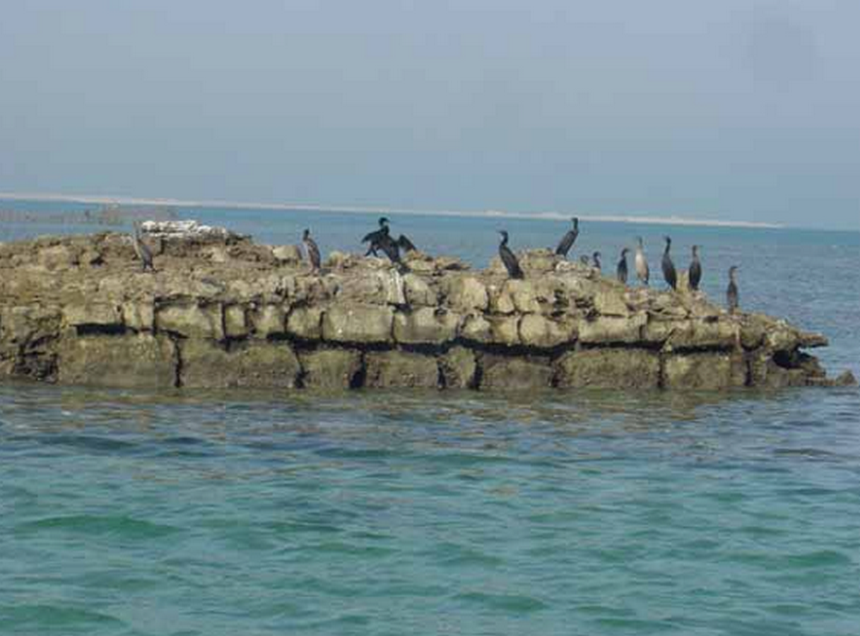
Dilmun’s early capital and sea access remain legible to this day due to a mix of archeological and geographical circumstances. The World Heritage site consists of four key archeological elements. The first of these is an archaeological tell (an artificial mound produced over time by various occupations) spanning over 16 hectares on Bahrain‘s northern coast. The following two elements are found in the intertidal zone and northern sea, inside and around a fossilized coral reef. A sea tower may be found about 1,600 meters northwest of the tell at the edge of the fossilized coral reef paralleling the shore, as well as a sea passage through this reef that runs from the sea tower to the capital’s ancient harbor bay.
The fourth aspect is the terrain surrounding the archeological site, which consists of palm trees and agricultural regions where old farming and water-distribution practices are still practiced.
Palm trees and typical agricultural gardens surround the site throughout the land component, with a concentration on the western and northern sides. The property is located in the Northern Governorate, in the Al Qalah village district on the northern coast, approximately 5.5 kilometers west of Bahrain’s current capital, Manama.
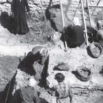
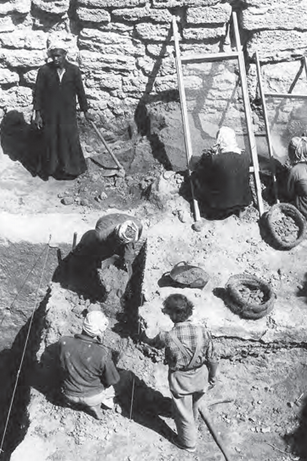
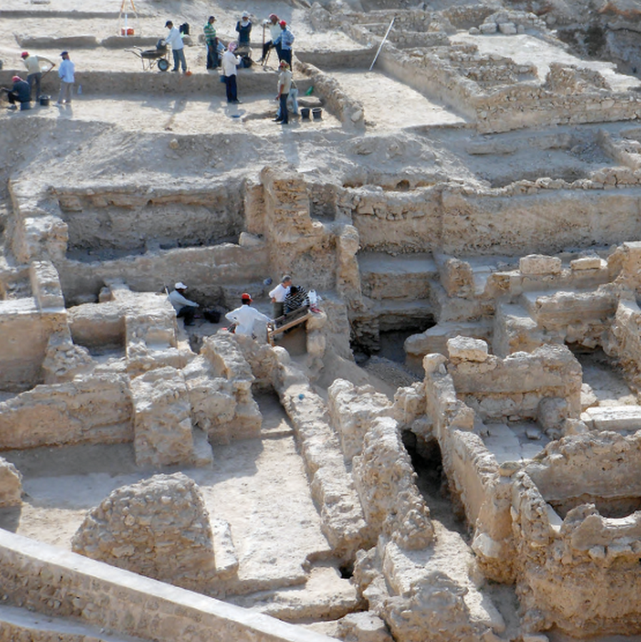
After 25 centuries of neglect, excavation has revealed almost everything we know about the Dilmun culture. In 1954, a Danish archaeological mission conducted the first excavations at the site. At the time, Qal’at al-Bahrain was thought to be a likely location for ancient Dilmun’s capital, and after many years of archaeological investigation (from 1954 to 2002), six distinct habitation layers were uncovered, previously enclosed by massive walls.
Architectural Significance
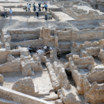
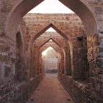
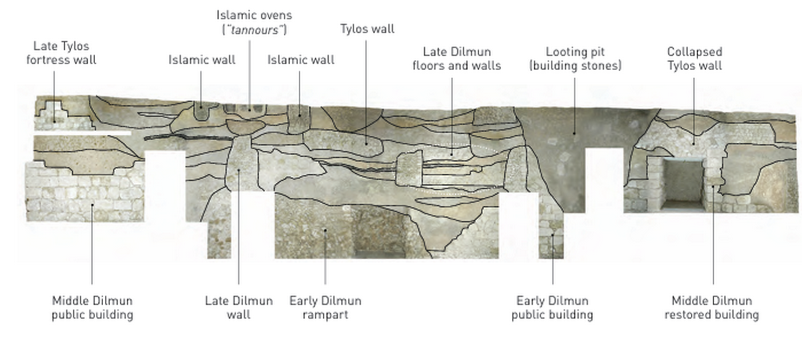
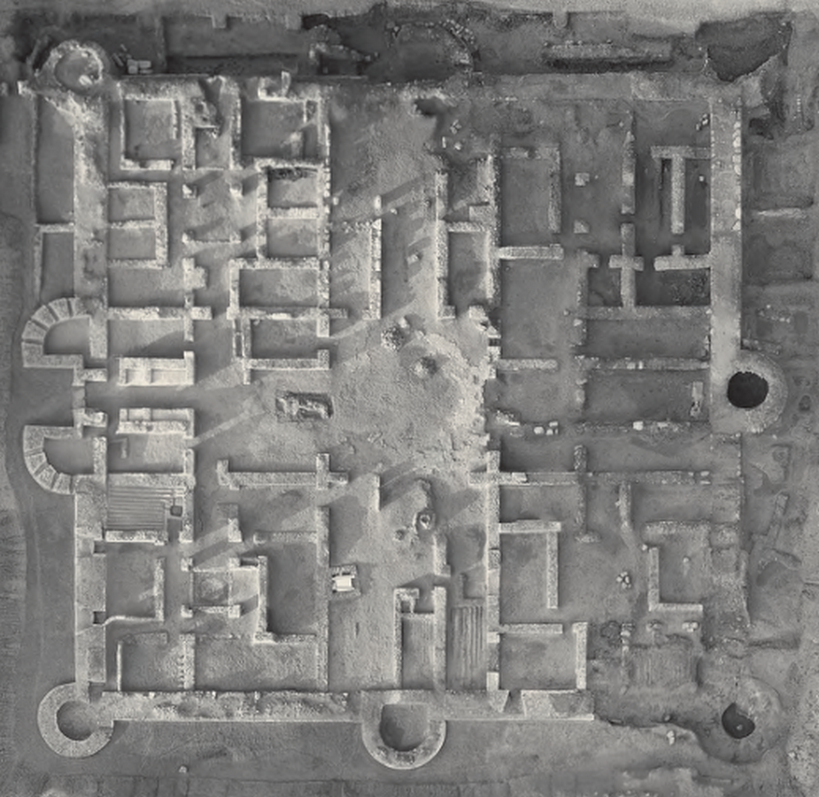
The early 2nd millennium BC Dilmun public architecture, which had a widespread influence on regional architecture, is shown by the palaces of Qal’at al-Bahrain. The site includes a collection of the best examples of defence works from the late third millennium BC to the sixteenth century AD, in addition to the design, ground plans, and technology of the Dilmun buildings that have been documented thus far.
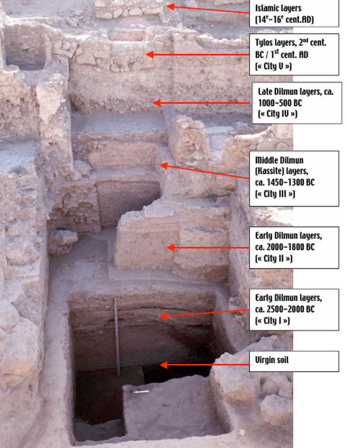
The architectural significance of the site lies in its stratification. Archaeologists have identified at least seven distinct cities (layers) built one atop the other. Here is the architectural evolution across the primary six historical phases:
Six layers of remnant
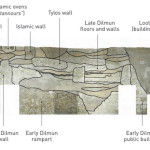
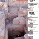
The site is regarded as one of the most significant historical locations that connected the “land between two rivers” (Mesopotamia) with the country of Sind during the Bronze Age. The oldest of these layers indicates the Dilmun civilization. Given its distinctive historical significance, this logically supported the site’s inclusion on the World Heritage List in 2005. The first of the six levels, which dates to the middle of the third millennium BC, attests to the beginning of Dilmun as a settlement. It is situated right next to the coast and consists of several tiny homes that were destroyed by fire, making them difficult to see.
The city that experienced the height of Dilmun civilization is represented by the next layer, early Dilmun. It was most likely built over the remains of the original village and is encircled by a massive wall. The people who lived there were also the ones who constructed the burial mounds that can be found all throughout the nation and the temples that date back to both the ancient Babylonian period and the time when Akkadians inhabited the island.
The period of greatest prosperity, which most likely spanned from 1700 BC to 1200 BC, belongs to the third layer (Middle Dilmun). This was in line with both the Kashian and the second half of the Babylonian eras. Buildings used to preserve dates are among the discoveries from this era. The fourth layer, also known as Late Dilmun, corresponds to the period between the ninth and fifth centuries BC, when Assyrian rule was in effect. This layer’s most significant feature is a gate that is three meters high. The palace of Uperi, the King of Dilmun, who is mentioned on cuneiform tablets, is believed to be a noteworthy structure that was also discovered.
The fifth layer relates to Tylos, the Greek name for Bahrain in the third century BC. Greek ceramics, glass, glazed ceramics, and stone statues are significant artifacts from this era.
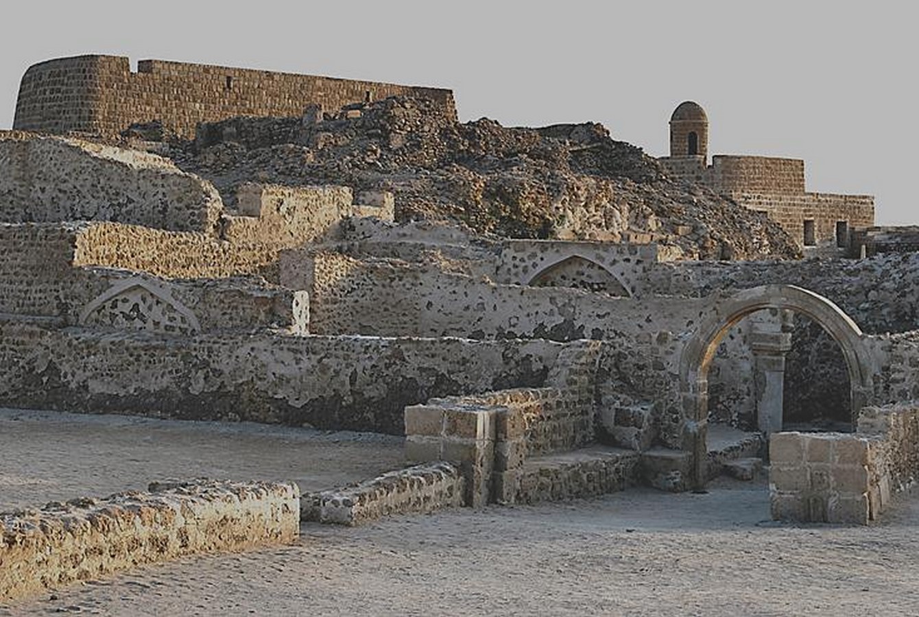
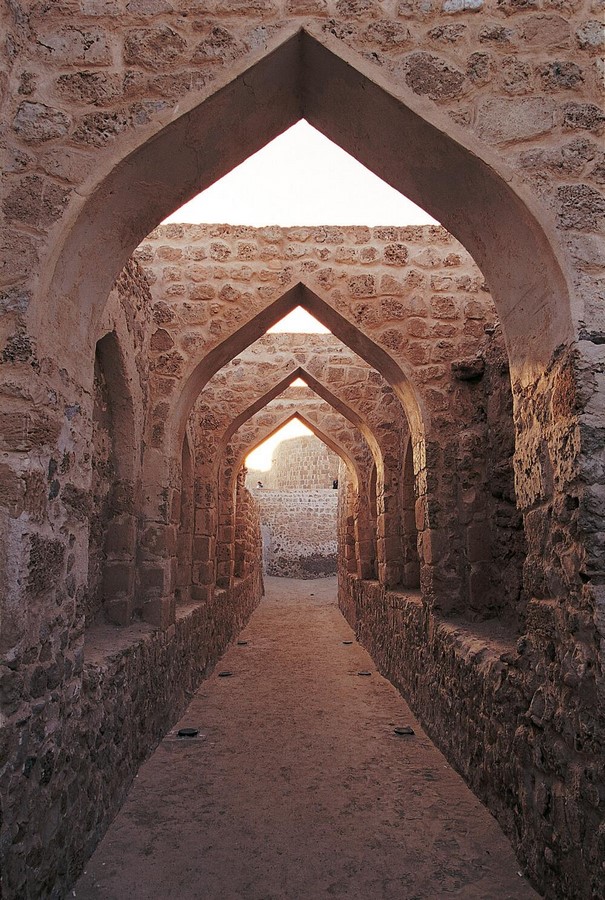
The island’s name changed to Awal during the early Islamic era, a transformation evident in the sixth and final archaeological layer. This period is marked by an Islamic fortification in the north and the remains of an earlier Islamic fortress, later overbuilt by the Portuguese in the sixteenth century. These features, extending back to the fourteenth century AD, illustrate the continuity of settlement. The six successive layers and cities found in one place testify to Qal’at al-Bahrain’s uninterrupted occupation. For millennia, it remained the island’s capital, with only brief interruptions.
| Historical
Period |
Key Features |
|---|---|
| Dilmun (2300 BC – 200 BC) | – Major hub for maritime trade – Well-preserved temple from 2000 BC – Residential structures and fortifications |
| Tylos (200 BC – 300 AD) | – Expansion of fortifications – New residential structures |
| Islamic (7th century AD – 16th century AD) | – Center for Islamic learning and culture – Construction of mosques and madrasas – Influence of various Islamic dynasties |
| Portuguese (16th century) | – Strategic military installation – Distinctive fort architecture – Sea tower and adjacent sea channel |
Cultural Significance
A point of intersection or connection between various cultures
This location was added to the World Heritage List because it contains the ruins of a significant port city where people and customs from all over the world came together, lived, and traded, creating a crossroads of cultures that is evident in its development and architecture. The majority of the biggest powers and empires in the area also invaded and occupied the site for extended periods of time, leaving their cultural legacies in various layers of the tell. Furthermore, this site serves as an example of the Dilmun civilization, which was clearly a major actor in the early Middle East despite being little known. The public architecture of this specific civilization, which influenced the architecture of the entire region, is exemplified by the palaces of Dilmun within the site. The several fortifications, all built on a same site, are the outstanding examples of defensive structures from the third century BC to the sixteenth century AD. Lastly, from the third century BC, the protected palm groves that surround the monument have been a feature of the local agricultural and scenery.
A maritime city of international importance
The nearby sea channel stands as living proof of the city’s immense importance along ancient maritime trade routes. The sea tower—likely an early lighthouse—is the region’s only known example of ancient nautical architecture. Qal’at al-Bahrain, once the capital of the Dilmun Empire and the original harbour of this vanished civilization, served as the commercial heart connecting fertile lands—still marked by ancient palm groves and gardens—with seaborne trade. Throughout its history, Qal’at al-Bahrain linked regional agriculture to distant markets, including the Indus Valley and Mesopotamia in earlier times, and China and the Mediterranean in later eras.
Similarly, the beautifully preserved urban fabric of the old capital, as well as the incredibly significant and diverse artifacts, reveal an amalgamation of languages, civilizations, and beliefs. For example, a madbasa (an architectural device used to produce date syrup) within the tell is one of the world’s oldest and reflects a link to the surrounding date palm groves, demonstrating the continuity of traditional agricultural practices from the first millennium BC onwards. Qal’at al-Bahrain is situated in a very important location. Historically, it was an incredibly important part of the regional Gulf political network, and it had a very active political role at many different times, leaving traces across the many strata of the tell.
It is now situated next to Seef’s bustling business and commercial center. The management of Qal’at al-Bahrain, which has developed into a site for government negotiations, Heritage Impacts Assessment projects, and cooperative planning processes between developers and various concerned government agencies, has occasionally been difficult due to rapid urban and infrastructure expansion.
Reference List:
Unesco.org. (2026). Available at: https://unesdoc.unesco.org/ark:/48223/pf0000264628 [Accessed 22 Mar. 2026].
Unesco.org. (2024). Available at: https://unesdoc.unesco.org/ark:/48223/pf0000211104.
history tools (2024). Unveiling the Secrets of Bahrain Fort: A Journey Through Time – History Tools. [online] History Tools. Available at: https://www.historytools.org/stories/unveiling-the-secrets-of-bahrain-fort-a-journey-through-time.
Archaeolist. (2026). Qal’at al-Bahrain. [online] Available at: https://archaeolist.com/sites/bahrain/qalat-al-bahrain [Accessed 22 Mar. 2026].
Centre, U.W.H. (2005). Qal’at al-Bahrain – Ancient Harbour and Capital of Dilmun. [online] UNESCO World Heritage Centre. Available at: https://whc.unesco.org/en/list/1192/.