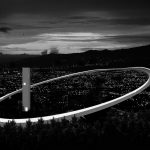
The Vantage Route proposes a comprehensive design approach to create a landmark within the height limit of 200 feet. The intervention utilizes the site spread to form an expansive structure that conserves valuable land space.
Studio Name: atArchitecture
Design Team: Neha Rane, Avneesh Tiwari
Area: 5 Acre
Year: 2020
Location: California , USA
Consultants: atArchitecture
Photography Credits: atArchitecture

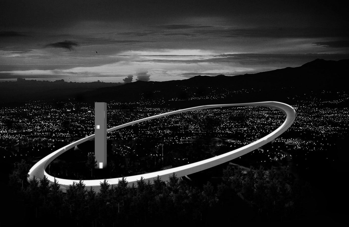
The structure has a thin footprint with maximum area afloat, featuring a square tower facing cardinal directions that anchor the unidirectional curvilinear loop. The design draws inspiration from pure geometry, which complements the organic nature of the surrounding landscape, including the park vegetation and river flow. The inclined ring mimics the qualities of a mountain trail, forming a trek through an urban landscape that encourages recreational activity and park regeneration. The inner surface of the parapet becomes a golden disc at night, highlighting the suspended quality of the ring and contributing to the skyline.
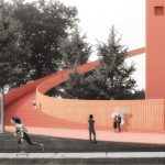
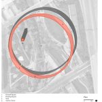
The intervention creates a social trail that engages visitors at various levels and directions, providing a sacred sequence of interactions between nature and the city. The trail starts at the ground square, where the ring rises out of the earth to frame a 42-foot-wide entrance plaza in the southwest corner. From there, the route steps up over the site, passing through dense tree foliage and gradually emerging to reveal views of Confluence point, San José Vietnam memorial, and other cultural sites.
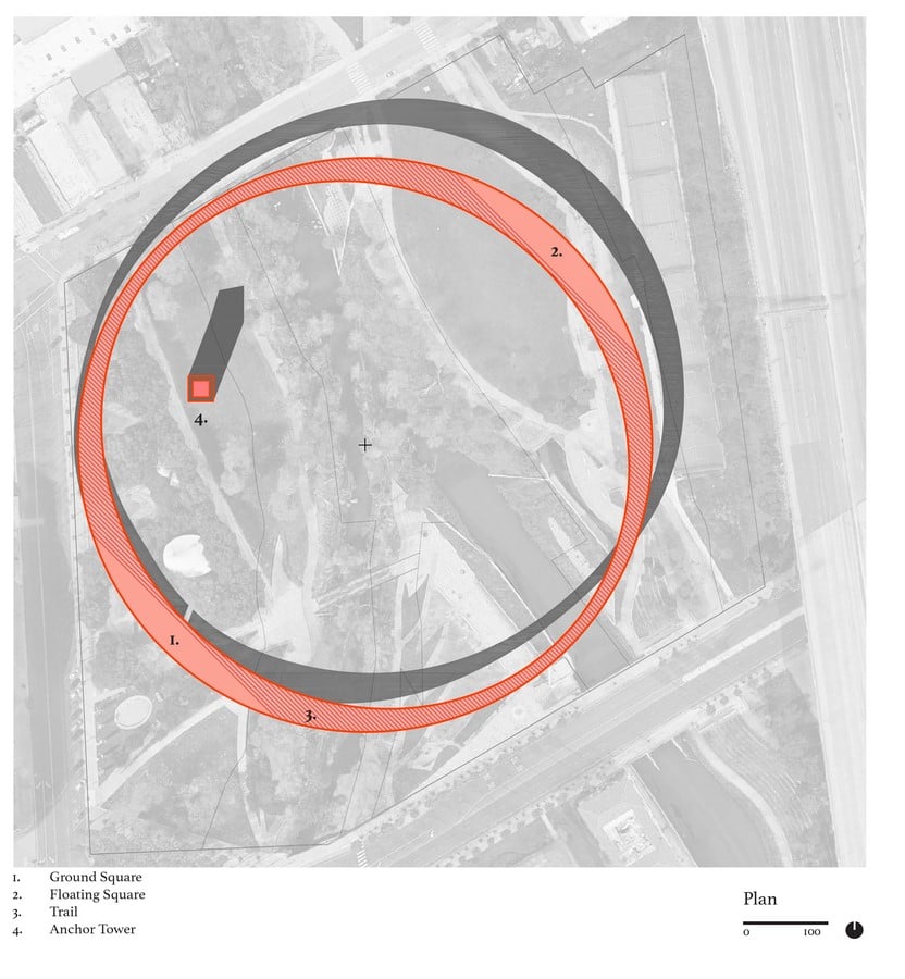
The vertical tower provides direct connections to viewpoints through a series of internal elevators. As the route hovers further above the landscape, the parapet reduces, offering unrestricted views of the city panorama and framing the river within. Finally, on the highest end of the loop, a cantilevered deck is formed, which straddles views of the hills in the northeast and the river running below.