Urban flooding has emerged as a persistent issue all over India, primarily because of rapid urbanisation, poor infrastructure, and loss of conventional water infrastructure. This paper explores why flood risks are on the rise in Indian cities concerning historic water-sensitive urbanism and contemporary urban design shortcomings. It also suggests responsive actions at the city scale using architecture and urban design actions like decentralised water systems, permeable landscapes, and blue-green infrastructure. The cities of Ahmedabad, Chennai, and Hyderabad are taken as examples to show how the introduction of traditional wisdom with modern design can produce climate-resilient urban spaces.
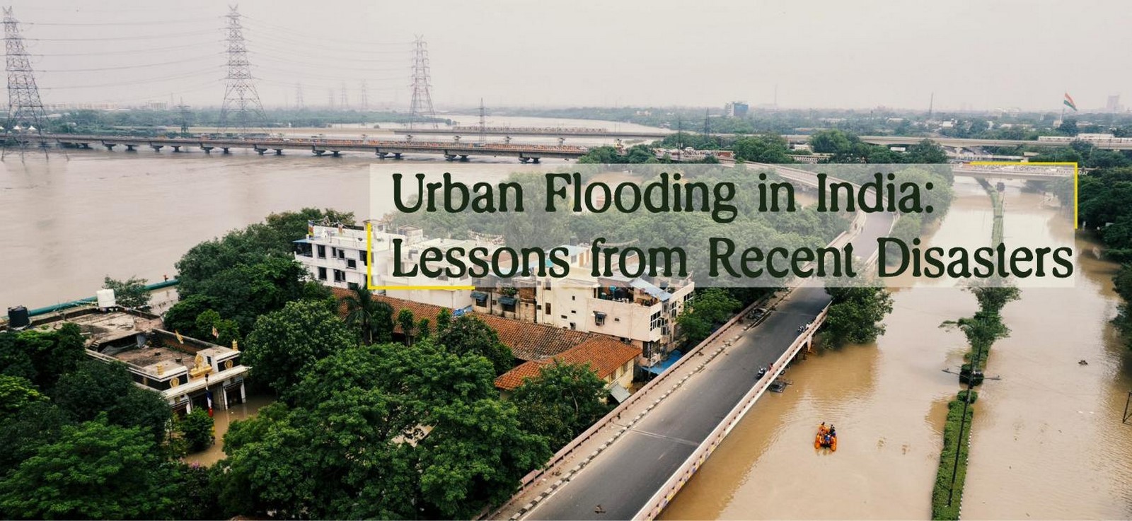
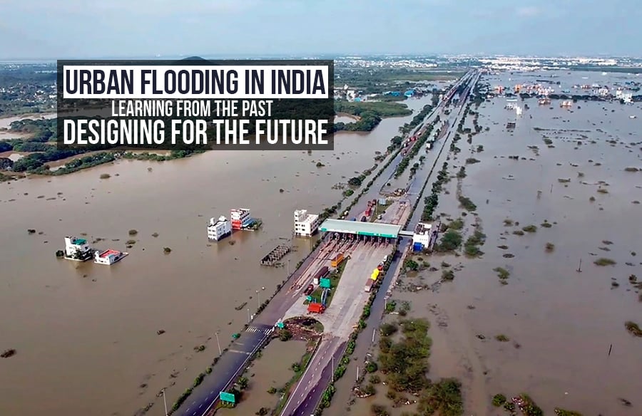
Urban floods in India were a rarity in the past, but now they strike cities almost every year. From the monsoon floods of Mumbai to the December floods of Chennai, Indian cities are subject to growing hydrological stress (NDMA, n.d.). Though the reasons are commonly being linked to climate change and rising rainfall variability, the genesis lies in a more profound urban and architectural failure — loss of water-sensitive design. In the past, Indian settlements balanced built forms with natural hydrology. Stepwells, temple tanks, canals, and lakes were a part of urban morphology (Satyanarayana, 2021). Conversely, modern cities are characterised by hard materials, invaded wetlands, and faulty drainage. This paper explores city-scale design responses to flooding by learning from ancient systems and re-imagining resilient urban and architectural solutions.
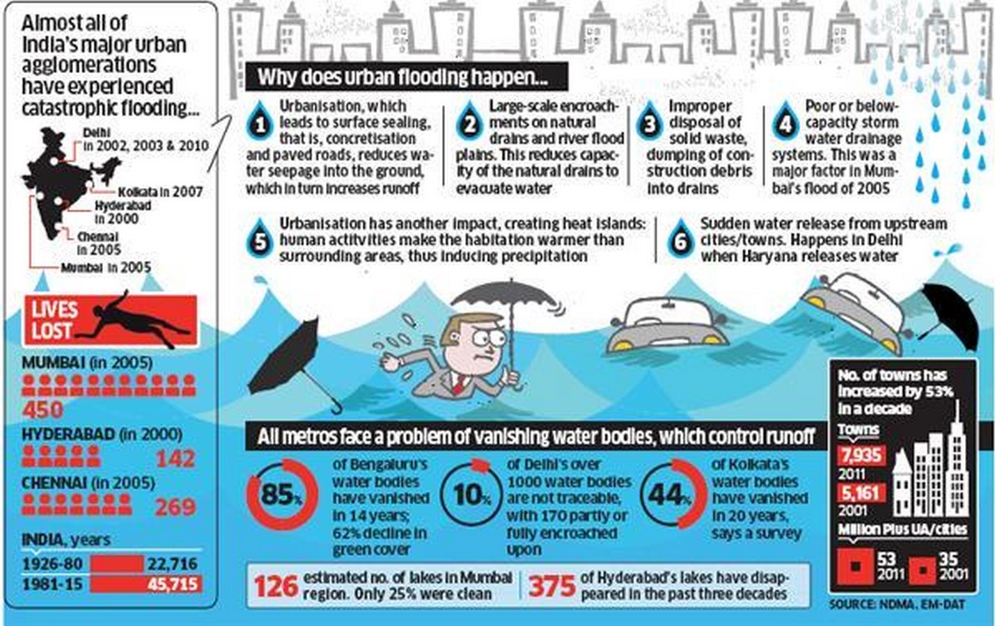
Modern Urban Flooding: Causes and Consequences
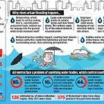
- Vanishing Water Bodies and wetland encroachments have obliterated natural buffers such as tanks, ponds, and wetlands. Hyderabad lost more than 3,000 lakes over the past three decades (CSE, 2022), severely cutting down the capacity of the city to absorb rainwater. The reduction in water catchments, such as Bengaluru’s Bellandur Lake or Pune’s Pashan Lake, has also resulted in raised flood risks in these urban areas.
- Nowadays, cities have filled the soil with concrete. This reduces the percolation and results in higher surface runoff. Bengaluru, with more than 78% built-up space, experiences water stagnation even during light rain (Drishti IAS, 2024). Urban development on natural floodplains has resulted in regular flooding in newer townships.
- Poor Infrastructure of Drainage
- Urban infrastructure is not developed to keep pace with population increase. Outdated and choked storm drains collapse during heavy rainfall, causing waterlogging and infrastructural loss. Mumbai’s Mithi River is an example of how a lack of proper maintenance of the urban drainage system worsens flooding.
- Urban Heat and Microclimate Changes Decrease in green cover lowers evapotranspiration, intensifying heat and diminishing natural evaporation cycles of water (Raman & Mani, 2020). This increases rainfall events and restricts the ability of the landscape to respond.
Conventional Responses: Water-Sensitive Civilisation
The history of Indian architecture abounds with water-sensitive urban practice:
- Stepwells and Tanks Buildings, such as Gujarat’s Rani-ki-Vav and the Tamil Nadu temple tanks, were not only water storage facilities but also social and thermal regulators (UNESCO, 2014).
- City-Wide Drainage Systems. Jaipur’s cities were planned following topographic contours, which allowed gravity drainage systems. These systems replicated watershed flows (Satyanarayana, 2021). Ahmedabad’s pols contained internal water courses and a common catchment logic.
- Vernacular Materials Lime plaster, clay bricks, and permeable stones facilitated percolation and cooling, assisting recharging of water as well as urban comfort.
Architecture and Urban Design Responses: Then vs Now
- Disconnection of Architecture from Ecology. Present-day architecture hardly incorporates rainwater harvesting or landscape water management. Buildings are detached from hydrological processes. Roofs tend to be treated as dead loads instead of being seen as catchment areas.
- Reversal of Drainage Logic As opposed to designing in terms of terrain, today’s designs level land, dividing across watershed logic and causing water clogging and drainage failure. Examples are new townships in Gurgaon or Navi Mumbai.
- Insufficient Design Regulations
There are no design codes in cities that incorporate water-sensitive urban design (WSUD) at the neighbourhood, block, and site levels. City Development Control Regulations (DCRs) tend to exclude drainage resilience or water catchment logic from the Floor Area Ratio (FAR) regulations.
Responsive Strategies at City Level
- Permeable Urbanism The use of permeable surfaces on sidewalks, streets, parking lots, and open spaces can curtail runoff by as much as 50% (World Bank, 2021). Chennai’s T. Nagar new pedestrian plaza features permeable pavements.
- Blue-Green Infrastructure Double-functioning parks like flood plains, stormwater ponds, bioswales, and green roofs store and filter rainwater. Bengaluru’s Cubbon Park and Delhi’s Neela Hauz are poster children for blending ecology and infrastructure.
- Example: East Kolkata Wetlands are a natural treatment system of sewage and flood buffer and treat more than 900 million litres of wastewater every day (Ramsar, 2020).
- Adaptive Building Design. Buildings may be incorporated:
- Plinth raising in flood-prone zones
- Rainwater harvesting tanks
- Green roofs
- Underground water storage
Utilisation of jalis and courtyards for airflow, as well as moisture balance
- Urban Watershed Mapping Urban plans should give due consideration to natural watersheds and incorporate them in zoning and infrastructure plans. Ahmedabad’s Sabarmati Riverfront project, though contentious, demonstrates how river-based planning can combine public space and flood control (Bhatt, 2022). Kochi has also begun mapping tidal wetlands and flood areas with the help of participatory GIS mapping.
- Community Engagement and Maintenance Local inspection of drainage lines, community restoration of tanks, and engagement with design choices enhance responsibility and maintain resilience initiatives. Community-led mapping and rainwater harvesting schemes in Indore and Alappuzha have shown replicable impacts.
Case Studies
- Chennai: Reviving the Temple Tanks. Post the 2015 floods, Chennai began reviving temple tanks and old stormwater channels. Urban planners used GIS to map the city’s lost hydrology, reinstating 15 tanks by 2020.
- Hyderabad: Lake Rejuvenation Mission Kakatiya focused on restoring over 45,000 tanks and lakes in Telangana, many in peri-urban areas of Hyderabad. It improved both flood control and groundwater levels (Government of Telangana, 2020).
- Ahmedabad: Drainage and Public Space Integration Sabarmati Riverfront brings together flood levels, stepped ghats, public plazas, and underground drainage — demonstrating how flood control can be an opportunity for civic engagement, rather than merely a crisis (Bhatt, 2022).
- Kochi: Comprehensive Urban Flooding Strategy. With the support of the AMRUT and Rebuild Kerala Initiative, Kochi has undertaken wetland preservation, green cover restoration, and cleaning of canals. It also initiated tidal gates and reinforcement of embankments with a focus on the original water channels.
- Ujjain: Sacred Hydrology and the city of Ujjain illustrates how city fringes and temples were oriented in response to seasonal water flows. The Shipra River ghats, tanks, and kunds were spatial tools both for ritual and flood control. Traditional bunds and stepped embankments at Ujjain are included today in its smart city makeover.
Indian cities today cannot afford to think about water as an engineering challenge. It is an urban architecture and design challenge — one that calls for learning from centuries of conventional knowledge alongside integrating modern design methods. From stepwells to bioswales, temple tanks to urban wetlands, the solutions both reside in the past and the inventions of the present. It is through only city-level, comprehensive strategies that India can transform its flood-prone cities into resilient water-sensitive habitats.
References:
Bhatt, V. (2022). Reimagining the Sabarmati: Urban water projects and public space in Ahmedabad. Urban Studies, 59(1), 112–129. https://doi.org/10.1177/0042098022107617
Centre for Science and Environment. (2022). Hyderabad’s vanishing lakes. CSE India. https://www.cseindia.org
Drishti IAS. (2024). Urban Flooding in India. https://www.drishtiias.com/daily-updates/daily-news-analysis/urban-flooding-in-india
Government of Telangana. (2020). Mission Kakatiya Progress Report. Telangana Irrigation Department.
National Disaster Management Authority. (n.d.). Urban floods. https://ndma.gov.in/Natural-Hazards/Urban-Floods
Raman, M., & Mani, M. (2020). Heat and hydrology: How Indian cities are changing microclimates. Journal of Urban Climate, 31, 100591.
Ramsar. (2020). Ramsar Sites Information Service: East Kolkata Wetlands. https://rsis.ramsar.org/ris/1208
Satyanarayana, V. (2021). Traditional water management systems of India. ISVS e-journal, 9(2), 65-75. https://isvshome.com/pdf/ISVS_9-2/ISVS9.2.5Satyanarayana.pdf
UNESCO. (2014). Rani-ki-Vav: The Queen’s Stepwell. World Heritage Listing. https://whc.unesco.org
World Bank. (2021). Water-sensitive urban design for Indian cities: Toolkit and case studies. World Bank Urban Series.
Urban Flooding in India: Lessons from Recent Disasters. (n.d.). Drishti IAS. https://www.drishtiias.com/blog/urban-flooding-in-india-lessons-from-recent-disasters
Staff, C. (2021, November 16). [Sansad TV] Perspective: Urban Deluge (Floods) – Civils Daily. Civils Daily. https://www.civilsdaily.com/sansad-tv-urban-deluge-floods/