


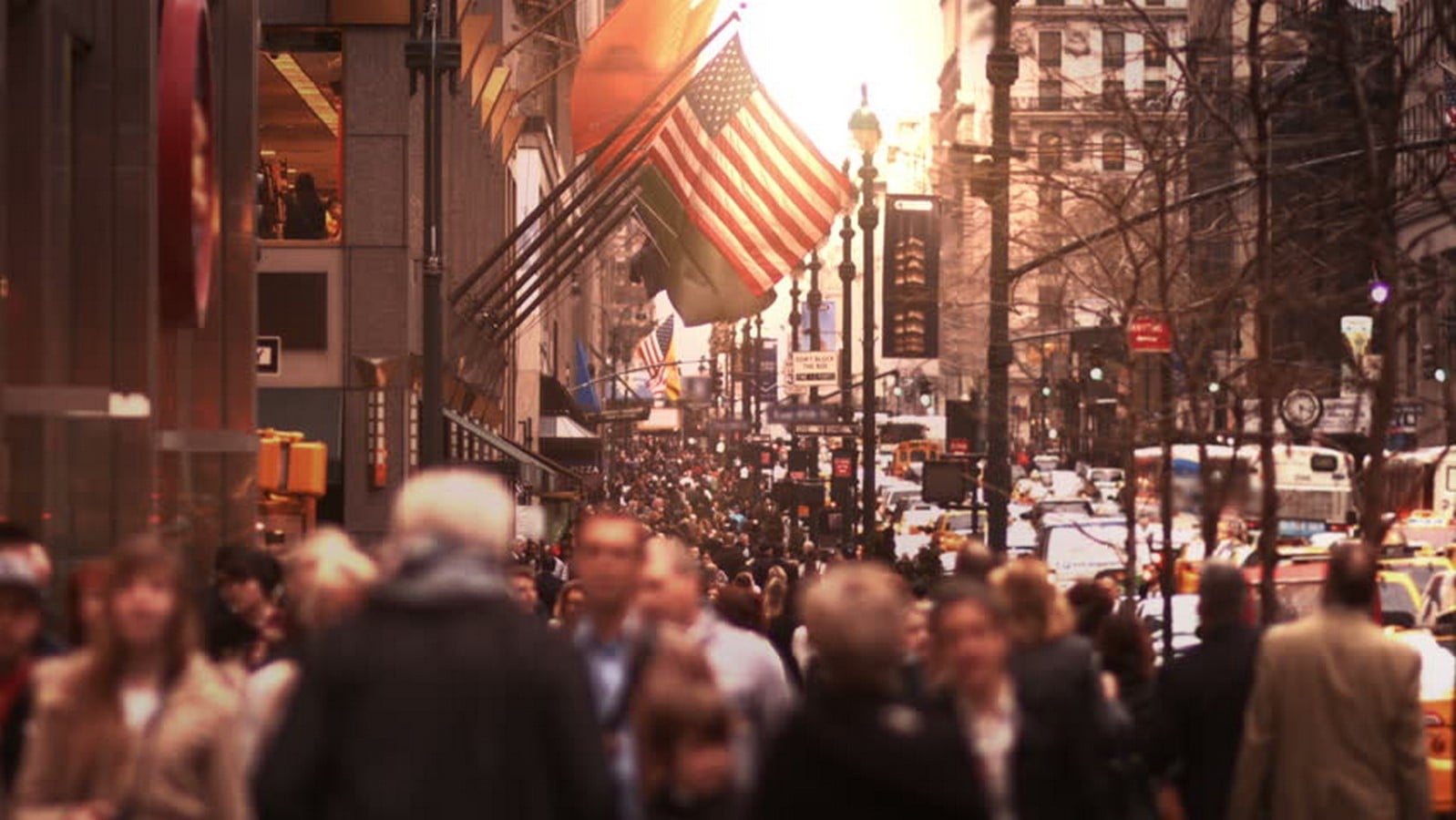
An astounding number of people have disparate intentions going about their ways in the silence of their minds, in a place that has absorbed all those disparate intentions, ideas and embraced diversity and cultures into the very essence of its being; Manhattan, New York. The metropolis of today has seen through time a transformation unlike any other city in the world with times of turbulence and crisis, times of glory and power, times of rejoicing and mourning, all manifested in the spatial realms of the greatest grid man has encountered and created, ‘the Manhattan grid.’

Attitudes determine outcomes
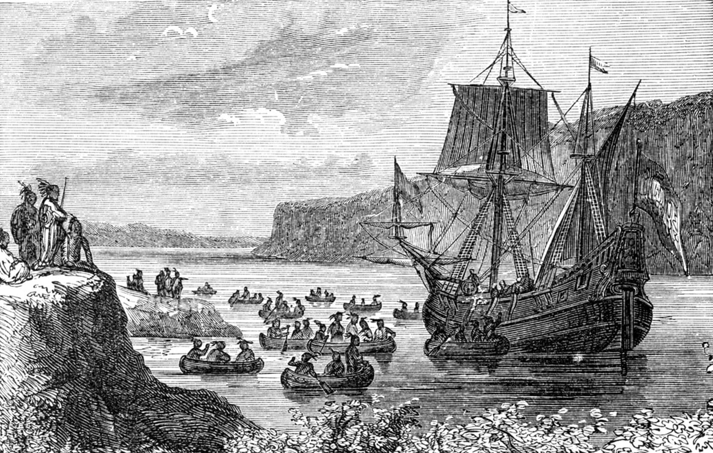
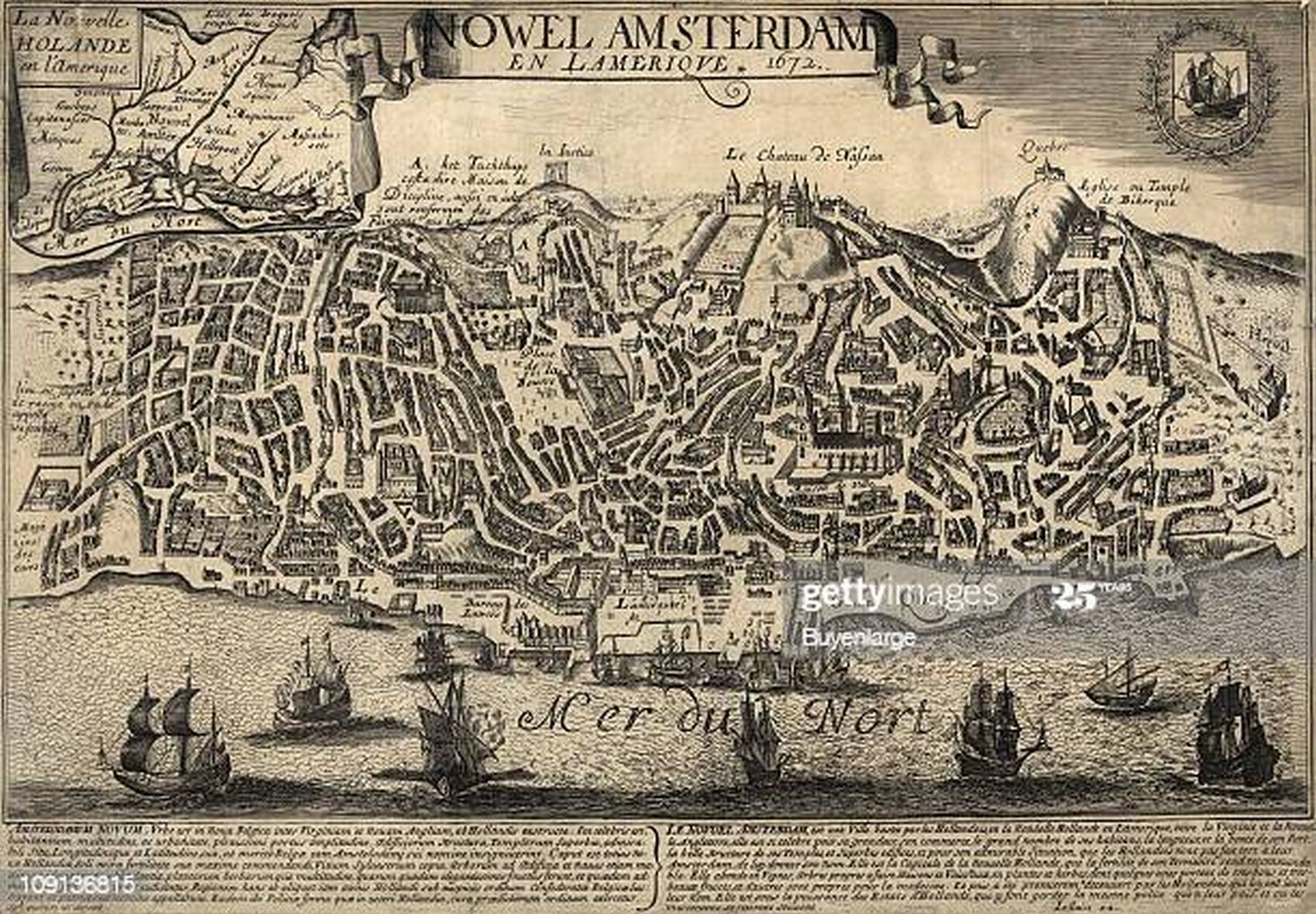
An island with a natural harbor laden with rich natural resources, a perfect geographic setting in the vast American continent was the habitation of the native Indians for a long time till the day a Dutch marine vessel sailed into its harbor in the early 1600s. On the southern tip of this vast unexplored island was established the first settlement New Amsterdam which later upon English colonization became New York. The proposition to the natives where land got traded for an amount of a few gilders, a situation that the natives thought to be temporary, marks the essence of what the city today is – it’s a real-estate deal. That lay the foundation of what the place in the future would be, a money-driven- capitalist approach, a commercial culture that makes political democracy seem perfectly normal. One wonders here about the existence of the place in case the first colonizers here would have been English or Spanish; would we have seen another Boston or Philadelphia, or any other city in America and no New York.
The vision
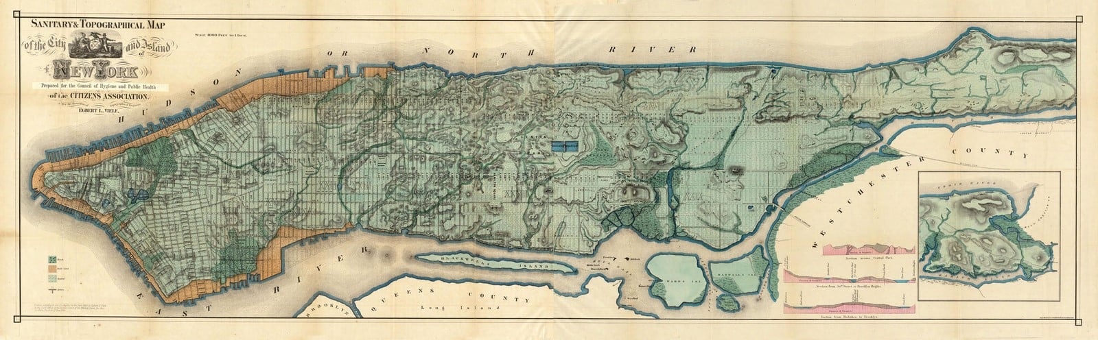
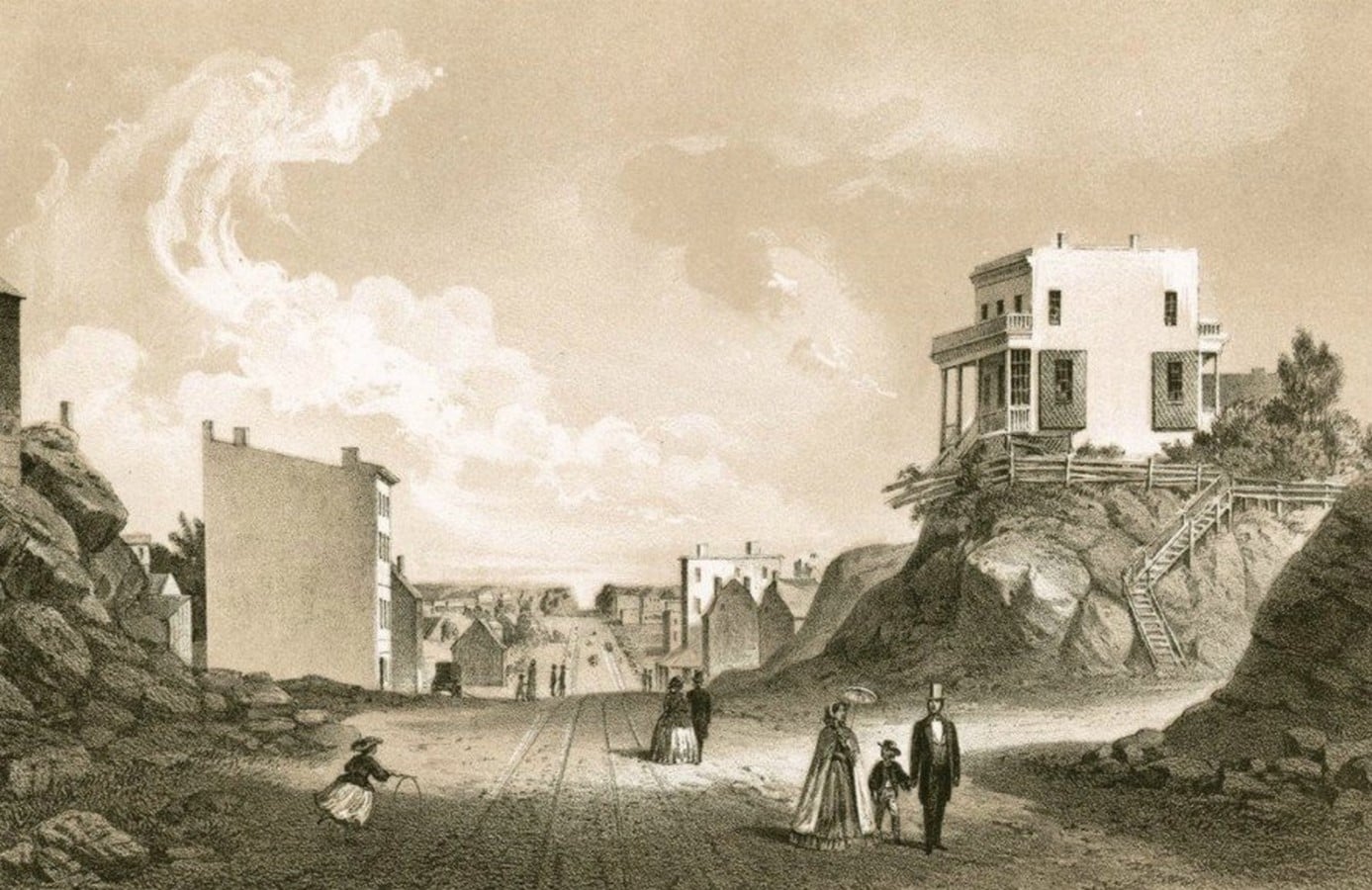
Events during the American Revolution made the island defenseless as it challenged the largest maritime empire in the world. The wartime destruction and aftermaths looming in shadows created uncertainties in the city and economic space, and the underlying civic disorder forced the commissioners of free America to envision a future of the place and imagine they did. The natural landscape of New York was unadulterated till the 1800s was a land of high and low grounds with plantations and abundant natural resources, like the North American continent’s diverse geography. The surveying of the common lands was undertaken by Goerck to create sellable lots of land by the Common Council who owned them. The draft Mangin–Goerck master plan of 1799 was presented to the Council in 1803 for approval, but political disorientation and
Conflicts led to the cancellation of the new map of the city. In March 1807, DeWitt Clinton undertook the task of ordering the chaotic northward growth of the place by a special commission laying a foundation for the new city by settling the ongoing property issues and land commodification. And when there were only a few hundred thousand people in Manhattan, a city was imagined for a billion.
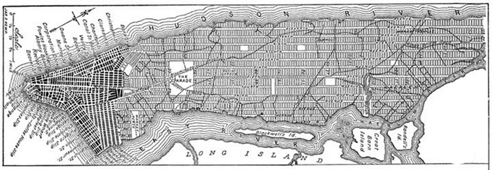
The Manhattan Grid Plan
The Commissioner’s plan of 1811 was an eight-foot (24m) map redrawn by William Bridges from Randel’s original master plan and engraved by Peter Maverick. The island was divided into 12 primary north-south avenues and around 155 orthogonal cross streets, and to replicate the angle of Manhattan Island, the grid was titled 29 degrees east of true north. Approximately 2000 long narrow city blocks emerge as a result. The development did not change the streetscape of the Greenwich Village and other southern tip areas, along with Stuyvesant Street because of its eminence and the amounts of populace residing therein. It led to the southernmost tip retaining its historical organic development paradigm, and current efforts in historical preservation to safeguard landmarks and places in Manhattan grid have led to an environment of cohesive urban growth.
Form emerging out of and sculpting culture and ideals
The grid was envisaged for the city and when geometry was overlaid on geography as is the case most times, geography suffered. A gruesome way of treating the landscape and nature, a totalitarian approach, manifested in an ungodly form, at a scale never attempted before in history. The planning had environmental demerits but allowed for real estate regularization in the city and a democratic approach to land parcellation. Also, the significance of this undertaking is the associated idea of American limitlessness, where the conviction that you are going to triumph over nature and that you can shape –or reshape anything, is the New York idea. The overwhelming vulnerability and disorder the city has witnessed, social, physical, and economical, the Manhattan grid was an ultimate answer, whereby the pure mathematical objects-straight lines and rectilinear blocks and corners assured civil resurrection by mathematical logic. The implied idea of the creation of a new world based on meritocracy and hard work is inherent to the catastrophe of the grid being constructed concerning nothing, in particular, succumbing to geometric ideals. This idea has made the city a melting pot of ideas, culture, and capital. The remarkable ethnic-racial diversity and its immigrant history have combined to make it an accepting city, in many ways, like no other in the United States. Multiculturalism, it is said, has evolved there in what might be called a particular New York way.
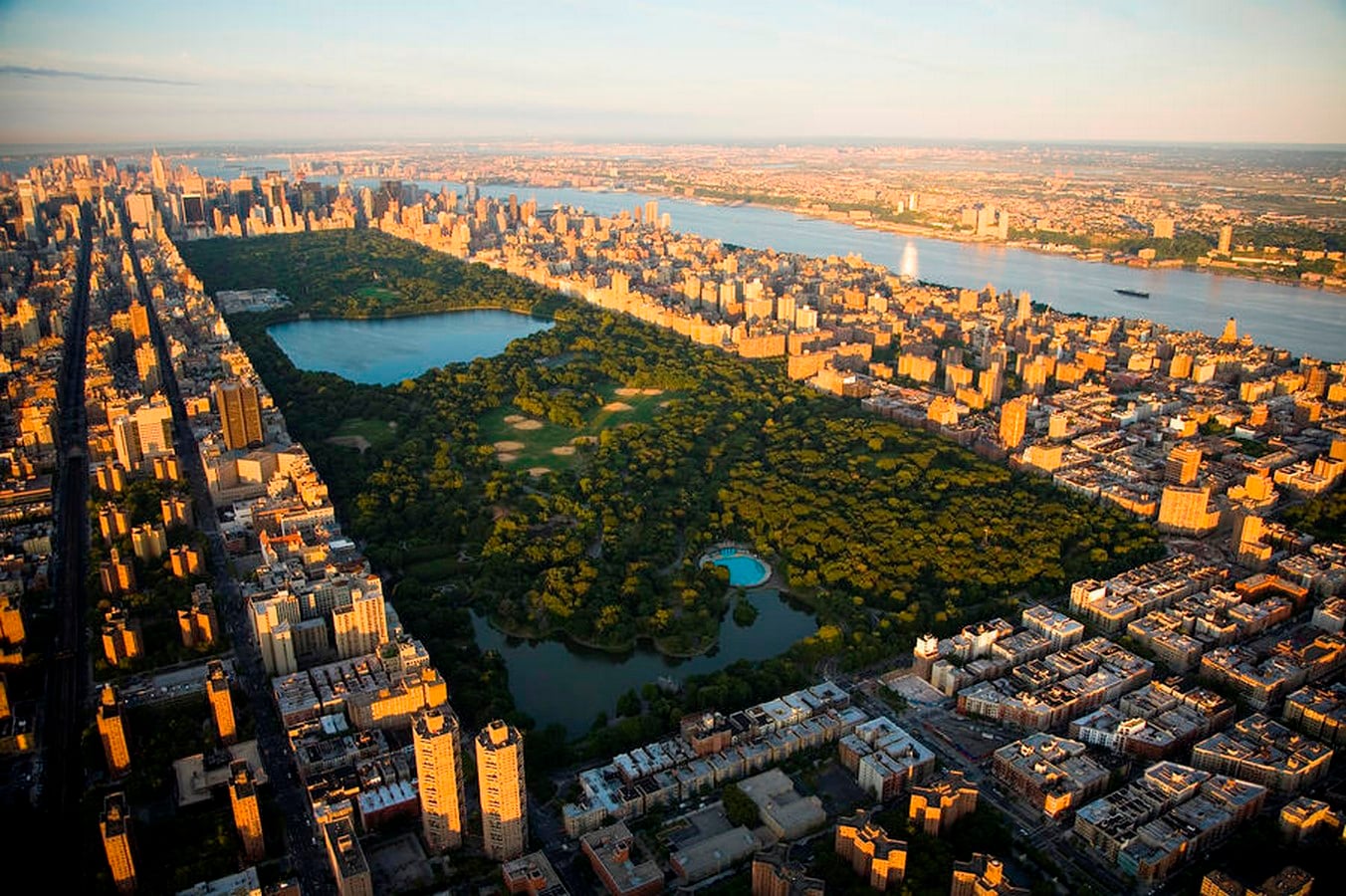
By 1865, around 38 different state laws had been passed for modification of the 1811 master plan. The single most alteration to the Commissioner’s master plan of the Manhattan grid was the addition of an 843-acre Central Park, situated between 59th and 110th Streets and Fifth and Eighth Avenues, which was an answer to the lack of public and civic spaces the grid created. The entry by Olmsted and Vaux was selected, and they envisioned the place to be an oasis from everyday life. This act is ironic since it was not long back that nature was tortured and tamed, geometry imposed over geography for the realization of the grid. Nature tamed to realize an artificial premise, and then made nature an edifice by human creation in an artificial environment, in a way revealing the New York approach.
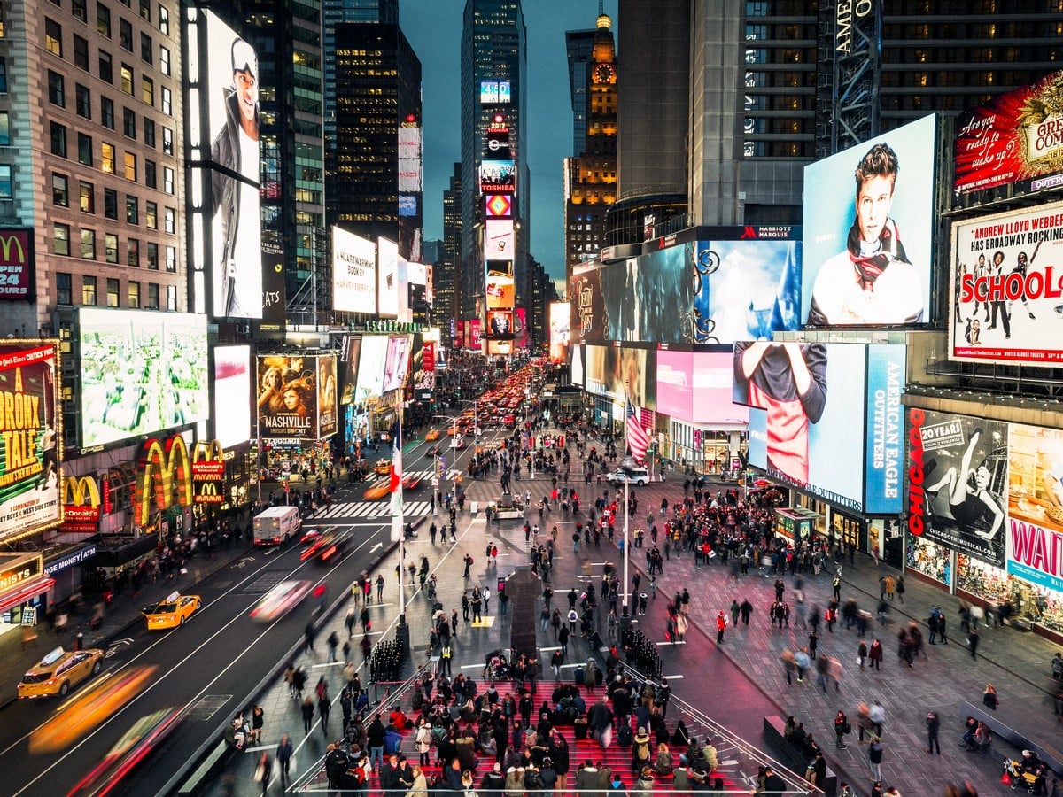
It is the underlying structure of the city that gives it a unique character, and the spatial exhibits weave about a narrative of cultural expressions. Today when we say New York, it is the streets full of people of all kinds moving about with disparate intentions fostered by the Manhattan grid image that strikes us. The grid has shaped the city that is Manhattan, New York today, not just in spatial domains but penetrating deep into the creation of culture and a typical society that is a New York way of life.


