The history of a neighbourhood is often recorded not only in monuments but also in its streets, houses, places of worship and everyday commercial spaces. The Mattancherry neighbourhood in Kochi, Kerala, offers a distinctive example of how migration and maritime trade have shaped the urban environment over centuries. Located along the historic trading coast of the Arabian Sea, Mattancherry became home to communities including Jews, Gujaratis, Konkanis, Jains and Marathis. Their presence influenced its cultural identity, architectural character and patterns of settlement. Historical maps, photographs, architectural records and surviving buildings provide valuable ways to examine how this neighbourhood developed and how its inherited character continues to change.
Mattancherry Neighbourhood: A Landscape Shaped by Migration
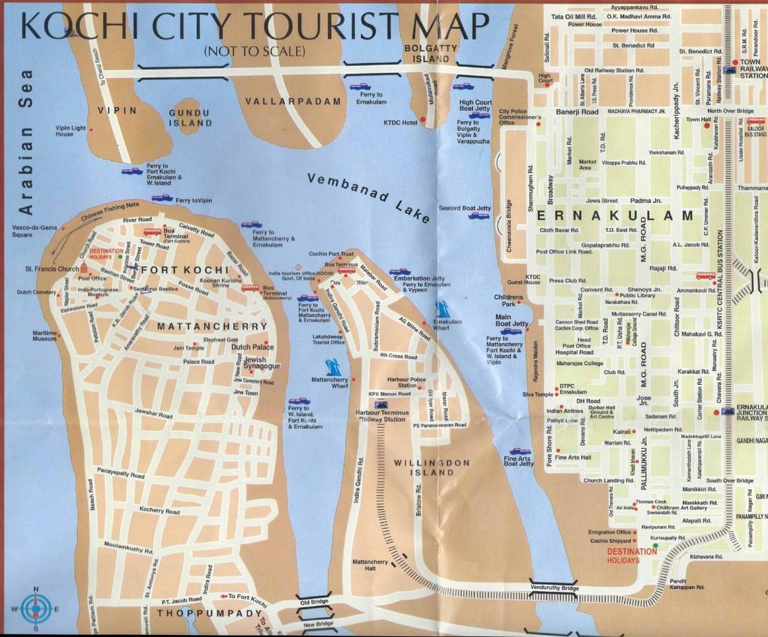
Mattancherry developed as an important commercial area associated with Kochi’s maritime trade, particularly the exchange of spices and other goods. Its coastal location connected local merchants with trading networks extending across the Arabian Sea and beyond. These connections encouraged the movement of traders, craftspeople and religious communities, contributing to the neighbourhood’s diverse social structure. The Kerala Revenue Department records the presence of Jewish, Gujarati, Konkani, Jain and Marathi communities, whose settlements contributed to the area’s distinctive cultural landscape.
Migration did not simply increase the population; it also influenced the spatial organisation of the Mattancherry neighbourhood. Commercial streets, religious institutions, residences and trading premises developed alongside one another, reflecting the requirements of different communities. The resulting urban fabric was neither entirely uniform nor organised around a single architectural tradition. Instead, it evolved through successive layers of occupation, exchange and adaptation. The surviving streetscape therefore provides a physical record of how social relationships and economic networks shaped the built environment.
Trade, Settlement and the Architecture of Exchange
The architectural history of Mattancherry is closely associated with its trading economy. Warehouses, shops, residences and religious buildings formed part of an interconnected urban landscape in which commercial activity influenced the use of space. Streets supported the movement of goods and people, while buildings accommodated storage, trade, domestic life and worship. This relationship between economic activity and settlement patterns remains important when interpreting the neighbourhood’s historic character.
The Mattancherry neighbourhood also demonstrates how architectural forms can reflect cultural exchange without losing their local identity. Traditional Kerala construction practices existed alongside features and objects associated with overseas trade and colonial contact. Imported materials, decorative elements and changing building uses contributed to the area’s architectural variety. These influences should not be interpreted as a simple replacement of local architecture by foreign styles. Rather, they reveal a process of adaptation in which local building traditions and external influences interacted over time.
The Mattancherry Palace: Royal Patronage and Architectural Adaptation
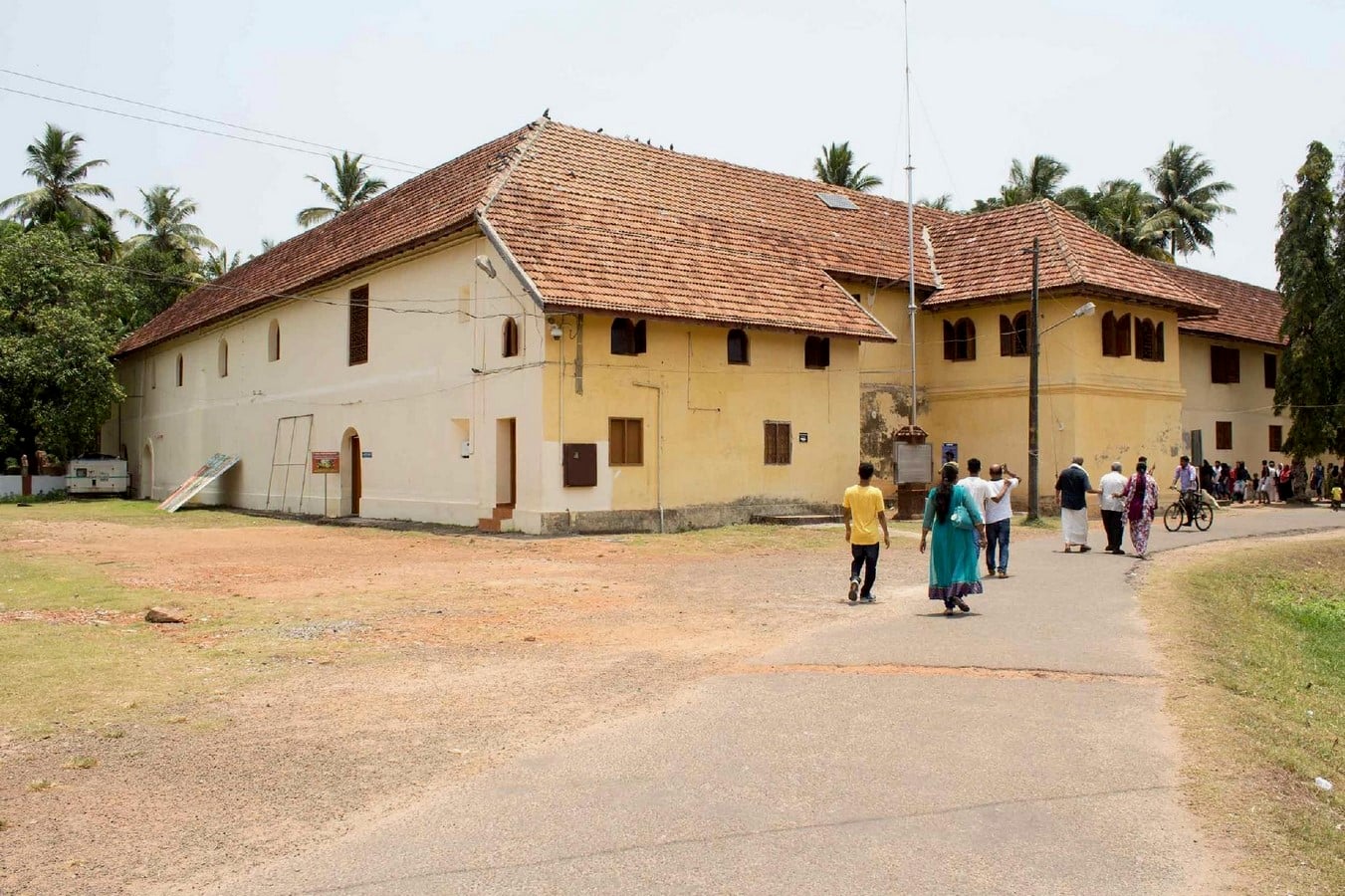
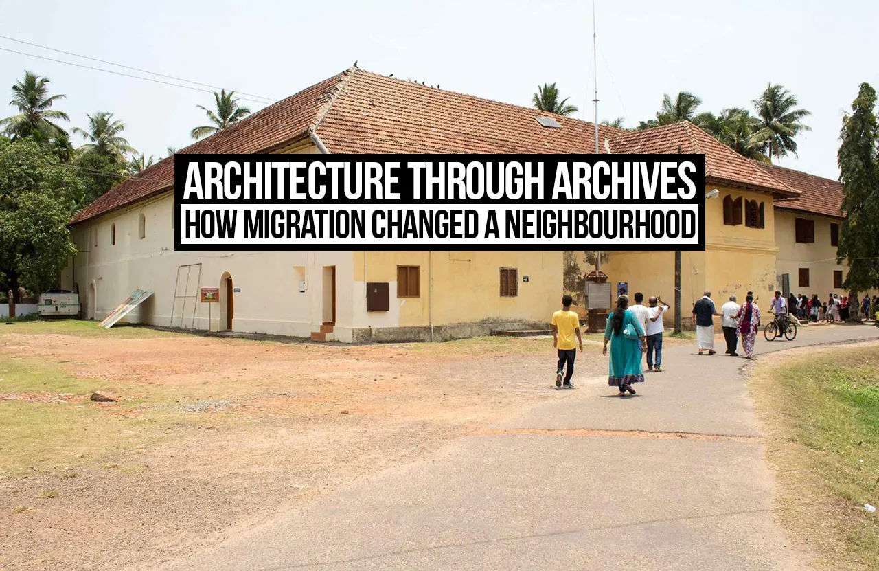
The Mattancherry Palace, commonly known as the Dutch Palace, is an important reference for understanding the relationship between political authority, cultural exchange and architecture. Built by the Portuguese around 1545 and subsequently renovated by the Dutch, the palace was presented to the ruler of Kochi. Its architectural arrangement follows the traditional Kerala naalukettu form, with four wings opening towards a central courtyard. At the same time, its history reflects European colonial involvement in the region.
The palace is particularly significant because it demonstrates that architectural transformation can occur through the adaptation of established building traditions rather than their complete replacement. Its courtyards, timber details, mural paintings and ceremonial spaces preserve aspects of regional architectural practice and royal culture. The palace also houses historical maps and objects that help contextualise the political and cultural history of Kochi. These records can be examined alongside the surviving structure to understand changes in architectural detailing, material use and the representation of authority.
The palace therefore offers a useful case for studying the Mattancherry neighbourhood through architectural evidence. Historical drawings, maps, photographs and present-day documentation can help distinguish original features from later interventions, although each source must be checked for its date and provenance.
Religious Buildings as Records of Cultural Identity
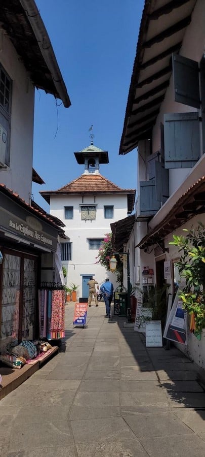
Places of worship provide another way to understand the relationship between migration and architecture. Mattancherry contains religious buildings associated with different communities, including the Paradesi Synagogue and Dharmanath Jain Temple. Their presence within the same broader urban area illustrates how religious identity became embedded in the physical structure of the neighbourhood.
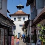
The Paradesi Synagogue, established in 1568, is particularly notable. Its architectural and decorative features include a clock tower, a brass-railed pulpit, imported chandeliers and hand-painted Chinese porcelain floor tiles. The synagogue was damaged during Portuguese attacks in 1662 and subsequently reconstructed. Its history reflects the movement of people, materials and artistic influences through international trading networks. The building is therefore both a religious space and a record of cultural connections extending beyond Kerala.
The architectural significance of the Mattancherry neighbourhood lies partly in this coexistence of different traditions. Temples, synagogues, Jain religious buildings, churches and mosques contribute to a layered cultural landscape. Their value cannot be understood solely through individual monuments; their relationships with streets, residences, commercial premises and neighbouring communities are equally important. Archival photographs and historical maps can help reveal how these relationships developed and how the surrounding urban fabric has changed.
Reading Historical Maps and Photographs
Archival research provides a method for comparing earlier urban conditions with the present-day neighbourhood. Historical maps can indicate street alignments, settlement patterns, waterfront relationships and the location of significant buildings. Old photographs can reveal changes in building façades, roof forms, street widths, shopfronts and the use of public space. Architectural drawings, where available, may provide more detailed information about plans, sections, construction techniques and alterations.
For the Mattancherry neighbourhood, such material should be compared with present-day photographs taken from similar viewpoints. A comparison of a historic commercial street with its current appearance, for example, may reveal the survival of traditional façades alongside changes in signage, shopfronts, building use and traffic. Similarly, comparing historic maps with contemporary street maps may help identify persistent routes and changes in the relationship between commercial and residential areas.
However, archival interpretation requires care. A photograph captures a particular moment rather than the complete history of a building or street. Maps may omit informal settlements, minor structures or everyday activities. Each document should therefore be identified by its date, creator, source and intended purpose. Where no historical image is available, the absence should be acknowledged rather than filled with an assumed reconstruction.
From Trading Neighbourhood to Contemporary Heritage Precinct
The Mattancherry neighbourhood has experienced changes in economic activity, occupation and the use of its historic buildings. Some premises continue to support commercial activities, while others accommodate antique shops, galleries, cafés and visitor-oriented businesses. These changes demonstrate how historic buildings can acquire new functions while retaining elements of their original architectural character.
Tourism and heritage-related activities can contribute to the continued use and maintenance of historic structures. However, they may also change the character of streets and the relationship between buildings and their long-term residents. The conversion of commercial premises, changes to façades and the introduction of new services can gradually affect the visual and functional continuity of the neighbourhood. Such changes need to be assessed through documentation rather than treated as uniformly positive or negative.
Understanding these transformations requires attention to both tangible and intangible heritage. Buildings, streets, construction details and historic maps represent the tangible record, while traditional occupations, food practices, languages, religious customs and community memories contribute to the neighbourhood’s living identity. The future of Mattancherry depends on recognising the relationship between these dimensions. Conservation should therefore consider the wider urban setting and its communities, rather than concentrating exclusively on prominent monuments.
Conclusion: Preserving the Layers of Mattancherry
The history of the Mattancherry neighbourhood demonstrates how migration, trade and cultural exchange can shape an urban environment over several centuries. Its streets, religious buildings, royal architecture and commercial premises preserve traces of the communities and economic networks that contributed to its development. Historical maps, photographs, drawings and surviving structures provide complementary ways to interpret these changes and distinguish documented transformation from assumptions.
A comparison between archival records and present-day conditions can reveal which architectural features have survived, how building uses have changed and where the historic relationship between streets, communities and commerce remains visible. Such research also highlights the importance of preserving the broader urban fabric alongside individual heritage buildings. Mattancherry is not merely a collection of historic monuments; it is a living neighbourhood whose identity has been shaped by movement, exchange and adaptation. Understanding its architectural history through archives can support more informed heritage management while recognising the communities that continue to give the place its character.