


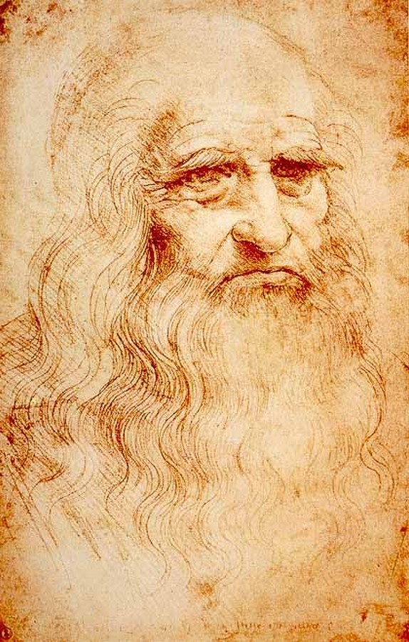
Leonardo Da Vinci was a renowned painter, sculptor, artist, engineer, scientist, draftsman, and architect of the High Renaissance era. The legendary Leonardo Da Vinci is well known for a lot of skills in scientific line, as well as artistic grounds. Da Vinci is known for his paintings The Last Supper (1495-98) and The Mona Lisa (1503-19). His notes and drawings reveal his artistic and scientific mind.
He explored various domains of creativity and experimented broadly. He believed that the eye is the most powerful sense. One perceives from what they see, and that becomes their knowledge. The power of observation leads to questions and results in innovation. From paintings, sculptures, maps, calculations, biological studies, body dissection to war defence devices, flying machines, and robots, Leonardo had mastery in diverse fields.
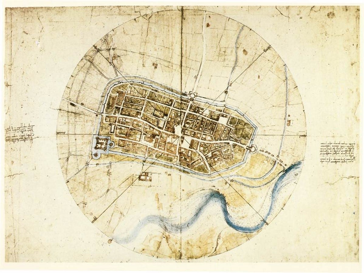
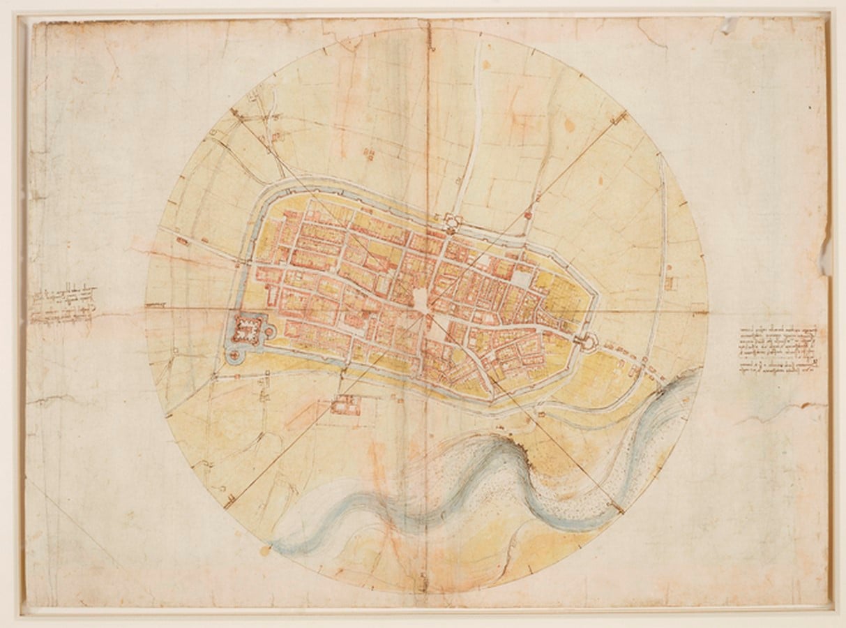
One of his obscure works is the map of the Italian town of Imola. This piece of art is a way ahead of its time, a hand-drafted satellite imagery map. The map dates back to 1502 and is the oldest example of an iconographic map of the place. Da Vinci has always been driven to the concepts of maps and optics. The maps drafted in high renaissance time were decorated with castles, dragons, mountain ranges, and house elevations.
Usually, the maps were represented pictorially without considering proper measurements and scale factors. The perspective was inclined towards aesthetic features and not practicality. Given that in those times, it was difficult to record precise measurements due to a lack of technology and tools, Leonardo da Vinci made it possible to draft an accurate satellite map of the town Imola.
Present-day living in a post-modern world with advanced technology at service, we take such drafts for granted, but almost 500 years ago, this was an immense shift in innovation.
By the end of the 15th century, Leonardo was beginning to be an established artist and known as a genius in all fields. He was a military engineer and architect. He came up with several ideas and innovations in favor of the military. His advanced approach to solving problems and remarkable inventions were encouraged.
In the fall of 1502, Da Vinci was appointed as ‘General Architect and Engineer’ to Cesare Borgia. He was commissioned to undertake the project by an army commander and politician, Cesare Borgia. Borgia seized the city of Imola in 1499. Conquering a fortified city was a milestone for the commander, and controlling such a settlement demands detailed geographic and infrastructural understanding of the built environment. Hence, Borgia ordered Leonardo Da Vinci to draft a map of Imola.
Unlike other artists, Da Vinci was ahead of his time and could anticipate the requirements of the future. To further understand the imagery of aerial maps, he experimented with flying machines, but none of his flying machines worked, and he barely had an idea of an aerial view. Nonetheless, he observed the problem with present-day mapping patterns.
He developed his tools for measurements like an odometer and magnetic compass for sensing the directions. Leonardo probably used his other invented devices like Bussola, which is used to measure degrees inside a circle. Physically walk around the city and observe every block, street, and intersection. Since there were no devices for measuring the distance, he would have manually measured all the dimensions. The process of measuring would’ve consumed a long time, and then Da Vinci would’ve started drafting.
Though historians say that Vinci’s old works portray that he was inclined towards aesthetics. He could focus more on the colours and artistic values in his artworks instead of the accuracy and precision. For drafting this map of Imola, Da Vinci trusted mathematics and calculations.
Leonardo implemented the technique developed by Florentine humanist Leon Battista Alberti. This mapping technique suggests that a town can be mapped using polar coordinates. The central plaza is believed as the focal point from where the eight principal directions of the compass radiated out. The plaza is situated in the middle of the grid.
The print of the map is inscribed in a circle. Over the circle, four lines run through the centre marking the eight polar dimensions. The name of the winds is also mentioned on the map in Leonardo’s handwriting. The use of delicate colours enhances the drawing visually yet maintains.
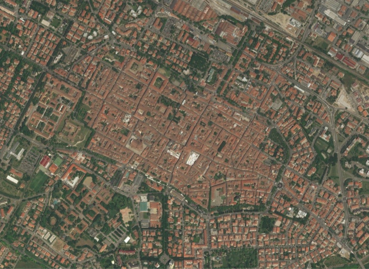
Today, we all are used to Google maps with different views like street view or aerial view. Commuting from one place to another is at ease now. Such maps are the perfect maps, with plain geographic lines and perfectly perpendicular to the viewpoint. The first satellite image was captured in 1946, and years later, the innovation of satellite maps came into being in 2005.
Although Leonardo Da Vinci rendered this map around 500 years ago, historians believe that the dimensions and scaling are so precise that the map can still be used to navigate around Imola city!
References
www.rct.uk. (n.d.). Leonardo da Vinci (Vinci 1452-Amboise 1519) – A map of Imola. [online] Available at: https://www.rct.uk/collection/912284/a-map-of-imola
Futurecdn.net. (2021). [online] Available at: https://cdn.mos.cms.futurecdn.net/BrFjeV6eGgAVG95rVeXDeV-1024-80.jpg.webp
kottke.org. (n.d.). How Leonardo Constructed a Satellite-View Map in 1502 Without Ever Leaving the Ground. [online] Available at: https://kottke.org/19/04/how-leonardo-constructed-a-satellite-view-map-in-1502-without-ever-leaving-the-ground
kottke.org. (n.d.). How Leonardo Constructed a Satellite-View Map in 1502 Without Ever Leaving the Ground. [online] Available at: https://kottke.org/19/04/how-leonardo-constructed-a-satellite-view-map-in-1502-without-ever-leaving-the-ground


