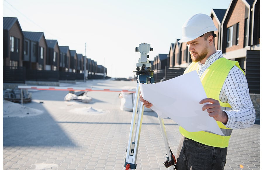
A jobsite geofence should cover every place where paid work actually starts and ends, plus a buffer for phone location error, with separate zones for shops and yards and a clear process for work that happens outside the line. Draw it around the gate, the site trailer and the laydown and staging areas rather than the building footprint alone. A boundary that is too tight blocks legitimate clock-ins and quietly shaves minutes off each shift. A boundary that is too loose lets punches start at the coffee shop down the block. The goal is a line that matches how the crew really works on that site.
The strategic layout of these operational zones, from staging areas to the building’s footprint, is a fundamental aspect of site design. Thoughtful planning here not only optimizes material flow and safety but also directly influences the accuracy of digital tools used for managing labor and resources on complex architectural projects.
Geofencing has become a standard feature of field time tracking because it ties a punch to a place. For specialty contractors running crews across several active projects, that link gives payroll and project managers a reason to trust the hours coming in from the field. The quality of that trust depends almost entirely on how the boundary is drawn.
Why the Boundary Is a Pay Decision
It is easy to treat a geofence as a technical setting that someone in the office configures once and forgets. In practice, the line decides which minutes get recorded, and recorded minutes become wages.
Federal wage rules are clear that the employer carries this responsibility. The federal regulations on hours worked under the FLSA state that work not requested but “suffered or permitted” is work time, and that management “cannot sit back and accept the benefits without compensating for them.” If a worker starts unloading material at the gate before the app lets them clock in, that time still counts. A geofence that misses the gate leaves the legal answer unchanged and simply makes the record wrong.
That is why the drawing step deserves the same attention as setting pay rates or overtime rules. A small, consistent gap on every punch adds up across a large crew and a long project.
Start With the Real Footprint of the Work
Before opening any software, pull up the site logistics plan or walk the site with the superintendent. Mark every place where the crew begins or ends paid activity:
- The main gate and any secondary access points where crews badge in or gather
- Site trailers, tool cribs and gang boxes where the day often starts
- Laydown, staging and material storage areas, which are frequently at the edge of the property or across an access road
- Designated parking areas where crews meet for morning huddles or safety talks
- Phased work areas that will open later in the project
Depending on the platform, a geofence time tracking app may let the administrator draw a circle set by radius from a center point, a polygon traced around the property, or both. A circle is quick and works well for compact sites. A polygon suits long, narrow or irregular sites better, such as a linear utility run or a multi-building campus, because a circle large enough to reach the far corners also swallows neighboring lots and businesses.
The practical rule is to draw around the work, then check whether the line accidentally includes places where nobody should be clocking in, such as a nearby restaurant, gas station or a crew member’s parked truck at a hotel across the street.
Build in a Buffer for Location Error
Phone location is an estimate, and that estimate gets worse in exactly the places construction happens. A 2022 study of smartphone GNSS positioning in the journal Sensors notes that standard smartphone chipsets can show errors of more than 5 to 10 meters under open sky and 20 to 100 meters in urban areas with obstacles such as buildings.
| Key insight
Smartphone location error can range from more than 5 to 10 meters under open sky to 20 to 100 meters in built-up urban areas, according to a 2022 study in Sensors. A boundary drawn exactly on the property line will reject some workers who are standing on site. |
Several jobsite conditions make the problem worse:
- Dense downtown sites surrounded by tall buildings, where signals bounce before reaching the phone
- Work inside enclosed floors, basements, parking decks and mechanical rooms
- Steel decking, concrete cores and heavy rebar that block or reflect signals
- Older or low-end phones with weaker location hardware
These challenges underscore how the very design and material choices of a building—from its structural elements like steel and concrete to the configuration of its enclosed spaces—profoundly affect the performance of modern digital technologies on a construction site. Integrating an understanding of signal propagation into architectural planning can enhance both operational efficiency and data accuracy.
The fix is a deliberate buffer. On an open greenfield site, a modest buffer past the property line is usually enough. On a downtown high-rise or an interior fit-out, the buffer needs to be larger, because the phone may report a position across the street even when the worker is standing on the third floor. Test before deciding: have a foreman open the app at the gate, inside the core and in the far corner of the laydown yard, and note whether each spot registers as inside the fence.
Plan for the Work That Happens Outside the Fence
Not every paid minute happens on the jobsite. Crews pick up tools at the shop, drive material from the yard and move between projects in the middle of the day. Federal rules treat much of this as work. The same hours-worked regulations state that travel from job site to job site during the workday “must be counted as hours worked.”
This is where wage claims often start. The case involved pay practices rather than geofencing, but it shows how easily travel and shop time fall out of the record when systems only count time on site.
A geofence plan should address this directly:
- Create separate geofences for the shop, the equipment yard and any fabrication facility where crews start their day
- Define how travel between sites is recorded, whether through a punch at each location or a supervisor-entered travel line
- Give foremen a documented way to add time when a worker legitimately could not clock in, with a reason attached to every edit
- Review those edits weekly so patterns get fixed in the setup rather than corrected by hand forever
Watch How Rounding and Automatic Rules Interact
A geofence rarely operates alone. Many time systems also apply rounding, automatic lunch deductions and early-punch restrictions. Each rule may be reasonable on its own, but stacked together they can tilt every shift in the same direction.
Federal regulations allow rounding start and stop times, for example to the nearest five minutes, only when the practice does not, over a period of time, result in failing to compensate employees for all the time they actually worked. If a tight geofence delays clock-ins by a few minutes and a rounding rule then trims the remainder, the combined effect can cross that line even though nobody intended it.
Review the full chain once the geofence is live. Compare a sample of recorded start times against the scheduled start, the posted safety huddle time and what the foreman observed. If recorded time consistently trails actual time, the boundary or the rules around it need adjustment.
Test the Fence Before the First Payroll
A geofence should go through a short field test before it governs anyone’s paycheck. A practical sequence looks like this:
- Walk the perimeter with two or three different phones and confirm where each one registers as inside or outside
- Test from the gate, the trailer, the laydown yard and the deepest interior work area
- Test from the nearest off-site locations crews frequent, such as a lunch spot or parking lot, to confirm they fall outside
- Run the first week with a daily foreman review of every rejected or missing punch
- Adjust the boundary, document the reason and keep the change log with the project records
Sites also change over a project’s life. A new phase opens, the laydown yard moves, the trailer relocates after the slab is poured. Put a geofence review on the same schedule as updates to the site logistics plan so the boundary keeps pace with the work.
A Quick Geofence Checklist
- Map every place paid work begins or ends, including gates, trailers, laydown and huddle areas
- Choose a circle for compact sites and a polygon for long or irregular ones
- Add a buffer sized to the site, larger for dense urban and interior work
- Geofence shops and yards separately and define how travel time is captured
- Give foremen a documented exception process with reasons on every edit
- Check that rounding and automatic deductions do not stack against the worker
- Field test with multiple phones and revisit the boundary when the site plan changes
Drawing the Line Fairly
A well-drawn geofence protects both sides of the payroll. Contractors get punches they can trust and a defensible record when a client or auditor asks questions. Workers get credit for every minute they spend on the job, including the minutes at the gate, the yard and the road between sites. The work that makes this possible happens before launch: mapping the real footprint, allowing for location error and planning for the time that falls outside the line.