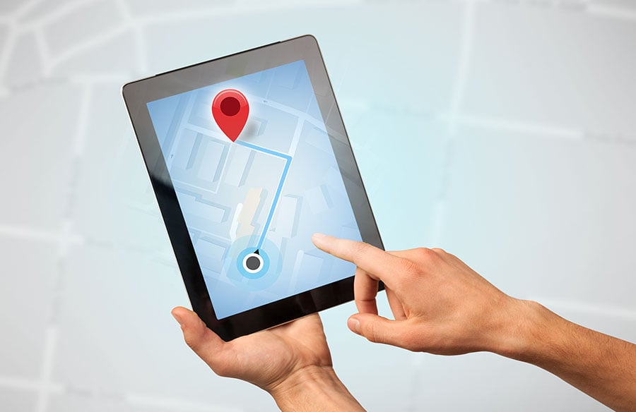
Location intelligence is the practice of making a decision about a place with data about where things are and where people go. The things can be customers, stores, visits, or competitors. The decision can be a new site, a sales territory, a marketing campaign, or a delivery route.
Understanding the flow of people and the distribution of amenities is crucial for architects and urban planners. This data can shape the design of public spaces, the placement of new buildings, or the strategic development of entire neighborhoods, ensuring they meet community needs and economic viability.
The label covers products that share very little. One vendor sells visit data taken from phones. Another sells software for mapping a company’s own spreadsheet, and a third sells code libraries to engineers. The fastest way to tell them apart is to ask whose data ends up on the map.
Each of the seven tools below stands for one kind of product.
| Tool | Category | Who it’s for | What it is not |
| CARTO | Spatial analytics inside a cloud data warehouse | Data teams that write SQL | An address-list mapper (CSV import does not geocode) |
| Placer.ai | Foot-traffic analytics | Retail, restaurant and real estate teams | A map of the buyer’s own customers |
| Esri ArcGIS | Enterprise GIS platform | Organizations with GIS staff | A single app (desktop, browser, mobile and server editions) |
| Foursquare | Place data plus an analytics suite | Developers and data teams | A self-serve source of visit counts |
| Maptive | Business mapping of the buyer’s records | Sales and operations staff without GIS training | A data provider (no foot-traffic or mobility data) |
| GrowthFactor | AI site scoring | Retail and restaurant expansion teams | A self-serve single-seat tool for new buyers |
| Mapbox | Developer mapping APIs | Software developers | A no-code workspace |
1. CARTO: Spatial Analytics on a Data Warehouse
What CARTO Does
CARTO is a cloud-native spatial analytics platform. It runs inside the customer’s data warehouse. That is the central cloud database where a company keeps its sales, customer, and operations records, and CARTO analyzes them there without making a copy.
A CSV file of up to 5 GB can be imported. The import, though, builds points only from latitude and longitude or from shape columns. Turning street addresses into points is called geocoding, and in CARTO it is a separate step in Workflows that spends Location Data Services credits.
Who Uses CARTO
CARTO is built for data teams that already run BigQuery, Snowflake, Redshift, Databricks, or a similar warehouse and write SQL. A team whose location data is a spreadsheet of addresses would need that warehouse link and the geocoding step before any analysis starts.
2. Placer.ai: Foot-Traffic Analytics
How Placer.ai Gets Its Data
Placer.ai measures visits to places using panels of mobile devices. Its data describes the people who visit stores, malls, and other sites, rivals’ stores included, while the buyer’s own customer file stays outside it.
From those visits, it builds trends, rankings, audience journeys, and what it calls a True Trade Area. A trade area is the zone a store’s customers come from, and Placer.ai draws its version from observed visits. Customers get the data through a dashboard, an API, or data feeds.
Which Teams Buy It
Placer.ai sells to real estate, retail, and restaurant teams, among many others. A typical user is a real estate team that wants to compare a candidate site with a rival’s store before signing a lease.
Access is by custom subscription. According to its pricing FAQ, subscribers can analyze an unlimited number of properties, chains and industries.
3. Esri ArcGIS: Enterprise GIS
What ArcGIS Covers
ArcGIS is Esri’s geographic information system, or GIS. That means software for making, analyzing and managing map data of almost any kind. It comes as one platform in several editions.
GIS platforms are indispensable for large-scale architectural and urban design projects. They allow professionals to integrate diverse datasets—from topography and environmental factors to infrastructure and demographic patterns—to create comprehensive site analyses. This holistic view supports sustainable design choices, informs master planning, and helps visualize the impact of proposed developments within their broader context.
ArcGIS Pro runs on the desktop, and ArcGIS Online runs in the browser. The Creator user type in ArcGIS Online includes a Pro Basic license, so one seat covers both. Business Analyst, Esri’s product for demographic and market work, comes as a desktop add-on, a web app, a mobile app and a server edition. Its US estimates are current to 2026, with five-year forecasts to 2031.
Who Needs a Full GIS
ArcGIS suits groups that employ GIS staff and have map work that goes well past sales questions. ArcGIS Online is sold per user on annual plans, and the seat price is something Esri quotes rather than posts.
4. Foursquare: Place Data and a Spatial Analytics Suite
What Foursquare Sells
Foursquare sells place data and a set of analysis tools. Its Places API returns points of interest, or POI, which are named businesses and landmarks with their map locations. Once usage is between 501 and 100,000 calls, Pro calls cost $15.00 per 1,000, and the rate drops at higher volume.
The analysis tools center on Spatial Studio, a web workspace. It has a free Community tier with 1 GB of storage and limited access to the data catalog. Its Enterprise tier is priced by quote.
Who It Serves
Places API buyers are developers and data teams who add place data to their own apps and models. Spatial Studio suits analysts who want to see large datasets on a map. Visit counts are not part of Foursquare’s self-serve pricing, and its audience and ad products go through sales.
5. Maptive: Business Mapping for Your Own Records
What Maptive Maps
The records on a Maptive map belong to the buyer, usually an account list, a store list or a CRM export. Every plan lays more than 50 US Census fields and Canadian census data underneath them.
Territories come from boundaries such as ZIP codes or census tracts, or from a hand-drawn line, and an automated tool can rebalance them around workload. A Location Finder returns the nearest locations to any address.
Who Maptive Is Built For
Maptive is aimed at sales, operations and planning staff with no GIS training. It is not a data provider. It sells no foot-traffic or mobility data, so its maps say nothing about the shoppers at a competitor’s location.
6. GrowthFactor: AI Site Scoring
How GrowthFactor Scores Sites
GrowthFactor is an AI site-selection platform. It scores a candidate address against the existing stores it most resembles. Nothing about a score is hidden: the platform lists the steps behind it and the data it drew on.
It also runs an MCP server, which is a connector that links AI tools such as Claude, ChatGPT, Cursor and VS Code to GrowthFactor’s data.
Who It Fits
There is no self-serve plan for new customers. Enterprise and Labs are quoted, and the one listed price is a $5,000 Discovery project that runs for 30 days.
7. Mapbox: Location APIs for Developers
What Mapbox Provides
Mapbox is a developer platform of code kits and APIs for maps, navigation, search, geocoding, and isochrones. An isochrone is the area you can reach from a point in a set time, such as everywhere within a 15-minute drive. Billing is by use. Each month includes 50,000 free web map loads and 100,000 free isochrone requests before charges begin. Past that, isochrones cost $2.00 per 1,000 requests up to 500,000.
Who Can Use Mapbox
Mapbox is for developers who build location features into their own apps and websites. It has no workspace for business users. Stored or batch geocoding runs through its Permanent Geocoding API, which requires a call with sales.
Mapbox and business mapping software overlap on a few jobs, and they reach them by different routes. Maptive location intelligence tools include a nearest-location search and ZIP-based territories as finished features, while on Mapbox a developer builds the same jobs from its APIs.
The First Question to Ask a Location Intelligence Vendor
Whose data is on the map? The answer places almost any vendor in one of the categories above within a minute.
If the answer is the vendor’s data, as with Placer.ai and Foursquare, the purchase is a data license. The next questions are about coverage, how the data is collected, and how often it is refreshed. If the answer is the buyer’s own records, as with CARTO and the app, the purchase is software. The questions then turn to file formats, geocoding, and who keeps the data current. Mapbox answers with whatever the buyer’s developers build, which makes the purchase a set of parts.
Esri ArcGIS and GrowthFactor answer both ways. They pair vendor data with the buyer’s records, so both sets of questions apply.