Landscape planning is a subject that combines art and science. Its experts are in charge of making outdoor places that are useful, environmentally friendly, and nice to look at. In the past, students who wanted to work in this field learned their skills through real models, sketches, and long site trips. But technology has completely changed how landscape design is taught and learned. Digital tools, virtual reality, drones, and other cutting-edge technologies have made it possible for students to learn in ways that are more engaging and effective. Let’s look at how these tools are making it easier for people who want to become landscape planners to learn.
The Integration of Digital Tools in Landscape Architecture Education
Collaboration and Remote Learning Tools
With the rise of digital tools for cooperation and online learning, students can now work on projects together even if they are not in the same place. Students can share digital drawings, talk about their ideas, and work together on group projects on platforms like Zoom, Miro, and Google Earth. These tools remove boundaries of distance, letting people work together across countries and encouraging a wider range of ideas to be shared.
Remote learning also offers flexibility, making it easier for students to balance their studies with other responsibilities. Digital libraries, tutorials, and forums mean students can access resources anytime, anywhere. Additionally, when it comes to assignment assistance, students have tools at their disposal that can ease the burden of heavy workloads. For example, if they’re struggling with complex design reports, they can turn to these resources and simply ask, “Can you compose a paper for me?”—receiving structured guidance that helps them meet deadlines and maintain academic quality. These tools not only reduce stress but also give students more time to focus on developing their creative and technical skills.
CAD and GIS: Streamlining Design and Analysis
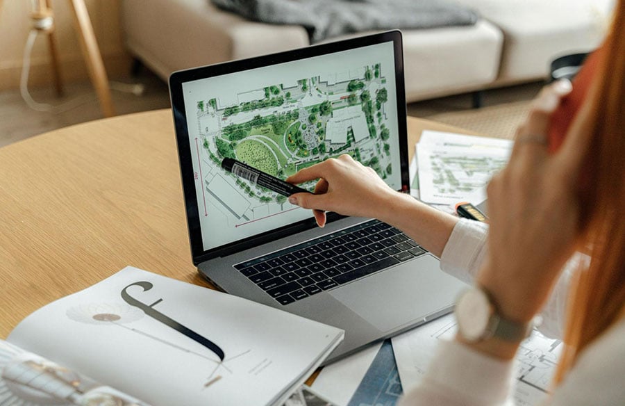
Computer Aided Design (CAD) and Geographic Information Systems (GIS) are two of the most common tools used to teach landscape design. CAD software lets students make exact and thorough plans for gardens, parks, and urban areas. Instead of hand-drawn sketches, they can use digital models. Not only is the planning process more accurate, but it’s also faster because changes and tweaks can be made more easily.
GIS plays a critical role in the analysis of landscapes. It enables students to collect, store, and analyze spatial data, such as topography, land use, and climate conditions. By integrating GIS into their projects, students can make informed design decisions based on environmental and geographical data. These tools allow for more comprehensive site analysis and foster a deeper understanding of how natural elements interact with human-made environments.
Digital Design and Simulation Software: Aiding Creativity and Accuracy
Along with CAD and GIS, landscape design students use 3D models and simulation tools to show how their ideas work. Using SketchUp, AutoCAD, and Rhino, students can make realistic three-dimensional landscape models that include plants, water features, and landforms. Digital models are better than flat drawings at showing size and scale, which helps students see how their ideas will look. To improve these models, Lumion and Enscape copy lighting, temperature, and other natural factors. Students can see how their ideas will work in the real world, which helps them think about them and make changes. Building Information Modeling (BIM) makes big projects easier and encourages people from different fields to work together by mixing outdoor designs with architectural and engineering planning.
Virtual and Augmented Reality: Immersive Learning Experiences
Imagine being able to walk through a park or garden that you’ve designed—without leaving your classroom. This is now possible thanks to Virtual Reality (VR) and Augmented Reality (AR). These immersive technologies are revolutionizing the way landscape architecture students learn by offering hands-on experiences in virtual environments.
With VR, students can take virtual tours of their landscape designs, giving them a real-time sense of scale, depth, and atmosphere. They can walk along the paths they’ve created, experience the flow of space, and even observe how light interacts with the environment at different times of the day. This provides invaluable insights that would be impossible to achieve through static images or models.
Using smartphones or AR glasses, on the other hand, lets students put their ideas on top of real-world places. In this way, they can see how their ideas will fit in with the surroundings and make changes as needed. Students get a better idea of their work when they really get into their plans. This leads to more careful and cohesive results.
Enhancing Visualization and Conceptualization
Students can better imagine their ideas with the help of these VR and AR tools. These tools make it easier for students to understand complicated design elements, try out new ideas, and get real-time feedback from teachers by letting them learn in a visible and collaborative way. This hands-on method helps students remember things better and better apply what they’ve learned to real-life scenarios.
Drones and Aerial Mapping: Precision and Efficiency
Drones are being used to map and analyze sites, which is another cool new use of technology in landscape architecture schooling. With drones, you can see scenes from above that would be hard, if not impossible, to get with other means. This technology is great for measuring places that are big or hard to get to because it lets students see high-resolution shots and learn about the shape of the land all from above. When students use drones to do full site studies, they can plan out slopes and look at plants. Afterward, they use this knowledge to make their drawings better, which makes them more true to life pictures of the landscape. Drone technology not only makes the design process more accurate, but it also saves time. Instead of spending hours examining a place by hand, students can focus on improving their creative ideas.
Sustainable Design through Technology
As sustainability becomes increasingly important in all fields of design, landscape architecture students are being encouraged to create eco-friendly and resource-efficient spaces. Technology is playing a vital role in this area, helping students develop sustainable designs with the help of energy simulation tools and climate analysis software.
These tools allow students to assess the environmental impact of their designs and make adjustments to promote sustainability. For example, students can use climate data to determine the best types of vegetation for a particular area or to design systems that manage stormwater runoff efficiently. By integrating sustainability into their projects from the outset, students are better prepared to address the environmental challenges they’ll face in their professional careers.
Conclusion
The way students learn and use their skills is changing because technology is being used in landscape planning classes. Students can work faster, better, and more environmentally friendly with the help of technology like digital design tools, shared platforms, interactive VR experiences, and drones. Students are not only getting better at technology by using these new ideas, but they are also learning more about the settings they create. As technology keeps getting better, learning landscape architecture will become more active and interesting. This will give the next crop of artists a lot of options.