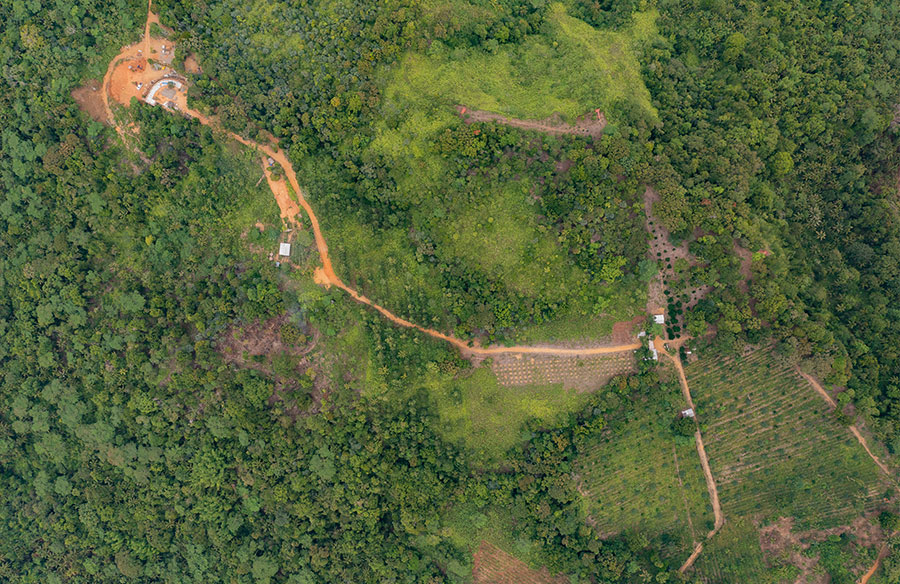
Deforestation presents a concern for the environment as forests are commonly known as the lungs of the Earth. They play a crucial role in preserving ecological harmony by supporting biodiversity and climate regulation while offering essential resources for various species, including humans. However, due to rising activities and industrial expansion, forested regions are dwindling at a rate. The utilization of satellite imagery has proven to be a method of addressing this problem by enabling precise and prompt identification of forest loss.
Exploring the World Through Satellite Imagery
Satellite images depict a different perspective of Earth from space. They provide insights into changes by showcasing landscapes from above-ground-level vantage points. High resolution satellite imagery has effectively revolutionized environmental monitoring with detailed visuals that capture small features unattainable through traditional ground-level observations alone.
The Historical Background of Deforestation
Throughout history, people have cleared forests for farming, logging, and city development. Nonetheless, deforestation has been happening at a rapid pace in recent years because of the growing need for land and natural resources. The usual ways of monitoring deforestation, such as on-site checks, can be slow and require much effort. Also, these methods have their drawbacks in hard-to-reach places. The emergence of satellite technology has come as a solution to these issues by offering a view of how deforestation has changed over time.
Benefits of Using High-Quality Images
High-quality images provide benefits compared to monitoring techniques. They offer extensive coverage of vast regions and capture intricate information for further analysis over time. This feature helps researchers spot trends and patterns in deforestation activities, which aids in developing intervention plans. Additionally, satellite images offer data that can be used to address deforestation incidents. This quick response is vital for minimizing harm and executing conservation efforts.
Studying the Shifts in Forest Coverage
Studying shifts in forest coverage demands information that can be obtained through data analysis using high-quality satellite images known for their ability to capture even minor alterations in plant life over periods. By examining satellite pictures captured at different points in time and contrasting them with each other’s details and features, researchers are able to evaluate the scale of forest loss during a given timeframe. Such insights help decision-makers by furnishing them with data needed to craft specific plans and actions to preserve and oversee forests effectively.
Cutting Edge Technological Advancements
Technological progress has improved satellite images, which helps spot deforestation effectively. Machine learning algorithms can analyze extensive data sets to pinpoint trends and irregularities with high precision. These algorithms make it possible to automatically identify areas where deforestation has occurred without relying on inspection. Moreover, cloud computing services play a role in managing and analyzing large amounts of data, allowing researchers worldwide to access high-resolution images easily.
Considerations for Conservation and the Impact on Policies
The knowledge obtained from satellite images plays a role in shaping conservation initiatives and crafting policies effectively. By offering information on deforestation trends and behaviors, satellite images empower decision-makers to create conservation strategies. Governments can use this data to enforce rules, designate protected zones, and promote land management practices. Furthermore, global organizations can utilize satellite information to oversee adherence to pacts.
Satellite Imagery’s Challenges
Although satellite imagery offers benefits, it also encounters obstacles and restrictions. Cloud cover can obstruct images, impacting data quality, while high-resolution imagery provides visuals. Analyzing vast datasets demands substantial computational resources. Interpreting satellite data calls for expertise, underscoring the importance of personnel in this domain.
Opportunities on the Horizon
The outlook for using satellite images to identify deforestation appears optimistic, moving with technological progress projected to improve the quality and precision of these images. Steadily evolving tools like artificial intelligence and machine learning are poised to simplify data interpretation. As a result, it brings greater efficiency and widespread access partnerships between government bodies, research facilities, and private enterprises, which will be essential in fully leveraging the benefits of satellite imagery for environmental preservation.
Final Thoughts
Utilizing high-quality satellite images proves to be an asset in efficiently combatting deforestation efforts. Its ability to offer up-to-date information enables scientists, officials, and environmental advocates to make informed choices. As technology advances further, the significance of satellite imagery in tracking changes will expand, bringing optimism for a greener tomorrow. It is essential to embrace this technology to safeguard our planet’s forests and guarantee a healthier environment for future offspring.